Mount Archibald
October 21, 2021
1730m
Chilliwack, BC
Mt. Archibald is a lowly, forested summit on the far SW Ridge extension of Cheam Peak but for some, mostly peak-baggers, this is considered as the first peak from west in Cheam Range. There are a few ways to reach this summit. The most notable is a sea-level grunt from Bridal Falls via some FSR systems. In winter or spring this would make the most sense. In summer and fall the easier way is to drive up Chipmunk FSR to Cheam Peak’s trail-head. There’s a well-flagged trail that goes from the parking lot all the way to the summit of Mt. Archibald. I always thought I would take the winter option from Bridal Falls but in the end I opted for the lazier option. The shortest route on Mt. Archibald served nicely as a morning trip as I could tag this peak and be back home by 3 pm for work in the afternoon and evening.
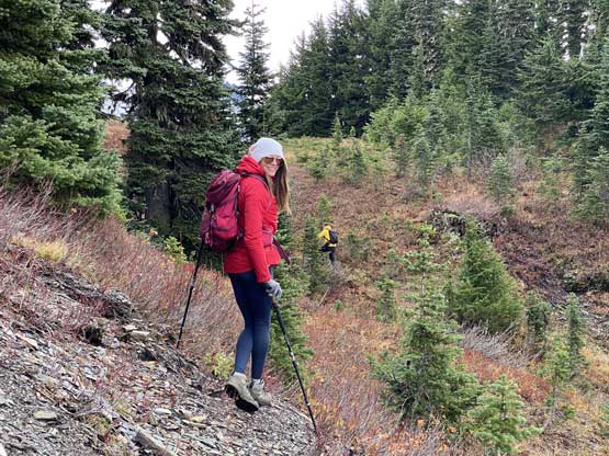
Holly had been wanting to get out for a while but there wasn’t really anything exciting given the weather and the time constraint. It took me a while to convince her to agree on Mt. Archibald. To my surprise Val decided to join us as well as I really thought this was going to be a “dumpster diving” kind of trip. The trip however, did turn out more than expected. To make sure Holly and I could both get back home in time for the afternoon commitment we agreed to meet in Abbotsford at 6 am. Among our vehicles my Tacoma was the only option to get us to Cheam Peak’s trail-head and it sure did not let us down. The lower half of Chipmunk FSR had been smoothened but the upper half was just as rough as I remembered from 5 years ago when I did Cheam Peak and Lady Peak. There’s an additional wash-out about 1 km from the trail-head that would stop most vehicles but the most sturdy 4×4 ones. I managed to crawl across in 4Low without scraping the bottom. I encountered a few more deep water bars further up that proved a little tricky for my long bed truck but nonetheless I managed to drive us to the trail-head.

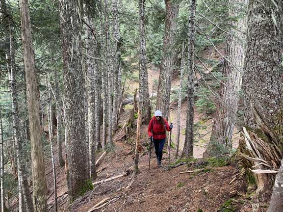
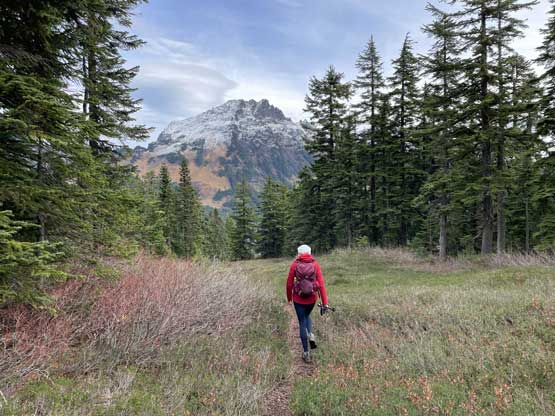
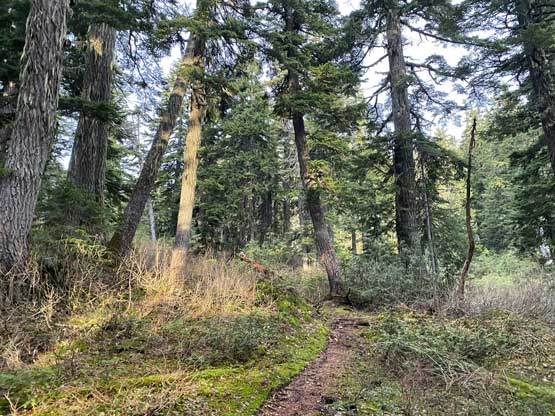
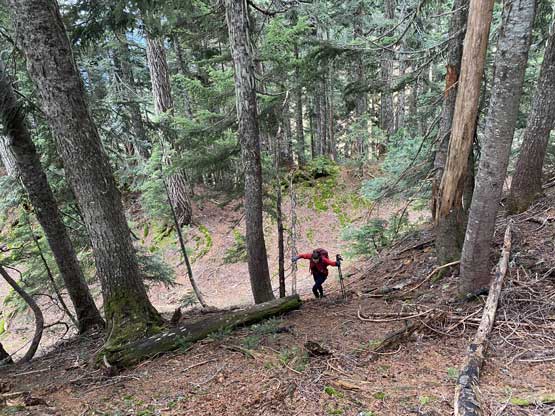
We were the first to arrive at Cheam Peak’s trail-head on this day and given how busy this spot had become in recent years this certainly felt like a privilege. We had the trail built in on the Gaia’s map and we soon realized that this was actually a well-maintained trail. The foot bed was easy to follow and the route was well flagged such that it was impossible to get lost. In short time we got onto Archibald-Cheam Ridge and took the left turn towards Mt. Archibald. There were a few small bumps to traverse up and over with at least 50 m of accumulated elevation loss, but again the trail was in a good quality.


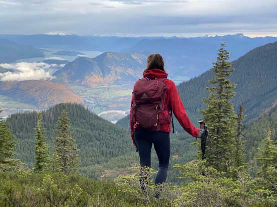
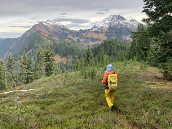
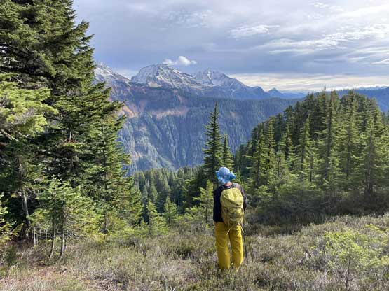
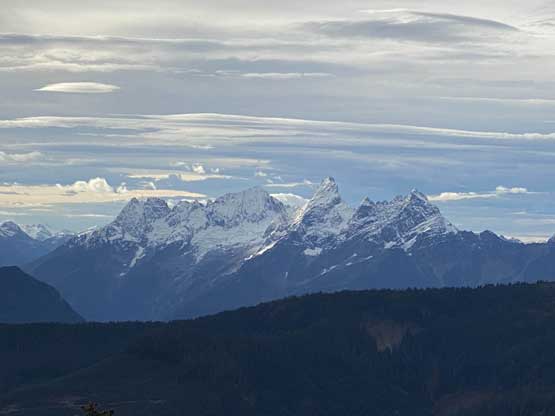
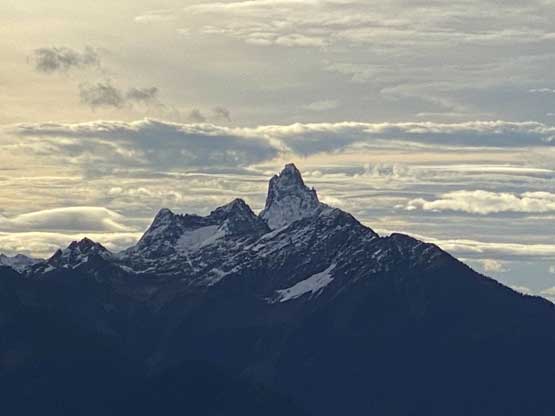
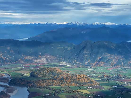
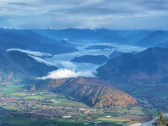
Eventually we got onto the broad east ridge of Mt. Archibald. The trail was still easy to follow and the views also opened up towards north. Nearing the summit we encountered a large opening area with views to the south. The actual summit was forested but somewhere near the summit we could always find spots with views. Combining all the views we almost got 360-degrees vistas so it was actually not too bad.


As usual for trips with Holly and Val we decided to linger for over an hour on the summit until it became too cold. For the descent we dashed down the trail in one shot and in no time we were back to the truck. I then carefully drove us down the rough FSR and it felt like literally eternity to get out of the woods. The rest of the drive back home was a bit heavy on the traffic that I managed to get back just in time for work. There was no extra time to take a nap, unfortunately.