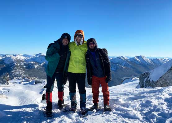
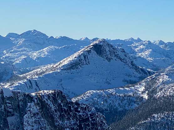
Mount Ichor
November 13, 2022
2090m
Nahatlatch River / Boston Bar, BC
Mt. Ichor is the unofficial name of a fairly prominent peak in the broad vicinity of “East Harrison” area accessed from Boston Bar via Nahatlatch River FSR system. This peak locates about 10 km up the Kookipi FSR from the bridge across Nahatlatch River. This Kookipi FSR is well travelled by the 4×4 enthusiasts as it connects the Nahatlatch area towards East Harrison. In normal years Mt. Ichor can be easily accessed but the entire Nahatlatch River FSR system had been destroyed by the apocalyptic flood in Nov. 2021. It wasn’t until almost a year later that they finally fixed the wash-out at km-14 on the mainline but the Kookipi FSR is still not in a driveable shape. Despite the close proximity to a popular FSR this peak is rarely ascended so I really didn’t have a plan until hearing that Matt J. and Ben B. had just put up a snowshoe track in the beginning of this prolonged high pressure system. It would be nicer to wait for the full fixture of Kookipi FSR but I couldn’t resist the temptation to use their snowshoe tracks. The extra distance that Matt and Ben walked was about 10 km each way so the entire trip would be about 30 km, which sounded brutal but not insanely outrageous. The road’s snowed in anyway. After making up my mind I convinced Shayan to join and he invited Teng at the last minute. None of them own a reliable vehicle so I offered to drive us there and back in my Tacoma.
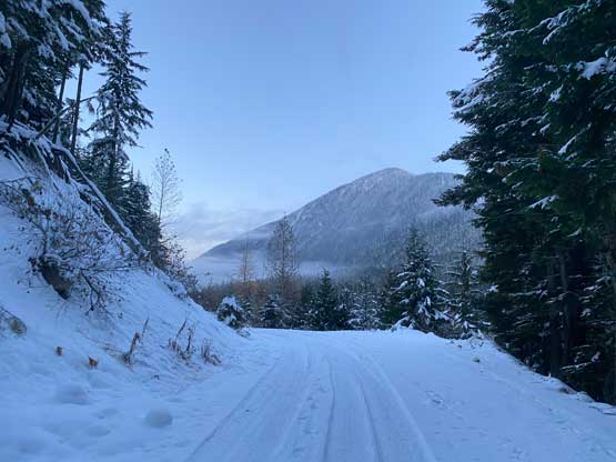
There hadn’t been a detailed online trip report so Matt planned the route solely based on Google satellite images. After overlaying his GPX file into my trusty map app (Gaia) I agreed that route being the most efficient way, and then knowing the existence of a set of boot/snowshoe track in addition to the GPX track I really didn’t need to do much planning. The three of us agreed to meet in Abbotsford at 3 am which meant I needed to wake up at 2 am. Thank to the bad sleeping schedule recently I ended up not catching a single minute of sleep, but that’s okay. This wouldn’t be the first time for me to do an all-nighter push anyway. The only thing we could have done better was to plan ahead to car-camp at the FSR, but the plan of this trip had undergone some changes at the very last minute such that car-camping was no longer an option. The drive from Abbotsford to the “trail-head” was actually faster than expected mostly because the Nahatlatch FSR mainline was in an incredible shape. I cruised up in about 50-60 km/h speed and in short time we arrived at the bridge and the start of Kookipi FSR. This spur road was in a rougher shape that made me switch to 4 wheel drive. I was hoping to drive past Matt’s starting point given that they had been actively working on the roads but the reality was cruel. The workers opted to park their machine in the middle of the road with no possibility to bypass, so instead of parking farther we had to park 1 km closer, making a long day even longer.
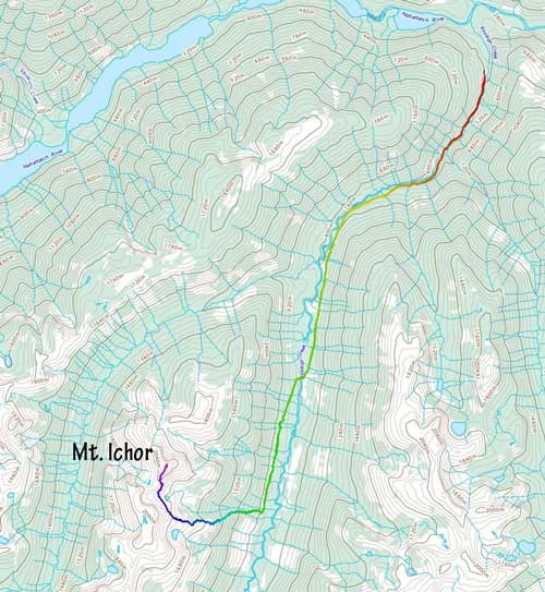
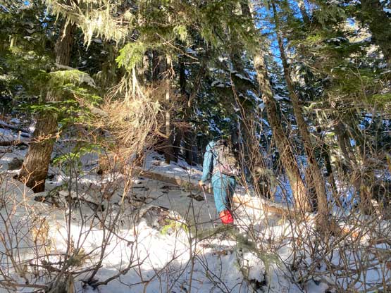
It was about 5:30 am when we started the plod. The road’s perfectly fine past the machine but two consecutive wash-outs beyond Matt’s starting point would definitely stop any vehicular access. There was also about 10 cm of snow past the two wash-outs. We all started by boot-packing but in less than a kilometer we decided to don snowshoes. The rocks under the thin coverage were not great for the snowshoes but we appreciated the added traction. A few more kilometers later we came across sudden tire tracks so the off-roaders had pushed all the way here from the East Harrison side over that 1200-m Kookipi Pass. I don’t think that would be a viable option for us given that we only had one vehicle and my tires aren’t even built for off-roading on snow. The tire tracks definitely made our walking much smoother so we cruised up the next few kilometers. We took the first break upon reaching an important junction where we needed to take a spur road across Kookipi Creek to the west side.

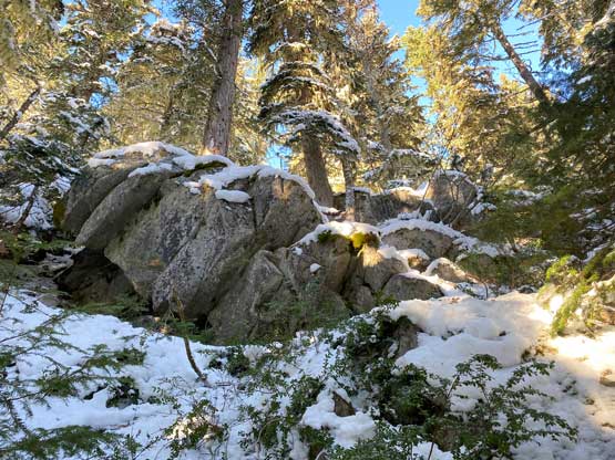
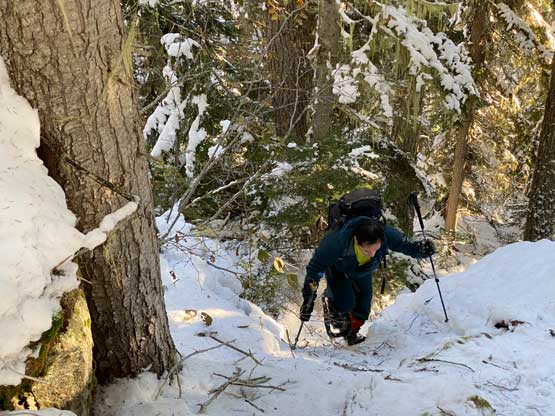
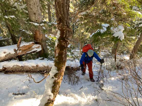
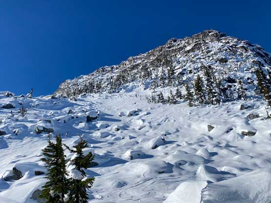
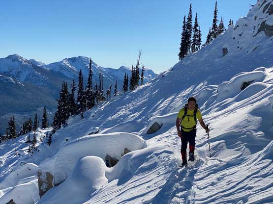
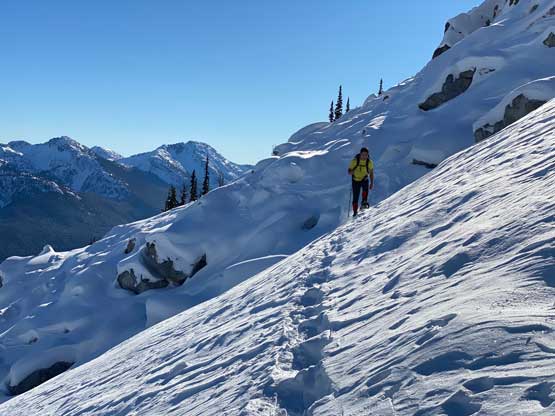
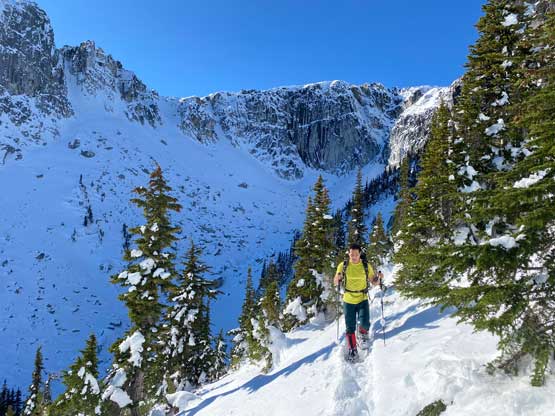
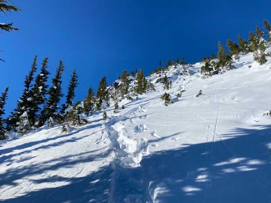
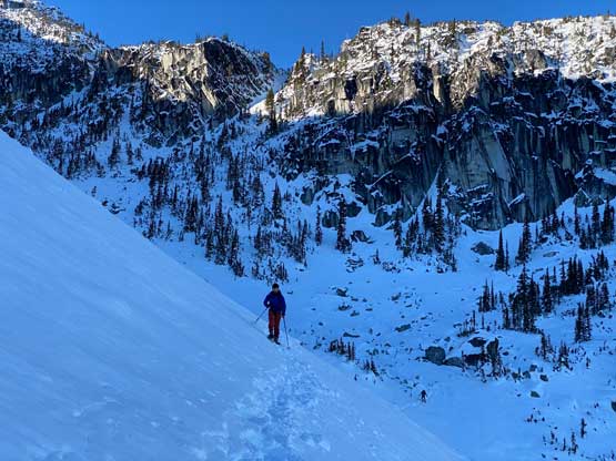
The off-roaders hadn’t gone across the creek so we were back to following Matt and Ben’s boot/snowshoe tracks and the next stage also lasted for a few more kilometers. The final stretch was mostly flat with minor up-and-downs. By the time we finally reached the base of the ascent route we were already 11 km into the slog. Not doing unnecessary lingering we picked up a secondary spur road and soon followed the boot tracks into the cut-block. Ascending the cut-block was straightforward. Matt had warned me about the slippery forest so I came prepared with mountaineering boots and semi-automatic crampons but those turned out to be overkill. Shayan and I managed the entire ascent without even needing to take the snowshoes off whereas Teng opted for microspikes. I found the snowshoes offered enough traction and the heel lifts actually made the ascent easier than using spikes or crampons. Having an existing track to follow was also a bonus as that eliminated any mental work associated with route-finding. We took numerous breaks before reaching the treeline zone where the snowpack drastically thickened from a few inches to over a meter deep.


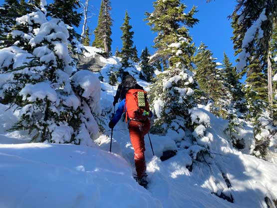
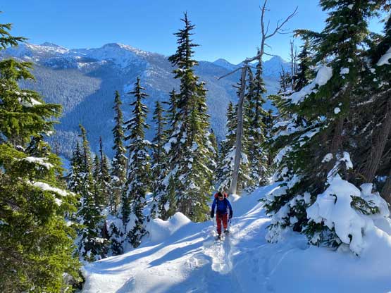
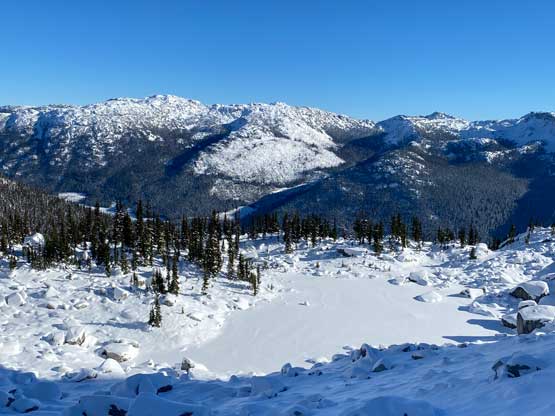
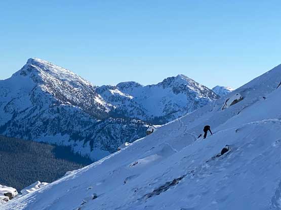
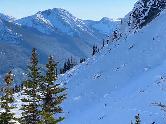
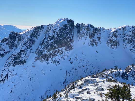
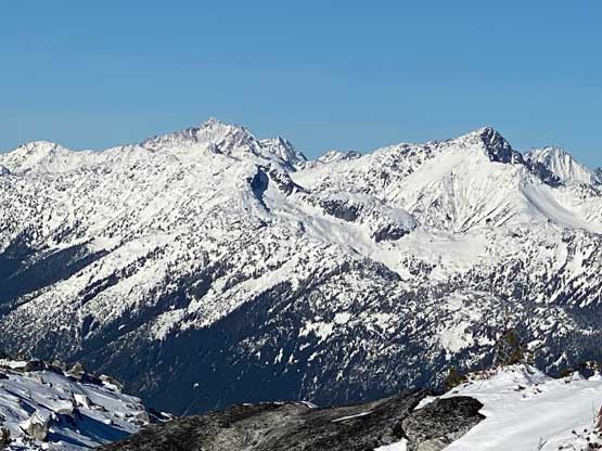
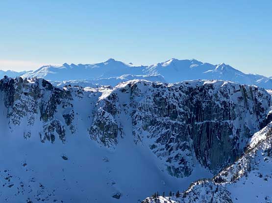
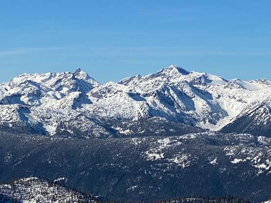
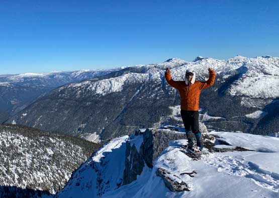
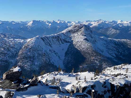
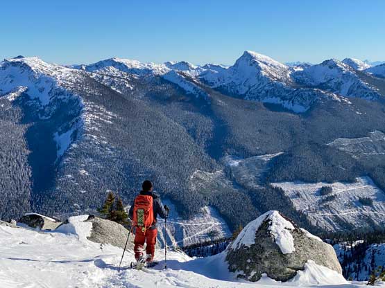
Matt and Ben had put in some serious work to dig out this trench of tracks so again, all we needed was to follow their footsteps. The tracks took some meandering courses across some bluffs, boulders and bushes into some semi-open areas. We finally ascended completely out of the trees at around 1800 m and then took a long side-hill traverse due north. The true summit of Mt. Ichor massif is on the north side. This side-hill traverse was a bit treacherous. The next stage up the SE Face onto the summit ridge appeared steep and daunting from afar but never actually exceeded 35 degrees. We then enjoyed an easy stroll up the broad south ridge to the summit where we got some incredible views towards all directions. This peak offers some unique perspectives of some of the most remote areas in SW BC so the effort paid off nicely. Shayan fell asleep right away on the summit whereas I kept myself busy by taking all kinds of zoomed-in photos for future uses.


It had taken us over 7 hours to get here but we still took a reasonably long stay on the summit. The descent was much easier than expected. The snowshoeing portion took no time as we just needed to follow the tracks but the lower forest was supposed to be tricky. I was prepared to don crampons at any time but I somehow just kept the snowshoes on. At one point I decided to take the snowshoes off mostly to save the expensive ‘shoes but I didn’t need to don crampons afterwards. I down-climbed a few tricky spots by facing into the slopes and that worked out perfectly. I did take a few slips but those were on non-consequential terrain. Teng and Shayan managed the entire descent without taking the snowshoes off. Back to the logging roads I decided to boot-pack the whole way out to save the snowshoes. In retrospect I should have donned the ‘shoes for the first 4 km back to the tire tracks as this stretch had sucked a lot of energy from me. For the final 7 km of plod back to the car Shayan and I somehow started jogging. The goal was set to beat head-lamp time. I was not positive about that but we did achieve this goal (barely) by jogging more than half of the distance, capping the round trip time to under 11.5 hours. Teng showed up about 15 minutes later so I got a little bit resting before starting the long ass drive homewards.


I managed to keep myself awake on the FSRs but I needed to take one break near Boston Bar. I think I slept for about 10 minutes before resuming the drive southwards to Hope where we stopped in McDonald’s for food. I then somehow drove us back to Abbotsford without needing to take another break and then pushed the rest of the way back home by 10 pm. I don’t normally do this home-to-home style of all-nighter push so I was completely exhausted.
