Elysium Mountain
November 9-10, 2013
2446m
Jasper – Victoria Cross Range, AB
Those familiar with Jasper area probably know there’s a long trail that brings you up to a high pass (Elysium Pass) on Victoria Cross Range, and Elysium Mountain is the peak guarding this pass on its west side. Despite the limited beta I could gather, Elysium Mountain appears to be straightforward enough as a winter ascent. On this past Remembrance Day long weekend, Ben and I decided to take advantage of the good weather to bag Elysium Mountain and its lower neighbour, Mt. Pattison. If weather cooperates then we could get not only amazing views, but also some valuable beta for some bigger objectives in this area like Monarch Mountain, Mt. Oliver and Snaring Mountain.

Elysium Mountain to Mt. Pattison winter traverse route. GPX DL
Given the recent dumps and the forecasted low temperature, it would certainly be a real winter trip. It’s 15 km one-way to the Pass, Elysium Mountain is 400 vertical meters above the pass on its west side, and the straight line between Elysium and Pattison is only 5-6 km. It doesn’t sound super long, but we had no clue how much snow at all elevation, how easy to follow this unmaintained trail with snow cover, how much bushwhacking, and whether there’s unexpected terrain or not. We had to haul the 30′ snowshoes, ice axes, crampons, avalanche gears, -20 degree sleeping bags, along with all other necessary stuffs, and we would plan 3 days’ supply to make sure we have enough time.
Saturday was the worst day weather wise and our goal was getting as close to Elysium Mountain as possible. Immediately after starting the trek we encountered the first problem of the trip: there’s not enough snow to put snowshoes on.. Given the fact we were hauling winter overnight mountaineering gears we certainly wouldn’t appreciate the extra weight on our shoulders so we tried to carry the ‘shoes on hand. We tried quite a few strategies but eventually gave up all of them. The most efficient way was still strapping them to our backpacks.. The trail was better than we thought, but it certainly wasn’t as snowy as expected and we had to haul the snowshoes for more than 10 km in with about 800 vertical meters’ elevation gain. Once we finally put snowshoes on we were not far from treeline. The trail then swung climber’s left (westwards) towards Emigrants Mountain. This section was quite hard to follow given the winter condition but thankfully there were marks on the trees helping us to stay on track. Well, the marks are not trail markers but rather the evidence of “cut branches” on the trees.
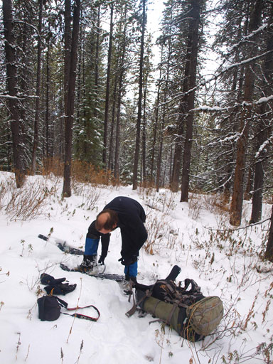
Finally got enough snow to strap snowshoes on after 10km in.
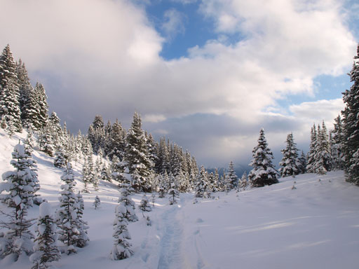
At the base of Emigrants Mountain the trail reaches its apex, offering some views of Miette River Valley. The weather wasn’t the greatest at this point. Elysium Pass was just in front of us, but at 150 vertical meters below… It was already getting late so after losing this massive amount of elevation we decided to set up camp. Well, 4 pm is late in mid November… It was also snowing lightly, but windless. The night was super long but thankfully my -20 bag was warm enough. The first time I woke up I thought it’s almost the time to get up, but oh man, it was only 9:40 pm…. Oh well, time to watch the stars then since the sky had already cleared up.

Higher up the views started to open up
Looking back at our tracks
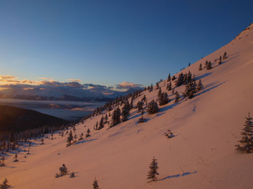
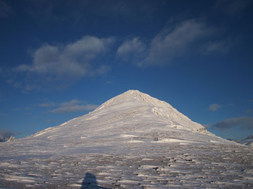
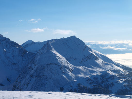
Elysium Mountain ahead. It’s still far away and there’s a significant loss of elevation
Definitely winter here!
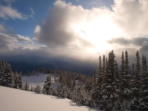
This storm was moving in fast
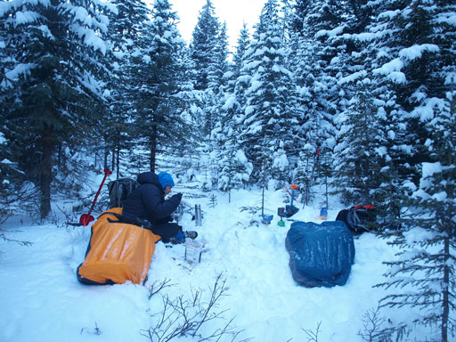
This is our camp
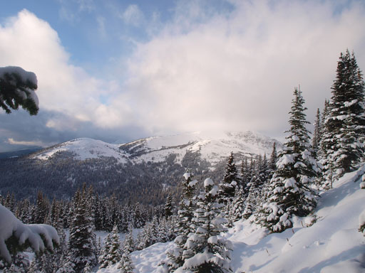
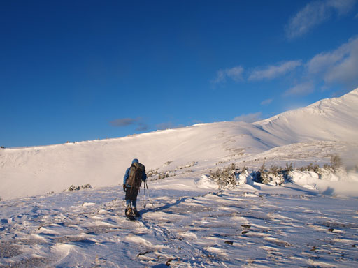
Another big problem surprised us in the morning. Well, we shouldn’t say that since we had the same issue on our Lightning Ridge trip in February.. We must have spent half an hour trying to get in the frozen boots. It was awful. We were originally timing for watching alpenglow on the summit ridge but now we had to watch sunrise at treeline. The views were still stunning though, with low clouds trapped in the Miette/Frazer River Valley. The ascent to treeline was relatively easy except for the occasional bushwhack at the lower slope, and a steep slippery roll in the alpine.

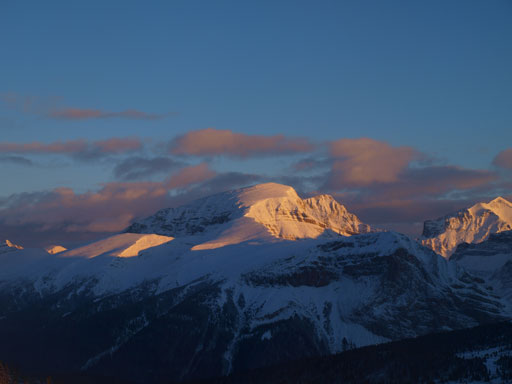
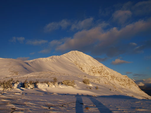
Alpenglow on Elysium Mountain

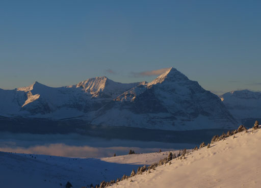
Alpenglow on Griesbach, Oliver, and Snaring. Click to view large size.
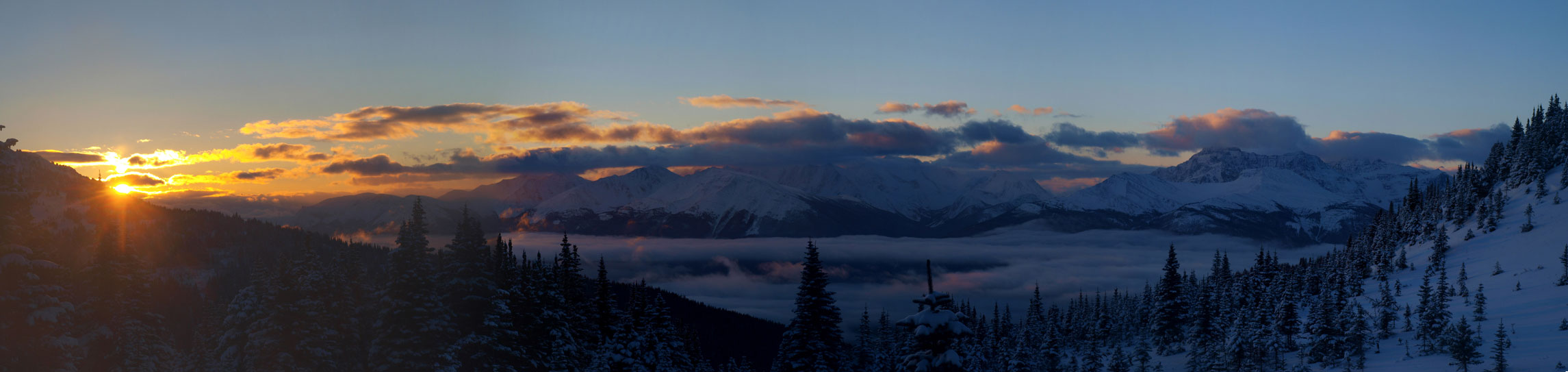
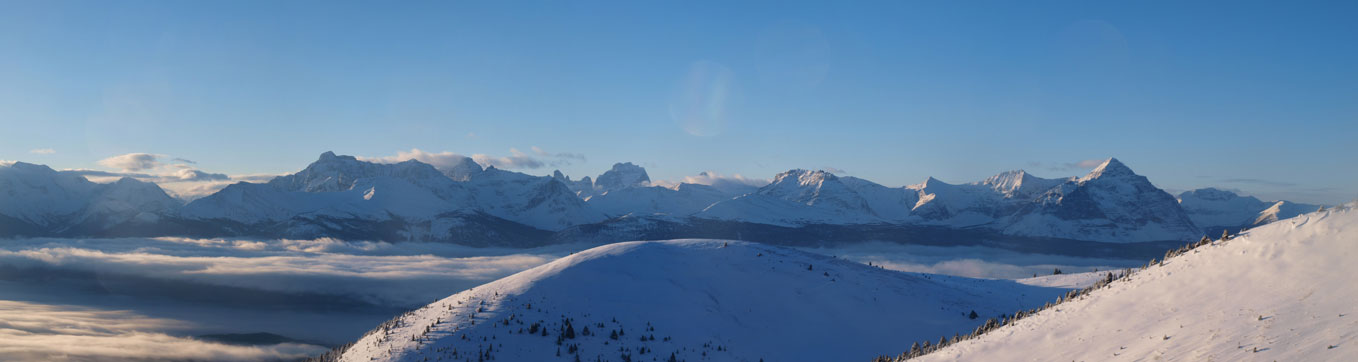
Panorama of Mietter River Valley at sunrise. Click to view large size.
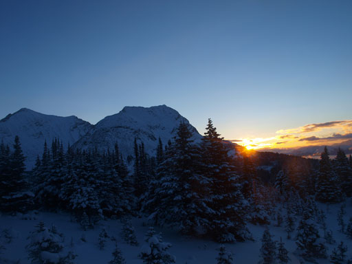
Sunrise over the shoulder on Emigrants Mountain

Another sunrise photo
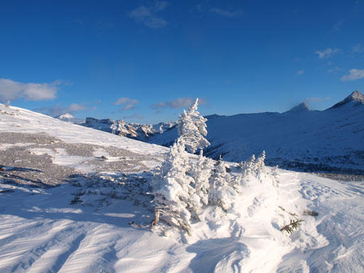
Beautiful alpine environment
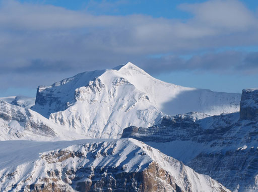
Mount Oliver
Ascending a steep roll

Traversing a slippery and steep section
Panorama of the peaks on the other side of highway. Highest is Mount Geikie.
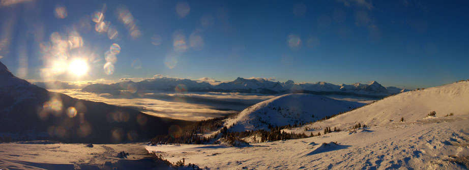
A full panorama of the inversion in Miette Valley
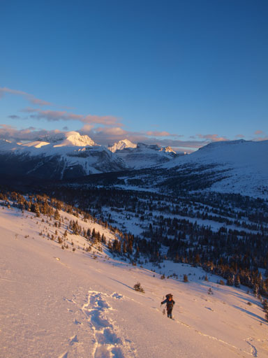
Looking up towards the summit
Mount Fitzwilliams group
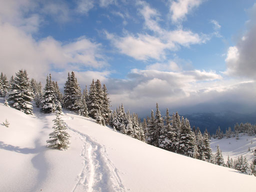
The broad ridge ahead would lead us easily to the summit ridge
Another stunning panorama was waiting for us once hitting the summit ridge with views of Bridgeland and Derr fully opened up. Looking back it was the Fitzwilliams group directly across the valley, with bigger peaks like Geikie behind. Our plan was carrying the snowshoes up and over the summit of Elysium Mountain since this would be the shortest way to get to Pattison. The summit ridge was also easy, but took us quite a while. And of course, the view of the top was not disappointing at all. We certainly wanted to spend more time soaking in the scenery but having a long day ahead we had to press on.
The broad summit ridge. As easy as it looks

Panorama from partway up the summit ridge.
A lonely tiny tree.
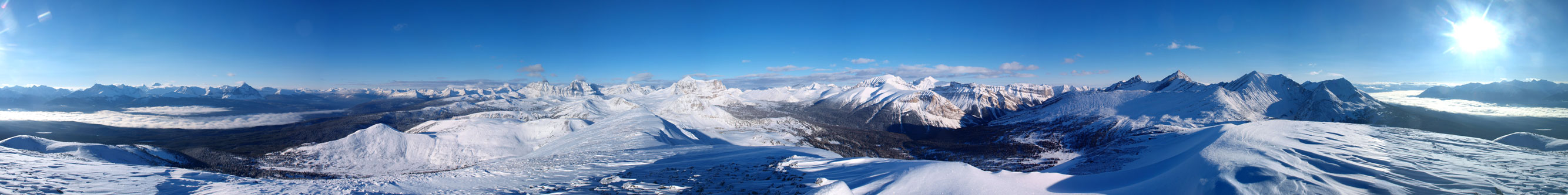
Summit Panorama. Click to view large size.

The deep side of V.C. Range – Griesbach, Oliver, Consort, Snaring

Looking into Mt. Robson P. Park. Yellowhead Mountain is the low one at center.

Inversion in Miette River Valley

The “impressive group” – Bridgeland, Derr, Monarch
Snaring Mountain

Mount McKean

Unnamed peak between McKean and Emigrants
Emigrants Mountain

Monarch Mountain

Mount Bridgeland

Derr Peak
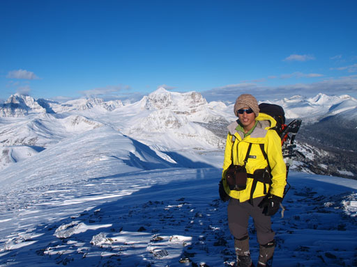
Me on the summit of Elysium Mountain

Monarch Meadows. It offers probably the only bush-free way to access Oliver/Snaring group.
Mount Pattison looks tiny but very far away from the summit of Elysium Mountain. At this point we weren’t even sure whether we were still motivated enough for that but since we had nothing else to do we decided to give it a go.
