Mount Girouard
October 5, 2014
2995m
Banff, AB
Mount Girouard is the highest peak in Fairholme Range which forms an impressive chain of rugged peaks east of Bow Valley in the Canmore to Banff corridor. It’s also among the few very prominent summits visible from the town of Banff, together with the attached Mount Inglismaldie. While its lower neighbour is a fairly well-known objective thank to the inclusion in Alan Kane’s Scrambling in the Canadian Rockies book, Mount Girouard does not have the “luck” to be included and thus, remains fairly obscured.
I probably shouldn’t use the word “obscured” as there’re still a few trip reports available. My initial inspiration came from the Rambler’s trip in 2011, and ever since that Raff’s pictures as well as Sonny and Marko’s ascent earlier in this year has helped bumping this objective up my list. But on the other hand, it’s neither technically difficult, nor long, so can’t be that high on my list. This past Sunday seemed like the perfect time. After 5 weekends in a roll of 3-day mountaineering trips I really needed a break to catch up the school work – a day trip would be the most suitable. To make the most use of it Vern and I figured it’s the time to get Girouard bagged.
Due to the last-minute decision neither of us came fully prepared. We’d simply follow Marko’s GPS track as well as our basic mountain sense up. The route basically ascends the drainage between Girouard and Peechee followed by scree-bashing up Girouard’s south slope, and goes at easy/moderate scrambling only. Compared to the complicated trip we did last weekend this would be very straightforward. Another thing that made me so happy about doing a day trip was the light pack. After a month of heavy duty weight-carrying we were back to our familiar “light-and-fast” mode. I think we actually interpreted this theme too seriously and ended up moving “too fast”..
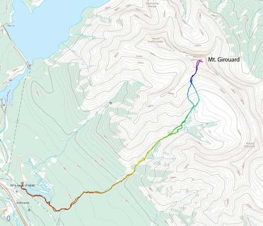
Mt. Girouard scramble route. GPX DL
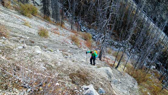
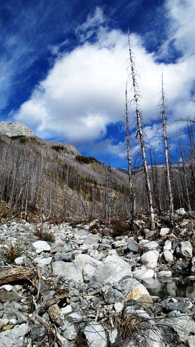
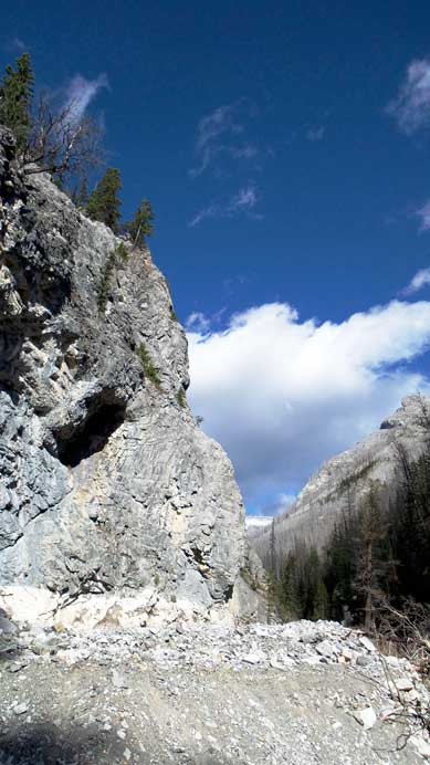
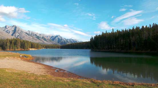
The day started with contouring around Johnson Lake on its south shore on a well-maintained trail (the only trailed section of our entire ascent). This was actually my first time hiking around Johnson Lake despite the fact it’s very popular for tourists, and I have to say it’s a great destination for family outings. After the lake contouring we had a short bush section to negotiate which wasn’t bad at all. Following the GPS track we quickly arrived at the ascending drainage. From here on the next few hours was simply ascending this drainage – a very tedious process dealing with lots of dead-falls (thank to the June 2013’s flood) as well as boulders. We even tried staying in the bush on climber’s right side and it actually worked nicely for a while. But eventually we had to bail into the drainage once it narrowed down. The boulders were generally stable, and I found it’s much faster if we could just hop from one to another without using poles.
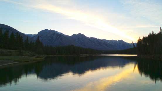
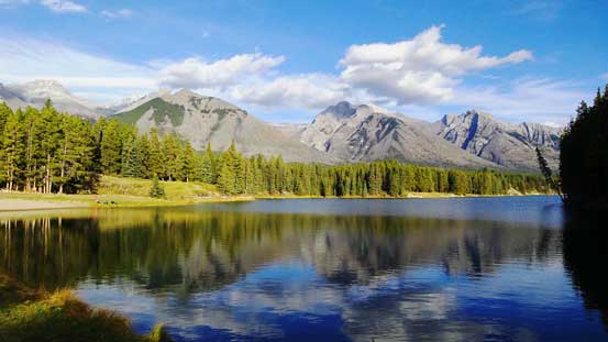
Johnson Lake in the morning
Cascade Mountain in morning glow from the opposite end of Johnson Lake.

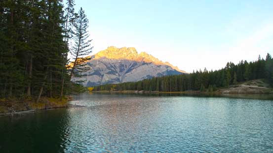
Mt. Rundle across Bow Valley

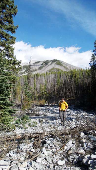
Vern ascending the typical terrain in this drainage
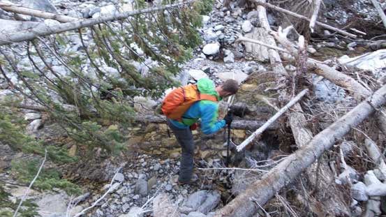
Oh the dead-falls…

And then came the boulders – fun for a while, not so much for hours…

Looking up…
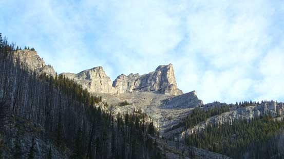
You don’t want to look too far up. This is just an ourlier and yes, after spending hours in this drainage this just doesn’t to get any closer. It’s very high up there and yes, you have to go much higher than that…
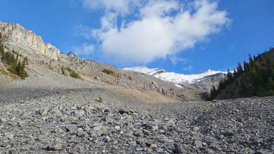
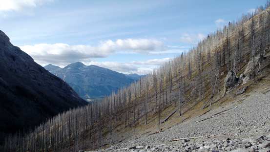
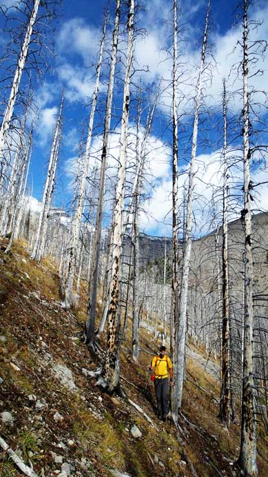
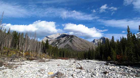
With good perseverance we eventually arrived at a fork where the creek splits. Following the GPS track we took the left branch, but immediately we realized staying at the bottom of this narrower creek would lead us to a steep and tight section. We ascended steeply up the left bank and then through a burnt forest high above the creek before cutting back into the drainage way up high. At this point we were not far from treeline, and looking ahead we could see the entire upper mountain. It appeared to be quite snowy but that wouldn’t create much of a hindrance for something rated at easy/moderate scrambling.
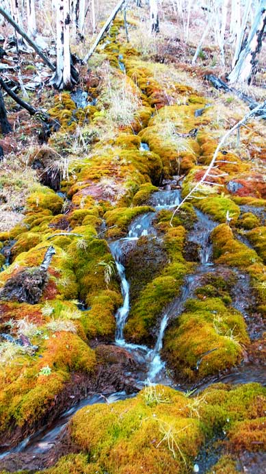
Neat fall colours
We ascended steeply up the left side bank

Then, through a burnt forest
Into the alpine. Our objective is the snowy peak in the background
Looking back. We just side-hill traversed through this burnt forest

Vern ascending

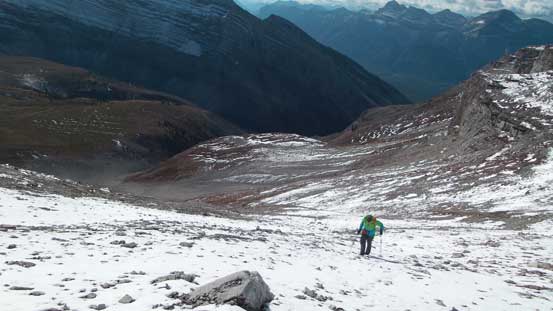
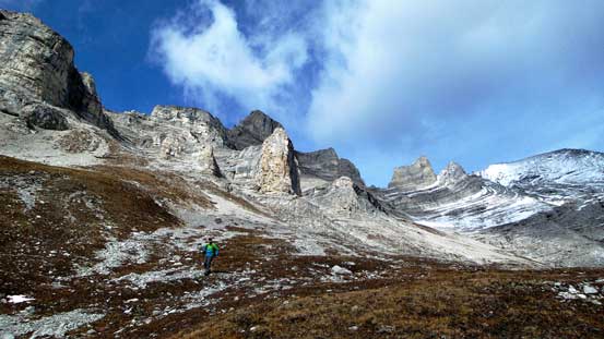
Route goes up the obvious scree gully on the left side before traversing a broad scree ramp
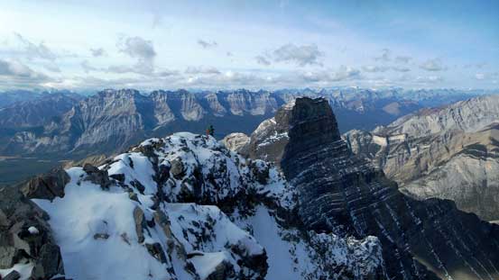
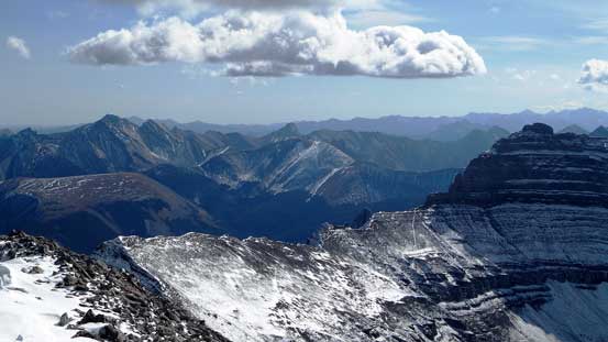
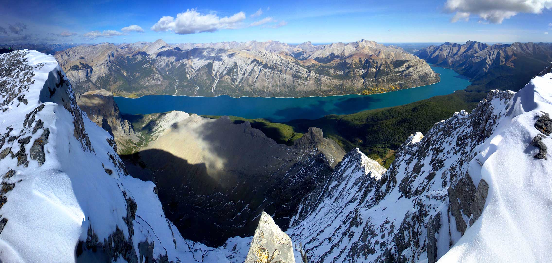
There were three highpoints straight in front of us and we were unsure which of them being the true summit. They appeared to be equally high while viewing from below. Once again, our GPS track helped and it led us curving climber’s left towards an obvious broad scree gully. Okay, the left one must be the true summit then… The scree gully was long and tedious and terminated at a broad snow covered scree ramp. We followed this ramp curving back climber’s right, around a corner and onto the main slope. From this point to the summit ridge was quite steep and slippery, but nothing too involved. We intersected the summit ridge just after the series of imposing pinnacles, and then followed it easily to the highest point. The view was excellent especially looking down at Lake Minnewanka. Due to the cold wind we didn’t linger long on the top.

Vern ascending easy terrain. Rundle in the background

The slope was very foreshortened but at least we were slowly getting closer
Traversing the broad scree ramp back climber’s right

On the scree ramp
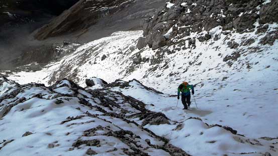
Around a corner, terrain got steeper and more slippery.
Great view of Mt. Peechee looking back. Yes we had to higher than it.

We intersected the ridge just to the right of the pinnacles

The north side was an overhanging drop-off. No wonder why Alan Kane says Girouard being “not a scramble” in his Inglismaldie’s page…

Mt. Inglismaldie looks very impressive

The broad summit ridge
Looking back along the summit ridge

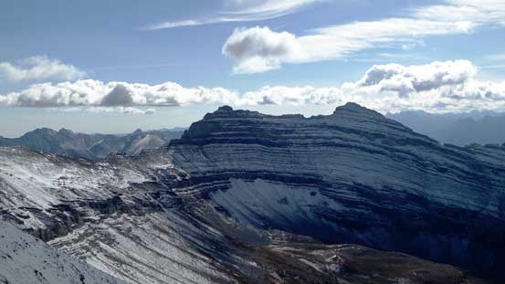
Summit Panorama. Click to view large size.

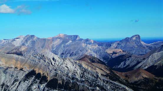
Lake Minnewanka
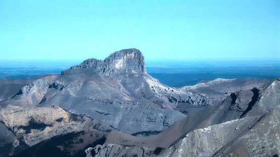
Devil’s Head looks bone dry. Should I be up there?! Mmm…

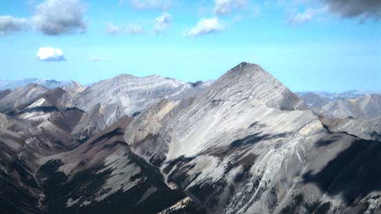
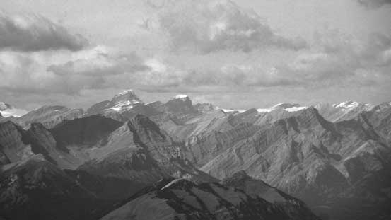
Mt. Costigan is another major summit in the Ghost
Mt. Aylmer is the highest peak in this area. I solo’d it 2 years ago, and what a hack of a slog that was…
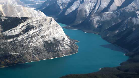
I really like the color of this lake in the fall
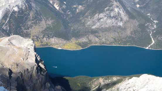
If you look closely there’s a boat on the lake
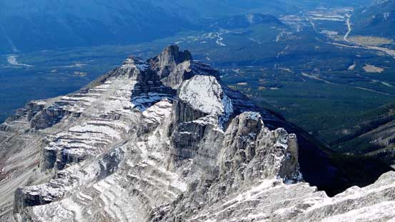
The series of pinnacles on Girouard’s SW Ridge

Cascade Mountain is actually a long chain of peaks (just like Rundle), but most scramblers don’t realize that.
Mt. St. Bride and Mt. Douglas in the distance
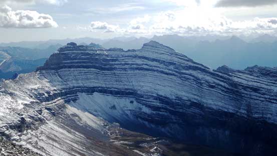
Mt. Peechee is now lower than us!
Front range peaks looking SE

Saddle Peak in the Ghost
Devil’s Head and an unnamed peak in the Ghost

Me on the summit of Mt. Girouard
Another panorama from the summit. Click to view large size.
The descent went uneventful until lower down we decided to take a short-cut. Before entering the trees we traversed far skier’s right and descended the next gully in that direction. The looseness of that gully made it a faster route for descending. (There wasn’t a significant advantage though, so if you’re not sure then going back the same way is probably the better idea). The most tedious part began once getting back to the main drainage. Hours of hours of boulder and dead-fall hoping were waiting for us, and soon it started to become miserable. The fact there’s not much view from the creek didn’t help our mood neither. To end the misery quickly we went faster and faster – faster to the point it started to remind me Fisher Peak racing with Grant… Oh well. Even that it felt like eternity to get though this long drainage. Seeing Johnson Lake was a very welcomed sign, and shortly after we were back at the car.

Carefully descending the slippery upper slope

Looking back. It looks quite impressive from here actually.
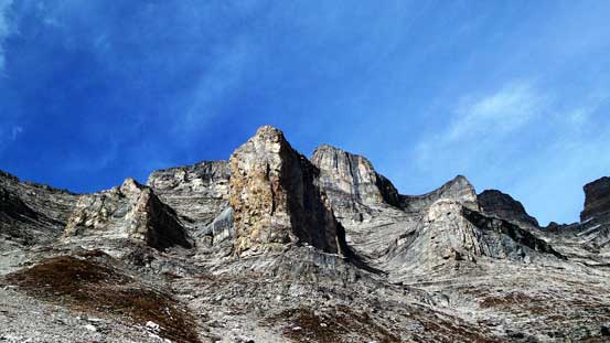
The pinnacles on Girouard’s SW Ridge

Some high clouds rolling in
Vern descending with the pinnacles behind

Our alternate descent route
Through the burnt forest again

Just before dropping into the creek.
Into the creek now.
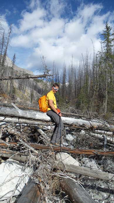
Lots of dead-falls…
A narrower section of the creekbed
Typical, typical
Almost done the creek walk
Back to Johnson Lake
Tourists’ view of Johnson Lake
Our round trip time was 9 hours 20 minutes on a furious pace. I think for most people it’ll take at least 11 hours and probably more than that. Speaking this objective, Mt. Girouard is not a mountain you do for “fun”, but rather a classic example of “quality suffering”. But on the other hand, it’s a fairly straightforward ascent with minimal risk. If you want to bag a high peak with one of the finest panorama view of Lake Minnewanka, then this is a good choice. When to do it? I think fall is the perfect time – the bushes are dead, the creek is low and the new snow adds to the front-range scenery.

Nice job, Steven & Vern! I’ve been wanting to try this one ever since Inglismaldie some years ago. Still wonder if Girouard is accessible from that side… : )
Thanks Grant. I still remember first time Liam brought up this objective I didn’t even know there’s a scramble route up. After noticing this route it immediately bumped up my list.
And you were complaining about Aylmer, this sounds worse.
Hey Tim. Yeah both trips are long slogs. I did Girouard 2 years later (so more experienced) than when I did Aylmer, so that’s probably why I found Girouard “easier”.