Mount Mercer
January 2, 2017
1704m
Chilliwack / Chilliwack Lake Road, BC
Mt. Mercer is known as the highest peak along the broad, semi-forested ridge extending eastwards from Elk Mountain, but unlike its lower neighbours this peak does not see nearly as many visitors. There have quite a few trails leading up this way but I don’t think they get maintained regularly, nor do they get strongly advertised on the internet comparing with the Elk-Thurston trail. The shortest summer approach is via Thurston FSR from Chilliwack Bench Road and with a decent high clearance 4×4 most of the elevation gain can be dispatched by the way of vehicle travel. The most popular route by far is still the traverse over Elk and Thurston but that’s also the longest option with lots of up-and-downs. A third option presents itself thank to the few trip reports on ClubTread and this one essentially follows an old road and then open forest up the east ridge. This won’t be the shortest, but looks like the most interesting one.
The new year began with an arctic high pressure system extending its figures southwards into the west coast. Blue skies were guaranteed but there’s that accompanied cold temperature as well as the strong outflow wind making things a bit less pleasant than they normally were.. For hardcore peak-baggers those wouldn’t even qualify as deterring factors so after some discussions it was Vlad, Al (Spectrum), Jeff Han and myself aiming for the east ridge of Mt. Mercer. A 6:30 am meeting at North Surrey Park followed by a cruise-sailing drive down Highway 1 we made some quick work into Chilliwack. Following the Chilliwack Lake Road for a while we made that left-turn at Foley Creek FSR which was the same as Cheam Peak’s access. The logging road was completely snow covered but very packed down thank to all the local traffics, and we had no problem making to the start of Chipmunk FSR in Jeff’s Xterra.
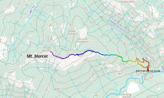
Mt. Mercer ascent route via East Ridge. GPX DL
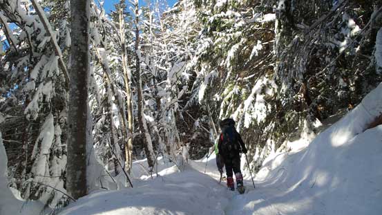
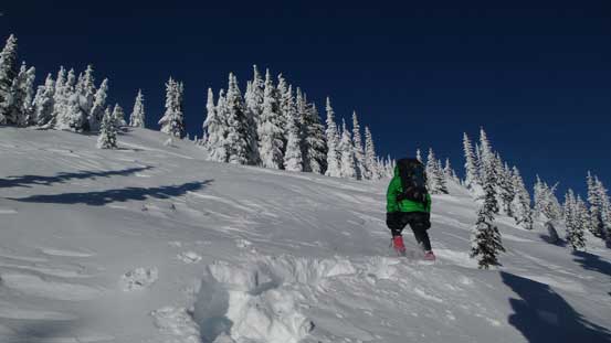
There are two ways to start the east ridge – one up the old road directly and the other following Chipmunk FSR for a few clicks before cutting back onto the old road. Both turned out to be alright but the first option wasn’t very pleasant at places. There were quite a few side-branches and we got confused in no time. Having no GPS track to follow we soon made some navigation errors deviating from the planned path. Not wanting to backtrack we made a call to short-cut and that turned out to be fairly steep and bushy at places. The old road was also chocked with alders at fair a few places and we had to detour to the side making some slow and tedious process. Things didn’t improve until we joined the path coming from Chipmunk FSR but it’s also here that the post-holing started to take over, but with Jeff leading at a blistering pace we didn’t get slowed down by much. Knee deep in no time and it’s only getting deeper.

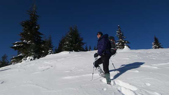
Struggling in snow…
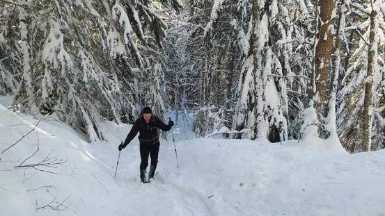
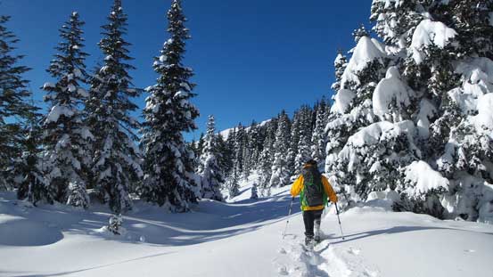
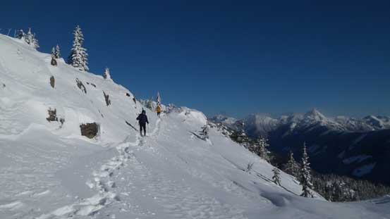
The typical plod up the lower old road.
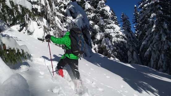
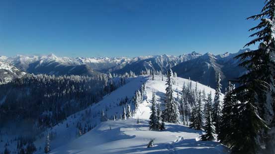
The old road was fairly steep at places and still had some confusing side-branches. Jeff did a great job route-finding and trail-breaking to around elevation of 850 m. After that the road started to traverse to the right (north) and soon enough it’s time to enter the forest. From here all the way to treeline it’s essentially just following this broad, wooded ridge up but the trail-breaking was arduous to say the least, even with 4 people sharing the fair. But hey, with plenty of time and a gorgeous bluebird day ahead I wouldn’t complain too much on that. Into the sub-alpine zone the views started to open up and it’s here that we took our first long break of the day. Resuming the ascent the snow condition didn’t get any better as we slowly approaching the first highpoint along the ridge.
Marching up…
Al mastering the deep snow.

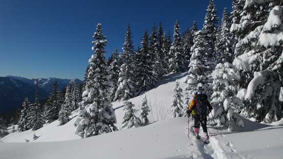
The views started to open up a bit now.
Vlad breaking trail.
Jeff leading the way.
The terrain seemed endless and the condition never seemed to improve…

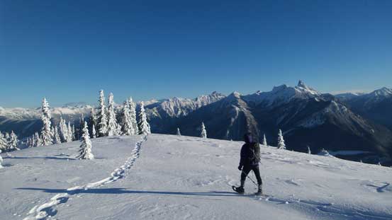
At least we got some great views.
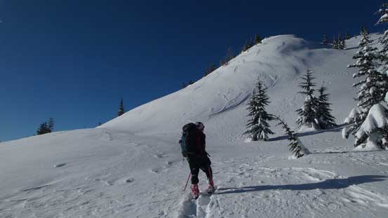
Al staring at the first steep rise.

Vlad and Jeff coming up.
Into the alpine that brutal outflow wind finally took over. It wasn’t nearly the coldest I’ve experienced but as of west coast standard it’s definitely not an often-experienced thing. Looking ahead it seemed like we still had a long ways to go with more than one bumps to traverse up and over. Being high on energy (and motivation) Al and I took over the lead here and went ahead, partially because of the wind and partially because we just had to keep plodding in order to make this summit bid happen. Balaclava on in no time and the worst area happened towards the second-to-last saddle where a narrow spot funnelled the wind. Putting my “storm degree parka” on and problem solved…

Al going up the steep slope towards the first bump.
Then we decided to traverse on the south side but shortly after we went back to the ridge crest.
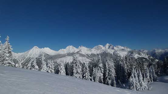
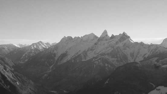
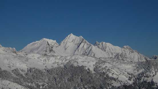
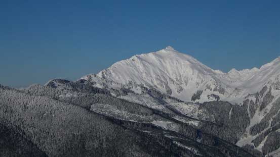
A full view of Cheam Range – the main reason why I came up here in winter conditions!

It’s apparent the new snow didn’t bond well thank to the wind transports.

It seemed like we still had a long ways to go…

Another view of Cheam Range
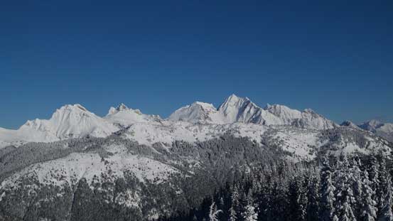
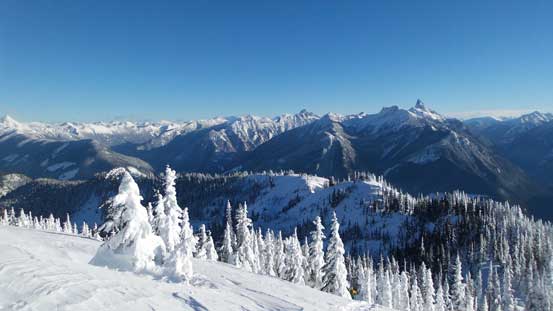
Panorama from Knight Peak to Foley Peak.

Cheam Peak and Lady Peak – two that I ascended in August last year.
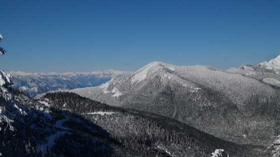
This forested bump is Mt. Archibald.
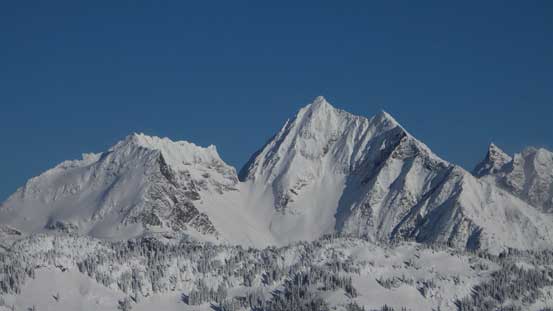
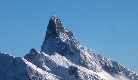
Welch Peak is the highest in Cheam Range
Up and over the last forested bump we were facing with the final push towards the summit. The trail-breaking was brutal for a while but the slope was short-lived. Unfortunately my camera completely died in this coldness and I spent the next half an hour or so warming it up inside my jacket. Jeff and Vlad joined shortly after but everyone’s camera were dying. Eventually mine functioned again. The views were surely great but given that wind there’s no time to linger any longer than necessary, so after a group photo we immediately started the descent.
Going over another bump now, looking back.
The final push..
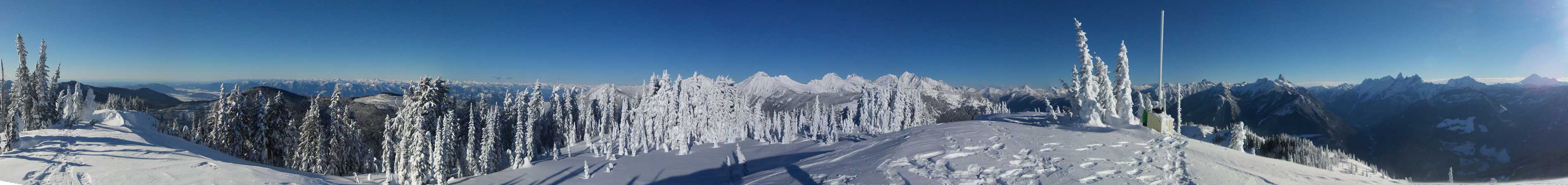
Summit Panorama from Mt. Mercer. Click to view large size.
Slesse Mountain with Mt. Parkes and Mt. MacFarlane in the foreground
A zoomed-in view towards Chilliwack and Fraser Valley
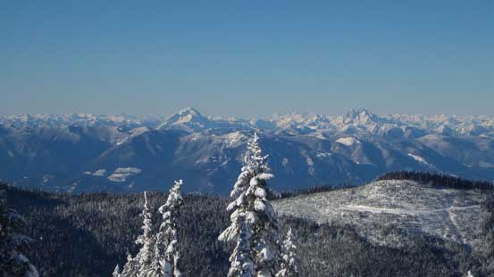
Mt. Robie Reid and Mt. Judge Howay on the skyline
American Border Peak is eye-catching from any side
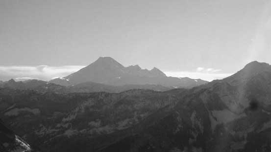
Mt. Baker the iconic volcano of the North Cascades
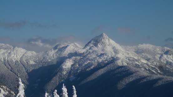
Williams Peak
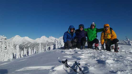
Our group shot on the summit of Mt. Mercer
Going down powder was effortless on snowshoes and it seemed like in no time we were down into the forest. We did spend some time taking pictures but my camera failed again somewhere along the descent. I was too lazy to spend another 20 minutes warming it up so that’s it for this day. Thankfully my iPhone (being inside my pocket the whole day) was still functioning so I did get some photos for the rest of this descent. Not wanting to put head-lamps on we sped up to beat darkness so the forested plod went by fast. Near the end Al and I took the variation and went down Chipmunk FSR while Jeff and Vlad opted to follow our uptracks. The advantage of Chipmunk FSR was that we could take the ‘shoes off and didn’t have to deal with that bushwhacking part, but the downside was a longer distance. Both options turned out well but Al and I managed to beat the other group by about 5 minutes.
Time to go home..
Vlad enjoying the scenic walk.
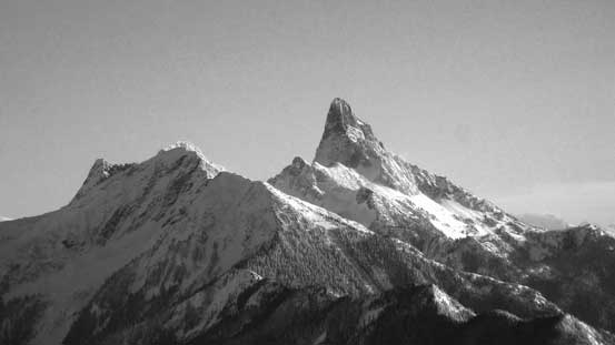
Slesse Mountain

Mt. Rexford
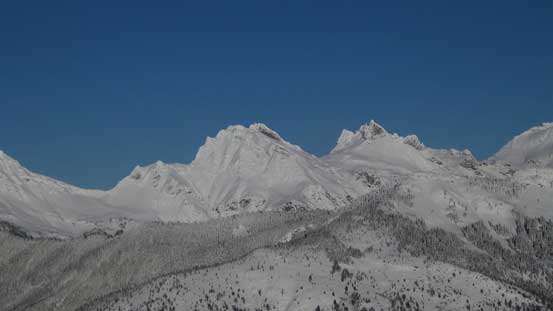
Welch Peak with The Still to its left and Foley Peak to its right.
Knight Peak and Baby Munday Peak
Cheam Peak

Looking back from partway down along the ridge

One last look at the Cheam Range
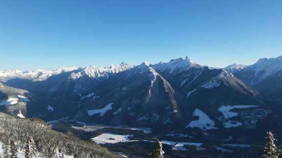
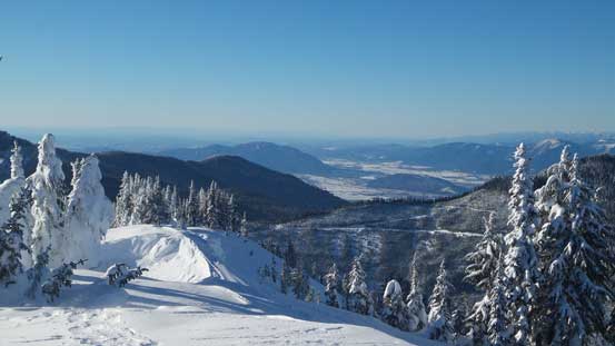
Chilliwack Valley and directly across is Pierce Lake area.

Walking down the last few clicks on Chipmunk FSR
After exiting that bumpy and icy Foley Creek FSR the rest of the drive back home from Chilliwack was uneventful. Speaking the east ridge of Mt. Mercer I should say it’s a fairly sizable day given the conditions we had and the views were certainly more expansive than anticipated given the small nature of this summit. I don’t think I would recommend this route for summer travel due to bushwhacking but in winter it does make a full day outing. And now I checked that weather forecast. It’s still sunny and I had to plan something for the next day.
