Camelshoof Peak
April 19, 2020
1555m
Lillooet / Fountain Valley, BC
“Camelshoof Peak” is the southernmost summit of Camelsfoot Range about half an hour’s drive north of Lillooet. It’s not the tallest in Camelsfoot Range but is definitely one of the more visible, and probably the most popular one. The summit offers some outstanding 360 degree panoramic views of the deep Fraser Canyon and the rugged Fountain Range, and a trail leads all the way up its south-east ridge to the summit, from West Pavilion Road. An old fire lookout also sits on the summit and one can also choose to walk up the road from the backside. I’m not sure about the driving situation of the fire lookout’s access road but I assume it’s used by ATV enthusiasts.
I had seen this summit from Fountain Peak just across the Fraser Canyon to the south, and I honestly wasn’t expecting much from it given its dull-looking profile. Alex and I made some last minute decision to head far north and away from the Coast Mountains given the unstable weather and the warming-up trend. We didn’t make to Lillooet until noon and from there we still had half an hour’s drive to the trail-head. The last 10 km or so was on the unpaved West Pavilion Road but its condition was much better than I thought. The trail-head wasn’t clearly marked. It’s apparently at the start of a spur road (which had become too rough to drive).

Camelshoof Peak via SE Ridge. GPX DL
The thermometer was reading 20 degrees and combining that with the bone-dry surrounding peaks we felt it’s hard to believe this was only mid April on a snowier-than-normal year. We decided to not bring any gears so I just used trail runners and the small summit pack. The first couple kilometers were rather mundane while doing some long and unnecessarily flat switchbacks, but once the first lookout point was reached we were blown by the views. My Gaia app didn’t show a trail beyond this first lookout point so I was expecting some bushwhacking over annoying dead-falls, but it turned out that the trail continued up the south ridge of Camelshoof Peak. The trail had a few dead-falls indeed, but seemed to be maintained by the locals and the going was much simpler than I thought. However, there was more elevation gain than it appeared and the hot temperature was also taking its toll on us. It took us a good while to reach the false summit where we had to take an energy break.
Alex hiking up the boring spur road

This is looking towards Moore Peak in Clear Range
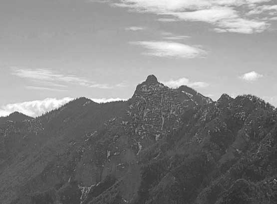
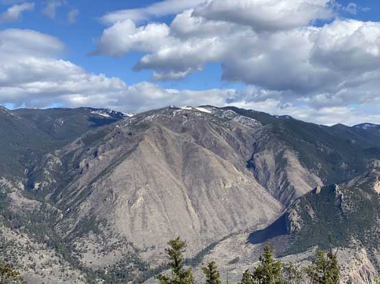
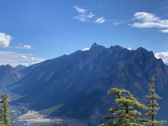
A closer look at Fountain Peak – our objective two weeks ago
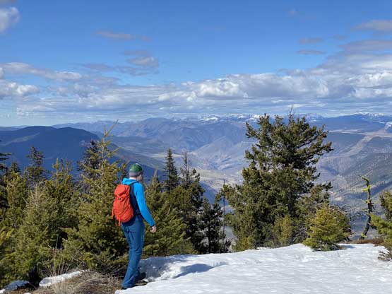
Alex taking in the views from the first lookout

Fraser Canyon
Mt. McLean on Mission Ridge that Alex and I snowshoed in 2015
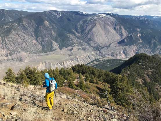
Going up the SE Ridge now
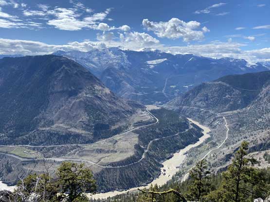
A wider shot of the Fraser Canyon

Plodding up. The terrain was pretty open at places

The trail does have confusing spots. Photo by Alex R.

The east side of the peak was surprisingly a shear drop

More about the Clear Range to the east

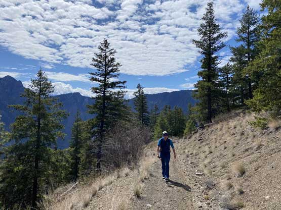
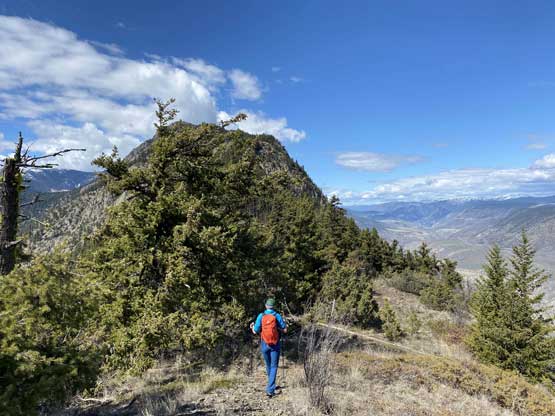
Me heading up the open ridge. Photo by Alex R.
Me having lots of fun on the hike. Photo by Alex R.
On the descent from the false summit to the saddle we briefly lost the trail in some deep and isothermal snow but soon regained it. We then had no further problem following the trail all the way to the summit, where we then wondered around to soak in all of the views.

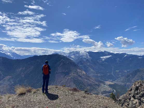
Dope view looking south from the summit

Zooming-in towards the switchbacks on West Pavilion Road
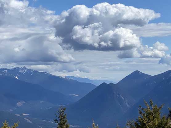
Fountain Range is much more rugged than Camelsfoot Range

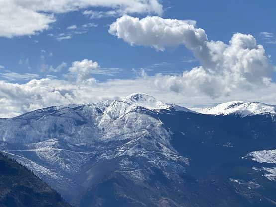
Mt. Brew, one of the tallest peaks in SW BC looms behind

This is a full show of Mission Ridge from Mt. McLean northwards

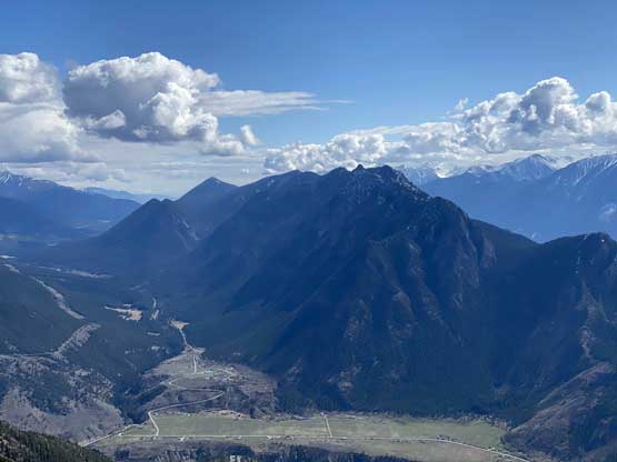
The rest of Camelsfoot Range, taller but less interesting

This is zooming-in towards Shulaps Range

A closer look at Mt. Brew
Alex taking in the views looking north

The fire lookout with Fountain Peak behind
This is zooming-in southwards down Fountain Valley

Me on the summit of Camelshoof Peak
Due to the lateness in the day we didn’t spend too much time up there. We also discovered ticks on our packs. The descent went by very quickly although the last few kilometers on that spur road still seemed to drag on for quite a while. Once back to the vehicle we did some thorough tick check and then were on the road. The drive down West Pavilion Road down to Lillooet was super scenic that we stopped a few times for some extra photos.
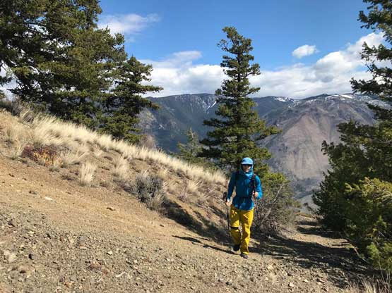
Me heading down from the summit. Photo by Alex R.

Fountain Range again

Looking back at the SE Ridge of Camelshoof Peak
Part of the long ridge running towards Moore Peak

Down to the logging roads now
The last look of Fountain Peak and its NE Face

Making a tourist’s stop to check out the raging Fraser River

Fraser River running southwards towards Lillooet
Earlier in the morning we drove here via Pemberton and now we opted to drive home via Hope making a full loop around the SW BC. It was quite a long and exhausting haul. Alex still managed to find a way to stay awake but I was sleeping for most of the time. We made back to Alex’s home by 8:30 pm and I didn’t make back home until almost 9:30 pm. I took a shower, cooked a late dinner, made some Instagram updates and then went to bed at midnight. A mere 4 hours later I would wake up again for the next trip…
