Capilano Mountain
April 28, 2017
1692m
Furry Creek / North Shore Mountains, BC
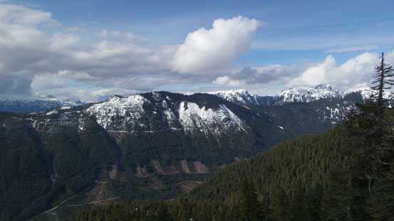
Capilano Mountain is a fairly broad, dome-shaped peak that offers some unusual views of the backside of our local Howe Sound Crest group. The access is from Furry Creek about halfway between Lions Bay and Squamish and the standard route is well documented in Matt Gunn’s Scrambles in Southwest British Columbia. However, the status of this peak remains a little bit obscured especially in recent years after the closure of Phyllis Creek FSR. To access the mountain one has to start from pretty much the Sea-to-Sky Highway and walk an additional 4-5 km. This might not seem like much to me but is enough to deter most scramblers hence putting Capilano Mountain into the category of “peak-baggers’ summits”. The Downing Creek Road which is the spur off Phyllis FSR has since become overgrown and the access trail (Beth Lake) has seen little maintenance so to knock it off a fairly long day is required.
Putting all of these together this seems exactly like the trips I’ve been doing recently. Earlier in the year I’ve got a pretty good perspective of this summit from the nearby Windsor/Deeks on a bluebird January day and that was the trip that inspired me to make an attempt. Given the type of terrain (bush, boulders, etc.) I’d expect some easier travel in spring especially given this year’s record-breaking snowpack at lower elevation, and then with some half-decent weather forecast I made a spontaneous decision to take Friday off. To avoid the morning rush hour traffic and still get some reasonable amount of sleep I opted to drive out on Thursday night and then sleep in my truck. The next morning I did not wake up until almost 8 am but half an hour later I managed to start the plod.

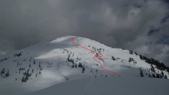
Capilano Mountain winter ascent route. GPX DL
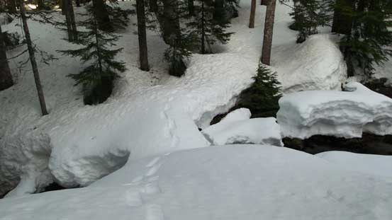
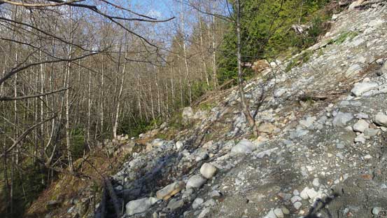
For those into mountain biking the initial 4 km down Phyllis Creek FSR can be shortened significantly. I don’t like biking so would take the laborious way. Boots and snowshoes in the pack, sneakers on and off I went, and in less than an hour I made to the spur road. The start of this road was still in a decent shape but soon enough alders started to grow in. It was still very fine for foot travel but any vehicle would have to stop in about 500 m down this road. Biking wouldn’t make much sense beyond this point neither and this made me feel pretty good. The next 2-3 km was a gentle uphill plod and the condition on this Downing Creek Road was pretty “average”. There were a few creek crossings towards the upper end with the last one across Beth Creek requiring a few boulder-hoping moves.

The crossing of Beth Creek.
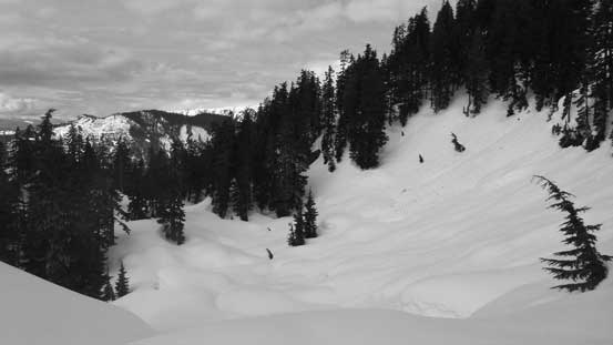
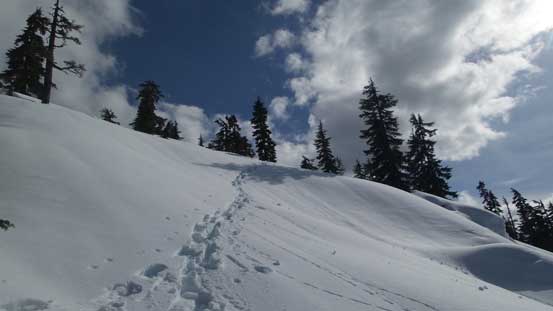
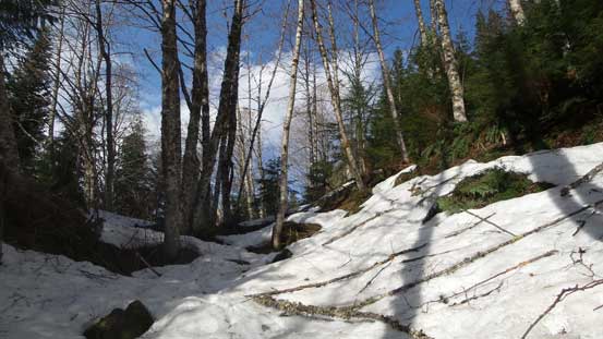
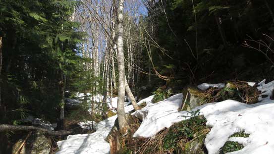
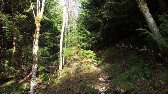
The start of Beth Lake Trail actually follows another overgrown spur road and was pretty hard to miss. After two switchbacks I started to encounter patchy snow so the sneakers were ditched soon. Boots on and up I went resuming the ascent, and soon enough the snow became continuous and I lost the trail near a large clearing. I did not bother to search around and instead, strapped the snowshoes on and ascended straight up into the forest. The initial section required bushwhacking in some tight timbers but the travel improved dramatically once merging into the old growth. Having GPS checked for every few minutes I knew I went too far on climber’s left so now with the improved forest travel I started to make a long diagonal beeline towards Beth Creek and the outflow on Beth Lake. Sure enough I picked up the well-marked trail and another 10 minutes or so later I was at the lake.
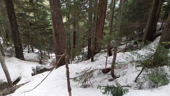
The typical forested ascent once the snow became continuous
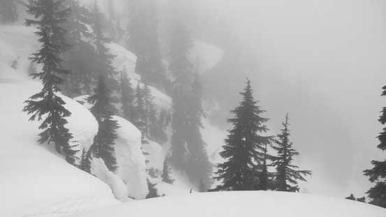
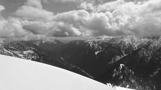
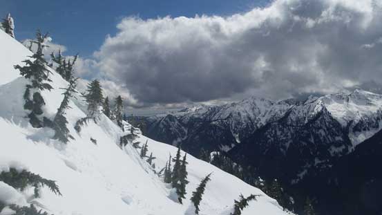
I spotted a snow bridge and went for it across Beth Creek just below the lake’s outflow, and then picked up the marked (by orange diamonds) trail on the opposite side. The route went around far on climber’s right to bypass a bluffy area before curving back left resuming the southwards path. I paid close attention to these orange markers but still lost them higher up. I suspect the remaining markers were all buried in snow as the last one I saw was only a feet above the snow surface… The terrain also became steep and bluffy and meanwhile I entered into the mist and then a couple snow storms blew in. At this point I had my iPhone in the left pocket and GPS in the right pocket and both were checked on a regular basis. The latter was for staying on route and the former was for some now-time weather updates. It was still shown as “partly cloudy” for Lions Bay and Squamish and that’s agreed by all the models I often use. I still wanted to have my fate on the weather forecasters so ignored the snow storms, and pushed on.
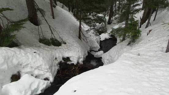
The crossing of Beth Creek just below the lake’s outflow.
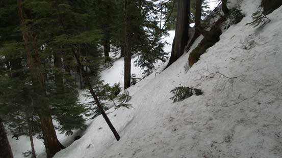
Ascending out of the creek on the opposite side.

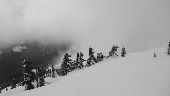
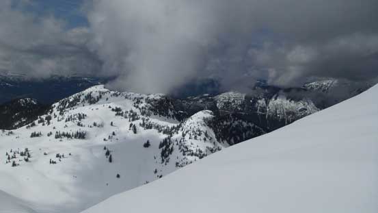
Weather deteriorating quickly… This picture sums up the ascent…
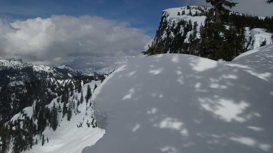
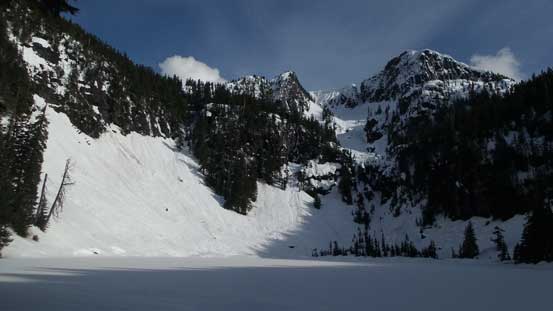
At elevation of roughly 1300 m I came to a wide bench and it was here that I left the summer trail. The reason is simple as the trail would traverse into and ascend a steep bowl with massive cornices threatening from all sides. The route I took involved a long side-hill bash to the climber’s right before coming up the steep but forested west side of a bump. The section worked out exactly as expected although the forested ascent onto the first bump was a tad steep at places, but manageable in my Lightning Ascents. From the top of this bump I easily descended into the first saddle (where the summer route joins) and then it’s another long plod up into the mist and onto the 1550-m plateau. I opted to ascend all the way to the top of this plateau mainly to reduce that painful side-hilling.

Very steep forested ascent onto the first bump. This part was my “variation”.
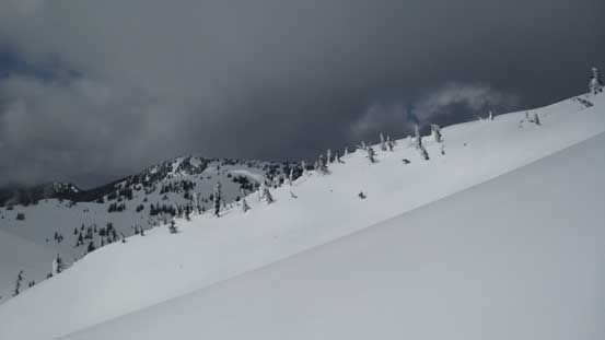
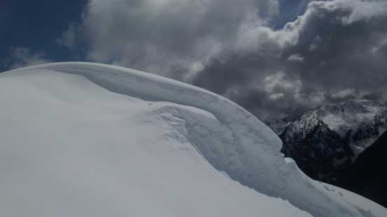
As you can see, the regular summer trail would be subjected to these cornices…
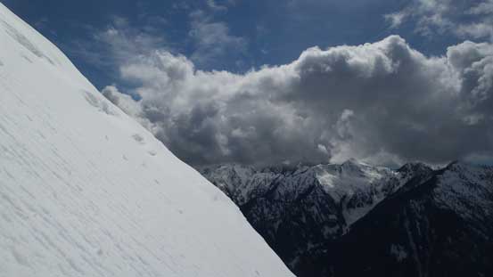
A few seconds of brief weather window then back into the white-outs…
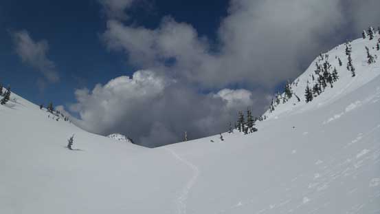
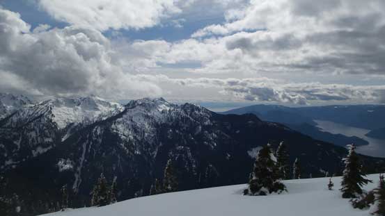
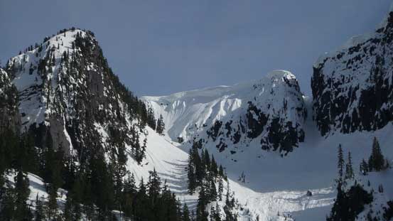
The next stage was a long gentle descent towards the base of the summit dome. The navigation was a little challenging thank to the flat light and white-out conditions but with the help of my GPS I did manage to keep the correct bearing and stay on the most efficient path. And then there came another minor bump ahead which I ascended about halfway to the top before spotting a bench to bypass the actual summit of it on the west side. Meanwhile the weather was finally clearing up and my motivation surely got a second boost.

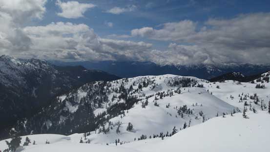
Descending from the 1550-meter plateau. Finally started to see something again..

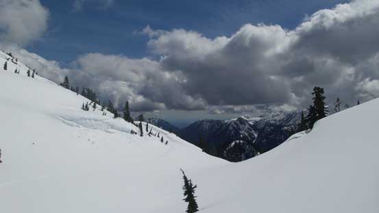
Weather was slowly lifting. My motivation was instantly boosted…
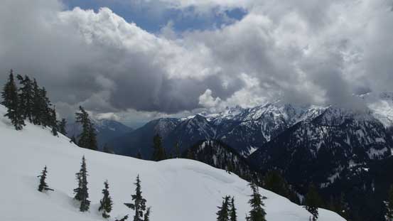
More and more sunshine started to show up. Maybe I COULD get some views today..

A zoomed-in view towards the famed Lions
The final summit dome appeared steep on all sides although the gentlest seemed on the far right skyline. However, getting there would still require some steep traverses and at this point I was already sick of the side-hilling so would just pick my route up the west face. Initially I zig-zagged through a couple ramps and rises and then went straight up onto the face proper. I kept the snowshoes on for as far as I could but not wanting to test the limits of my Lightning Ascents I opted to ditch the ‘shoes at about 100 m from the top. The ice axe was taken out since I brought it up anyway and the final snow climb steepened to about 40 degrees near the top. It was very fun as the snow was in some perfect conditions for step-kicking. And then the actual summit was only 5 minutes away.

Looking ahead to the ascent up the final dome.
Ascending into the sunshine.
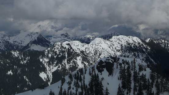
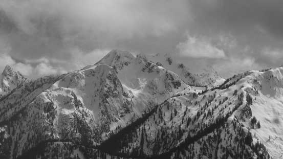
Appian Mountain to the south.
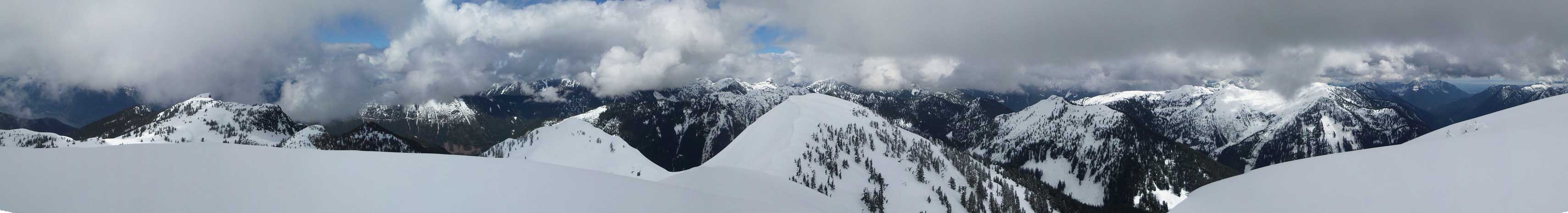
Summit Panorama from Capilano Mountain. Click to view large size.

Some unnamed peaks to the south-east.

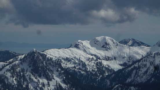
Ben Lomond catching some sunshine.

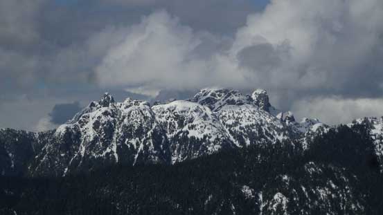
A zoomed-in view towards Crown Mountain massif
The Capilano River valley in the Greater Vancouver watershed.

Looking down at the full stretch of that plateau which I just traversed across
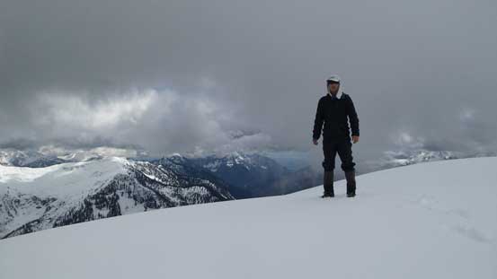
Me on the summit of Capilano Mountain
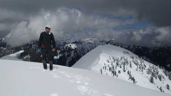
Another picture of me on the summit of Capilano Mountain.
It had taken me over 6 hours to get here and it’s time for a long break. I watched the clouds coming in and out but there’s little sign of significant improvement so not wanting to descend in dark I had to move on. I had little interest in doing anything fancy about the route so would reverse the exact. That 40-degree down-climb was very fun thank to the very homogeneous snow conditions, but post-holing took over when I got to near the ‘shoes. I thought about to keep plunging down but now I had no choice but to strap the snowshoes back on. And then reversing across that entire stretch of the plateau was very scenic as I got what I missed on the way in.
Time to head down..

A sideways view from the 40-degree down-climb.
It’s pretty big up there…
Looking down.

Finished the snow climbing section, now looking ahead to the plateau traverse
More and more sunshine started to show up.
As you can see, traversing onto the right hand skyline would be very steep too.

An unusual perspective of Mt. Windsor
Lots of cool snow formation up there.
Back down to the first saddle now. Lots of up-and-downs still awaiting.
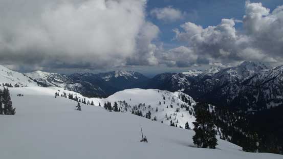
Gorgeous country.

I was happy to have these views back as I missed them all on the way in.
A review shot to show my route up Capilano’s west face.

Almost back to the top of that plateau now, looking back.
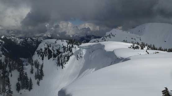
Massive cornices everywhere.
The long ridge of Chanter Peak catching some sun beam.
Just another view from this plateau.
Mt. Windsor, Deeks Peak and Howe Sound
Mt. Hanover with Brunswick Mountain behind.

The Lions
This is the unofficially named “Enchantment Peak”
Descending from the 1550-m plateau.
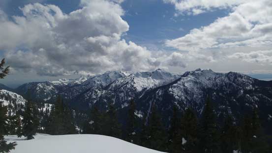
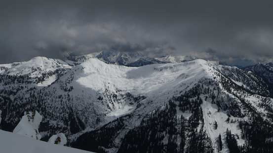
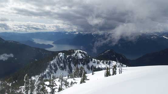
A full view of the Howe Sound Crest group.
The fun was over too soon as I slowly descended into the forest. Up and over the first bump I got to face the steep part. I did not feel like switching gears so just down-climbed facing inwards while kicking in with my snowshoes and it worked out perfectly. Then into another mini bowl, up and across a bench traverse I got to enjoy another fast plunge down the slushy snow. It did not take me long to arrive back at Beth Lake. I did a short detour to check this lake out (totally worth it) and then did the last long break of the day.
Note the massive cornice in the foreground.

A northwards view. Goat Ridge and Sky Pilot Mountain on the skyline.
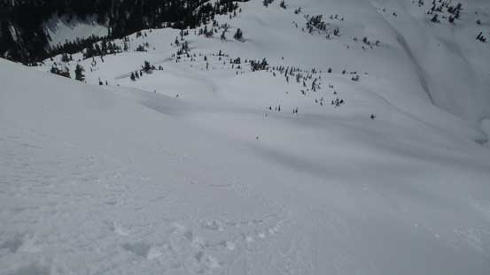
Descending into this mini bowl.
A closer look at Sky Pilot Group.
The lower reach of “Mineral Peak” in foreground.
Plunging down.
The typical North Shore’s treeline country.

Tricky route-finding at places…
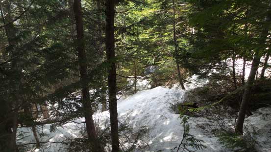
Into the mature forest.
The snow bridge crossing Beth Creek
Checking out Beth Lake. Totally worth it…
A closer look at the alpine country above the lake. Note the cornices..
Descending from the lake I opted to follow the orange diamonds instead of reversing my uptracks, hoping to stay on the “trail” but I failed. I lost the trail not far down and soon enough I entered a zone of miserable secondary growth forest. The terrain also steepened significantly so not wanting to deal with the potential Type III fun I bashed back a little bit, cut sharply to the skier’s right and eventually merged onto my own tracks. Along this section there was some inevitable bushwhacking but nothing bad as far as my experience could tell, and before realizing I was already down to the remnant logging roads. I kept the ‘shoes on for as far as the snowline went and then, snowshoes off, boots off and sneakers on. Needless to say the moment of putting the sneakers on was the most enjoyable of the day…
Descending from Beth Lake I lost the trail again…
Made down to the logging roads now.
Snowshoeing down the road.

Running out of snow now.
The ‘shoes were off.
The 2-3 km slog back across Downing Creek Road was not as bad as I remembered from a couple hours ago but that’s probably because of the improved weather and the fact I was going downhill now. It still felt long though… And then there came the final 4 km back along Phyllis Creek Road which was a plain slog. Musics definitely helped on killing time. Eventually I got back 11.5 hours after leaving the truck in the morning which was not bad.

The typical conditions on Downing Creek Road.
A major rockslide area.

One of the many small creek crossings.
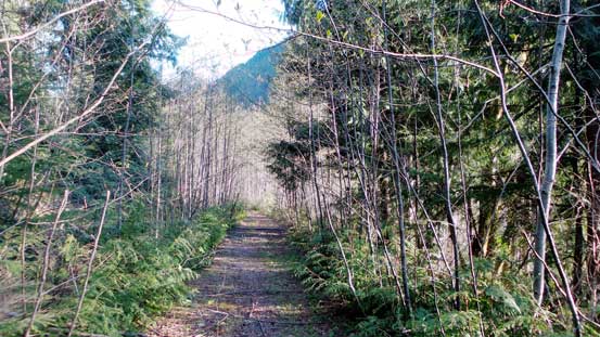
This is the initial few hundred meters on Downing Creek Road

Back to the main Phyllis Creek Road now.

One last look..
Overall this was another very satisfactory day especially considering the so-so weather and I was exceptionally happy about my objective picking as anything higher would have been soaked in, while anything shorter would probably not really worth taking the day off. Now I’ve got some fresh beta about the Furry Creek access zone and I think I’d want to come back for other peaks before the roads become totally shit (which seems like the norm nowadays).
