Castlecrag Mountain
August 1, 2021
1765m
Vancouver Island, BC
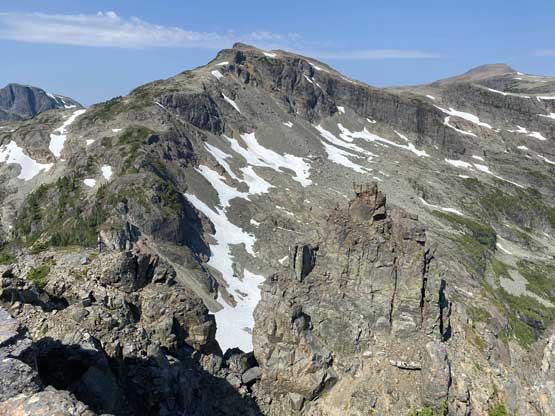
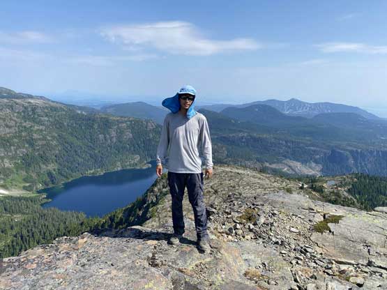
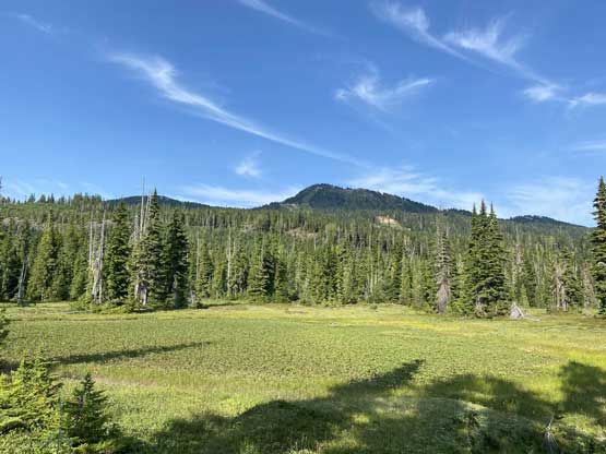
Castlecrag Mtn. is a small summit in the area of Forbidden Plateau dominated by Mt. Albert Edward but this peak does boast a somewhat iconic profile viewing from the north. According to the few chats with the hikers in that zone this peak is actually decently popular, which was to my surprise. It’s definitely more popular than Jutland Mountain for example. A trail/path has been pushed from the campground at Circlet Lake across the outflow of Moat Lake all the way to the south slopes of Castlecrag Mtn. where the peak can be ascended in a short stroll. Contrary to the rugged north side, the standard route on the south side if nothing fancier than a “walk-up”. Alex, Vlad and I did it as a last objective of a loop traverse after completing Jutland Mtn., Mt. Albert Edward and Mt. Frink.
From Frink/Castlecrag col we picked up the trail traversing across the south slopes of Castlecrag Mountain. The side “trail” that ascends onto the summit of this peak was well-marked with a large cairn. We ditched our packs there and made a quick dash for the summit. Thank to the rugged profile this peak actually offered some nice views and we all played around the edges for some photography.


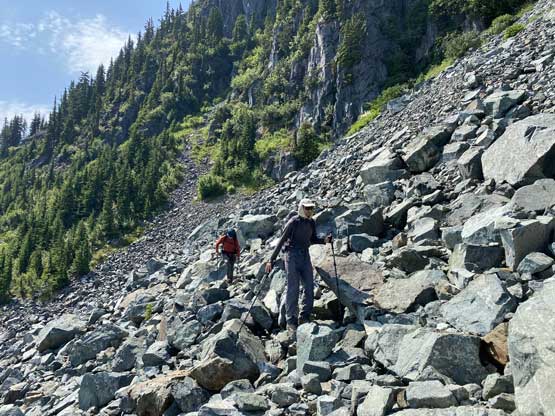
The descent back to the packs was uneventful and then we resumed the traverse on this well-marked trail. The next few hours were extremely miserable thank to the heat and the unpleasant terrain. We all expected a trail with similar quality as the section below Circlet Lake but we were wrong. This trail was more like a North Shore’s trail on which we must deal with rocks, roots, boulder fields, high steps and up-and-downs. The going was slow and we all ran out of water. Thankfully we were able to eventually push down to the outflow of Moat Lake before calling for a long break.


I somehow accidently triggered the SOS on my inReach while sitting on my backpack relaxing at the outflow. At first I thought I heard some beeps but none of us knew what exactly that was, so kept hiking. About 20 minutes later that beep started to become more and more frequent and it’s becoming obvious that the sounds were coming out of my pack, so I stopped to check out the inReach devices, and sure enough it showed “SOS in Process”. I had to type a few messages to explain the situation and thankfully I was able to cancel it. Form that spot we pushed onward to the small creek that we loaded up the water bottles a day earlier. And from there we pushed all the way out taking a few necessary breaks here and there. I thought about to make a loop lower down as suggested by others but none of us was in the mood for that and all we wanted was to get out. Needless to say, this hike-out was very unpleasant and at the end of the hike the distance clocked at 43 km and that explained why we were so damn exhausted. Vlad had developed some massive blisters on his feet.


After the trip we drove down into the city of Courtenay for some cell services to make plan for the next two days. The original plan was an overnight ascent of Mt. Tom Taylor but none of us was in the mood for that. We decided to take it easy and then I remembered reading a post about Adder Mountain on the “SWBC Peak Baggers” Facebook page a while ago. We all did our own researches and agreed on that plan.
