“Quirin Peak” (Hydro Mountain)
November 13, 2021
670m
Mission, BC
This is just another unnamed bump in the Fraser Valley that both Robin Tivy from bivouac.com and Grant Myers from peakbagger.com took the “authority” to provide a name. I have no clue who actually named it first but whoever came later, opted to provide a completely different name. These two sites store some of the most comprehensive mountain-related information so it’s unfortunate that they could not even cooperate in this simple naming process. Whether one chooses to trust R. Tivy (“Quirin Peak”) or G. Myers (“Hydro Mountain”), these names are unofficial and has not been approved by the government of B.C. This peak refers to the highest point in the immediate vicinity of Hoover Lake not far from Mission. The entire area has been heavily logged and the summit locates in the middle of some secondary-growth jungle with no view whatsoever. However, this peak does boast over 500 m prominence as it’s the highest point between the lower Stave Lake and the flats of Miracle Valley.
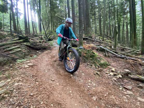
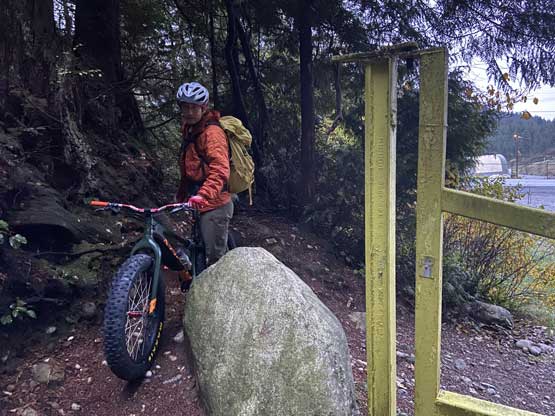
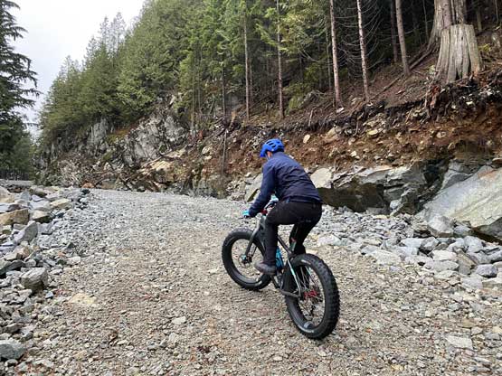
Despite that a logging road goes to within 20 vertical meters from the top this is by no mean a “drive-up” summit. The road is gated at the very bottom. For a number of years I thought about to just walk these roads on foot but then I came across the oppourtunity to actually bike it. I recently got my bike from Matt Juhasz’s “North Shore Bike Shop” and it made perfect sense to use this peak to test out the bike. The weather was not good enough for anything else anyway and Matt was keen to show me some proper mountain biking techniques. I underestimated how late the sunrise was at this time of a year such that by the time we got to Steelhead at 7 am the horizon was just bright enough to not require the use of head-lamps. We opted to park at a not-so-obvious pull-out about 500 m to the west of the gated FSR.
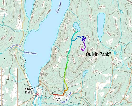
The bike to the bottom of the FSR was on the paved highway but actually held some notable elevation gain. By the time we made to the gate, less than 10 min in to the trip I was already exhausted from the uphill biking and needed a break. The grade of the road was mostly very steep except for short stretches of flat-ish riding. Again, my performance was horrible but once I fully warmed up I was able to actually paddle at least half of the uphill sections. The steepest stretches were also kind of rough so I had to push the bike up, but Matt, with 20 years of biking experience was able to effortlessly paddle most of the way up. At the junction with “Hoover Lake Trail” we found the spur road to our right. This spur road was steep and rocky but not as bushy as the satellite images suggested, such that we were able to ride and push the bike all the way to the very end.


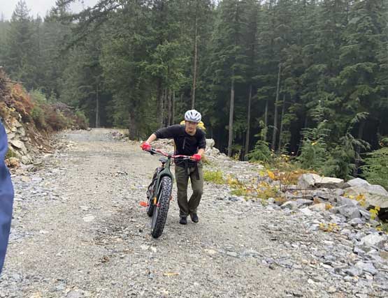

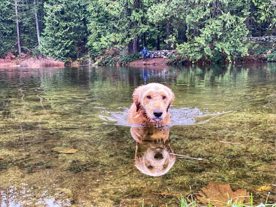
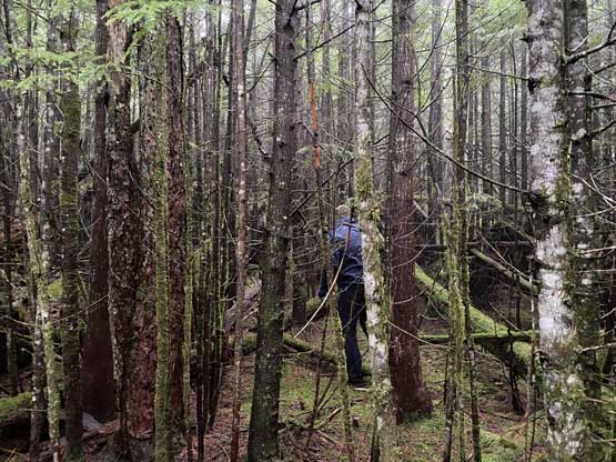
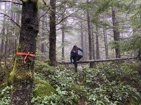
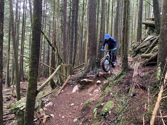
After ditching the bikes we dived into the bush. We were able to pick up a trail but we weren’t sure whether this trail actually brought us to the highest point, so we dived into the bush again. The contour lines suggested the summit area was rather flat so we bushwhacked for quite a while to search for the highest point. The conclusion was that it’s impossible to tell from naked eyes where would be the highest ground, as the visibility was next to nothing in the woods. After having enough of this bushwhacking fun we bailed eastwards and soon rejoined the aforementioned trail. The downhill biking was not as scary as I thought but the shaking on my shoulders and arms was very tiring. Matt saw the (hiker’s) “Hoover Lake Trail” as a singletrack playground for him so we took the bikes onto that trail. We soon had to ditch the bikes but then we walked down to the lake anyway. I did not find this lake to be any magic but it’s good to check it out nonetheless. Once back to the FSR we enjoyed a fast ride back to the vehicle. The lower portion of this road was not as rocky as the upper spur, so the ride was a lot more comfortable.

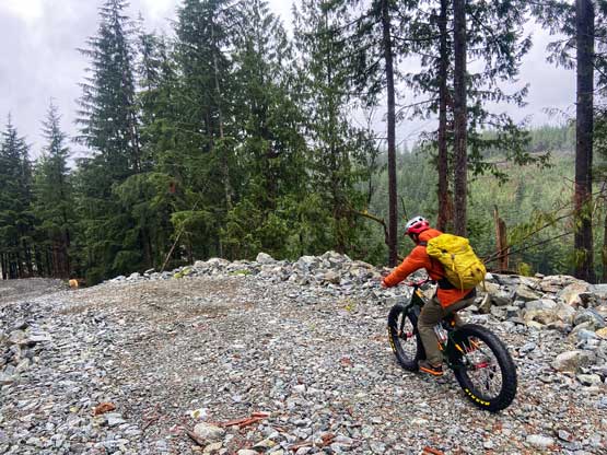


The day was still young so we made a spontaneous decision to drive to the nearby Bear Mountain Park to practice some proper mountain biking. The biking on a gated FSR was obviously not “fun” enough and Matt wanted to show me more. I had previously summitted Bear Mountain so we were not keen to ride to the very top, but Matt knew a popular loop that was somewhat suitable to the beginners. The uphills were exhausting and it turned out that I pushed more than half of the way up. The descents had some rough and steep sections at the beginning that I had to walk the bike down, but I did manage to ride down most of the lower trails. At times it was scary but I always kept the speed in control. We finished the loop at 11:30 am right in time for the torrential rain to come. The current Atmospheric River event in SW BC was catastrophic, causing countless wash-outs, flash floods and closures of major highways.