Charleston Peak
December 31, 2017
3633m
Las Vegas / Spring Mountains, NV
There’s some confusion about the name. It seems like “Mt. Charleston” is the more commonly used one but according to the government topographic maps the official name is actually “Charleston Peak”. As a peak-bagger I have to follow the official name. Asides that, this is the 8th most prominent peak of the “Lower 48” and also the most prominent, as well as one of the highest in the state of Nevada. Two popular trails run from the village all the way to the top and they themselves can be combined to make a loop. The easier of the two goes up Trail Canyon/North Loop and is considered as the “standard route”. In the right conditions nothing’s required beyond a pair of sneakers.
The fact that reaching the summit of Charleston Peak is nothing fancier than a hike had put some damper on my motivation but there’s always the bright side. The winter of 2017/18 has seen some of the driest conditions in the southwest desert areas and for this particular objective there’s virtually no fresh snow to be seen. This is such an anomaly that one would usually expect some treacherous snowshoeing at this time of a year. Jake and I had discussed the options but in the end we figured it made simple sense to take advantage of the conditions we had. The crux was finding a car-camping spot. At about 8 pm a ranger came and kicked us out of the trail-head parking lot but that didn’t mean we would pay a single penny for camping. There’s plenty of places outside the national forest and you just have to be a little bit creative sometimes. The place we found was quiet (off-road) and actually didn’t require too much of a driving detour, although this isn’t something I would want to share in public.
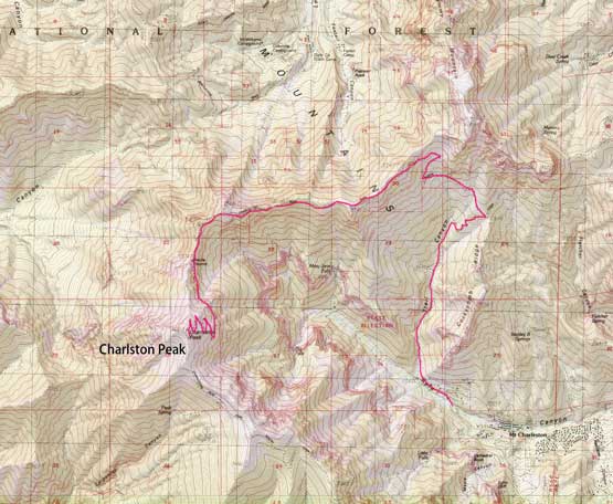
Charleston Peak via Trail Canyon/North Loop
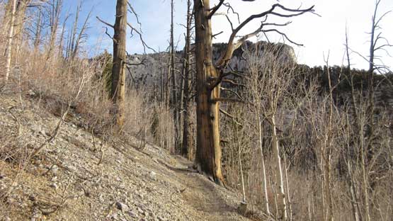
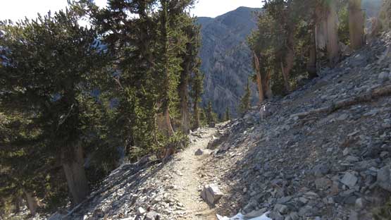
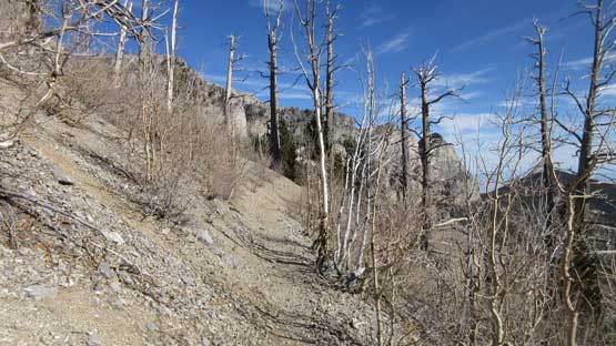
As usual we opted to start the day at dawn just when it’s bright enough to not require illumination. Much of the lower approach from Kyle Canyon to Trail Canyon is a boring plod. The first few miles are actually on an old Jeep road with lots of loose gravel that makes slippery footing. The terrain starts to get a little bit interesting when we merged onto the official North Loop trail at a “saddle” feature. The following hour was then spent navigating some long switchbacks underneath the shear cliffs of Mummy Mountain.
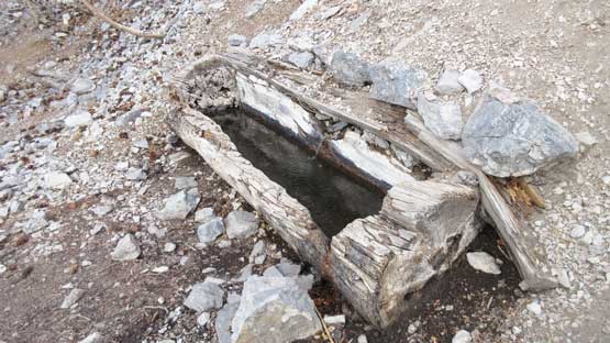
There’s a very interesting water tank along the way.
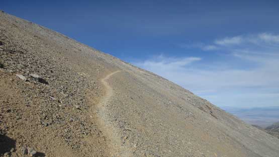
As typical as the trail goes above the North Loop junction
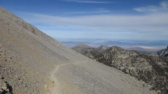
At first we thought the trail would traverse along the ridge crest for miles and miles but actually not. We did crest the ridge a couple times but mostly we were traversing horizontally on the left (south) side and much of this stage was sheltered from views. This wasn’t without highlight though as the trail does traverse beside some shear drop-offs. It might be exhilarating for hikers with vertigo but less so spectacular for us.

Me traversing one of the scree ledges. Photo by Jake R.
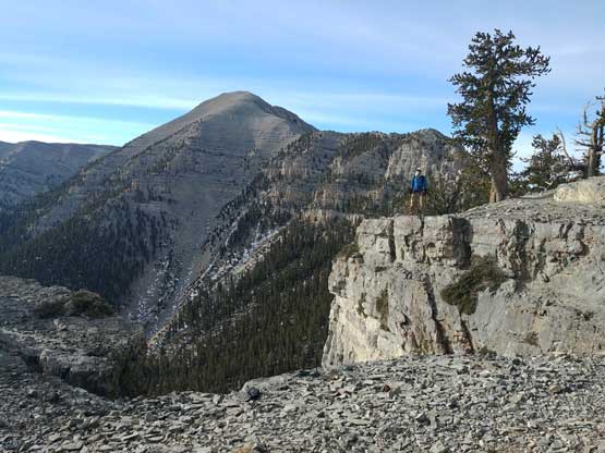
Our objective – Charlston Peak behind. Photo by Jake R.

Jake traversing the scree ledge

Typical, typical.
There’s some shear drop-offs
After what seemed like a long while we finally got to the base of our objective. There’s an option to take the Devil’s Thumb direct (3rd class) scramble route but with just trail-runners we decided to just stay on the trail. The final stage is characterised by some endless switchbacks on the scree slopes so it’s all about perseverance. The final few minutes along north ridge was actually quite scenic but the actual summit has some structures.

More traversing… This seems never-ending…

At this point Jake went ahead.
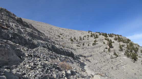
The massive NE Face scree slopes. This looks similar to the C. Rockies…

About halfway up the final scree face, looking sideways towards north.
Oh the scree trail…
Finally cresting the uppermost north ridge with some expansive vista
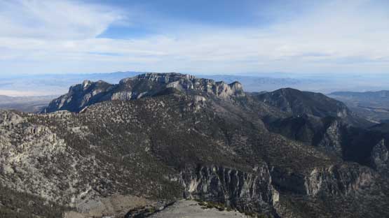
This is looking towards Mummy Mountain

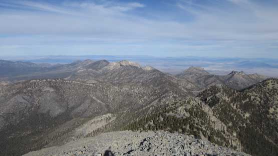
Partial Summit Panorama from Charlston Peak. Click to view large size.

Partial Summit Panorama from Charleston Peak. Click to view large size.

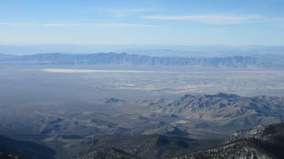
This is looking down at Las Vegas skyline. The view’s a bit hazy.

Mummy Mountain

One of these smaller peaks is “The SIsters”
Another zoomed-in view looking north into US-95 Corridor
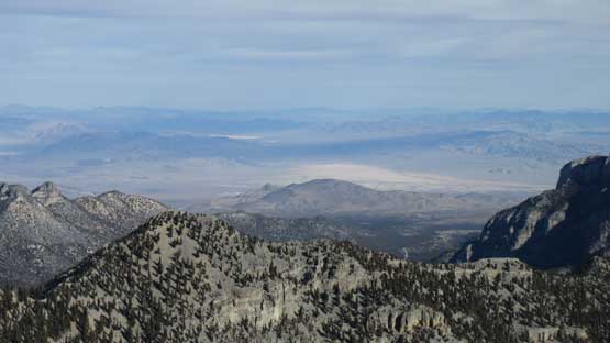
The immense Mojave Desert and the town of Pahrump
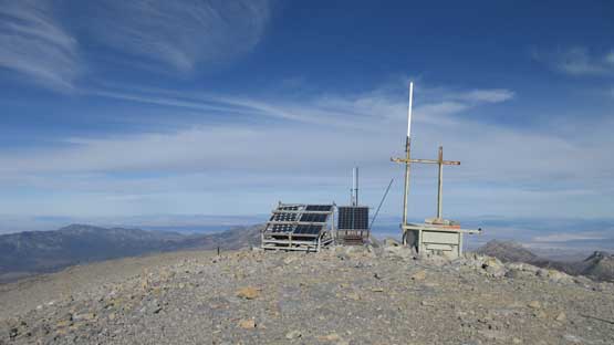
The ugly structures on the summit…

Clark Mountain is a iconic one in Mojave Desert
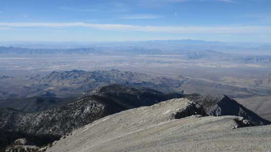
A wider view of the desert to the west. Telescope Peak on the skyline

Mummy Mtn. with some interesting cirrus clouds above
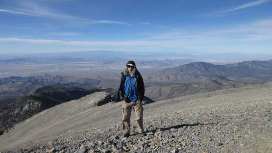
Me on the summit of Charleston Peak. “Ultras” #33

Summit register with familiar names…
As much as the views reach we didn’t want to spent too much time lingering. The plan for this descent was to take one or two breaks along the way but for some reasons we ended up pressing down in a single push although we did stop frequently for some photos. I think we got back to the vehicle in less than two hours.
Following this trail down the NE Face scree slopes

Another look at Mummy Mtn.
Oh the trail slog.

Fletcher Peak and Kyle Canyon
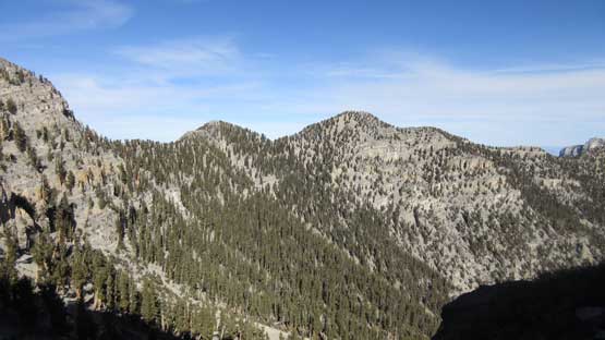
This is the bumps along the undulating ridge we just traversed across
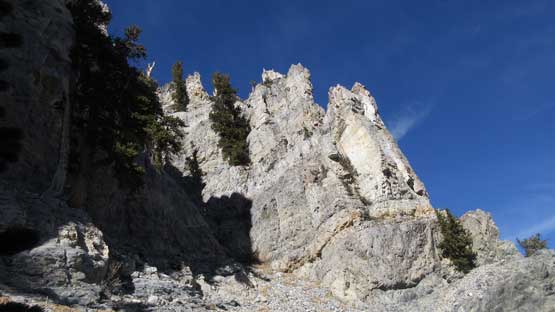
The limestone scenery really resembles my old playground – C. Rockies

Another view looking down through Kyle Canyon where we drove from.

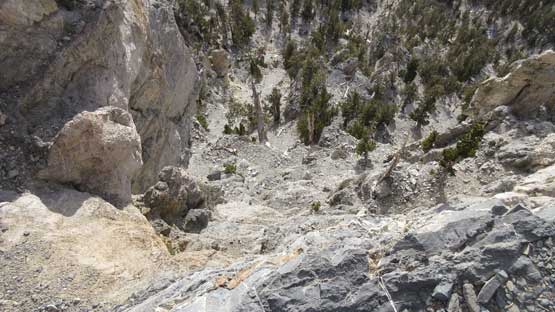
Mummy Mountain is surrounded by cliffs on all sides.
Descending the North Loop Trail

This is roughly where Mummy Mountain’s scramble route branches off

Down, down, and down..

One last look at the walls around.
Overall I would say the only challenge of this trip comes from the physical aspect given the distance to cover (17 miles round trip) but that’s pretty standard for Jake and I. The quality of this ascent was slightly better than expected because there’s actually some unexpected scenery to be taken in. Despite the boring plod we did traverse and ascend through some cliffy terrain that gives a slight feel that Charleston Peak isn’t just an “glorified hill”.
