Crossover Peak (East & West)
July 4, 2021
2175m
Chilliwack, BC
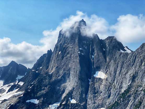
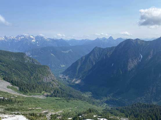
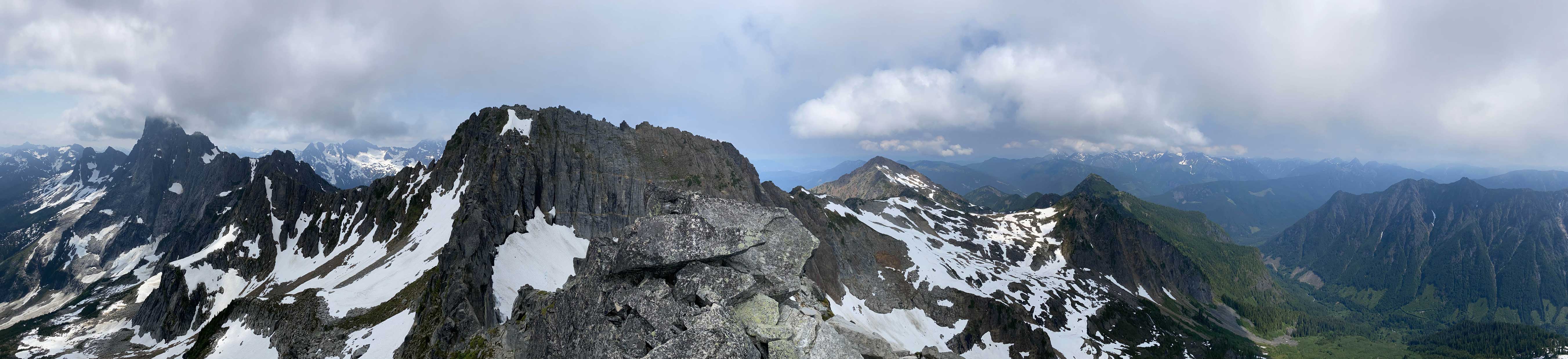
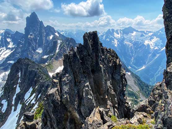
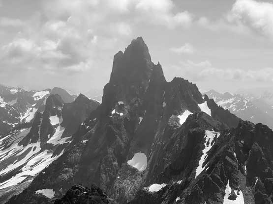
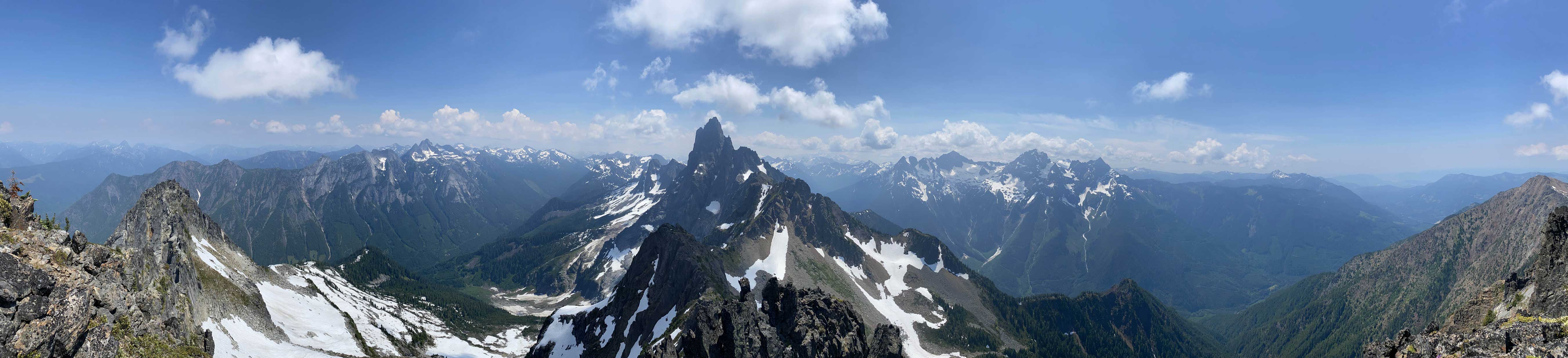
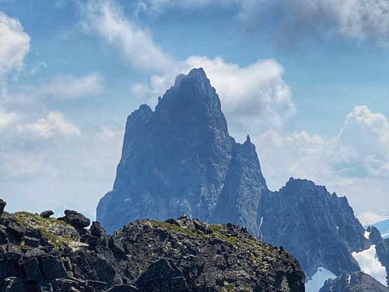
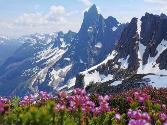
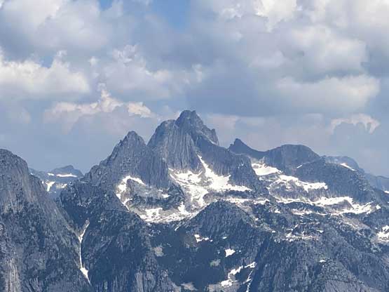
Crossover Peak is significantly overshadowed by its much more fabled neighbour – Slesse Mountain and this is somewhat unfortunate because Crossover Peak itself is a worthy destination and you also get magnificent views of Slesse Mtn. that you don’t get by climbing Slesse itself. This peak has two summits with the west one taller than the east one but the east summit is the one that offers superb rock quality. The SE Ridge direct on the east peak had bumped up my radar ever since Al, Ilia and Silvana did their trip earlier in this season. The cool plan was to climb the east peak via SE Ridge, rappel off the SW Face then link up with the standard route of the west peak because to “claim” a success on Crossover Peak I do think one has to bag the true summit, which is the west peak.
Winnie and I had been struggling to find suitable objectives in SW BC because she wanted rock climbing with easy accesses while I’m only interested in bagging peaks via their easiest possible routes. To ascent Crossover Peak via SE Ridge would push both her and my criteria because it’s not really rock climbing as she wouldn’t call 4th and non-sustained low 5th class as “climbing”, and this is also not the easiest way up this peak (so to me, this isn’t the “highest chance of success”). However, if we really have to stick hard in our ways of seeing the mountains then we had already ran out of mutual objectives in our local region, so Crossover Peak SE Ridge and that’s it. Winnie was not interested in linking up the west peak but I was fine to do that one solo, so not a big deal. Earlier in this long weekend we had already ascended Elkhorn Mountain on Vancouver Island and this was the 3rd day of the 4-day weekend.
I figured that to ascend both summits would still require a sizeable day and I did not want to wake up at 3 am for this particular objective. The solution was then to car-camp, so by 6:30 pm I grabbed Winnie by making a long detour to Vancouver and then drove down Highway 1 eastward with minimal traffic delay. While driving into Chilliwack River Valley I could see hundreds if not thousands of cars parked on the side of the road to camp and we weren’t surprised given that it’s the July long weekend. The Nesakwatch FSR was rougher than I remembered from 5 years ago when I soloed North Spire and Mt. Rexford but did not impose much of a problem to the Tacoma. There were already half a dozen vehicles parked including two Rav4s and one more vehicle would end up showing up an hour later. I decided to just sleep on the passenger seat of my truck while Winnie took her time to set up a tent.
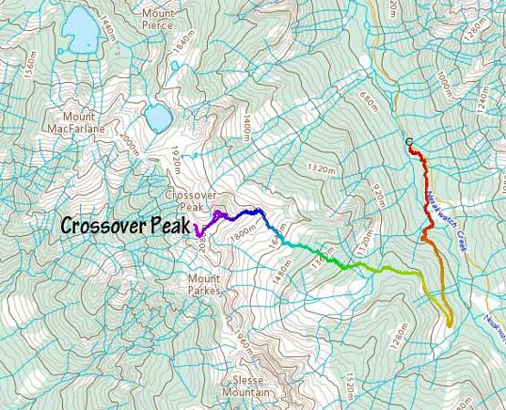
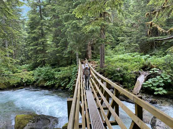
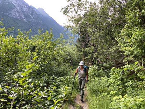
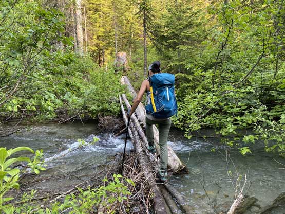
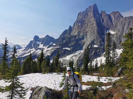
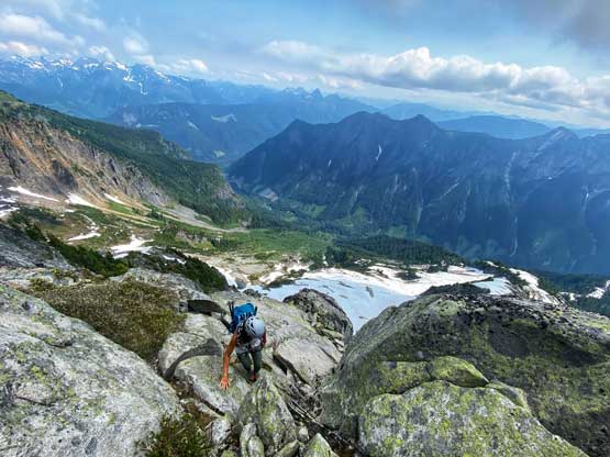
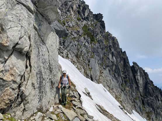
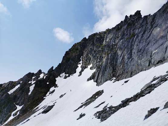
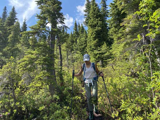
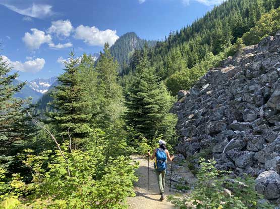
The next morning we woke up at 6 am and began the trip an hour later. This was not nearly an “alpine start” but we were both tired from the lack of sleep recently and none of us was in the mood to rush. I decided to hike in trail-runners up the Slesse Memorial approach while carrying mountaineering boots for the rugged parts and rock shoes for the SE Ridge itself. This proved to be a good idea as I did need all three pairs of footwear, as usual. The hike-in took us just over an hour and then we correctly located that climber’s foot bridge to link up with the “Crossover Pass Trail” that was largely built by volunteers in the climbing community. I swapped footwear to the boots just before the foot bridge. We loaded up water bottles because we weren’t certain about water sources higher up, but this proved to be unnecessary as there were plenty of streams up high. The trail was in an amazing shape and was very easy to follow. Near treeline we started to run into snow and undefined stretches and after a while trying to figure out the trail and Al’s GPS track I gave up. We were only 200 m under the ridge at this point so we just aimed there straight up. The bushwhacking we encountered was rather minimal and the going was decently smooth.
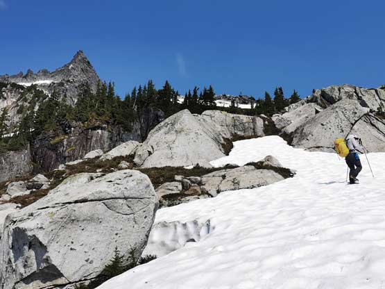
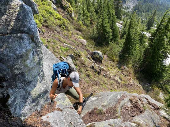
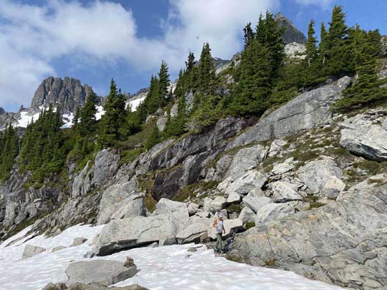
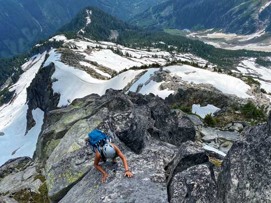
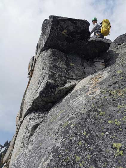
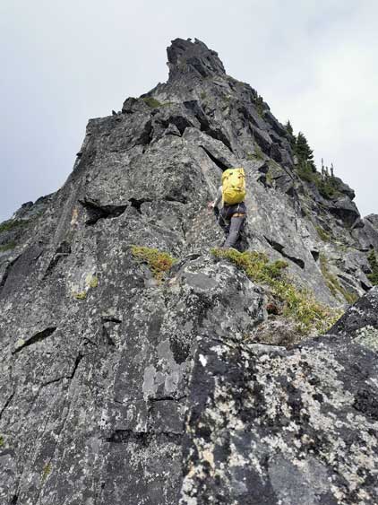
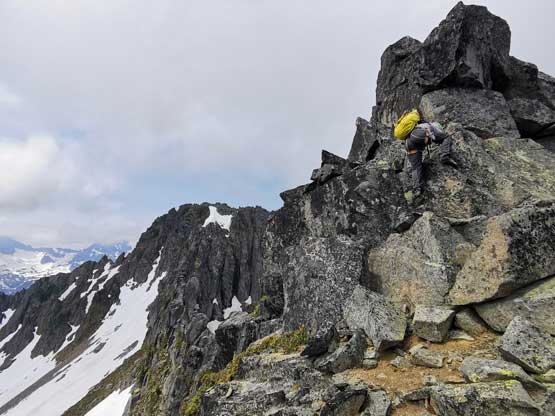
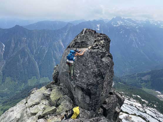
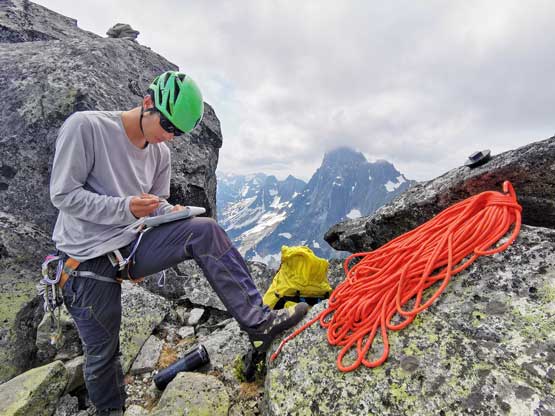
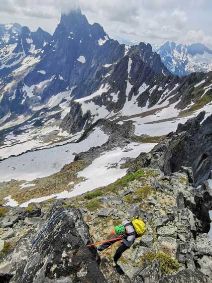
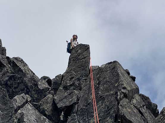
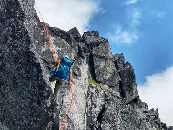
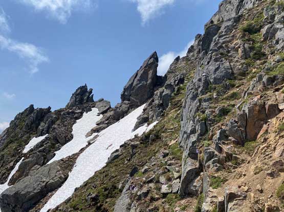
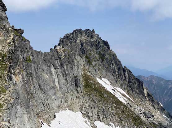
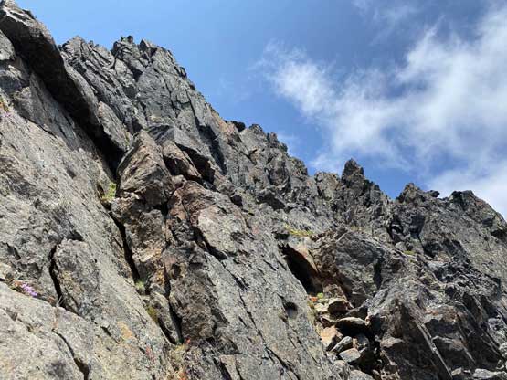
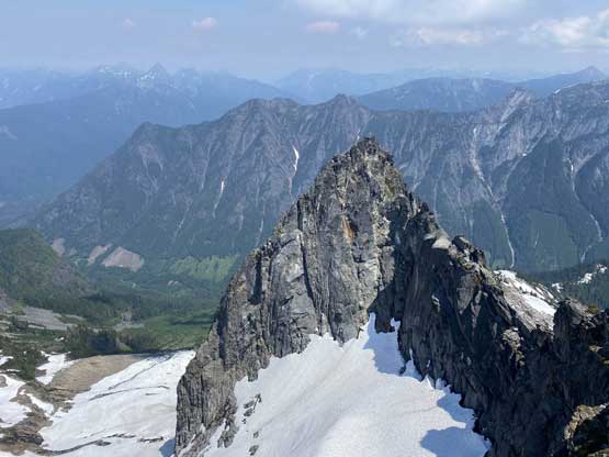
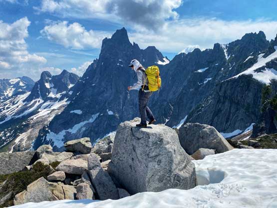
The ridge started off with more hiking and scrambling and the climbing section was pretty distinct to identify in front of us. The actual ridge climb would only last for 100 vertical meters. At the base of the climb we took our time donning harness and swapping footwear for rock shoes and soon enough we had passed Al’s gigantic orange sling that they used to rappel off on the bail. We knew the difficulties could generally be bypassed on climber’s right side on grassy ledges but we tried our best to stick to the ridge crest for added challenges and fun. We encountered short steps of low 5th class here and there but the climbing never became sustained. I volunteered to carry the rope and lead as if I could solo it then Winnie definitely could. It turned out that we kept soloing all the way to the summit. The trickiest move might actually be to gain the true summit boulder. We climbed it without a problem but Winnie opted to rappel off me whom was anchored to the summit by a sling. I then cleaned the anchor and just down-climbed as I have longer legs.
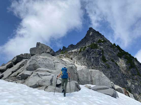

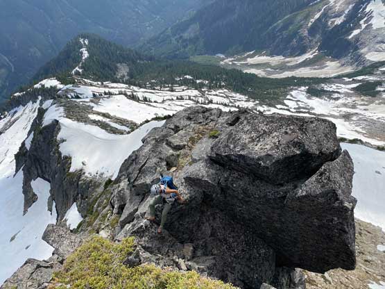
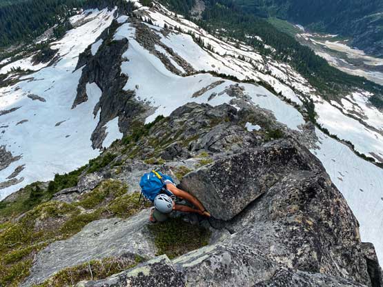
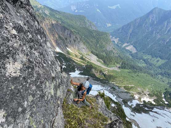
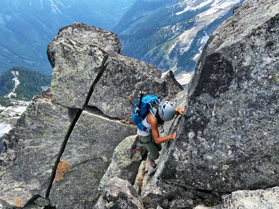
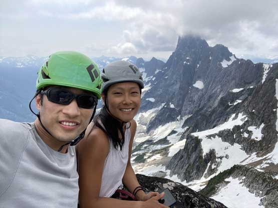

We didn’t linger long as I still had the west peak to climb. We searched for a “scramble” route down from the east summit but to no avail. I tried pretty hard to down-climb two lines that I spotted but turned around on both (even with rock shoes) and said fuck-it-and-let’s-rappel. We found no existing anchor on the upper SW Face but a massive horn that we easily slung a cord around. From there I led down a 30m rappel to the pre-existing anchor that I remembered from Al’s trip report. From there we did the second 30m rappel to get down onto snow then easily traversed snow to a flat spot that Winnie could wait for me tagging the true (west) peak.

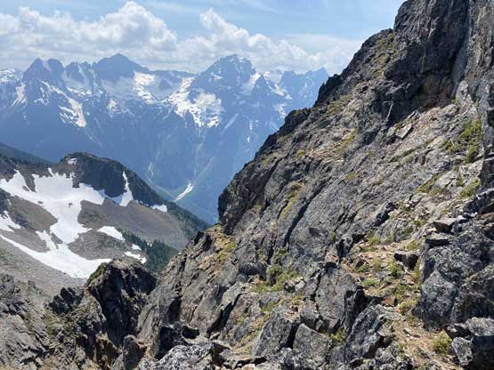
The traverse towards the south ridge of west peak looked to involve at least one section of steep snow, so I took my time donning crampons and ice axe. They turned out to be crucial as the slope was steep and the snow condition was rather crappy. I wore my crampons across some steep heather and dry dirt to access a smaller patch of snow higher up, and after that I ditched ice axe and crampons. The scramble on the south ridge was not difficult but involved extensive route-finding. Lower down I passed two slings but I did not feel that spot to require a rappel. Then I traversed right on an obvious ledge and scrambled some bushy steps on the east side of the ridge. The hardest for me was to cross a notch feature high up on the summit ridge. I didn’t spent too much time looking around but the line I took (on the west side of the ridge) involved at least one airy 4th class move on questionable rock. There were a few moves needed to get out of that notch as well and the true summit was on the far end of the ridge, which was a bit frustrating as I had to traverse across quite a few towers to get there for a marginal gain of maybe 1 meter.

I didn’t linger on the summit at all because Winnie was still waiting for me and she could not see this true summit from her position. On the descent I decided to not fuss around with anything other than the exact line that I took and even if I spotted a line that might work easier I still went with the known. In just over half an hour I was back on the snow and rejoined Winnie soon. Again, we decided to stick with the known on the descent. The main snow gully looked tempting but we opted to traverse some snow and boulders back to the SE Ridge of the east peak and descend. I checked GPS many times to make sure we descended through a few bluffs and bush bands at the exact same spots that we did on the ascent and soon enough we were back on the trail. The rest of the descent was uneventful but boring. We took a massively long break at the creek crossing to load up the water bottles and also to rest our knees. The final 4 km return to the vehicle was not too bad wearing trail shoes.
Our round trip time was 10 hours 20 minutes. Our moving pace was decently fast but we took massively long breaks here and there. The drive-out was not as difficult as I thought it’d be so maybe the water bars just looked worse at night. The drive home was however, a different game. I cut a long stretch of “red” on Highway 1 by using Fraser Highway even though Google did not direct me there. I knew for sure we had saved time by taking this variation as Google generally underestimated the time needed through “red zones”. I thought about to head straight to White Rock but I also knew Winnie had to wake up early for work the next day, so I offered to drop her off in Vancouver. We got there after 9 pm and I got back home by 10 pm.
