Mount Marriott
May 13, 2021
2735m
Pemberton, BC
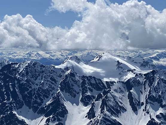
Being the highest peak in the western Cayoosh Range with over 700 m prominence Mt. Marriott is not a secret in the SW BC scrambling and peak-bagging community. The route from Marriott Basin accessed from Duffey Lake Road is well-written in Matt Gunn’s Scrambles in SW British Columbia. I’ve seen mixed reports of the quality of this so-called “standard route” with great views but also unpleasant and endless hopping on talus fields. This had been one of those objectives that I would definitely do at some point, but not in a hurry. This was no longer the case until Matt’s “Midnight Crew” made an ascent last weekend from Seven Mile Creek valley to the north-west and reported “fast and easy travel” and “snowshoeing to the summit”. This access was also not a secret because Simon had written a great trip report about Nequatque Mountain a number of years ago, but most peak-baggers, myself included, weren’t creative enough to consider the same valley and the same spring timing for a quick grab of Mt. Marriott.
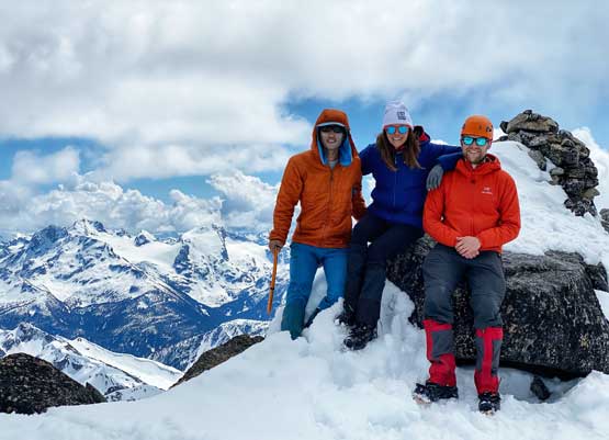
Matt’s trip was on Saturday of last weekend and since then there had been at least 2-3 groups taking advantage of the tracks. I could not join the gang because I had a bigger mission on Chimai Mountain, but when the next window formed a few days later in the midweek I was dead set to make this happen. I was about to go for a solo mission but at the last minute, Holly and Andrew K. managed to join. The decision was made at 10:30 pm on Wednesday night to meet in downtown at 4:30 am on Thursday morning so it was a huge hurry to get things packed.
The next morning I grabbed both of them from Holly’s place in downtown then drove up the familiar Sea to Sky corridor to Pemberton. After some breakfast in McDonald’s we resumed the drive up towards D’Arcy. The logging roads in Eight/Seven Mile Creek valleys started immediately after Gates Lake. We came here with fresh beta about the roads to the point that I knew exactly where my truck could get to. The roads were a little bit rougher than anticipated with a number of water bars lower down and some steep grades. Once turning onto the Seven Mile Creek Road the going became even rougher. I drove past the common starting spot for another few hundred meters on some narrow and bushy spurs and parked pretty much at where Matt’s truck stopped, so I was quite happy about the performance of the Tacoma. Without the fresh beta provided by Matt as well as in Francis’ trip report I would not consider attempting this last switchback. However, in the end it turned out that my truck handled it very fine.
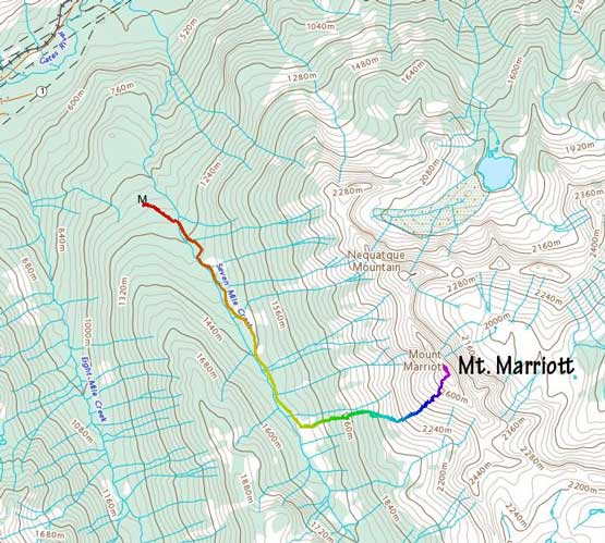
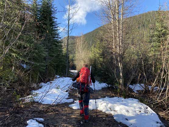
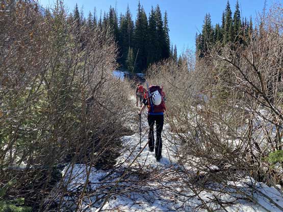
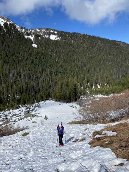
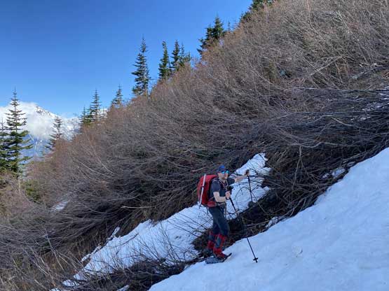
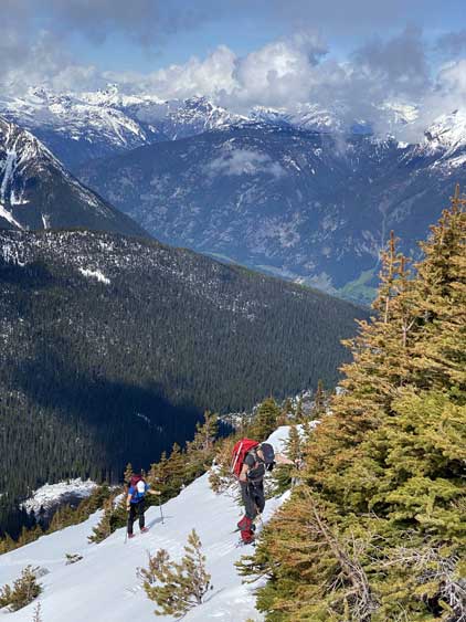
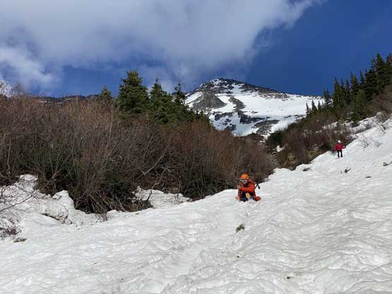
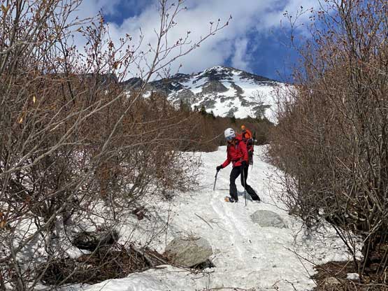
Within a few hundred meters we started to encounter patchy snow that made me to strap the snowshoes on, only to take them off within 5 minutes. I thought the dry patches would only last for a short while so carried the snowshoes in my hand, but it turned out that the dry section stretched for a few kilometers all the way past Nequatque’s turn-off. The snow on the FSR was also mostly firm and supportive in the morning that we were able to walk to within 1 km from Mt. Marriott’s starting zone at 1450 m elevation before finally strapping the snowshoes on. The bushwhacking on the last 2 km of the road was notable and would only get worse as the snowpack melts further.

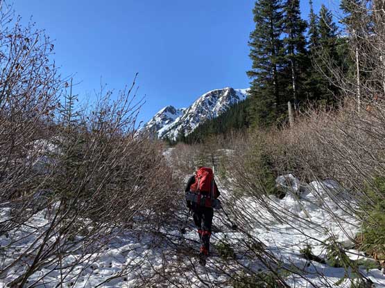

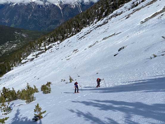
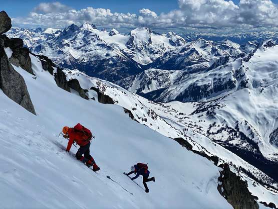
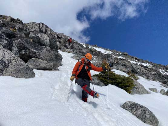
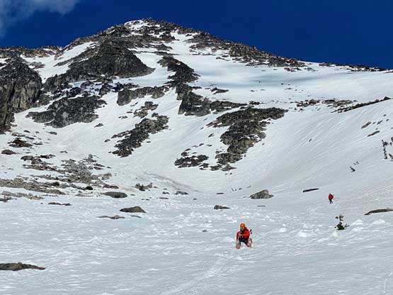
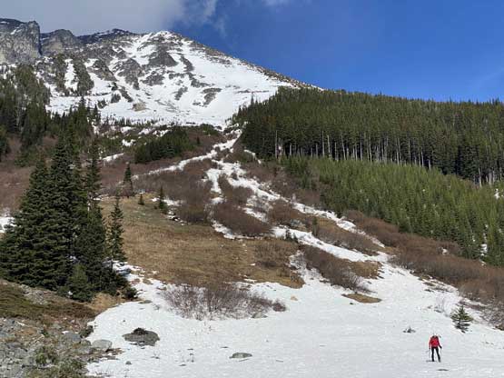
We took a long break at the base of the route ditching some unnecessary gears. The route appeared much drier than expected. The lower section up a gigantic fan of slide path looked bushy but turned out that we didn’t really need to touch any bush. We were able to snowshoe straight up one of those snow strips/gullies for a few hundred meters. The middle section had some melted-out spots that forced us to snowshoe some steeper slopes on climber’s right side of the fall line to reach what I would call the “middle basin”. Ascending out of this basin further towards climber’s right we dealt with another long stretch of steep snowshoeing on 35+ degrees slope to access the upper SW slopes.

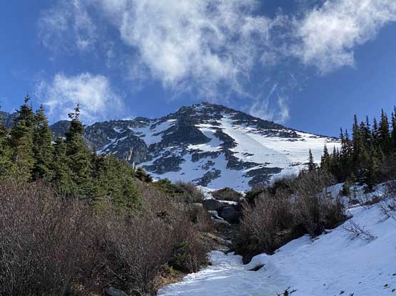


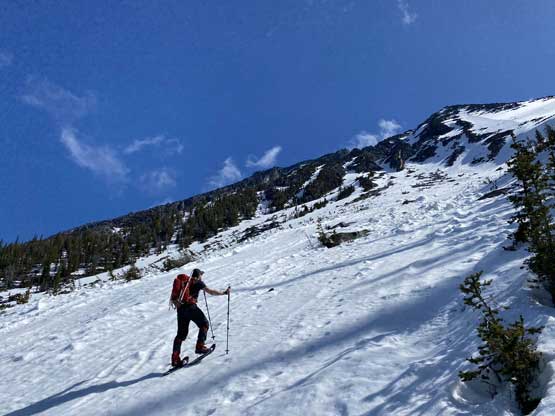
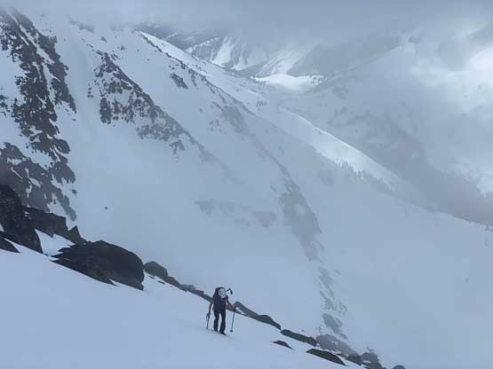
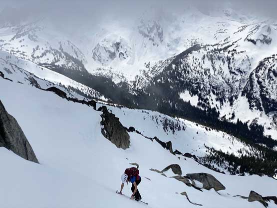
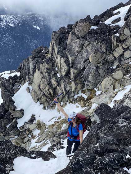
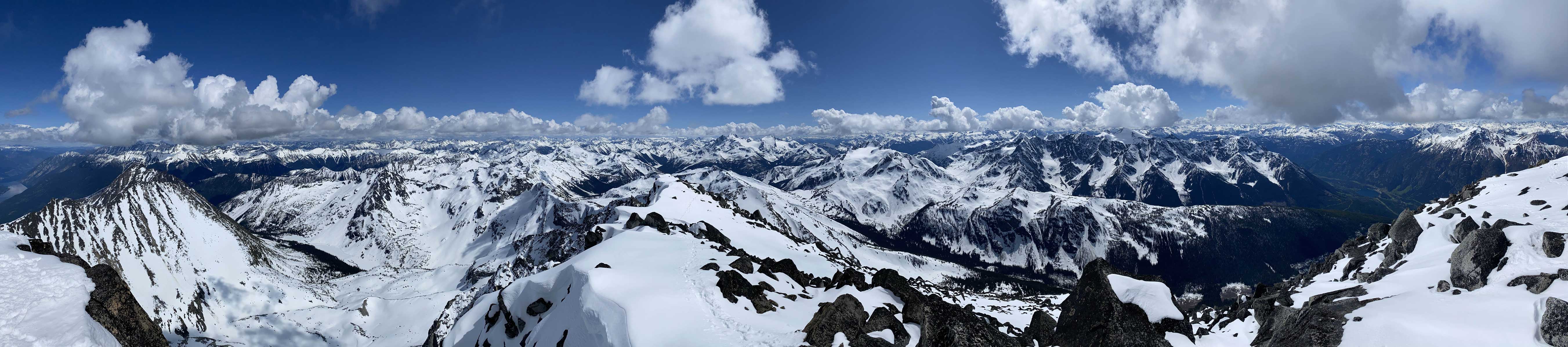
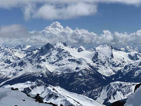
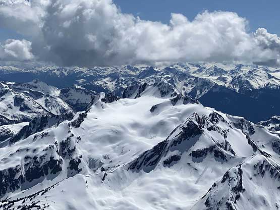
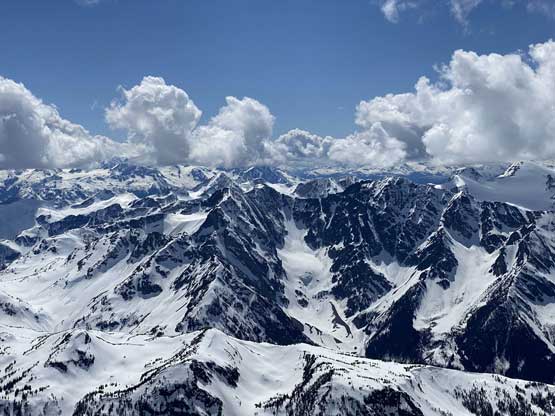
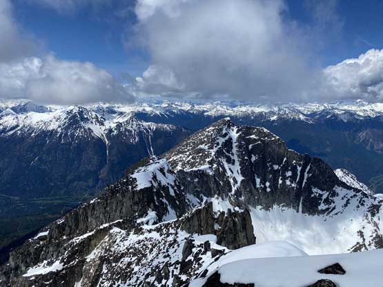
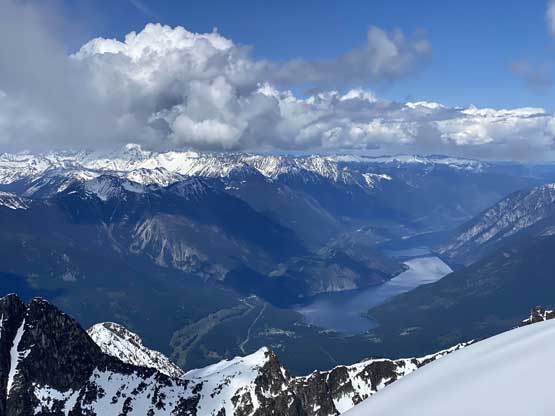
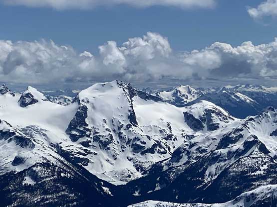
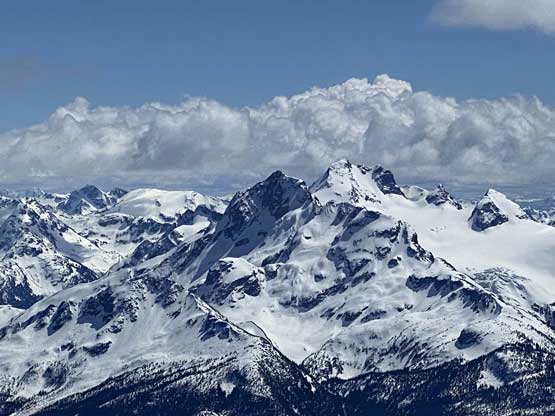
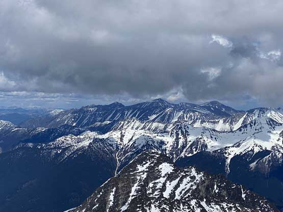
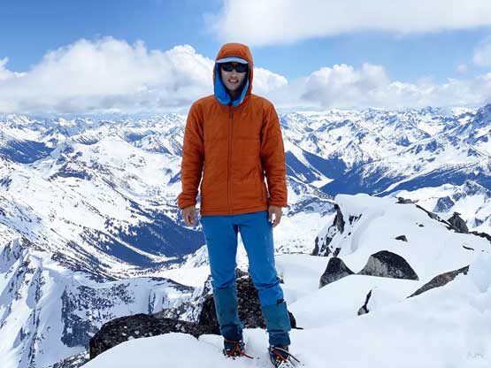
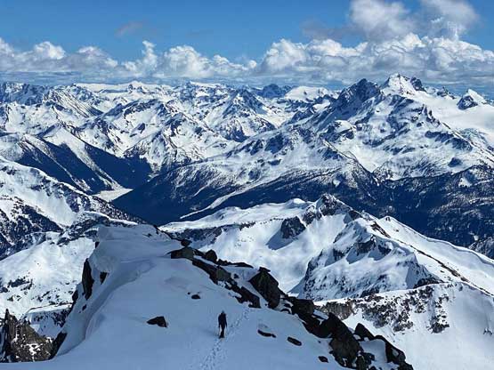
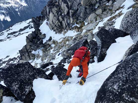
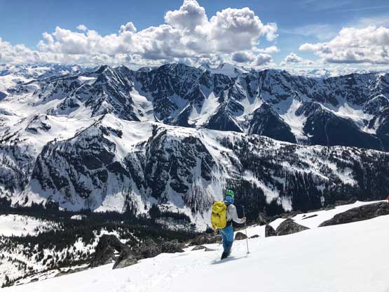
The upper SW slopes was rather just a 500 vertical meters of slog on a mix of snow and talus but the view was extremely foreshortened. I kept looking at GPS to remind me how far we still had to ascend. The weather had also turned into mostly cloudy with occasional white-outs that further diminished our motivation, but we knew the clouds would come in and go and there’s decent chance we could get some views from the top. We kept snowshoes on until we couldn’t find any further continuous snowline to zig-zag around those boulders. The snowshoes were then ditched and the crampons were donned. A lot of crampon use on dry ground was required on this particular day. There’s one steeper section about 100 m under the summit that required some brief scrambling. We arrived at the summit still in some white-outs but the clouds magically cleared up gradually over the next hour and we lingered until we got all the views.


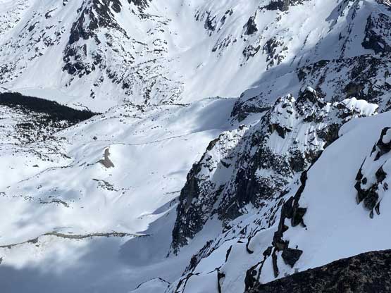


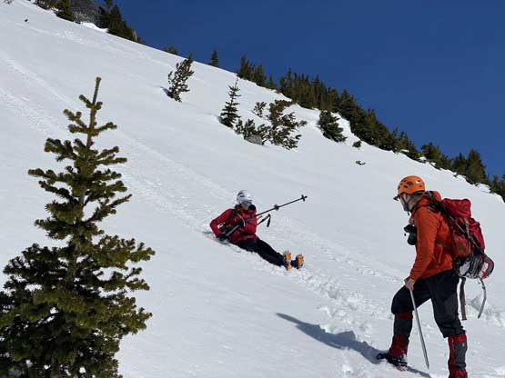
The descent was harder than we thought. While the upper route wasn’t too bad following our own tracks the post-holing took over before reaching the spot where we ditched snowshoes. The snow condition combined with the slope grade meant snowshoeing down wasn’t an option, so we had to suck it up and post-hole. Some of the holes we punched through required a few minutes of digging to get out. A few hundred meters further down we finally found enough of continuous snow that glissading then became the proper and the only efficient technique to get down this mountain, although none of us was wearing proper pants for glissading. The one particular glissade that I thoroughly enjoyed was the long run that got us down into and past that “middle basin”. I must have lost 200 vertical meters in one single run. A combination of glissading, boot-skiing and post-holing was used to descend the lower gullies back to the deactivated forestry roads. The final plod out of the FSR required us to use snowshoes and bushwhacking through those alders on snowshoes weren’t particularly fun as the they tend to catch the branches to make us face-plant.


In the end our round trip was almost 11 hours but that included at least three hours of long breaks we made here and there. We were running a little late on the schedule so I didn’t take too many stops on the way back aside from one stop in Squamish for a very-late dinner and another stop also in Squamish for (cheaper) gas. I eventually dropped Holly and Andrew off in downtown at 10:30 pm and made back to White Rock in another 50 minutes.
