Bedson Ridge
September 29, 2013
2240m
Hinton, AB
Along with Mount Kephala and Boule Roche, this is one of the three officially named peaks in Boule Range in the easternmost part of Jasper National Park. Though visible from Highway 16, this range is in an obscured part of the Park since it’s on the north side of Athabasca River. To get there one must travel through a small community called Brule Mines accessing from Hinton. Apart from being infrequently visited by local rock climbers, these mountains see little traffic. In particular, I couldn’t find any information about how to attain Bedson Ridge’s summit. One would think the natural way being its ridge line starting from Athabasca River, but after carefully examining both the government topo map and the satellite images, I drew out a direct line starting from the community of Brule. This direct route adds elevation gain but shaves off a ton of distance.

Bedson Ridge scramble route. GPX DL
The weather pattern for this past weekend was unstable throughout the entire Rockies and the forecast kept changing. The objective got changed a dozen times as well. Eventually at the last minute, Ben and I decided to give Bedson Ridge a try as Hinton got the best forecast. The first thing was finding where to park! We wanted to park as close to Supply Creek as possible but on the other hand, we couldn’t park at someone else’s home. Here I’m giving some detailed directions. Note that the road number on Google map is labelled wrong. We followed the main road, Center Street down and turned right at Mountain Road. And then at the first major intersection (52nd St., gravel road), we turned left again and parked at a pull-out on the left side.
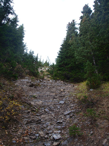
The road turned to ATV tracks at its end, and by following it down we soon arrived at Supply Creek. It was bone dry… Well, we had to go back then since we didn’t bring any water along.. Embarrassing but thankfully we were only a couple hundred meters into the trip so we didn’t waste too much time. This creek is much wider and dryer than expected so that the bushwhacking is near non-existent. Comparing to Boule Roche‘s approach which is only a couple k’s away, this is surely a fresh change. The next 1 hour or so was simply following this dry creekbed up.
Following Supply Creek up.

Gorgeous morning lighting.
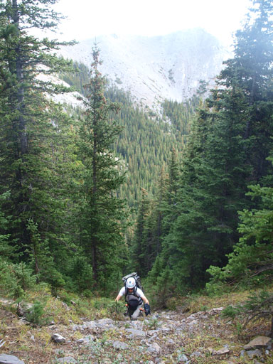
Further up the creekbed splits into two branches. It was hard to tell which was the major branch and we picked the left one. Both of them would work and the only difference is, the left side is moderate scrambling while the right side is easy scrambling. At treeline, the pleasant rocks/staircases switched to awful rubble/scree. We were planning to aim more climber’s right but side-hilling on these rubble was horrible so we actually went more or less straight up. This dumped us at many series of short slabby rock bands and each involved moderate or difficult scrambling but nothing troublesome. It didn’t take us long to top out on the ridge crest. We were welcomed by the first view of our objective, and also, the cold and strong wind…
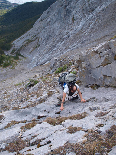
There’re a couple short slabs to scrambling through

Side-hilling…
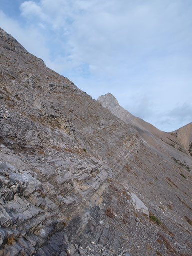
Typical terrain on the “left branch”.
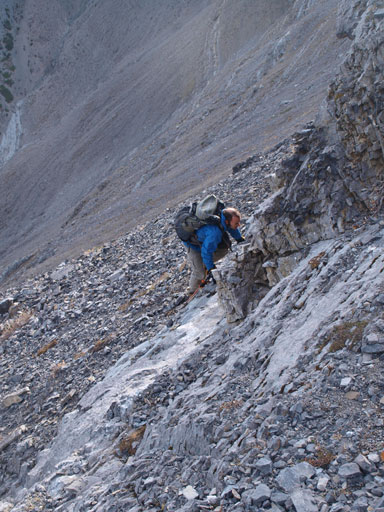
Another short rock band

Panorama looking back towards Brule

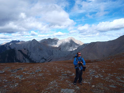
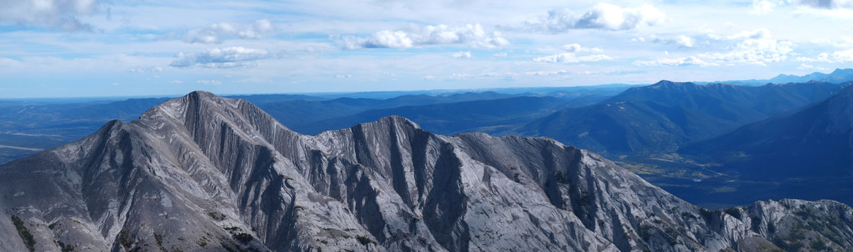
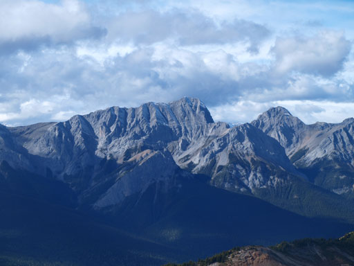
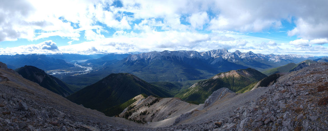
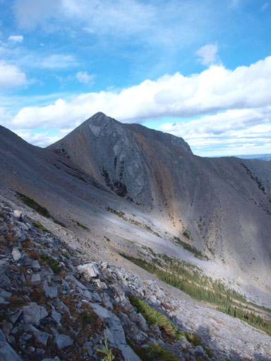
Panorama of the other side. Ahh, this is Bedson Ridge!

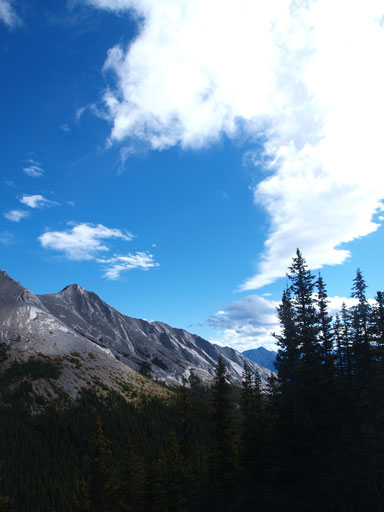
This impressive looking pinnacle doesn’t have a name.
Now we had a couple options. It’s all about the trade-off between distance, elevation gain/loss, bush, and side-hilling. We picked a “mixed” line that involves all of them. Initially we lost elevation towards skier’s right and once hitting the creek floor we went straight up on the other side. We came across a cut block about halfway up and followed it for the rest. This brought us to the crest of a “middle ridge”, and the rest was simply ridge-walking. It’s hiking/easy scrambling but the wind was cold and strong. We also went down the other side of the summit for a while hoping to see human signs but we couldn’t. There wasn’t a cairn so we built one and left the register there.

Down to the other side, the creek bed was still wide and open
Ascending a cut block to minimize bushwhacking
Looking back

This is the same peak as the “impressive pinnacle” shown above
We travelled up and over this col.

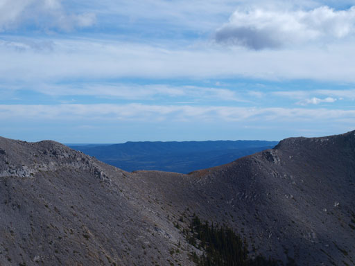
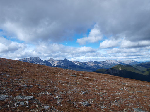
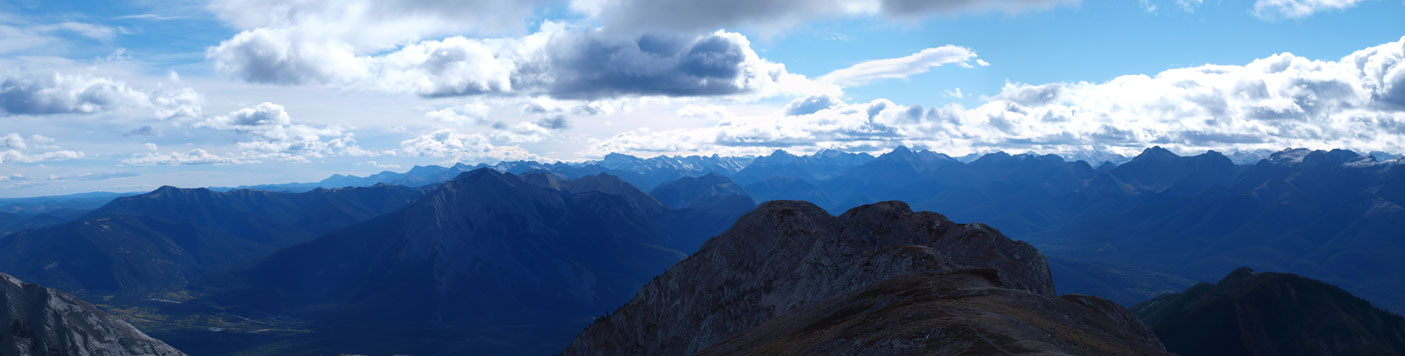
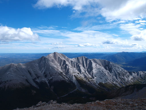
Panorama of the less familiar side. Lots of unnamed peaks in an obscured part of Jasper
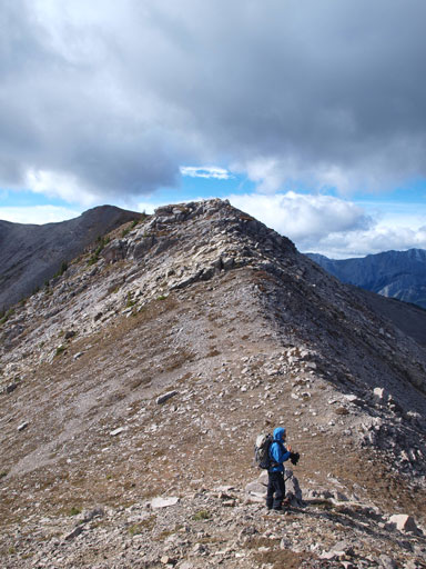
The ridge walk is as simple as it looks

This impressive peak at the south end of Boule Range also doesn’t have a name
Ben enjoying the scenery
Flat plateau
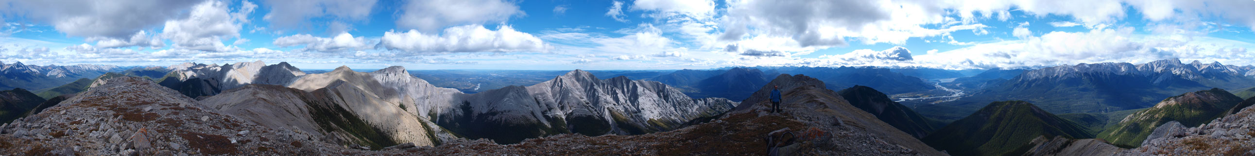
Summit Panorama. Click to view large size.

Interesting lighting on Boule Range. The high point is Boule Roche
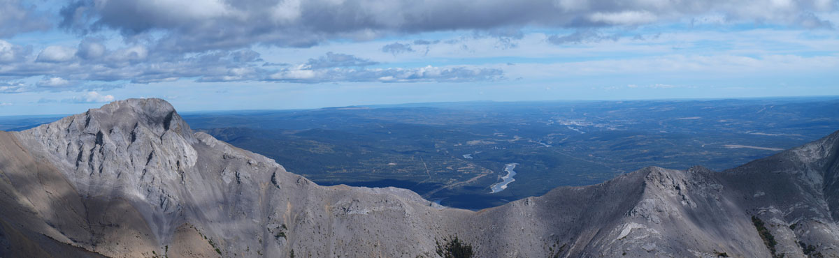
Zooming-in towards the prairie
South end of Boule Range
Looking south towards Fiddle Range and Miette Range
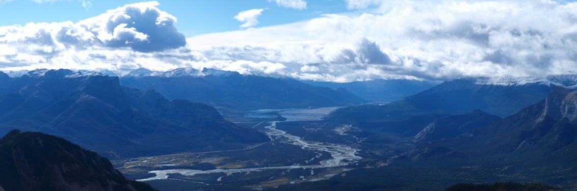
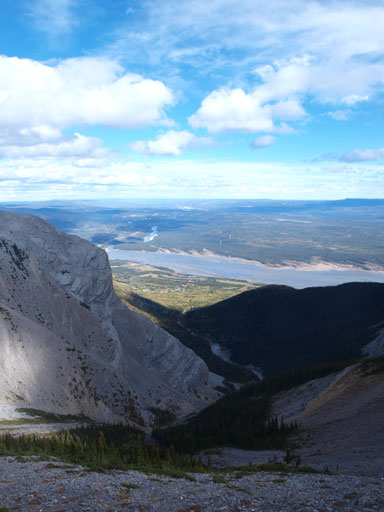
And, Athabasca River Valley

Panorama of Bosche Range. Mount Aeolus is the highest
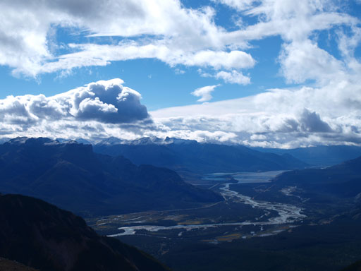
Athabasca River Valley
Mount Aeolus
Unnamed peak at south end of Boule Range
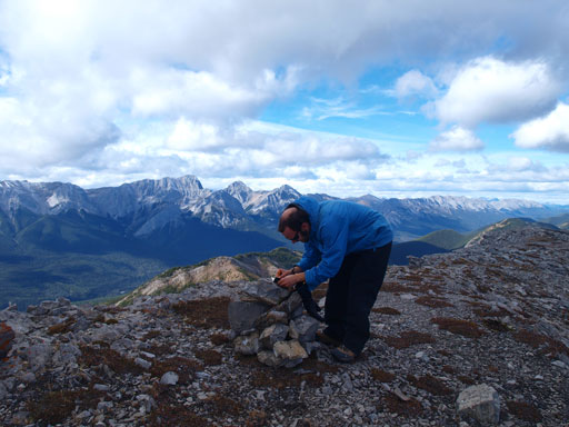
Ben signing the register that we brought up
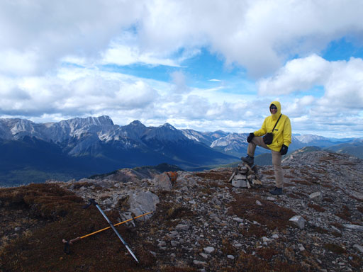
Me on the summit
Panorama of Bosche Range side. I bet this valley gets very little traffic!
Due to the cold wind we didn’t stay long on the summit. We retraced back to the first ridge crest (lots of elevation regain) and took the scree bowl on skier’s left. There wasn’t short rock band intervening our way and we soon lost elevation in no time. This slope brought us to the creek bed below (right hand side branch referring to the approach). This creek went easy, but long, before joining the main creek, and the rest was easy hike back to the car. Our round trip time was about 9 hours on a modest pace.
Blue sky from the descent
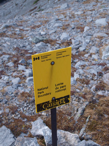
The ridge crest is actually on the Park boundary. The summit is in the park, while the parking lot is outside.
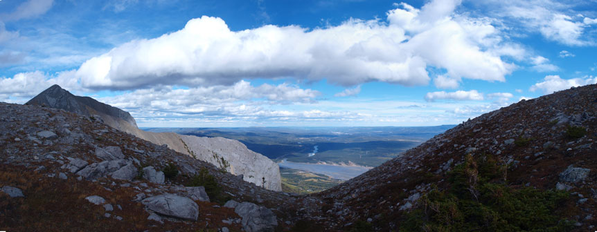
Panorama view again.
As you can see, the terrain is easy around here. All lines work
We picked a direct line down. Gorgeous scenery in the background

Brule Lake

There’s one optional step for fun
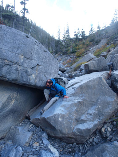
The same step. It’s easily bypassed on climber’s left

Down to the wide Supply Creek

Brule Hill. Official name though, but I don’t see the point bushwhacking up there…
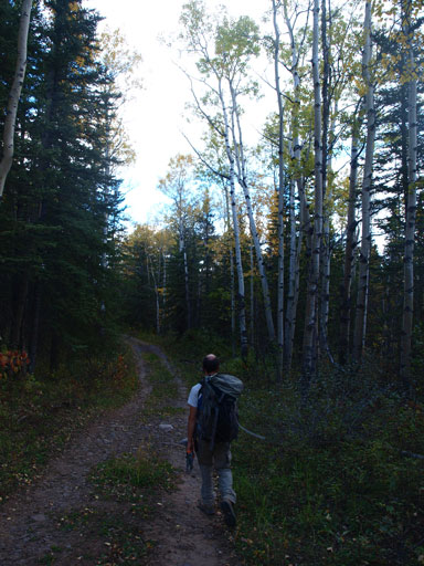
Back to the ATV trail
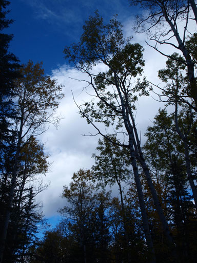
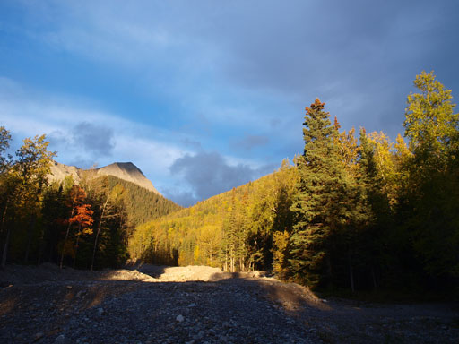
I like the colours in this photo.
Bedson Ridge was proved to be a worthy objective and offers interesting views of Boule Range and Bosche Range. You’ll also get interesting perspectives of the familiar peaks towards the other side of Athabasca River. The scrambling, though tedious at times, is straightforward. Unlike other exploratory ascents in Jasper, this one involves very little amount of bushwhacking. Supply Creek actually reminds me Nihahi Creek and Jura Creek in Kananaskis, wide, dry, and open.

Looks like a neat trip Mr. Song! Very pretty country. Just wanted to let you know, that the Southern most summit along the Broule Range is Roche Brule, although its not “official” everyone in the area calls it that. Thought you might like to know. 🙂
Thanks man. I’ll definitely keep that in mind! That’s a good reason to head back up that col!