Snowshoe Peak
August 20, 2019
2663m
Libby / Kalispell, MT
Snowshoe Peak stands as the highest summit in the Cabinet Mountains a sub-division of Rockies, taller than anything else in the close vicinity and far from any major city. With over 5000 feet of topographic prominence this peak is also known as an “Ultra”, hence not entirely unheard in the peak-bagging community. It’s one of the 57 Ultras in contiguous US and the list attracts peak-baggers from all over the country. The Cabinet Mountains in NW Montana are not known for its rugged topography, but Snowshoe Peak does boast at least a somewhat interesting profile. The standard route, NE Ridge goes at class 4 from Leigh Lake. There is a much-longer route from the west that’s technically easier, but because of the mature beta of the NE Ridge I think most peak-baggers would prefer this way, and that included Adam and myself. An ascent of Snowshoe Peak was the primary objective of the first phase of our 2019 peak-bagging road trip and we were excited to finally get there on Day 3.
The drive to the trail-head was trivial in Adam’s Subaru and the navigation was done purely by Google Map app. We did our evening routine at the trail-head including repacking, cooking and setting up tents. For the NE Ridge we would bring ice axe, crampons, a 30 m rope and a small rack of rock gears. This might sound ridiculous to some, but we wanted a guaranteed chance of success. “4th class” is one zone that I tend to be cautious with and having no previous experience in NW Montana we wanted to be fully prepared for the worst. The Blackwell Glacier bypasses the technical crux but in August we expected to deal with glacial ice, so traction devices were also needed.

Snowshoe Peak via NE Ridge. GPX DL
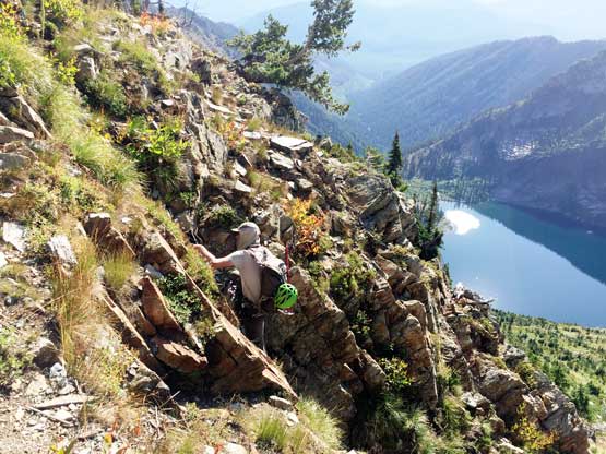
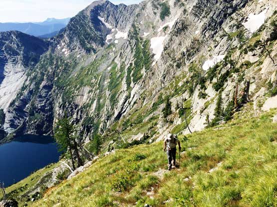
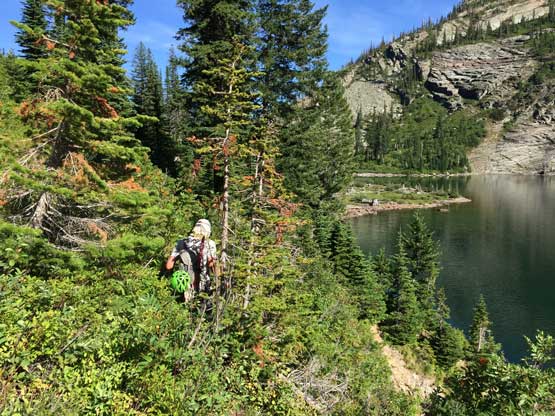
The next morning we woke up at first light and got going not long after sunrise. The plod to Leigh Lake wasn’t as bad as some made it sound like. A group of hikers descended from Leigh Lake and informed us “you needed to be mountain goats to get there”, and that made me abandoning the trail-runners all together on this peak. I regretted the decision as the trail to Leigh Lake was certainly doable in trail-runners… The traverse around Leigh Lake still had a decent trail and we loaded up water bottles at the lake. The steep grunt to Snowshoe/Bockman col from Leigh Lake was the least pleasant section of the ascent. There was nothing tricky but we had to deal with hundreds of meters of steep grass, scree and some brushes. The south-facing aspect didn’t work too well with the hot temperature neither, that halfway up I was completely done with energy and had to call for a break. I ate a lot of food and my energy was back, thankfully. Higher up we stood closer to Greg Slayden’s GPS track traversing a long ways away from the central gully, before picking up what seemed like the easiest route (3rd class) that climbs back to gain Snowshoe/Bockman col.
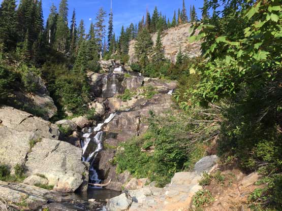
A small waterfall on the approach to Leigh Lake

Arriving at Leigh Lake in the morning

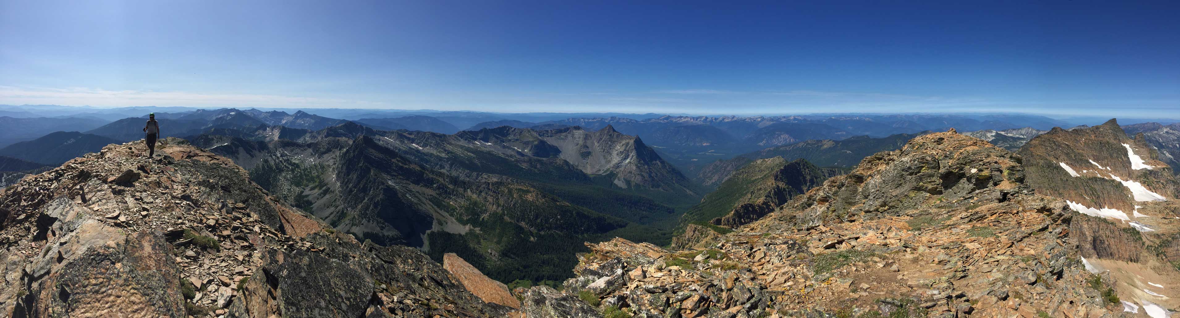
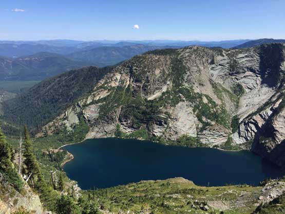
This is the shear E. Face of Snowshoe Peak behind Leigh Lake

Another photo to show how clear the water is in Leigh Lake

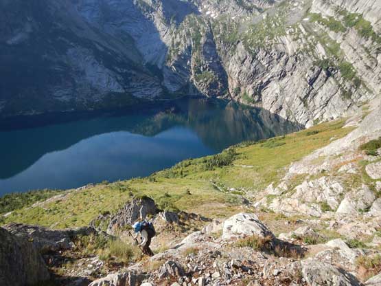
Adam picking a route ascending above Leigh Lake
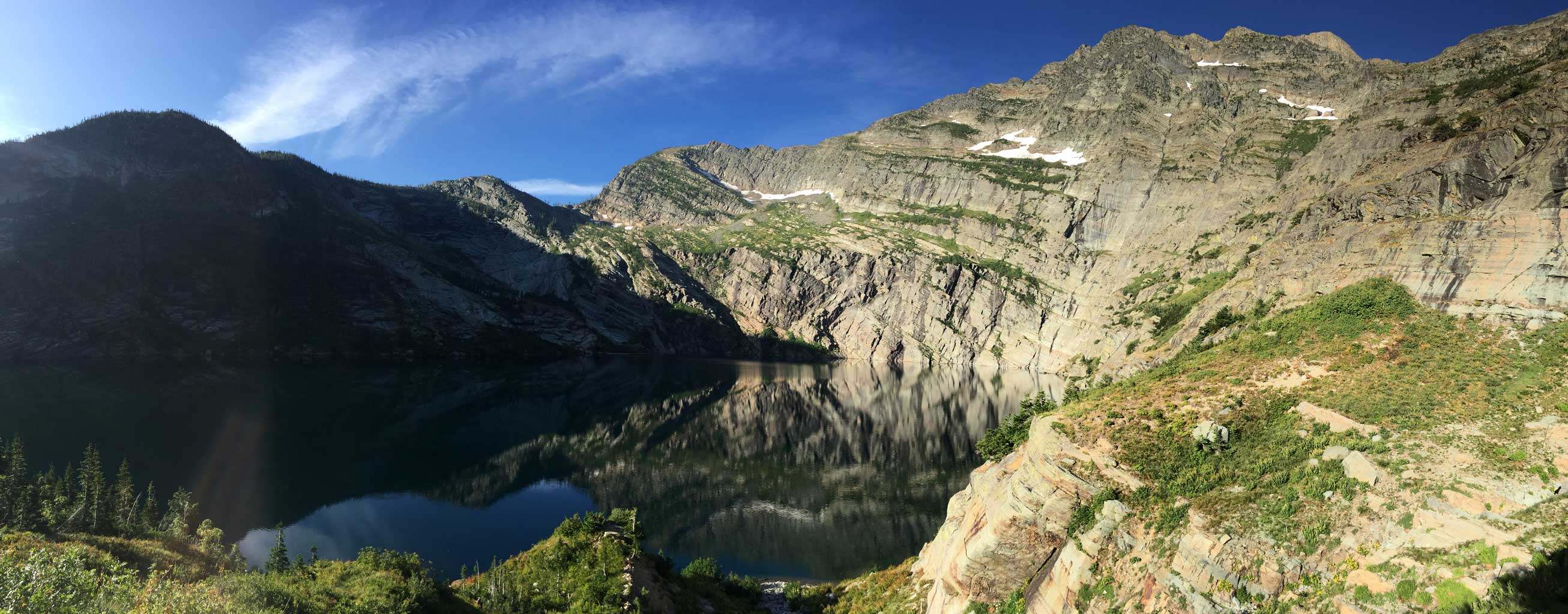
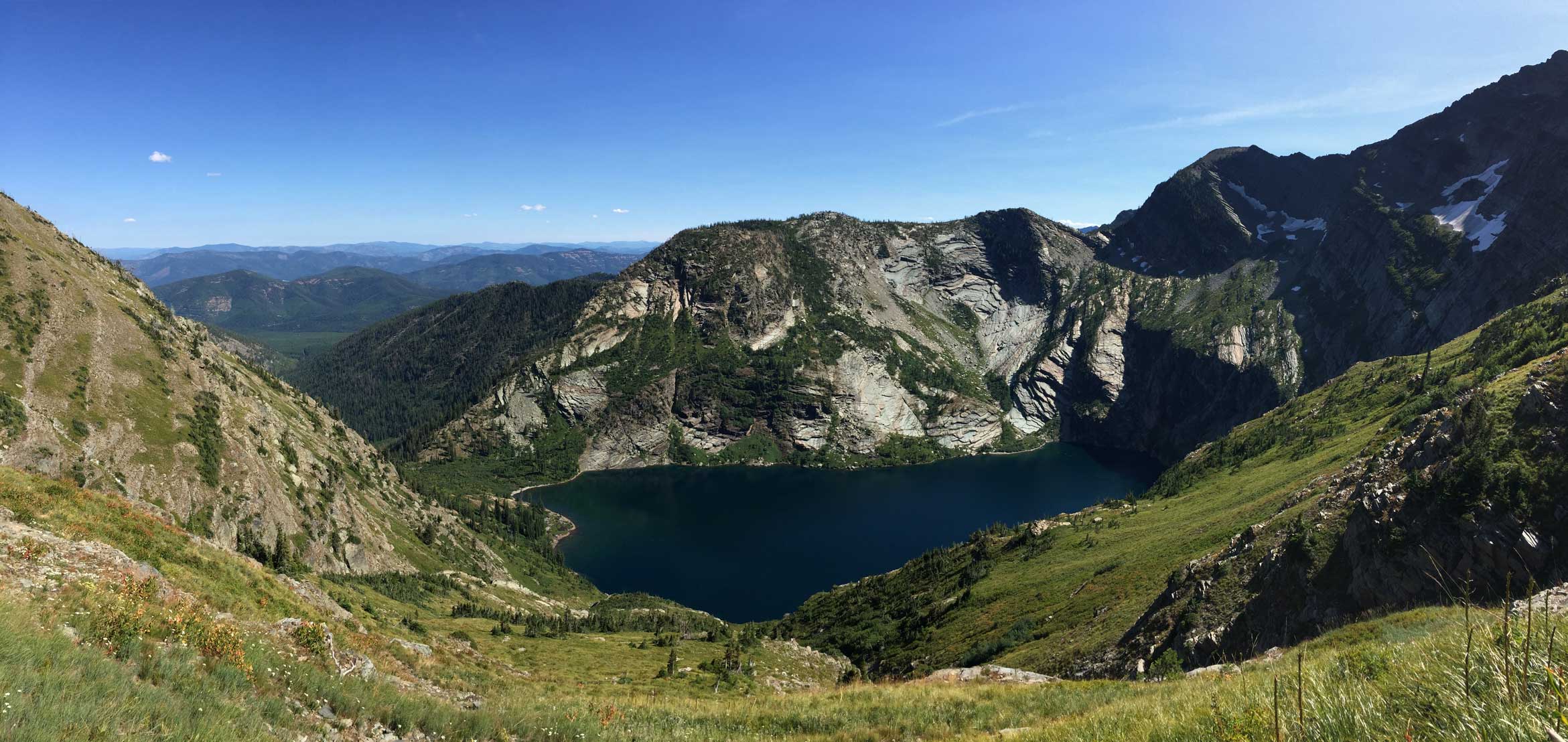
Panorama of Leigh Lake and E. Face of Snowshoe Peak. Click to view large size.

It might seems difficult but the scrambling was actually straightforward
Me slogging above Leigh Lake. Photo by Adam W.
Me ascending onto the upper stretch of this grunt. Photo by Adam W.

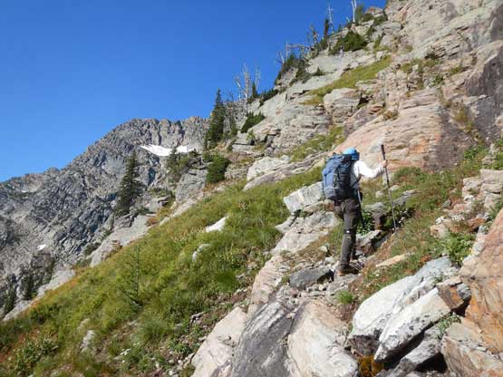
Adam ascending the steep slopes
After a long traverse here’s Adam on some scrambling terrain
Almost at Snowshoe/Bockman col
Snowshoe Peak from Snowshoe/Bockman col
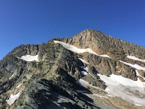
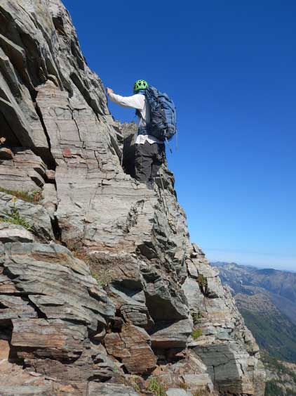
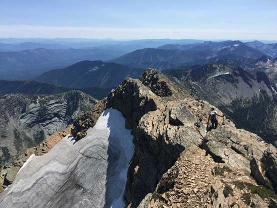
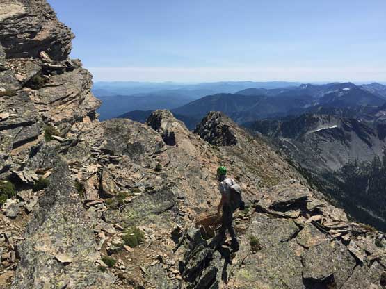
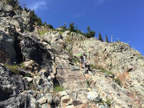
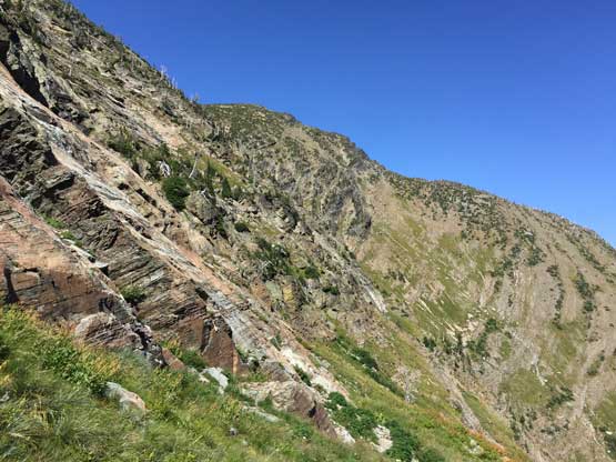
We ditched some food and water at the col to reduce the weight of our packs, and proceeded up the NE Ridge proper. The terrain was very similar to the southern Canadian Rockies that the climb was mostly on ledges and chimneys. The rock was mostly loose limestone and shale “dinner plates” but I personally am more comfortable on the Rockies choss versus the Cascadian choss that breaks in unpredictable patterns. After a while of increasingly steep scrambling we came to our crux, a short but stiff 4th class chimney. Adam led it and I followed without taking the rope out of our pack. Looking around we saw no easier alternative so we might rappel it on the descent, even though that meant we had to build a rappel station. Higher up we encountered a lot of 3rd class terrain but nothing technical. The supposed crux was bypassed on snow and that especially made sense considering we had hauled ice axes and crampons. The glacier was indeed icy, but imposed no problem. We climbed as far as we could on snow that steepens towards 35-40 degrees near the top before merging back onto rock, and at this point we weren’t far from the summit ridge.

There’s a long stretch of flat ridge walk, with Bockman Peak behind

Adam on the first tricky move. Class 3 but exposed

Looking across Bockman Glacier towards A Peak

Adam dealing with some typical choss on this route

Adam ascending into the 4th class chimney
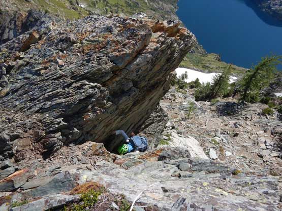
Me stemming up the chimney. Photo by Adam W.
Me continuing on challenging terrain. Photo by Adam W.

Adam on the NE Ridge scramble

A relatively easy section. Bockman Peak behind
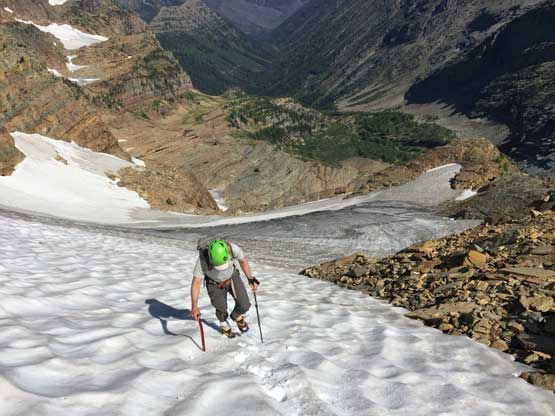
Adam ascending Blackwell Glacier to bypass the supposed crux on route
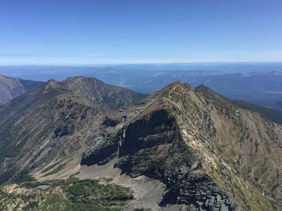
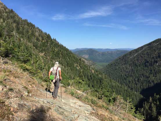
To access the summit ridge we had to traverse horizontally across a bowl of scree (on game paths), to the west side. The rest of the ascent was done almost entirely on the west side of the summit ridge and Adam did a great job route-finding to keep the scrambling within “3rd class”. There were a ton of micro terrain decision to be made, but generally speaking there’s more than just one way to the top. We checked out both summits and the southern (closer) summit was definitely higher, so I relocated the register to the actual highest point. We spent at least an hour on the summit soaking in the views. The heat was taking its toll on us and we both felt extremely lazy and tired.

We traversed across this scree bowl to the “backside” of summit ridge

Adam picking a line up the summit ridge. There’s a ton of route-finding here
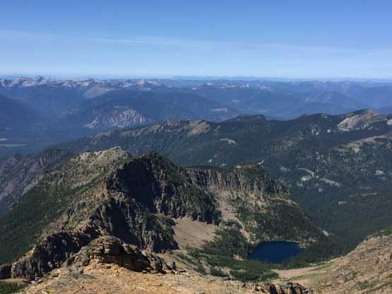
Looking down at Bockman Peak, with Mt. Snowy to the left
Ibex Peak left of center in foreground; behind is the west lobe of Cabinet Mtns.
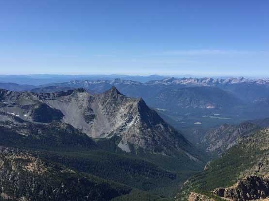
Partial Summit Panorama from Snowshoe Peak. Click to view large size.

Partial Summit Panorama from Snowshoe Peak. Click to view large size.
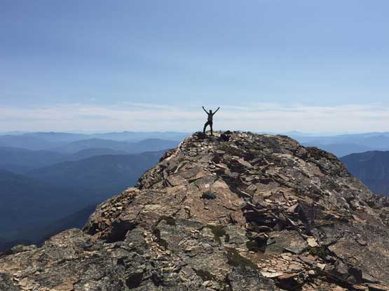
Adam celebrating his P-Index 500 as well as his 90th Ultra
This is a NW side view down towards Snowshoe Lake

The officially-named “A Peak”

Me on the summit of Snowshoe Peak with A Peak behind

Adam and I on the summit of Snowshoe Peak
Eventually it’s the time to descend. Adam had hit his P-index of 500 right on this peak and we were happy about this achievement. We stood closer to the ridge crest on the summit ridge and found similar, if not easier terrain and that further confirmed there’s multiple ways on the summit ridge section. Descending the glacier was easy peasy and in no time we made good progress down the NE Ridge. I found a bomber pinch point just above the chimney and we did a short rappel to avoid down-climbing 4th class, and our next stop was Snowshoe/Bockman col. We both wanted to bag Bockman Peak but the heat and our tiredness made our decision.

Looking down towards Blackwell Glacier and Leigh Lake

Panorama looking south from slightly under the summit. Click to view large size.
Adam working his way down the summit ridge

We couldn’t stay entirely on the ridge crest and had to do some detours
Adam doing his route-finding

Traversing back across this scree bowl to rejoin NE Ridge

Adam and the shear NE Face of Snowshoe Peak
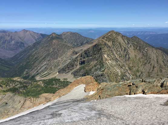
Blackwell Glacier and Bockman Peak
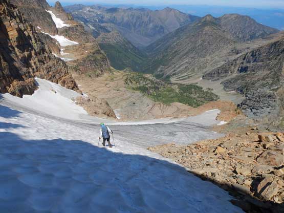
Me descending Blackwell Glacier. Photo by Adam W.

Adam down-climbing NE Ridge

Adam rappelling the 4th class chimney lower on the ridge
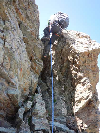
Me rappelling our crux. Photo by Adam W.
Down from the col we retraced our own GPS track through cliffs and steep grass. I made a stupid mistake that costed at least an extra 10 minutes of backtracking. I put too much trust on the GPS unit and missed something obvious. The rest of the descent to Leigh Lake was soul-crushing in the heat. There was a stream of water at about 3/4 of the way down and we spent another half an hour there taking some much-needed resting. I even did a quick laundry to cool my clothing off. The hike-out was also tedious especially on mountaineering boots but at least not very long.

Adam starting down from Snowshoe/Bockman col
Leigh Lake below
More about the typical terrain on the upper slopes descending from the col
Here we had to traverse a long ways across this bench of steep grass
Panorama of Leigh Lake from partway down from the col. Click to view large size.

Adam and Leigh Lake
Back to the lake shore

An obligatory shot of Leigh Lake once we got back to the shore
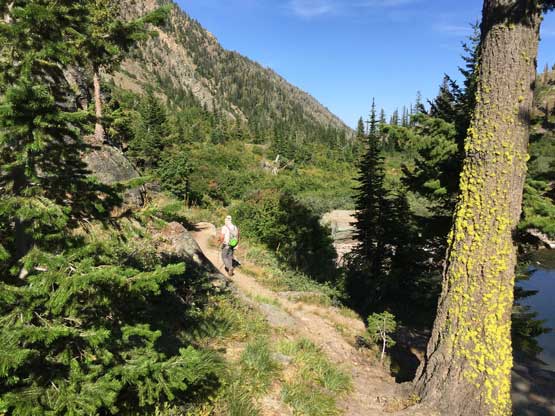
Joining the official Leigh Lake trail
The hike-out was quite boring…
Overall I think Snowshoe Peak exceeded our expectation, and definitely worth doing. It’s comparable to a standard “difficult scramble” in Canadian Rockies and the view was worth the effort. At this point we had to make an important decision about our second phase. It seemed like we were definitely going towards Glacier National Park. We received an invite from Sean C. to join on Mt. Stimson and we definitely had two confirmed permit spots, but Connor M. at 56/57 on contiguous US Ultras list was gong ho for Mt. Cleveland to finish his project. The problem for Mt. Cleveland was that we hadn’t secured a permit yet. Tough-as-fuck decision but let’s face it…
