Mount Brewer
June 15, 2013
2810m
Invermere, BC
After taking advantage of the morning hours on the summit of Swansea Mountain, Eric, Ben and I were looking for the second objective of this day. There were more patches of blue sky showing up above the Purcells than the Rockies, and after quickly skimming through Matt Gunn’s Hikes around Invermere and Columbia River Valley, we picked Mount Brewer. It’s on the same range as Taynton and Goldie, but considerably less popular. It’s 150 meters higher than Goldie and further in the Purcells, and I now fully understand why it isn’t a popular objective. Driving 26km up Brewer FSR for just a scramble might not be that inspiring to most people except for the locals.
We probably shouldn’t have picked this objective if we knew the roughness of this road. The guidebook describes it as “high clearance or car + 2.2km”. We thought that we’d make to the last bit for sure since our SUV is certainly more than just a “car”. The FSR started pretty easy until the first fork. From there on, the next 15km or so has lots of sections that’re pretty much all on a pile of rocks. There were also some bush and a couple exposed sections. There was no major barrier but the road was very, very rough. A small car definitely cannot make it… I felt very sorry for Ben’s vehicle, but since we’d make up this far we just had to give it a go. At the last 2.2km we were determined to give it an attempt so up we went. It turned out be not much rougher than the previous 24km. It had more potholes and grooves but nothing troublesome. Making to the high parking lot already gave us about 1000 meters elevation gain, and we thought the day would be pretty short with only 900 meters to go. Well, we ignored how snowy at that elevation..

Mt. Brewer scramble route. GPX DL
The hike started out smoothly but not far up we lost the trail. We went across a creek on a sketchy log and followed a faint path through forest up. Glad we quickly made the call that we were on the wrong side and backtracked back across that creek. We soon spotted a trail that we’d missed earlier in the day and I decided to go up it. Ben spotted another one that involves a little bit more backtracking, and Eric and Ben decided to take that one. My trail soon came to an end but after a brief short faint section I soon rejoined the main trail. Since they did more backtracking I was a lot ahead. We regrouped together further up after encountering snow. The post-holing was not inspiring but generally not too bad. The snow never exceeded knee deep and we could always find snow-free lines through the forest. The trail brought us to a large meadow area. It was here that we went off-route again. We kept following the trail up and through the large opening area, but if you want the quickest ascent line you want to go climber’s right. Kilometers of post-holing punished us but again, it was still tolerable and we could maintain a reasonable pace. The snow got somehow supportive higher up and we quickly made our way up the next bench where we thought the Brewer Lakes were.
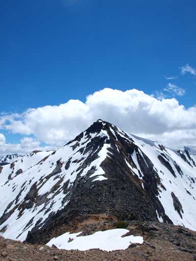
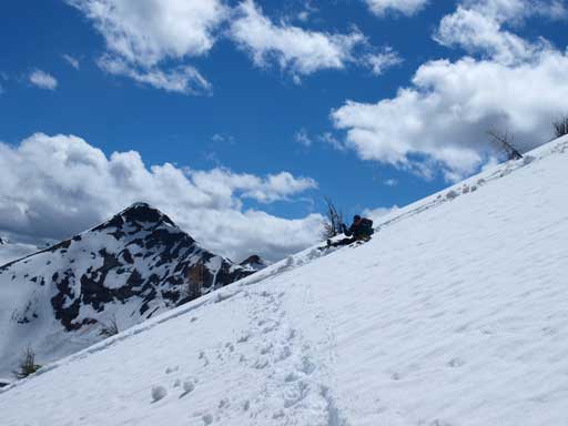
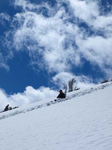
Instead of going around the steep slope we opted for kicking steps straight up the steep snow line to save us some time and energy. The slope was steep, but it was far from step-kicking. There was more post-holing, and the slope was very foreshortened. We must have used more than 1 hour to get up this big thing. The snow line brought us directly to a small summit. It was until now that we realized we had traveled too far. We made to the wrong peak, but it looked like we could get up Brewer by a simple ridge-walk going over another summit. In retrospect, we got better views by adding the extra time. And, the ridge provided some interesting scrambling too. The views were already great on the first summit, even though most of the bigger peaks like Nelson, Delphine, and Jumbo Mountain were still in the clouds.
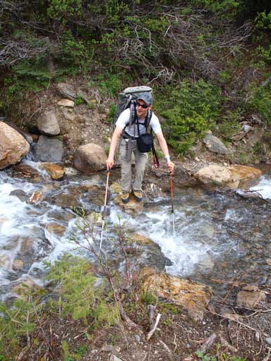
Ben ready to jump the first creek.

Eric’s turn to balance over this slippery log
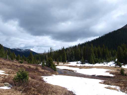
Now here comes the opening/meadow area
Great view already, from partway up the big snow slope

Eric going up the snow slope

Ben leading the way

Ben and Eric approaching the first summit

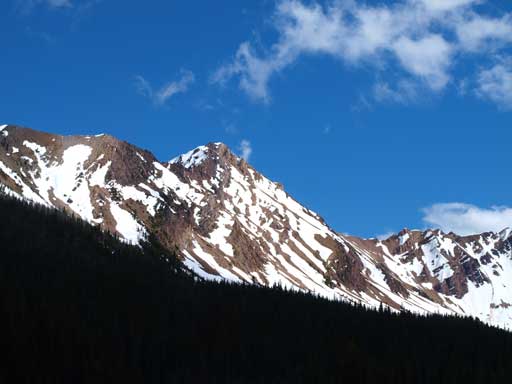
If you have time you can explore the ridge system. All peaks are unnamed here though.
Another unnamed peak that probably deserves a name…

Impressive unnamed summits in the distance.
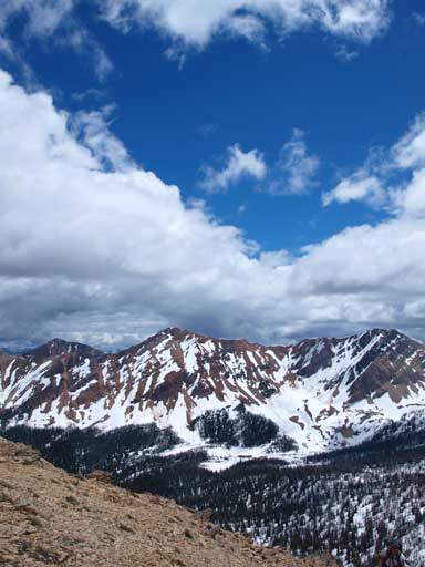
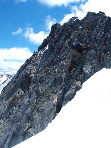
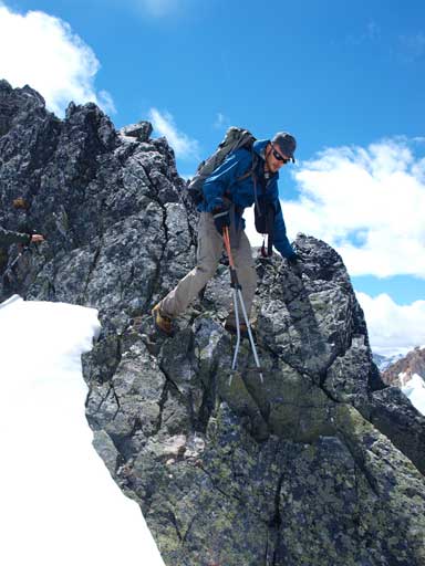
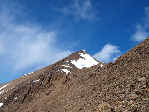
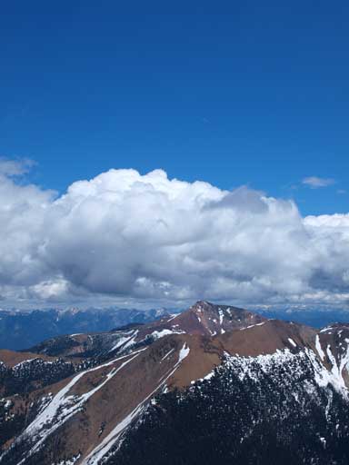
We quickly started the traverse towards the second summit. It was easy scrambling till the top where there were some large boulders. The connecting ridge to Brewer provided some challenge to us. There was one section that qualifies difficult scramble unless you take the exposed scree bypass on skier’s left. The rock was solid and we chose to down-climb the direct line. And once down to the connecting col, it was merely a scree slog up Mount Brewer. It did take longer since the slope was again, foreshortened. The summit view was just beyond gorgeous, with all the rarely seen peaks in the Purcells showing up. Because we didn’t bring a map up, we couldn’t identify the peaks towards north. I correctly guessed Mount Nelson, but what I thought was Jumbo Mountain turned out to be Mount Delphine. Jumbo was the other big peak towards west.

Traversing to the second summit
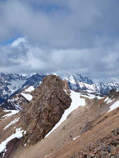
An interesting rock formation on this ridge

Looking back at the first summit
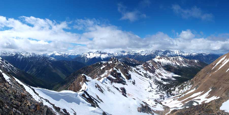
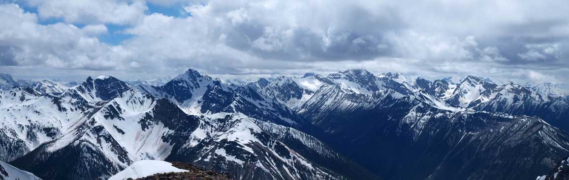
Panorama looking west from the second peak

The true summit of Brewer from the second summit
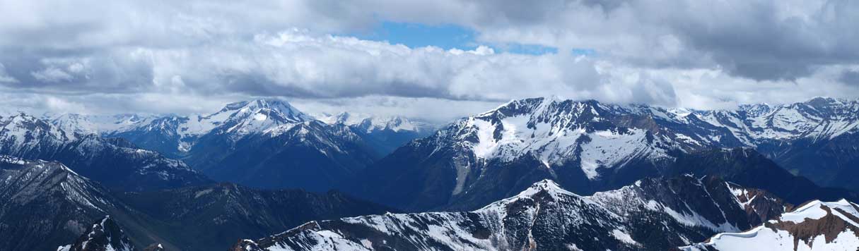
Panorama looking east
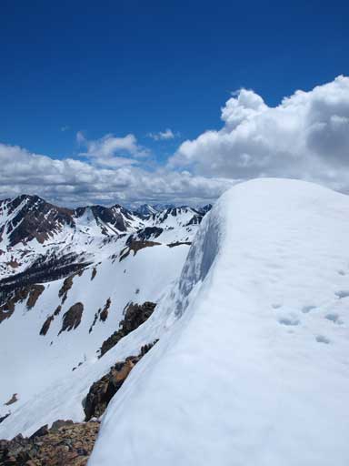
There were some cornices on this ridge

Looking over Monument Peak. Jumbo Mountain should be behind, hidden in the clouds
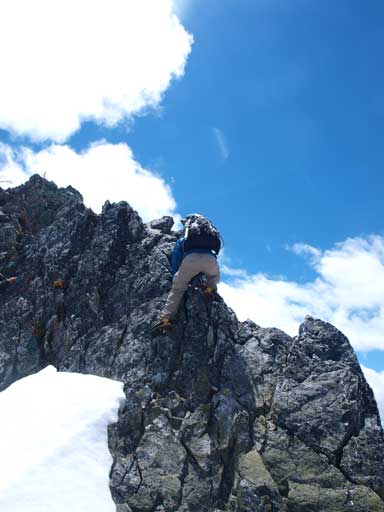
Ben down-climbing the difficult bit
Eric’s turn
Ben playing with the rock
Going up the true summit

Redtop Mountain and Mount Earl Grey
Looking back towards the second summit
Unnamed summit with interesting clouds above

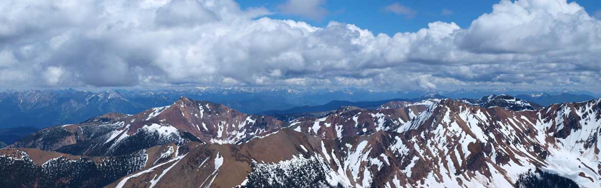
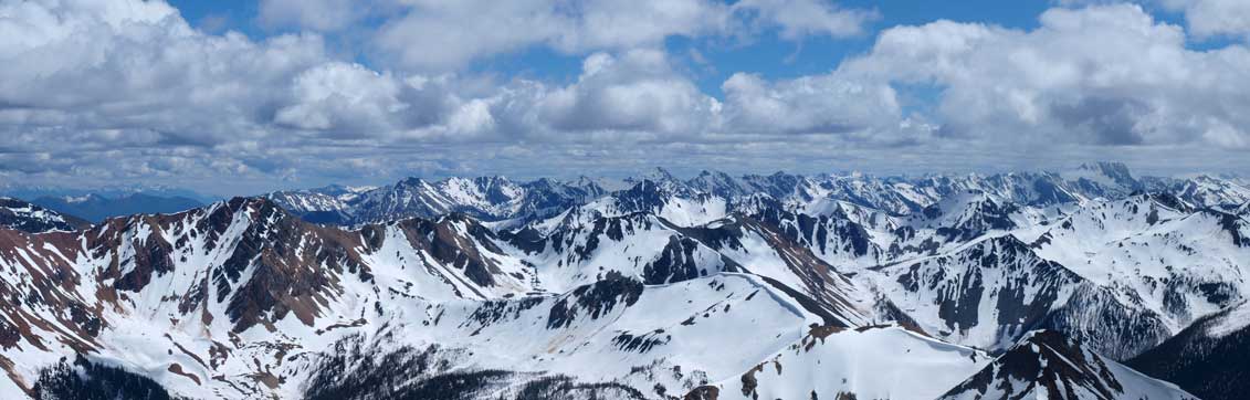
Summit Panorama. Click to view large size.
Looking East
Looking South. Most of the peaks in this area are unnamed
Looking southwest. One of them must be Coppercrown (I think it’s the high peak right of center)
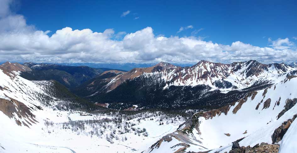
Looking up Toby Creek and Jumbo Creek.

Delphine and Nelson group, north of Toby Creek
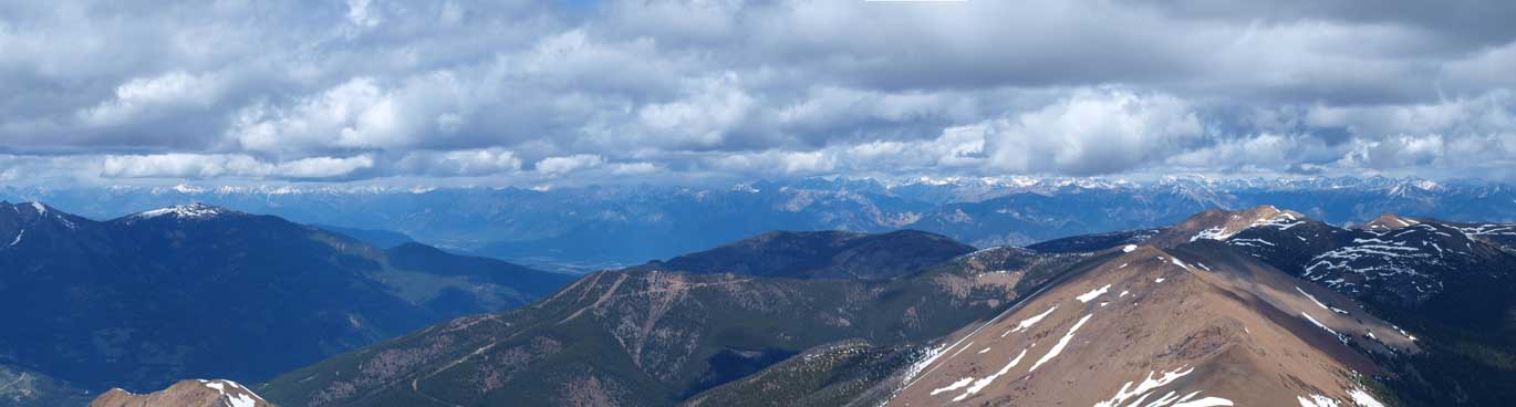
Looking over Panorama Ski Resort and Mount Goldie towards the Trench and the distant Rockies
This must be Mount Delphine

Mount Nelson
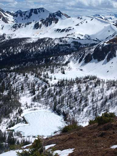
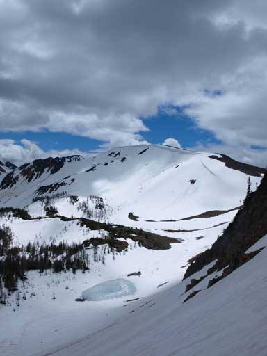
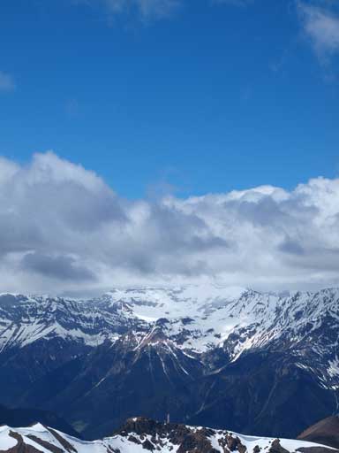
Brewer Lake was still frozen
We took a long stay on the top. This ascent had already taken us longer than expected and we thought there would be no 3rd peak on this day, so why not just enjoy the views for longer. Eventually we decided to descend. After debating between a long glissade line versus the most direct line we chose to descent scree first. Eventually we merged to snow where the terrain was not too steep. The condition was quite rough for glissading. The snow was completely isothermal, and we also needed to be very alert with the possible wet snow avalanches. Once entering the trees we picked the most direct line towards the valley bottom. Down-hill post-holing was far easier than uphill and we made down in no time. And then we simply followed our up tracks back.
Ben glissading down the mountain
Eric sliding on snow

Ben and Eric with big terrain behind
One of the many, many unnamed summits
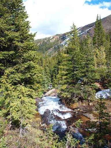
Back down to the valley bottom.

Wild flowers
The drive back down the long Brewer FSR was again, very rough, but Ben managed to make it back with no mishap. We took a dinner break at Invermere and took some photos at Windermere Lake. Well, since it’s our first time at Invermere, we need to do some obligatory tourism stuffs. With great forecast for Sunday, we thought it was the correct time to get closer to the Bugaboos, and with still 2 hours of daylight time we started the drive to give an early start for Sunday.
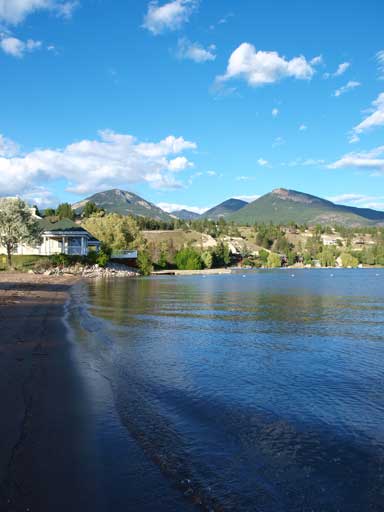
At the end of this day, we gave Windermere Lake a brief visit
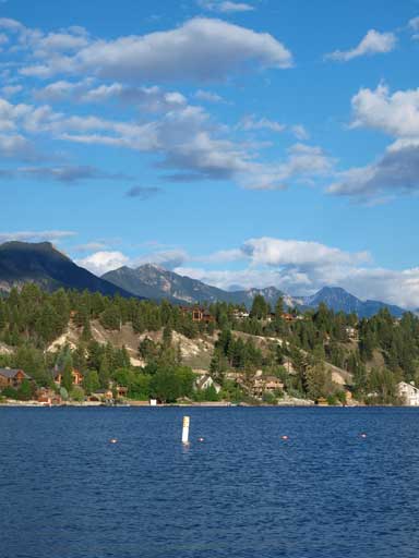
Windermere Lake. Next time when I have a long stretch of days I might go here again!
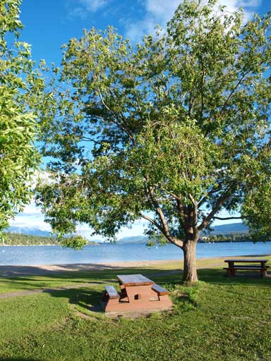
A perfect place to relax
