Tumwater Mountain
March 26, 2023
1366m
Leavenworth, WA
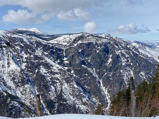
Tumwater Mountain is a lowly and forested peak that looms above the town of Leavenworth. It does not boast any mountaineering interest and in fact, I wouldn’t be surprised if “bagging the summit” is the least popular activity that happens on the flanks of this mountain. The main attraction is the prominence (>700 m). Matt J. had recently explored a direct route straight up the east ridge, shaving at least 5 km distance off the standard route and it sounded appealing. A few Washingtonians had since followed and questioned Matt’s sanity for putting up this “60 degrees route with fatal exposure”. I checked the maps and I do not think it’s either “60 degrees” or with “fatal exposure”. What they described sounded rather like Lincoln Peak but I don’t think those guys would even dare to make an attempt on Lincoln Peak, so I wouldn’t take their words for granted.
Nikita and I decided on Tumwater Mtn. on Sunday mostly because of the sunnier weather there. Anywhere closer to home would have guaranteed cloud coverage. Nikita had just made a solo climb of Mt. Matier on Saturday in Pemberton, British Columbia and subsequently didn’t get home until 2 am in the morning. She did need at least a couple hours of sleep so I made her to come to White Rock at 6:30 am. That was good as I was also too spent to wake up at an ungodly hour after an exhausting day at work. The drive to Leavenworth then took about 3.5 hours. It was raining on the west slopes of the Cascades but the drizzle turned into sunshine after cresting Stevens Pass. It felt like a warm spring day at the trail-head so I took off some layers (long johns etc.) and threw them into the car.

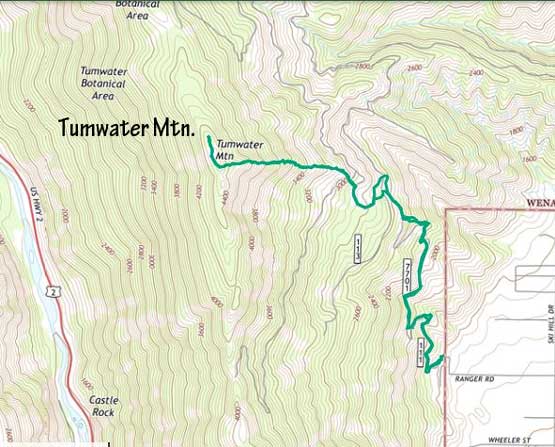
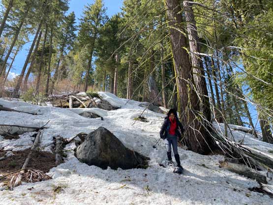
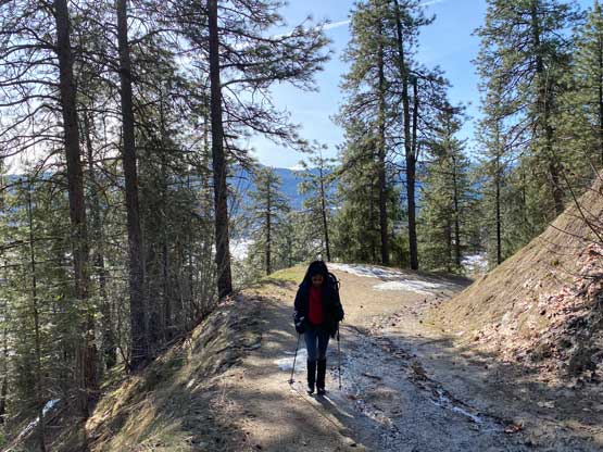
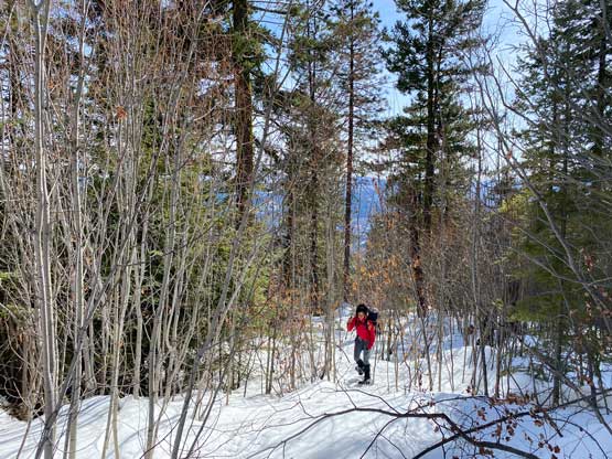
The ascent started at the winter closure gate but even if the gate was open we wouldn’t be able to drive much further. Within a kilometer we encountered patchy snow that would stop all vehicular traffics. I led us taking several short-cuts because I absolutely love taking short-cuts and it didn’t take us too long to reach continuous snow at around 750 m elevation. We strapped the snowshoes on and easily plodded to where Matt’s route diverged from the standard. I could get glimpses of views of the upper section of this “east ridge direct” option, and it looked rather tame.


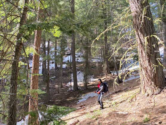
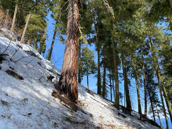
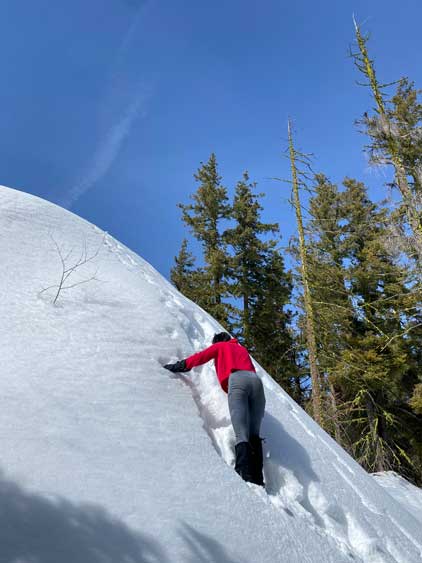
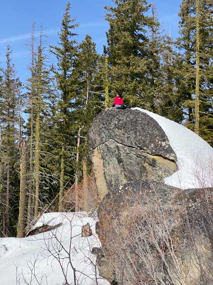
Nikita and I left the road slightly earlier than Matt’s tracks but it didn’t really matter. What I didn’t realize beforehand was the level of bushwhacking on this route. Thankfully we had the maximum depth of snowpack at this time of a year, so most of the dead-falls were covered. There were still lots of alders and tight timbers that I understood where the other groups’ frustration came from. Without a thick snowpack I probably wouldn’t have recommended this route neither. In terms of the route-finding it was very straightforward. About halfway up the east ridge we encountered several bluffy stretches where I estimated the average slope would be 35 degrees but that’s about it. There were enough “ramp” features among the bluffs and trees to offer easy passage for snowshoe travel. The slope became open near the top, but the slope angle never exceeded 35-40 degrees and in short time we topped out onto the broad and fat summit ridge. The true summit boulder problem lies to the north so we traversed there first. On this particular day we needed to take the snowshoes off and climb a short pitch of 45-degrees ish slope to reach the top of that boulder. The previous groups had apparently claimed the success without climbing to the top of the true summit boulder. There were lots of snowshoe tracks on the flat summit ridge but no track had been made to the top of the boulder.


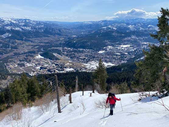


Both of us felt Matt’s route to be rather efficient than “scary” so we opted to descend the same way than to deal with the extra distance on the standard route. The snow had softened considerably so some extra care was needed to descend the steep, open-ish upper slopes. The condition finally felt like spring in this part of the mountains. The bushwhacking didn’t feel as annoying on the descent because we just needed to follow our own tracks while pushing the bushes around. We even took one additional short-cut after descending back to the road, and then took the same short-cuts lower down. Our round trip time was under 5 hours on a leisure pace. I originally considered driving to Wenatchee for another objective afterwards but decided against that. Instead, we made a direct dash homewards and I got back to White Rock in time for dinner. Nikita would then have another hour of travel back to Richmond, by bus.