Picacho del Diablo
March 23-25, 2022
3095m
Baja California, Mexico
Picacho del Diablo, or “Peak of the Devil” is the highest peak on the Baja peninsula of Mexico and subsequently boasts over 2000 m prominence and over 300 km isolation. This is one of the greater peaks in the desert areas. This peak is also considerably more rugged than the surrounding ranges making even the standard route a tough fair. Most parties would need 3 days to complete the ascent as the route involves a near-1000 m descent on rough terrain just to reach the camp site. That lost of the precious elevation must be regained on the egress day. The summit day involves tricky route-finding through bushes, boulders and class 3 scrambling. In addition to the technical challenges the access of this peak is in Mexico’s National Park meaning some logistics with an associated gate hour must be content with. This peak was the primary objective among Doug, Arthur and myself when we pulled the trigger to drive from Colorado all the way down to Baja California. The original plan was to tag Picacho del Diablo first, but the weather was less than ideal on our arrival day. We modified the itinerary to ascend Volcán Las Tres Vírgenes first followed by Sierra La Laguna High Point in the southern Baja. Those are the two other ultra-prominent peaks in this area.
The drive from La Paz near the southern Ultra to Picacho del Diablo would take almost 20 hours. It’s not very practical to drive through the night in Mexico considering the unpredictable road conditions, bad drivers and political check-points so most parties would consider taking two full days. The three of us decided to push the drive in one day, but with additional few hours’ work done on both sides. The day after completing Sierra La Laguna we drove over an hour into darkness before finding a roadside camping spot for free. The day of March 22nd was spent entirely for driving. I took the morning shift and got us most of the way back to Santa Rosilia not far away from Tres Virgenes. We stopped at the same burrito place as a few days earlier, but they no longer made the same ones. All of the options had meat in them. Doug and Arthur are vegetarian so only I managed to order a few burritos (con carne). Doug and Arthur then took over the drive to get us as far north as possible all the way to near the west coastline of El Rosario. This time we found a great restaurant for dinner and then we pushed another 1-2 hours into the dark and camped.

We still had at least 3 hours of drive in the following morning, so opted to wake up at 5 am again. The drive northwards along the coastline wasn’t too bad, but the windy roads into the National Park took a while. The checkpoint at the gate was interesting. They wanted to record our exact itinerary, which was understandable, but they also wanted to take a picture of the treads of our shoes, which was kind of weird. The last few kilometers to the trail-head was finally on a dirt road and we were quite glad to have a Subaru Forester, as some ruts were definitely not “car terrain”. We eventually made to the trail-head at around 10 am where another party with British Columbia licence plate was also gearing up. They were rock climbers to climb the connecting ridge (reportedly 5.8 or something) between Cerro Botella Azul and Picacho del Diablo and also over 3 days so there’s a decent chance we might end up seeing each other again on the trail. I had previously looked at that ridge. It was tempting as an option to avoid the 1000-m descent into the valley but the “beta” was sketchy and insufficient to say the least. After wishing them luck Doug, Arthur and I eventually took off at around 10:40 am, sticking to our own agenda.
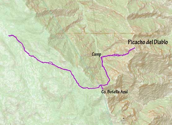
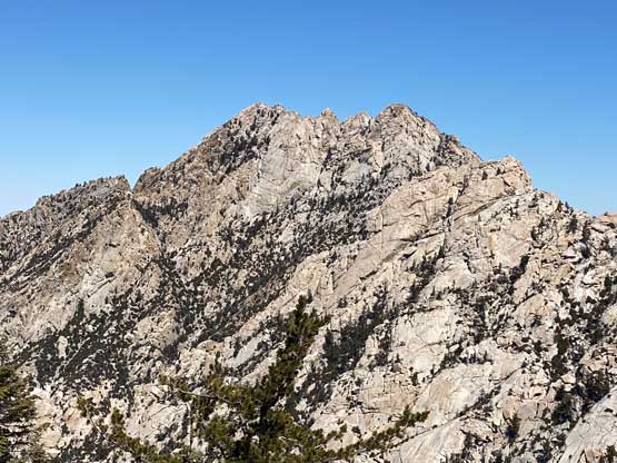
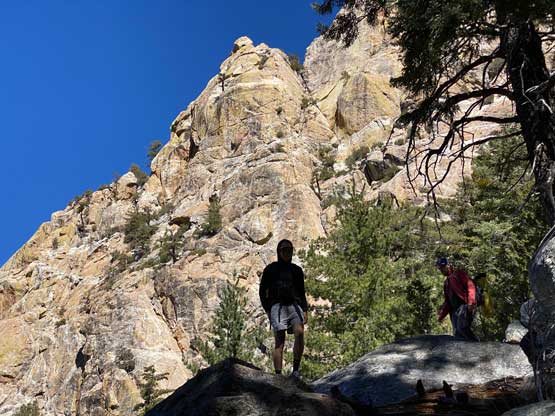
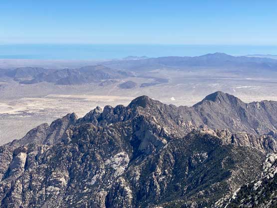
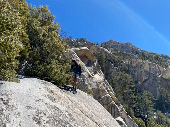
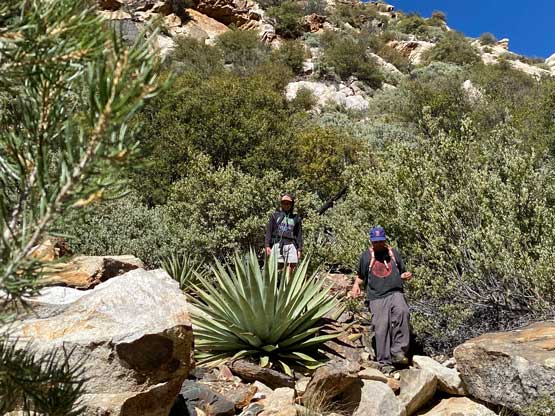
The first stage of the trip was about 8 km of boring plod to “Blue Bottle col” in which there wasn’t much else to see other than trees and dirt. Again I opted to listen to music the whole way to kill time. Doug and Arthur had set a steady pace so we eventually got there in 2.5 hours after leaving the vehicle. We dumped the backpacks and went for a short stroll to check out the summit of Cerro Botella Azul, or “Blue Bottle Peak”. This detour only required 50 m elevation gain but the reward was substantial. First of all Cerro Botella Azul is a ranked peak (peak with 100 m or more prominence) but for the most important the view of Picacho del Diablo was quite decent. This peak can also serve as a fine objective for hikers without scrambling and backpacking experience.


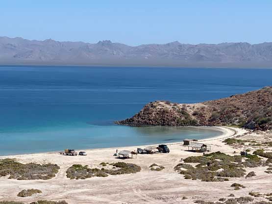
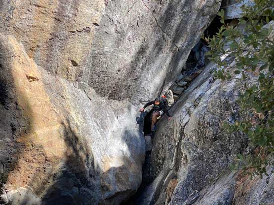
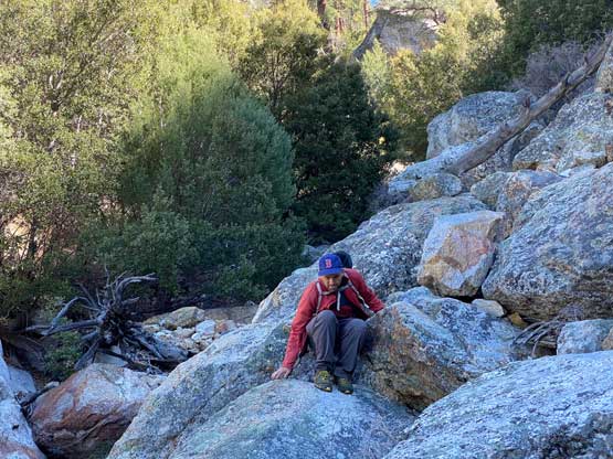
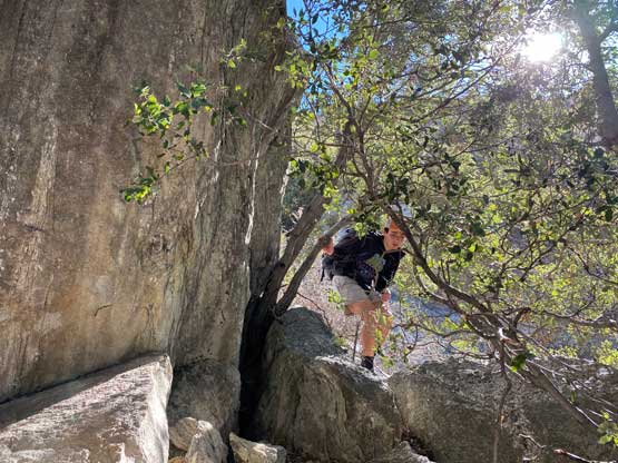
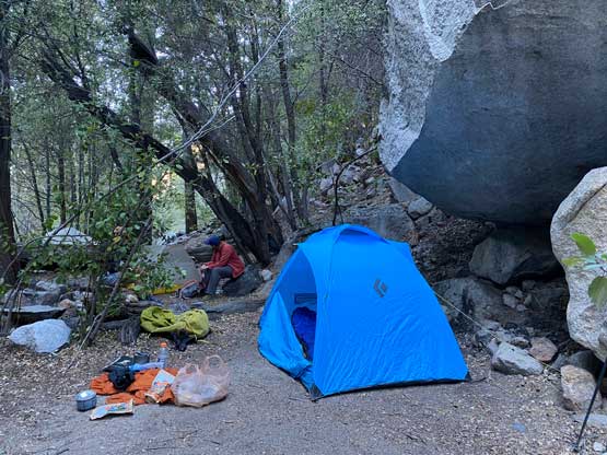
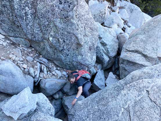
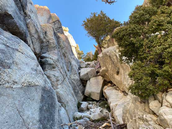
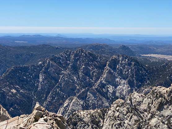
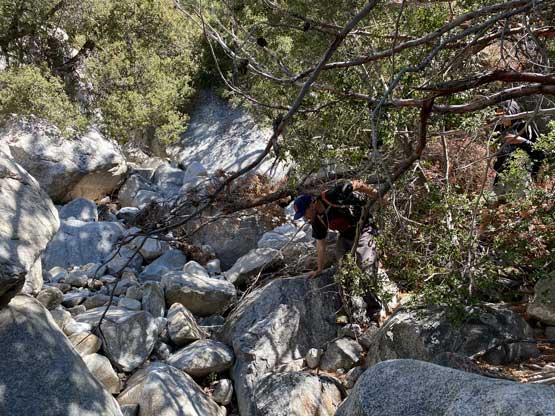
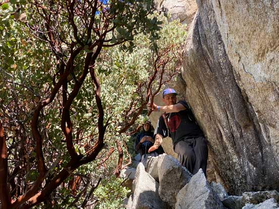
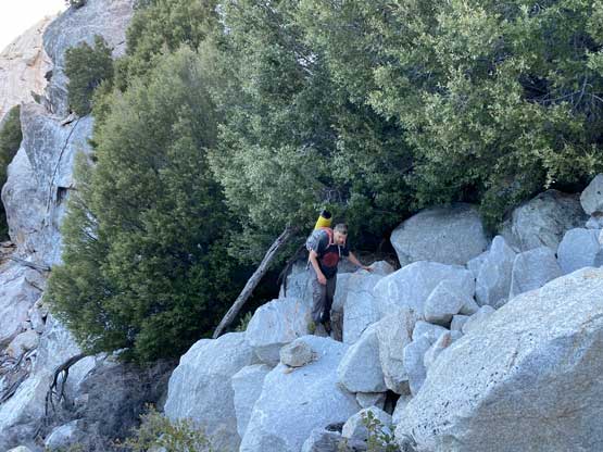
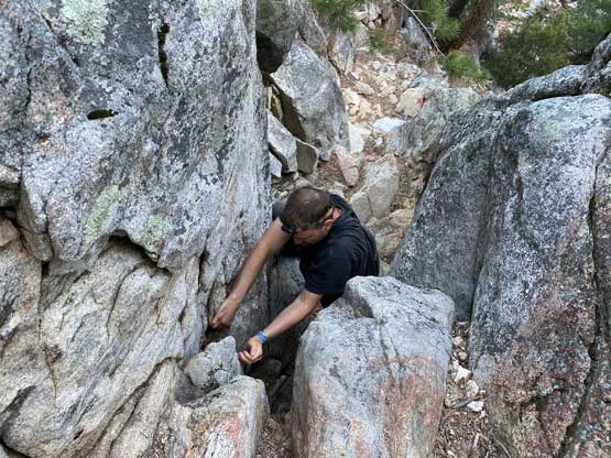
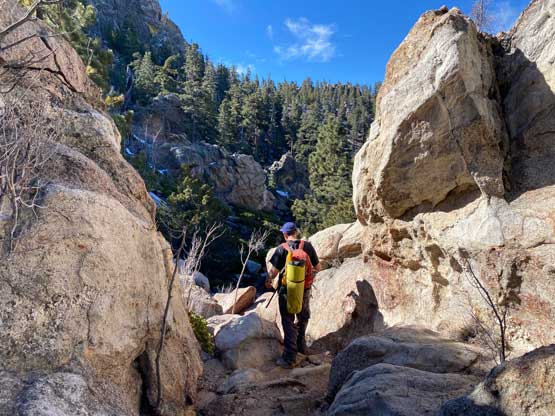
We found fresh snow on the north side of the “Blue Bottle col” but the amount of the snow was not concerning. The snow condition was also more interior-like meaning that they weren’t forming sheets of ice. We all brought microspikes after seeing fresh snow on the ground but they turned out to become training weight. We had downloaded a few sets of GPS tracks and had read the description thoroughly before coming down to Mexico and the general consensus for the next short while was to “traverse high and far before making a descent into the valley”. The route-finding was easier than we thought because there was already a trail developed. The trail was quite easy to follow and by sticking to this trail we ended up mostly tracing Connor McEntee’s GPX track. A while later after losing 300 m elevation we finally made to the point that we could simply just dash down into the valley. The terrain was mostly on boulders but there were also game trails, cairns and flagging here and there to facilitate the navigation. The crux of this descent came rather sooner where we must down-climb into a short chimney. I would classify this step as “class 4” but without much exposure. Arthur, being a much better rock climber, didn’t even bother to search for the easiest route and simply down-climbed a 5th class route in the gully’s constraint. Eventually a few valleys/gullies converged at around 2050 m elevation and the underground water had come to the surface. The rest of the descent to Camp Norte at 1920 m elevation was again, mostly on boulders and easy-to-follow trails. We made to the camp with a few hours of spare daylight but were too spent to do anything. The goal for this night was to simply take a much-needed rest.

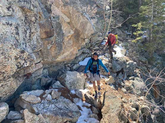
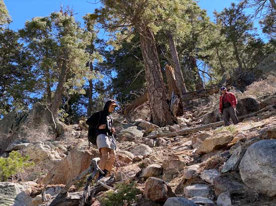

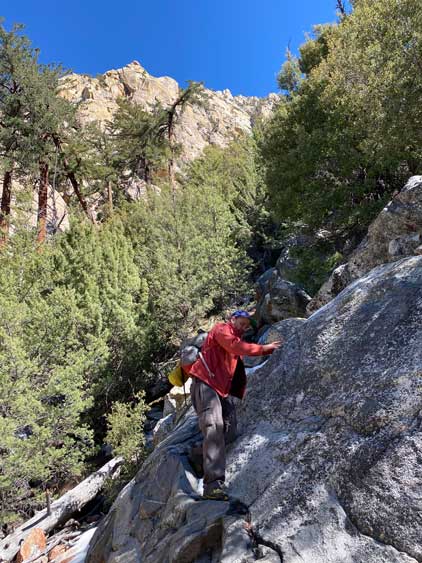


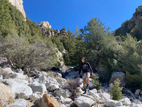


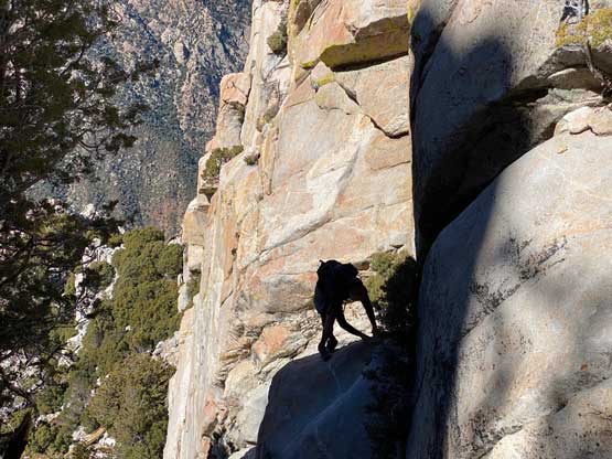
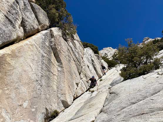
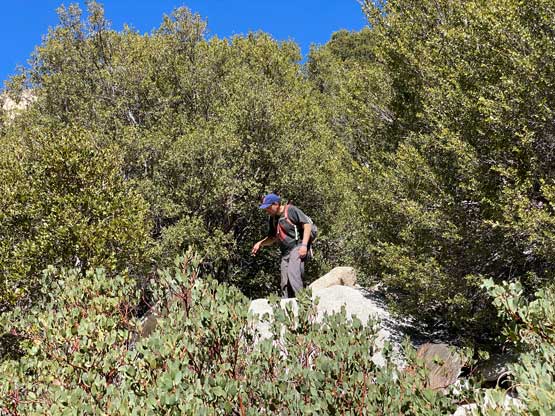
We had decided to break this ascent properly into 3 days so the objective for Day 2 was to tag the summit, and get back to camp. I thought this would be quite a lame day considering the distance and elevation gain, but it turned out much harder than anticipated. Doug and I opted to start at daybreak but Arthur would start a few hours later to catch us up. We were mostly able to follow the trail through the lower bushes but the trail forked here and there making so much confusion. I had to constantly consult with the GPS map but the GPS does not work too well in the micro-terrain of gullies. Eventually we ended up ascending too far on climber’s right and completely lost the trail. Some GPX tracks that we downloaded continued ascending the right hand side of the gully but we decided to correct this mistake by dropping a short ways into the main gully and the going indeed became easier. This was at around 2400 m elevation zone. The progress up to this point was much slower than I thought and I started to become tired of looking at the phone’s screen. For the next while we mostly stayed in the gully and were able to mostly follow the path but we did get off-route again a few times. Arthur ended up getting off-route from basically the start of the climb but he was good enough to just scramble the low 5th class rocks and bash through the dense bushes on the rib to the north. Arthur eventually caught up with Doug and I just above the infamous “wall street”. This section of class 3 granite slabs were quite fun.
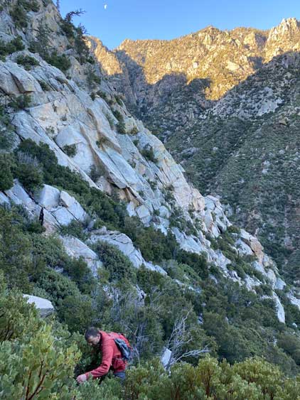


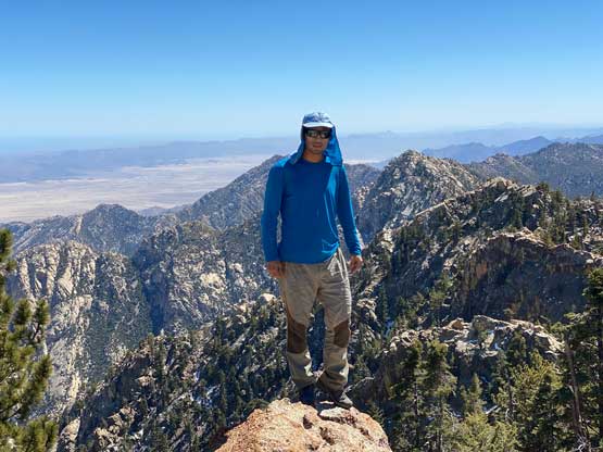
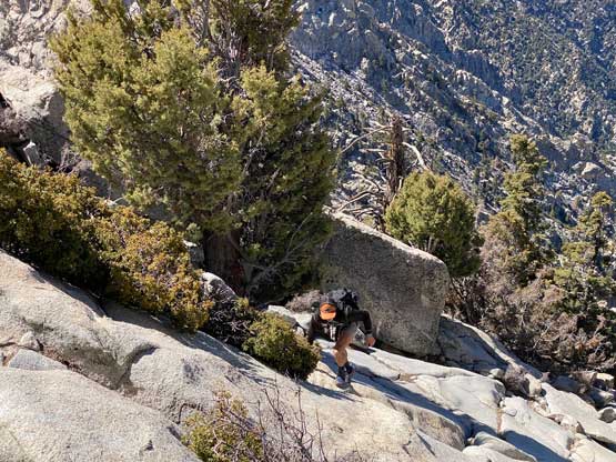
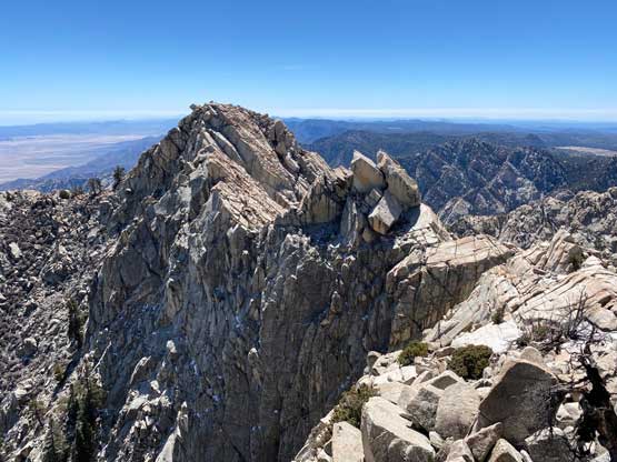
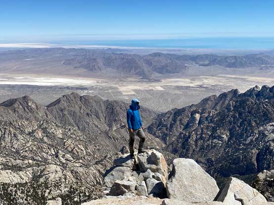
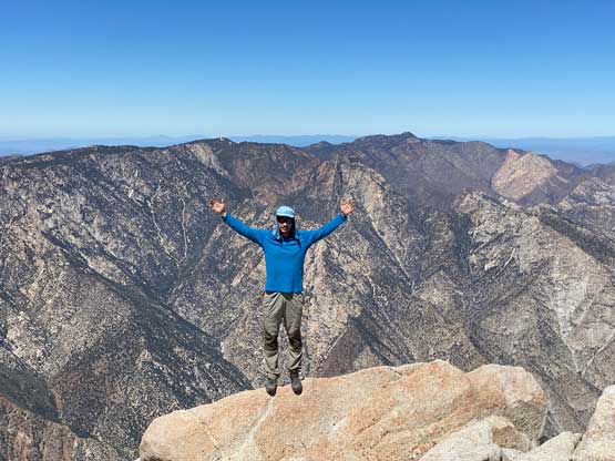
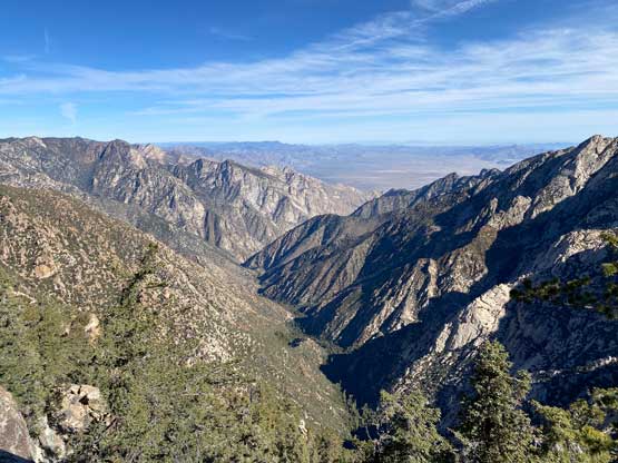
Above the “wall street” the route made a turn to the left and the end of this section we almost got off-route again. I realized the mistake and opted to backtrack to trace the existing GPX tracks. Arthur decided to just bash up the wrong route but eventually had to down-climb to rejoin us. The three of us then climbed a section of steep 3rd class terrain to bypass a large chockstone. The route finally fanned out above this section and the final 200 m grunt to the summit was quite a slog. Again, we were mostly boulder-hopping and the route-finding requirement was never-ending, even on easier sections. This was the first summit we climbed in this trip that had no trees on top, meaning the first and the only 360-degree panorama we got in Baja California.


The descent back to the camp would be a tiresome game. Doug made a head start after spending only 10 minutes on the summit. I opted to start the descent 15 minutes later and Arthur would start another half an hour later. We all re-grouped at around that chockstone section. Following the route down to around 2400 m ish was without event and then we opted to descend further into the valley to see what’s actually going on. We knew Doug and I’s route were off-track on the ascent in this zone. At around 2300 m we came across more flags, cairns and a better-defined path through the maze of boulders. A descending traverse to the down-climber’s left later saw us rejoining the morning’s route above a mini-shoulder. The rest of the descent to camp was uneventful but painfully slow as the terrain was never pleasant. I think our round trip time of the summit day was around 9 hours, which was on par with most other groups.


The decision for the egress day was to get out, drive to Tijuana and back into U.S. before dark so there were a lot of things needed to be done. Doug and I got up in dark and made a head-start again. About 20 minutes later we were able to turn off the head-lamps. The route-finding felt more confusing to go up than two day earlier, likely because the gullies diverge on the ascent but converge on the descent. We almost got off route by taking a wrong valley to the right, but thankfully I had a habit to consult with GPS every few minutes. We loaded up the water bottles at the last possible resource and entered the correct valley to the left. The next few hours were spent grunting up the boulders and game trails. That class 4 step did not feel any easier than two days earlier since climbing up required more muscle strength than down. Eventually we rejoined the better-defined path at that traversing section where the other team also showed up. Arthur also caught up to us at this stage and we did the rest of the re-ascent to Blue Bottle col in a group-of-five. The rest of the hike-out was boring and mundane and not worth to document much.


The hike-out was basically as expected overall and now we had a long drive down the winding roads back to the west coastline. We then drove north towards Ensenada which was the first major city we visited in Baja California. The traffic was horrendous in the city and cost about an hour’s delay. We eventually made to Tijuana at around sunset. The traffic was still bad, but not as terrible as in Ensenada such that we were able to squeeze into the border line-up in the fading daylight. We made a mistake by taking the “rapid lane” without previously filling out the forms online. Thankfully we were able to cut into the “all traffics” lane at the very last minute as otherwise who knows what kind of hassle we had to deal with. The crossing from Mexico to U.S. was much easier than I thought. The securities mostly cared whether we would bring in drugs and did not ask us a single personal question. This was very much unlike the U.S./Canada border crossing. The new decision was to ascend Grapevine Peak in Death Valley on the following day, so the new objective now was to push as far north as possible. Doug and I took turn driving a few more hours to the north past San Bernardino and eventually had to call a day at 1 am. We were simply too spent to drive any further.

