Mount Clitheroe
June 30, 2013
2747m
Jasper – Tonquin Valley, AB
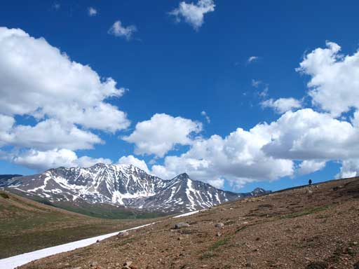
Mount Clitheroe was the primary objective on our first visit to the infamous Tonquin Valley. There is no information regarding its climbing routes, and based on a couple photos we could find online, we figured that there might be a scramble route up. However, the crux was to determine which of the several points is the true summit. They look to be equally high, so my preference was to scramble up the westernmost highpoint which looks like the easiest.
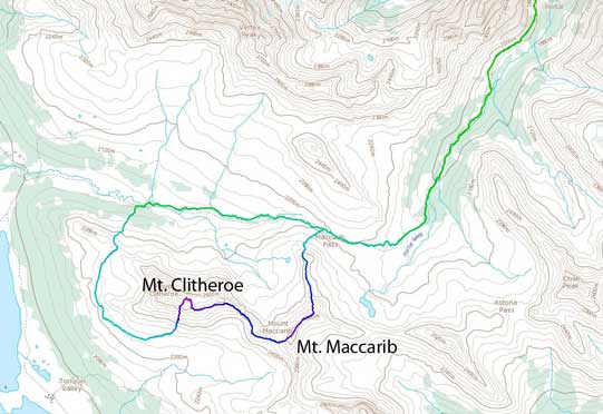
Mt. Maccarib and Mt. Clitheroe scramble route. GPX DL
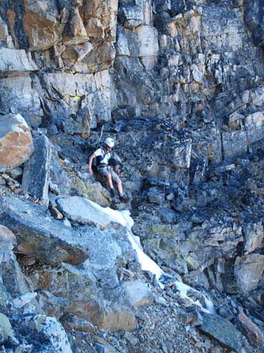
After reaching the summit of Mount Maccarib, Ben and I started the descent down its west face/ridge. Like the many other peaks in this area, we were already prepared for hundreds of meters of boulders, and yes, we were right. The descent went painfully slow. There is a small bump between Maccarib and Clitheroe, and we went on its side rather than going up and over it. However, the side-hilling was proved to be very tiring and miserable on the endless boulders. The connecting ridge went well until the first notchy section. A couple pinnacles forced us to traverse around on climber’s left, but the traverse didn’t go easily. We were forced to backtrack for a couple times. I made the call that we probably couldn’t go up from this side, so we started to traverse side-hill resisting gaining or losing elevation. Like we just encountered earlier in the morning, the side-hilling went horribly slow and miserable. There were also a couple steep snow gullies to traverse over. Ben was wearing the hiking shoes which performed poorly on steep snow. We must have spent hours on this side-hill terrain, on either boulders or snow. After eternity we came to a big gully that we decided to go straight up the gully hoping what we saw was the true summit.
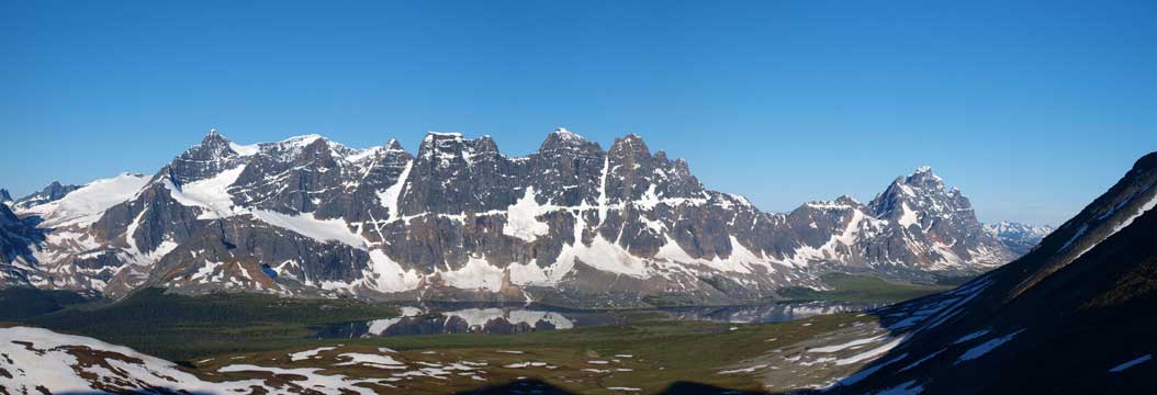
The Ramparts with Amethyst Lake below
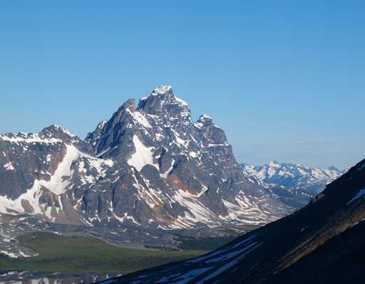
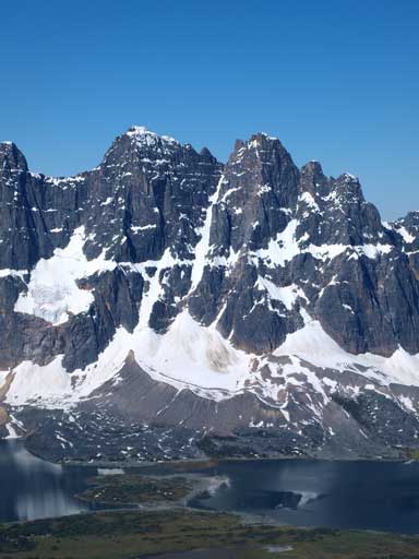
Mount Geikie
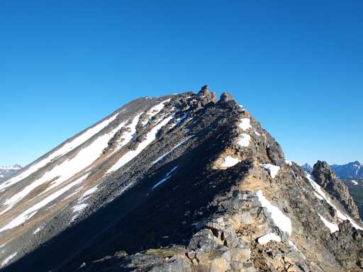
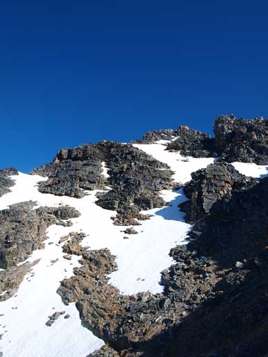
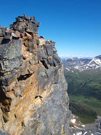
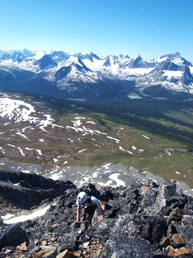
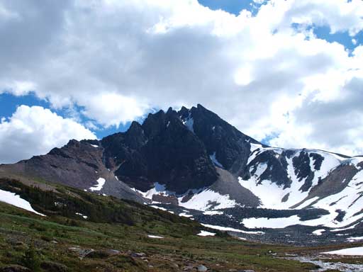
The ridge up Mount Clitheroe looks innocent, because you cannot see the last bit
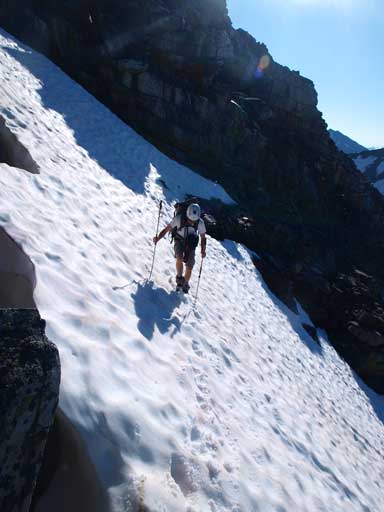
Crossing the first snow gully
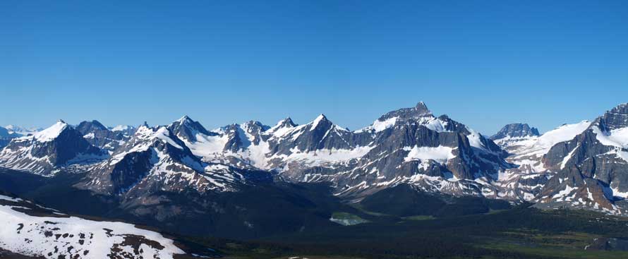
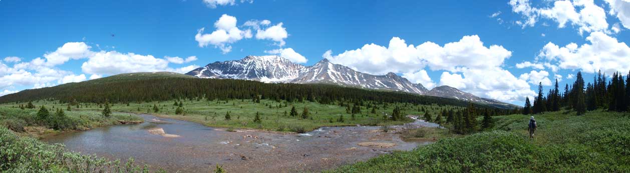
Panorama looking at the peaks towards south
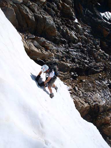
Ben crossing the crux snow gully
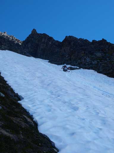
From here we split up as Ben went up the rock route, and I would traverse to the snow line. It certainly consumed time to gear up with crampons and ice axe, but I found the snow being more enjoyable. Going sideways was fine without crampons, but going uphill definitely required crampons unless I wanted to kick really hard. After a long time the snow disappeared and I was already at the summit block. I attacked it from climber’s left side. The scrambling never exceeds moderate on this mountain if you do look for the easiest line. Once topping out I was surprised to find out that I was actually standing on the true summit! The previously spotted westernmost summit appeared to be slightly lower. I could kinda tell that you can traverse to that highpoint while staying mostly on the ridge crest. We didn’t bother with that since we didn’t want to deal with another hour of boulders. Minutes later Ben showed up on the top.
I went straight up the obvious snow route. The summit is the highest point you see in this photo

Ben decided to go up the rocks
Near the top. The summit is to the right of this photo
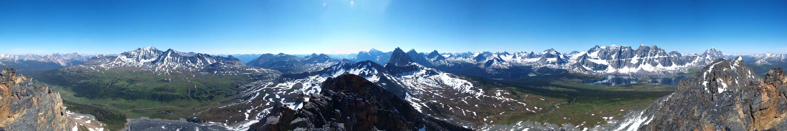
Summit Panorama. Click to view large size
Looking south

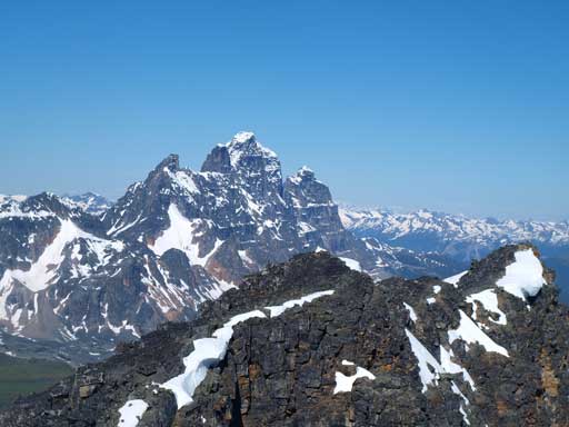
Erebus on left; Fraser at center. The Ramparts on right
Geikie

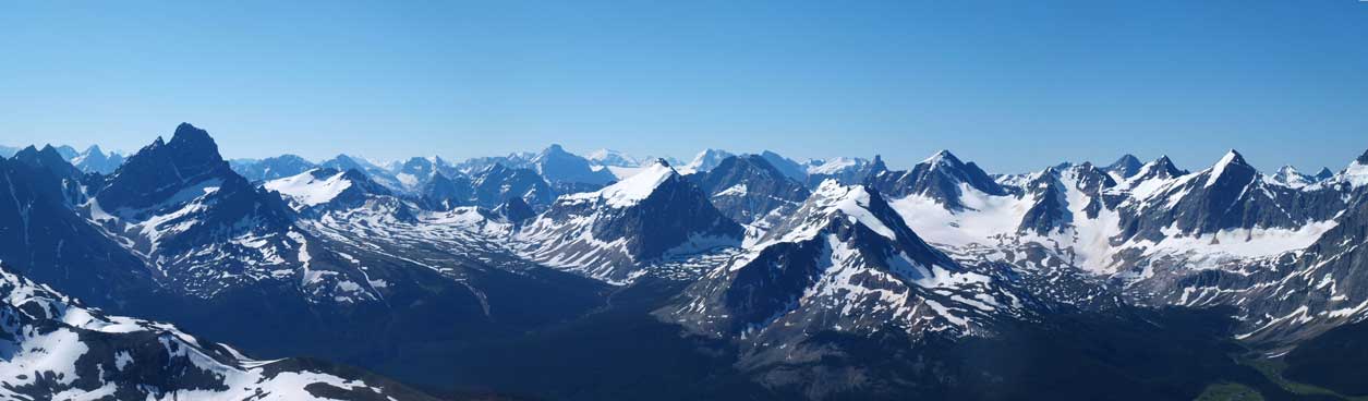
Peaks towards northwest
Peaks towards east, all labelled. I believe all of them are scrambles. I’ll come back for all of them.

The north side of Clitheroe is a shear cliff
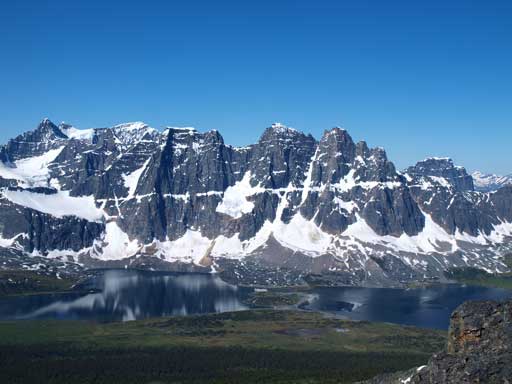
The Ramparts

Erebus
Dungeon and Redoubt
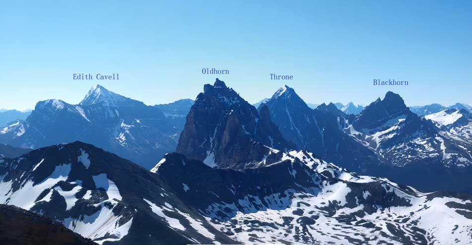
Impressive peaks with labels. Edith Cavell is the least impressive in this group…
Ben coming up the last few steps
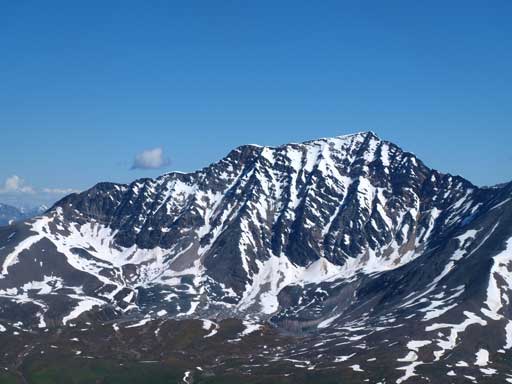
A closer look at Majestic Mountain

Curia, Basilica, and Roche Noire, with Rostrum Hill being tiny, in front of Noire
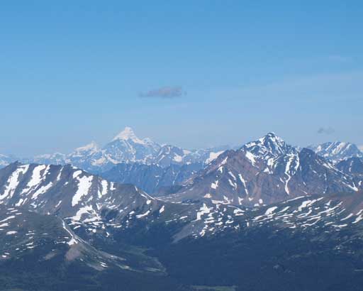
Mount Robson.
On the way down we decided to use a gully rather than retracing all of the side-hilling. The initial part of our alternate descent gully was awfully loose. We were extremely careful here about descending paralleling to each other. Luckily for us, the loose stuff would soon give way to nice and neat snow line! From here on it was hundreds of meters of glissading or plunging-step down the snow gully. Very fun! I would highly recommend doing this mountain in late spring, and climb up and down one of the snow gullies would be much more enjoyable than slogging up loose scree/boulders while worrying about dislodging a boulder to your partner.
Looking down our descent gully

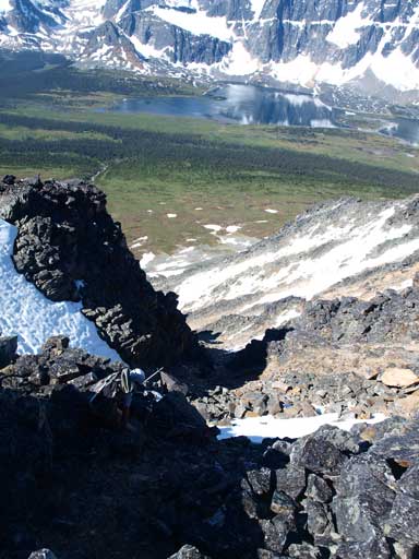
Looking through a gap on the summit ridge
Ben carefully descending loose terrain

Descending snow
Glissading!
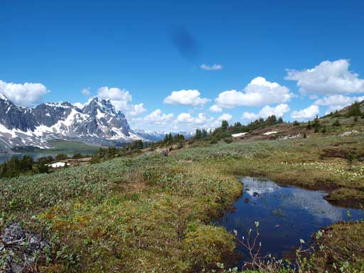
Instead of regaining to Maccarib/Clitheroe col and hopping extra hours on boulders, we decided to contour around Mount Clitheroe on its west side. It certainly added extra distance, but we also got more views and some variety than just retracing. I certainly wouldn’t mind spending extra hours to check out the view in this area, especially given the perfect weather. Also, there wasn’t any mosquitoes showing up at treeline level which really surprised us a lot. We were really preparing for 50 mosquitoes buzzing around though. It definitely worth to do this highline contouring, as we got all perspective of the Ramparts and Amethyst Lake. Once we were back to the north side of Clitheroe the terrain finally became bouldary and we decided to just bail down the Maccarib Creek where the trail goes. The creek was running high and we had to ford it. The worst part regarding mosquitoes was near the creek but once we made back to the trail on the other side, the bugs were gone! Slogging back to Maccarib Pass was numbing. It didn’t look to be that far but we did gain quite a lot of elevation, and the pass just wouldn’t get any closer…

The Ramparts

Flowers

This photo shows our descent gully. You can go up it too
No mosquitoes?! Wow!

Panorama of Tonquin Area. Amethyst Lake surely looks big

A zooming-in shot

Around the corner, looking back towards Geikie
The north side of Clitheroe is much steeper

The Ramparts again

L to R: Bastion, Turret, Geikie, Barbican
Majestic Mountain and Vertex Peak

Panorama of Maccarib Creek Valley
Dropped down to Maccarib now.
Slogging back to Maccarib Pass. What you cannot see in this photo is how much elevation we had to regain…
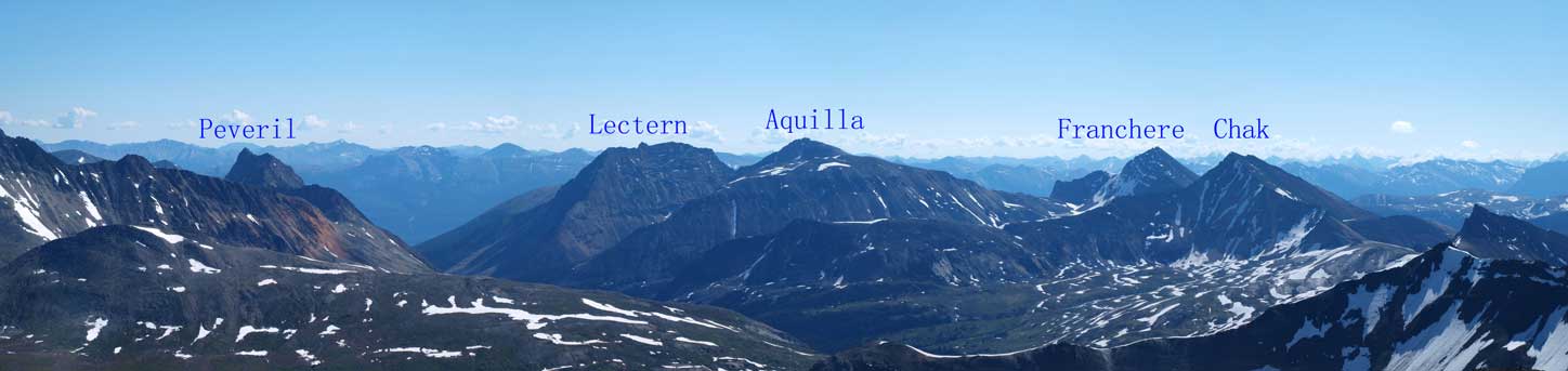
And once on the pass, what was left was just another 12km slog on a well-maintained trail, on such a hot afternoon though. There was not much to say about the de-proach except for pure perseverance. It went on forever, and it kept descending forever. After eternity we finally came to the broad col between Lectern and Peveril, and then skirting around Peveril’s side went painfully hot. And then we steeply descended into the trees and thankfully we finally made back to Circus Creek where I eventually refilled my water bottle… And then, we were looking at another broad pass between Marmot Mountain and unnamed peak, and I knew we had to pass that broad col…

Chak Peak

Typical condition on Peveril Creek Trail. It certainly gets regular maintenance!
Aiming for the broad col between Peveril and Lectern

Lectern Peak looks to be another day of boulders. You gotta love boulders if you like Jasper scrambles…
Our round trip time was 15 hours and overall this was a very satisfactory trip in the mountains. I’m sure Mt. Maccarib does see some traffic but the true summit of Mt. Clitheroe is for sure more “obscured”. The peaks around Tonquin Valley all look amazing and I’m sure I’ll come back at some point.
