Ample Mountain (Cayoosh Point)
November 17, 2019
1817m
Lillooet / Duffey Lake Road, BC
“Ample Mountain” is the unofficial name of the lowly, but locally prominent summit (P2K, over 2000 feet of prominence) on the far eastern reach of Cayoosh Range not far from the small town of Lillooet in the interior side of Coast Mountains. The peak was used to be known as “Cayoosh Point” but there’s a brief explanation on bivouac.com about the change to “Ample Mountain”. Basically both names were unofficially given by the same guy, Mike Cleven but the new name has some evidence of being used historically on some mining photos. I don’t think this peak draws much attention from anyone but the peak-baggers or locals and I’m sure “Cayoosh Point” is the more popular name as also suggested by Google Earth, but I prefer “Ample Mtn.” to preserve the historical value.
An ascent of this peak had been on my mind for at least three or four years because of the easiness of access and the short nature of the hike. The downside was the long drive. It’s very difficult to justify driving over 4 hours each way just for this uninspiring forested bump, but in this so-called “shoulder season” it might actually make a lot of sense. The Lillooet area sits on the rainshadow side of Coast Mountains that might provide the only dry spot on a soggy day. This was exactly the case of this past Sunday. Alex and I had been discussing the potential objectives for a few days and in the end we opted to downgrade to “Ample Mountain” and because of that, Ben and Sean also decided to join. I was surprised there were four of us interested in such a dull summit in marginal weather. The morning of Sunday was downpouring in Vancouver. We all got soaked pretty thoroughly while carpooling at the church in West Vancouver at around 5:30 am. I thought I had to drive but it seemed difficult to cramp four of us and our shits into my truck so we decided to use Sean’s Rav4 instead. The drive through the misery up Sea to Sky corridor was almost for sure harder than the hike itself and I was pretty happy that for once, I didn’t have to be on the driver’s seat.
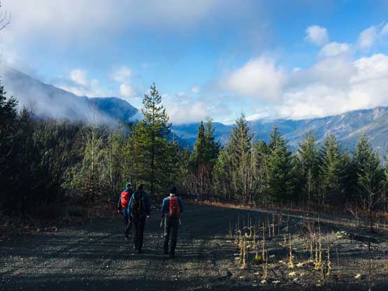
As we drove past Pemberton onto the Duffey Lake Road the weather did gradually improve but not to the extent suggested by the weather forecast. By the point we parked at the start of Seton Ridge Road it went back to pouring. We thought about waiting for a bit but decided that such would be pointless given the fact we also had to bushwhack on this hike. The condition of Seton Ridge Road surprised us given the lateness in the season. It was easily in “2WD” condition. We easily made up and over the pass and then descended over 100 m down to the saddle. Even the spur road appeared drivable so we opted to explore. We tried a couple roads and decided to park at about 2 km from the drivable end due to a few big waterbars. The weather was still mostly grey with some light drizzles.
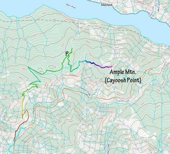
Ample Mtn. (Cayoosh Point) from Seton Ridge. GPX DL
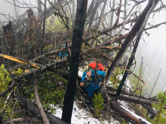
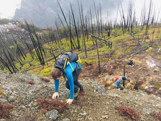
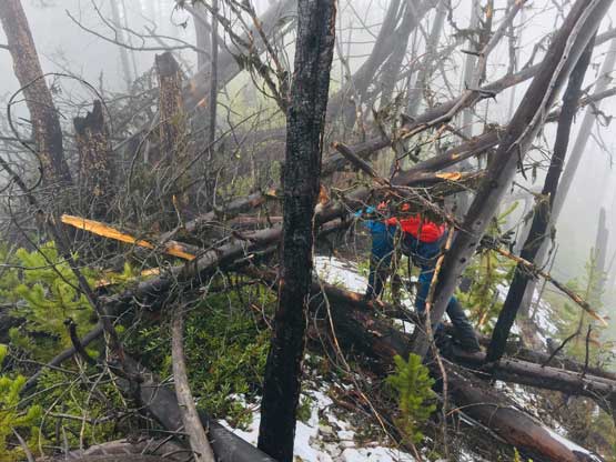
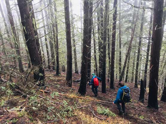
We decided to enter the forest before reaching the highest spot on the spur roads at around 1200 m elevation. It really didn’t matter where exactly to enter the forest as bushwhacking is unavoidable. The ascent up through the mature forest was easier than expected but the weather continued to drizzle on us. The stoke level was very low but at this point we were already committed to make the summit no matter what. We managed to pick up what seemed like an user-maintained trail in the woods and followed it all the way to the summit ridge. The travel on the ridge was nowhere as pleasant as in the woods due to the criss-cross of dead-falls and lots of young trees. The logs were a totally mess and very slippery when wet. We were all soaked through in no time but again, there’s nothing else to do other than pressing on. We had to crawl up and over a shit ton of logs but thankfully the worst of those weren’t super sustained. There were always some nicer stretches of ridge-walking to keep our hope relatively high.
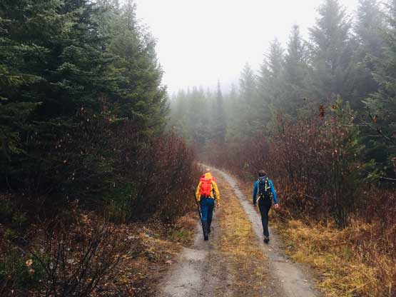
The start of the walk. We opted to save the car and walk this spur road
Sean trying to be happy. It was raining…
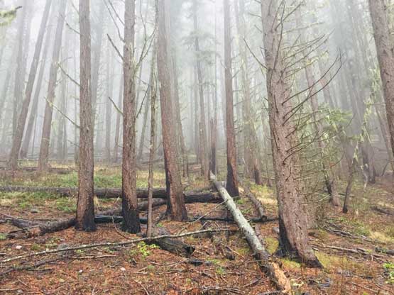
Upwards into the woods and into the dreary
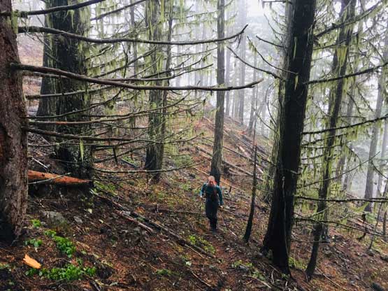
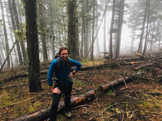
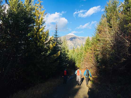
Ben hiking up the forest. We picked up a trail at this point
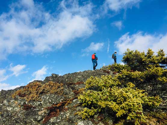
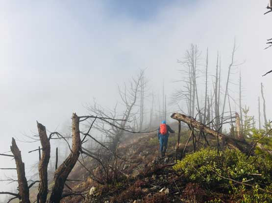
Alex bushwhacking the start of the long summit ridge…
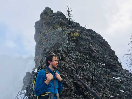
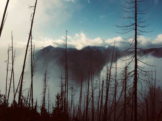
At this point the weather finally started to improve and we could see the first glimpse of blue colours of the day. The Seton Lake valley were covered in fog and we were above that layer of clouds. The traverse of the summit ridge was also more fun than expected and even offered some scrambling oppourtunity. We all scrambled up the first 3rd class step but opted bypass the next tower. The true summit was pretty well positioned for looking down into the town of Lillooet and Fraser Canyon and despite the clouds, we were all pretty satisfied about the views. We lingered up there for over half an hour but there’s no sign of further improvement.
The clouds finally lifted and we could see the route ahead
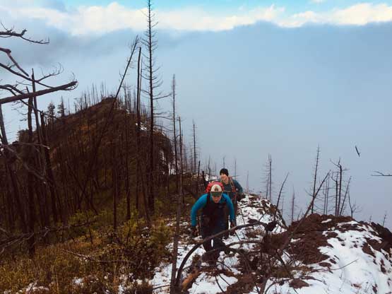
Alex and Ben on one of the nicer stretches of the ridge.
Sean finishing the 3rd class step along the ridge
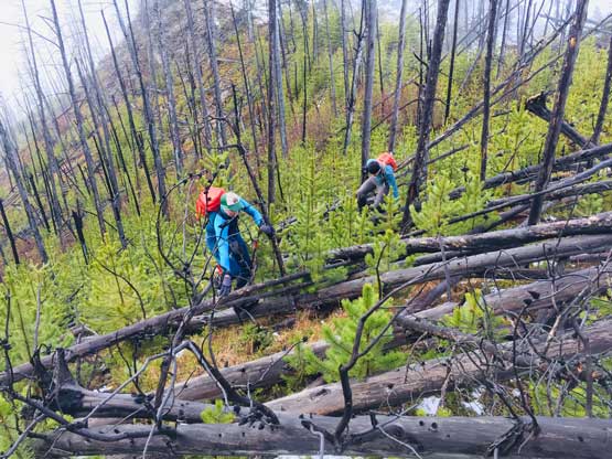
Back to bushwhacking in a tangled mess of (wet) dead-falls…
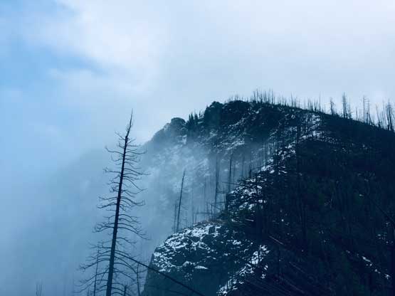
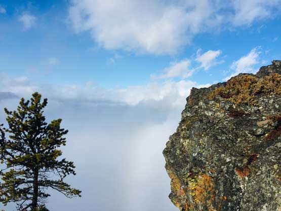
The north side of this peak is actually a shear drop…
Sean and the next 3rd class tower.
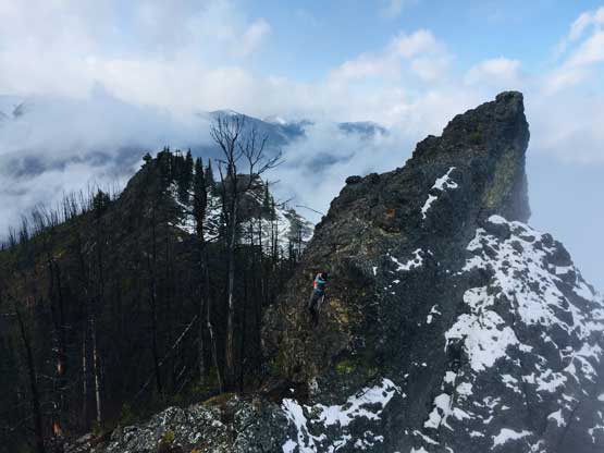
While the rest of us bypassed, Ben decided to scramble over it
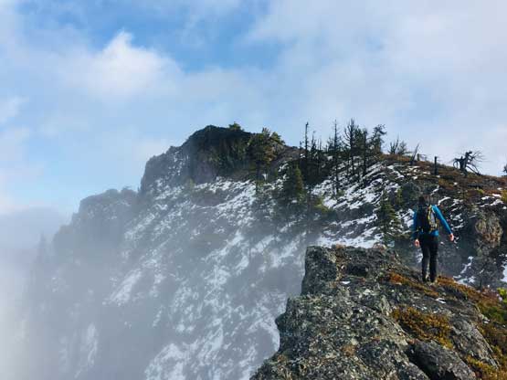
Continuing onward towards the summit
Ben high up on the summit ridge. Note the valley clouds behind
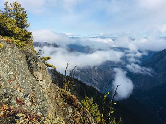
Near the summit looking east down into Lillooet
The last few steps to the summit of Ample Mtn.
Too bad we couldn’t see Seton Lake but valley fog wasn’t bad neither
This is looking further down east along the ridge.
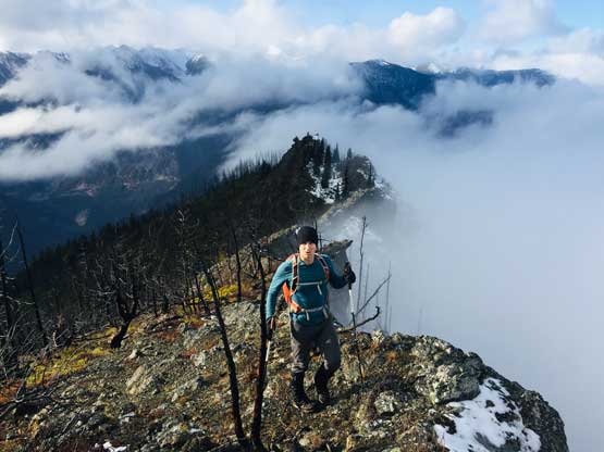
Ben approaching the summit of Ample Mountain
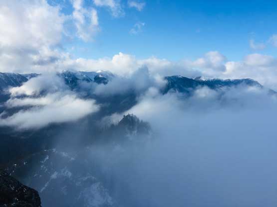
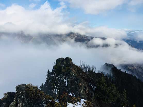
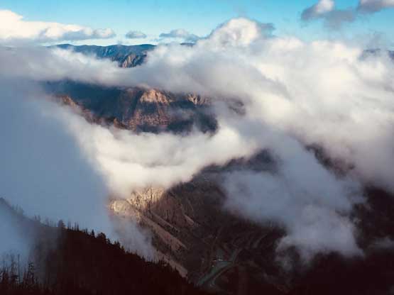
Very cool clouds scenery from this little peak
Another photo of the clouds scenery looking up Seton Ridge
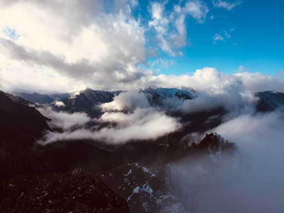
This is the massif of Mt. Brew hidden in clouds
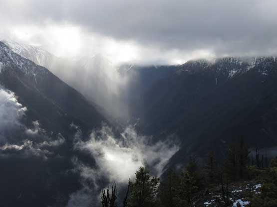
Some local weather in Phair Creek valley
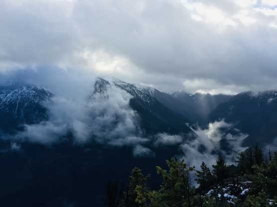
Another photo looking east towards some lesser peaks by Lillooet
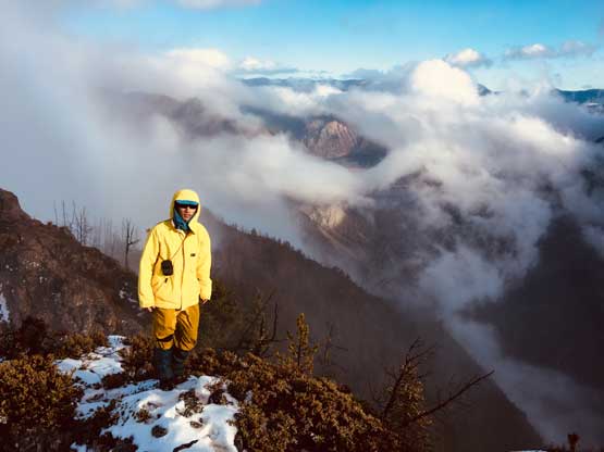
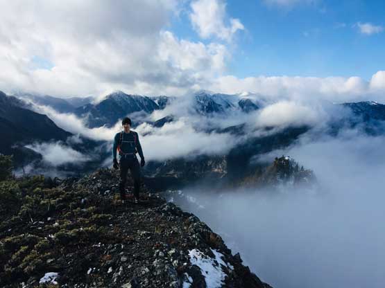
Me on the summit of Ample Mountain (Cayoosh Point)
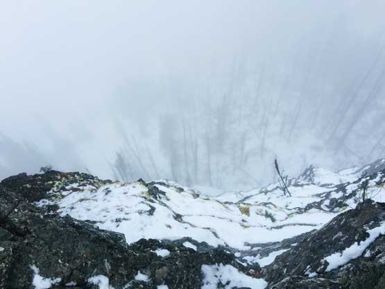
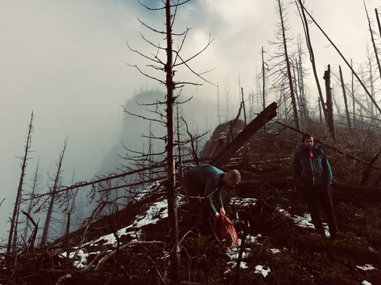
We were back into the white-outs during the descent so there’s little worth to document about. We pretty much just followed our own footprints back down the summit ridge, over endless dead-falls and then into the forest. I used GPS a few times to make sure we could pick up that game trail and were back to the logging roads almost exactly at where we entered the woods in the morning. The weather finally cleared up fully at this point and we could see Mt. McLean et al. on Mission Range. The day was still young and Ben suggested we could do a stop at a viewpoint near Seton Lake because that spot was famous on Instagram. The view from that spot wasn’t disappointing but the more important, we all got to practice our Insta skills to some extent…
Taking a break while descending along the ridge
A brief clearing reviewed some views
Alex hiking back into the mist
Bushwhacking…
Into the mature forest now
Back to the spur road
Mt. McLean in the distance
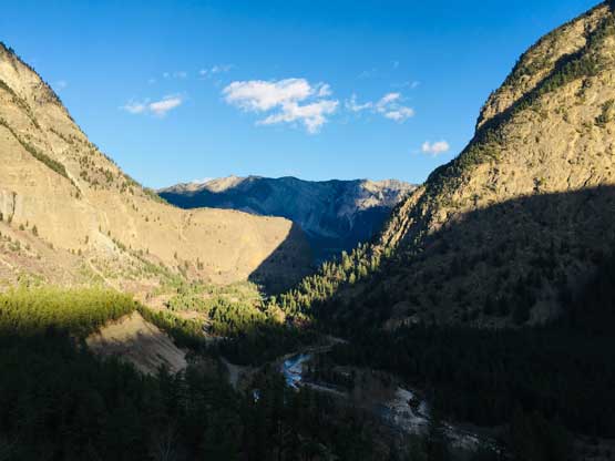
The Seton River canyon leading down into Lillooet
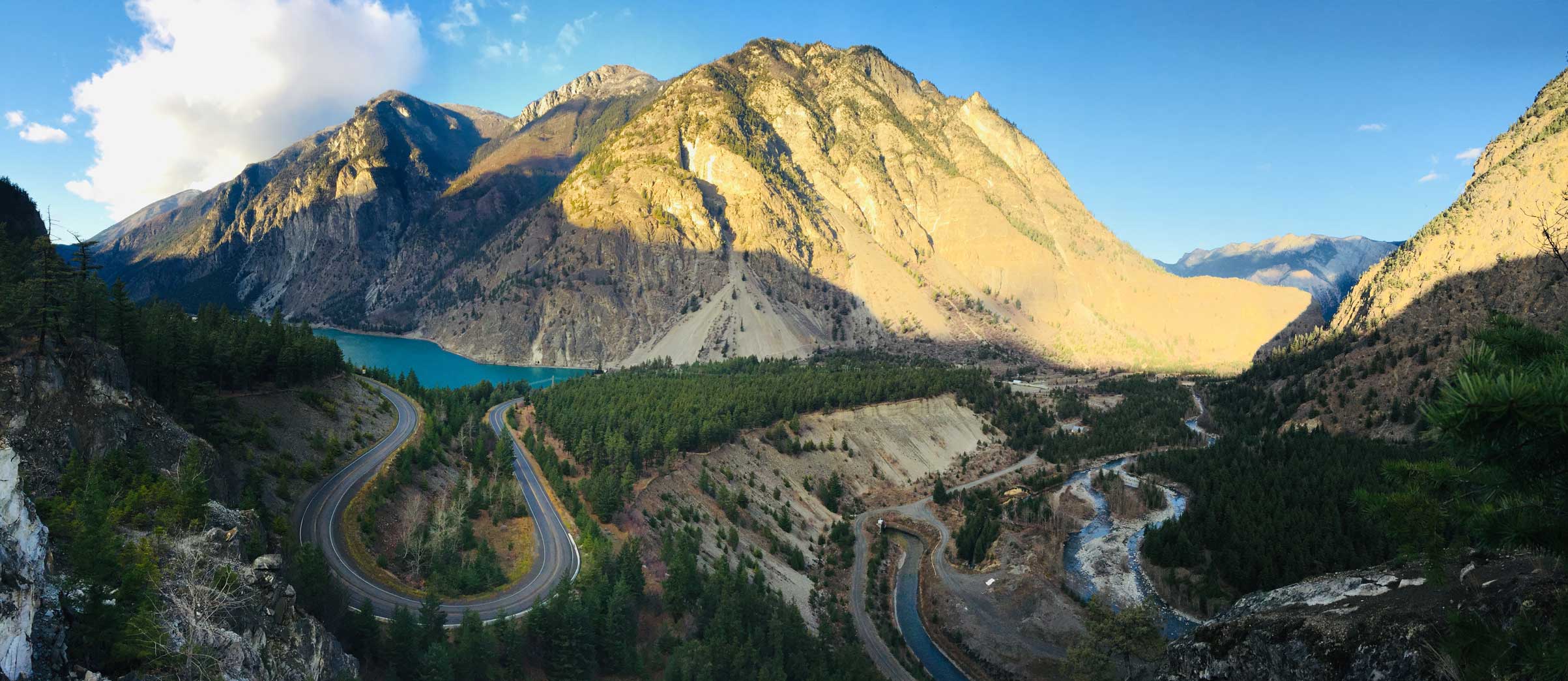
A panorama of Seton Lake from that Insta point. Click to view large size.
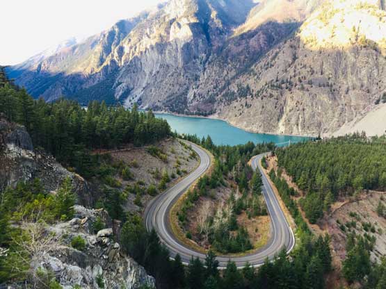
Seton Lake and the road’s big bend.
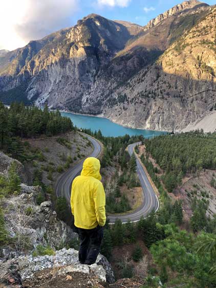
Me posing for the ‘gram… Photo by Sean C.
The rest of the drive back home was long and exhausting but because I didn’t have to drive, I just passed out on the backseat. I didn’t wake up until we were back to Whistler… This was once again, a better-than-expected day on a better-than-expected peak. Thanks Sean for driving the whole way.
