Williams Peak
September 16, 2021
2123m
Chilliwack, BC
Williams Peak is a popular objective for a number of reasons but the most notable is the inclusion in Matt Gunn’s Scrambles in SW British Columbia drawing the masses’ attention even back when social media wasn’t even a thing. Apart from that Williams Peak boasts an iconic profile, a paved road access, a trailed approach and a straightforward “standard route” via the south gulley. Most people wouldn’t believe that I hadn’t done this peak but here’s the reason. I was trying to bag peaks in the most efficient way and I needed Goetz Peak as well as Mt. Northgraves. Both of those peaks share the same approach as Williams Peak but to get all three in one trip requires an overnighter and subsequently a much-harder sell to partners. To scramble Williams Peak as a stand-alone objective meant I had to repeat 80% of the trip another time for the other two peaks. But eventually I convinced myself that the approach to Williams Peak’s base wouldn’t be that bad such that a repeat wouldn’t be that much of a sufferfest, so I wasn’t dead set on that overnighter idea. Matt J. happened to need this peak very badly because it’s a “P600m” objective and Vlad also keen to get out on another scramble before a prolonged period of rain event.
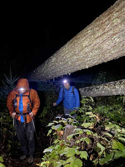
The best weather was on Thursday but I needed to be at work no later than 4 pm. The only way to make that happen was to hike the approach in dark. Vlad took a bus to White Rock the evening before and crushed in my home. We then woke up at 3 am and grouped with Matt in Abbotsford an hour later. Another hour later we had parked at Williams Ridge’s trail-head. It’s a rare treat where we didn’t have to drive a logging road to access a peak. In fact, we could have driven up the Ford Mountain FSR to shave off 600 m elevation gain but that would add some bushwhack into the trip and the status of that road was unknown. We determined that since none of us needed to save energy for anything we might as well do the full hike for completeness.
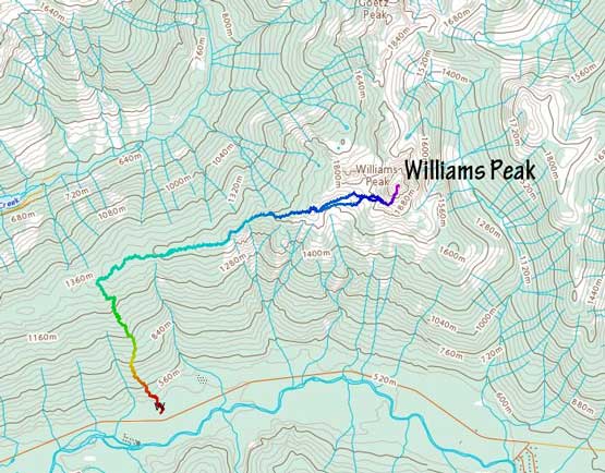
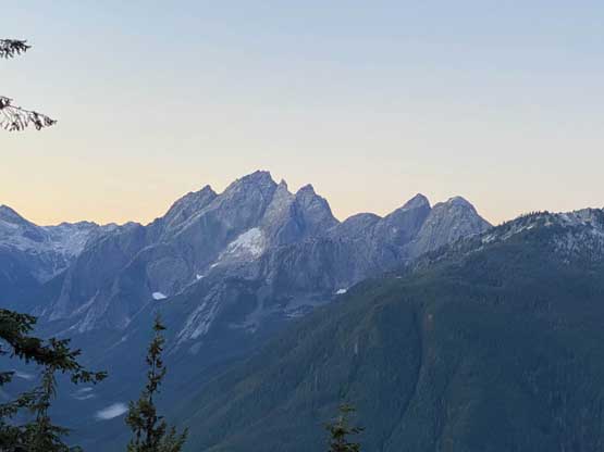
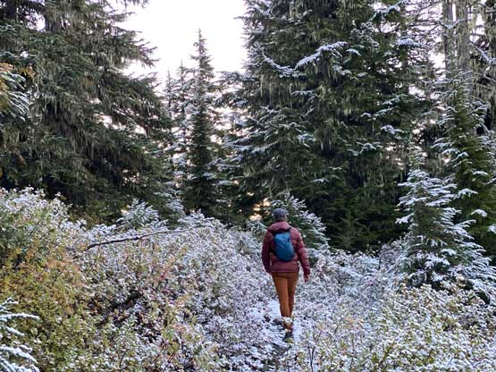
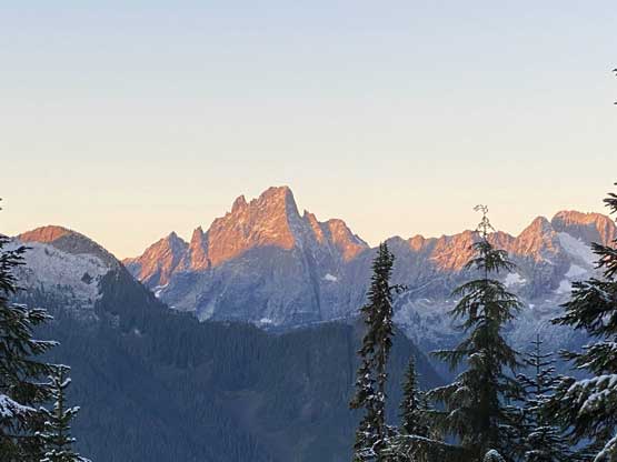
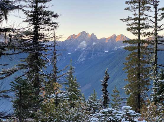
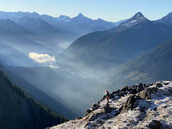
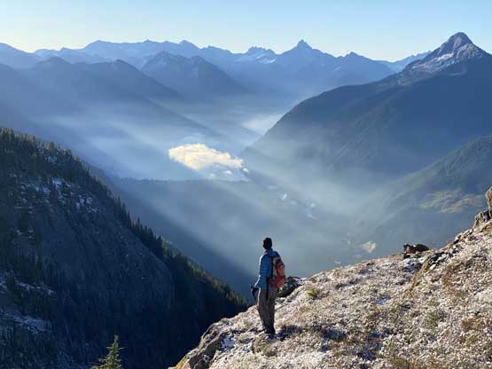
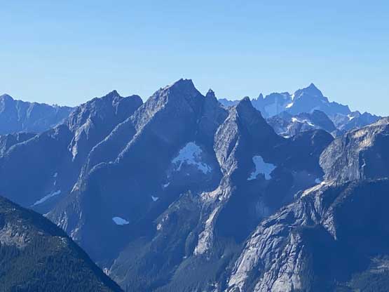
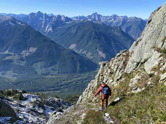
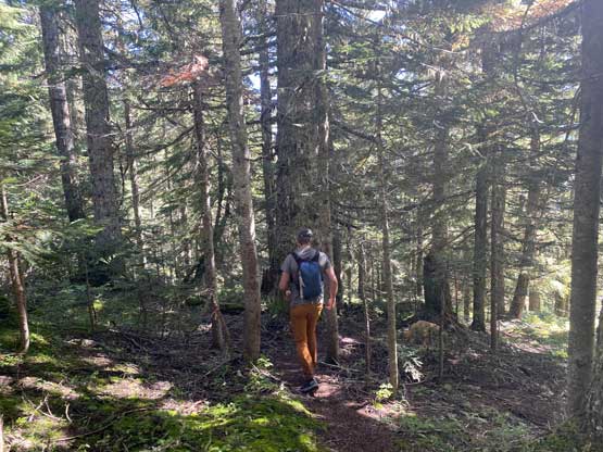
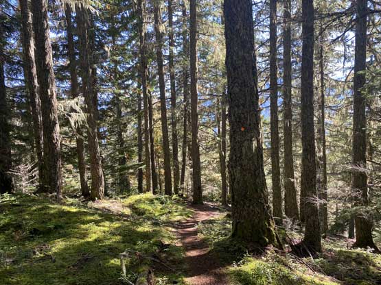
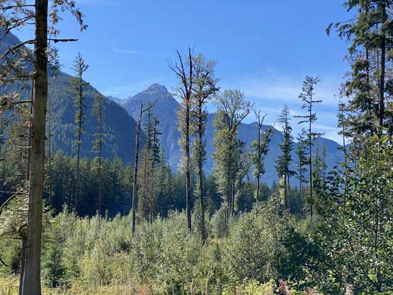
The start of this trail had a few confusing junctions because we were essentially walking on some deactivated logging road spurs. Thankfully with the GPS technology these days the navigation wasn’t a problem. Once the logging road gave way to a proper trail we just had to put one foot in front of another for 900 vertical meters of grunt. The trail quality wasn’t bad but there were a number of dead-falls especially on the lower stretches. The lower half was steeper and rougher than the upper half of the grunt. We made to the ridge in 1 hour 20 minutes and it was still in a pitch dark. Without doing any lingering we pressed on. The brushes were extremely soaked from the recent precipitation and that further made me glad to have avoided the bushwhack from Ford Mountain FSR. From where we topped out on Williams Ridge to the base of Williams Peak had at least 4 km of plodding. The trail on the ridge was unfortunately overgrown such that we still got soaked by the wet leaves. About half an hour later we came to some sporadic openings with views southwards towards Slesse Mountain, and soon after that we found fresh snow on the ground. It’s apparent that the area got dumped by an inch of fresh snow and the snow did stick around because of the colder temperature. The trail unfortunately became wetter and more overgrown as we pushed higher towards the base of Williams Peak.

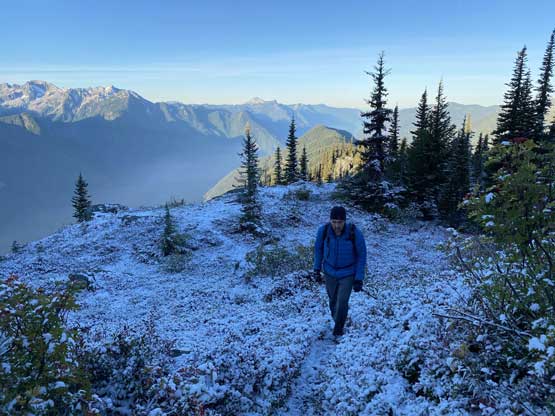
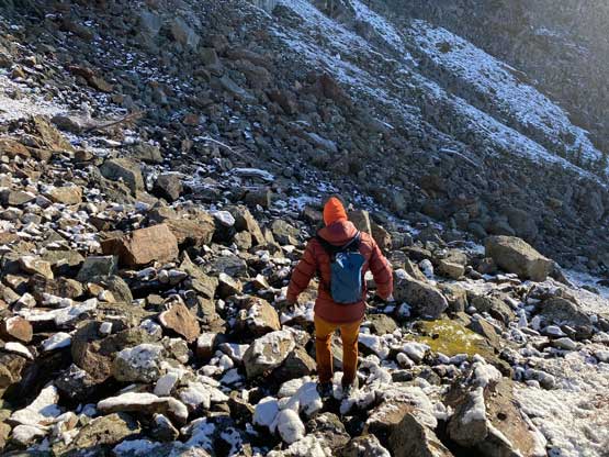
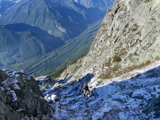
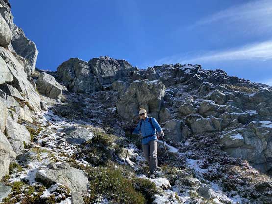
There’s one spot where we got a brief treat of sunshine and we took the only long-ish break of the ascent. We then committed to the treacherous 50-m descent into the boulder basin west of the peak. The fresh snow made the heather slope extremely slippery. The traverse across the basin on a mix of boulders and heather slopes was actually the worst. None of us had read the obsolete Matt Gunn’s book since the route is well marked on Gaia and Matt even downloaded a GPS track from AllTrails. We stayed lower in the basin on the ascent and descended by traversing higher up and the conclusion was that boulder-hopping was unavoidable no matter what. I’m sure in drier conditions this would be no-brainer but with fresh snow I had to pay 120% attention to the footings. Matt didn’t seem to get bothered by the boulders but Vlad and I had to go at a snail’s pace. Eventually the boulders gave way to a slippery heather/dirt slope. I did not find this part to be that bad probably because I was wearing rigid mountaineering boots such that I could kick and/or edge into the grass/mud.


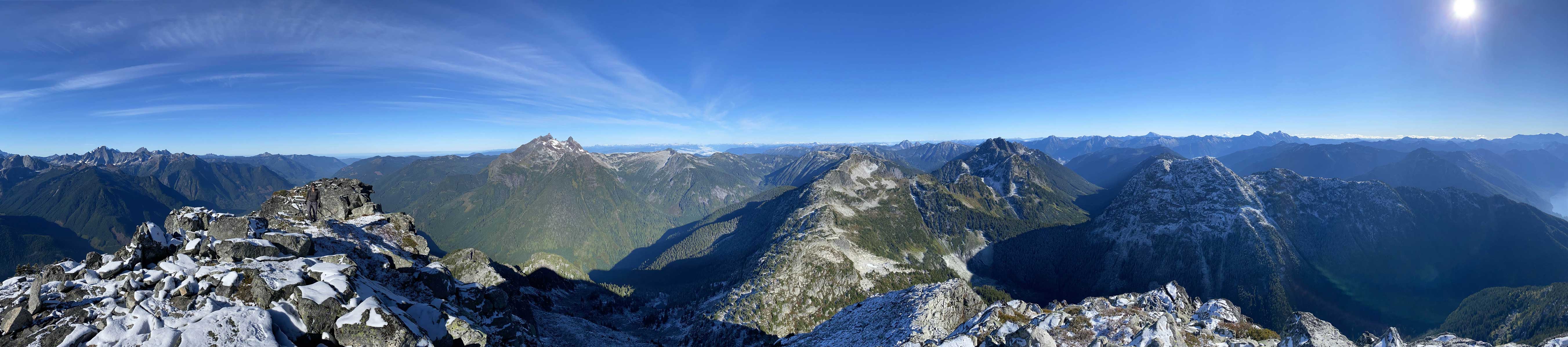
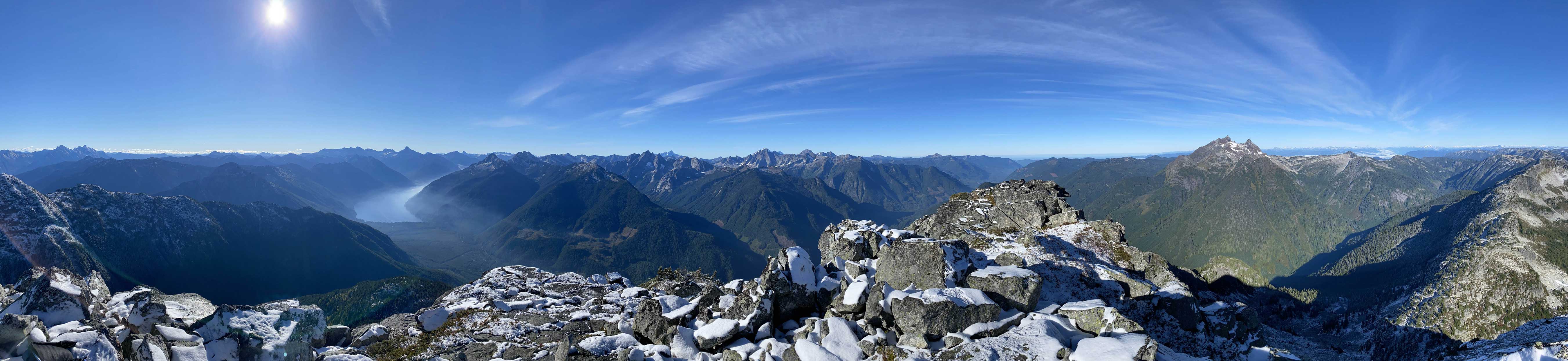
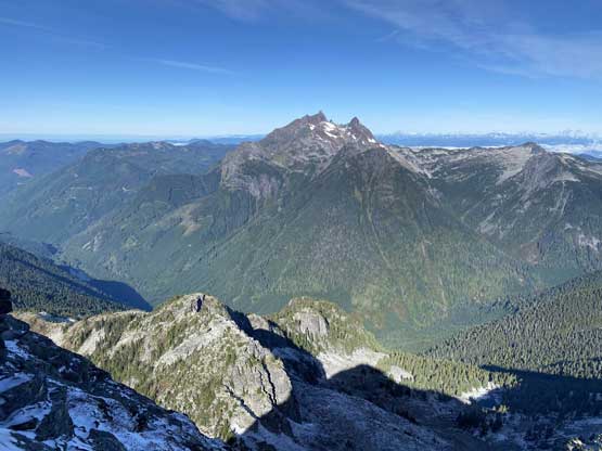
Around rounding a corner we traversed into the south face’s gully. Again I did not read Matt Gunn’s book nor any trip report and I thought this gully had some 3rd class terrain but I was wrong. The gully was actually easier than the boulder fields we just negotiated. Probably because of the volume of the traffic there had developed a master series of “staircases” in the heather and dirt and we rarely had to use our hands to scramble up anything. The ascent up through this gully was however, fairly foreshortened but in the end it dumped us right onto the summit. I then discovered another reason why this is a popular summit, the glamorous 360-degree views…


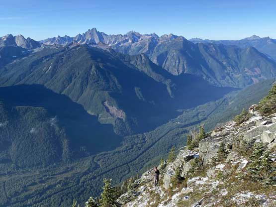


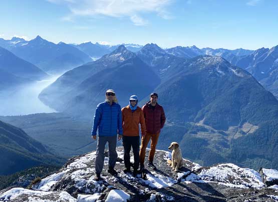
After about half an hour we started the descent. It had take us 4.5 hours to ascend and we weren’t doing particularly good on time probably because of the fresh snow. Descending the south face gully felt sketchier than on the ascent because the snow was still there and the heather was still slippery, but we all managed without a slip. The upper stretch of boulder fields back into the basin was still wet and slippery but then the lower basin had already dried out. By the time we grunted back up onto the approach ridge we could see all of the south and east facing slopes had dried out on nearby peaks. The plod back across Williams Ridge seemed to drag on forever due to endless micro up-and-downs but the final 900m-descent was a blast. All three of us went at our own pace on the descent with Matt going first and Vlad following last. Our round trip time was about 8 hours and considering the difficult conditions this wasn’t bad.


Matt then did a great job driving us back into Abbotsford and I resumed the drive back to White Rock. Vlad unfortunately had to take bus again to get back to Richmond. I got back home with about an hour of spare time before work and even managed a short nap.
