Klitsa Mountain
October 13, 2019
1639m
Port Alberni / Vancouver Island, BC
Klitsa Mountain is the second highest summit on the southern half of Vancouver Island and is highly visible from Highway 4 west of Port Alberni. This peak locates in an area that holds some rainfall record and the alpine snow usually don’t go away until August, despite the relatively low elevation. “Kleet-sah” means “always white” so this is a very aptly-named peak. From mountaineering perspective the peak can be accessed from three directions but the easiest and the most commonly used is via “Brooke George Trail” from Nahmint River to the south. The access requires lengthy and complicated link-up of logging roads and the last several kilometers on N600 spur requires HC 4×4 vehicle. Providing one does manage to get to, or reasonably close to the trail-head this ascent is rather a pleasant day-hike with scrambling no harder than “class 2”, if staying on route.
An ascent of Klitsa Mtn. on this past Sunday was a pure spontaneous decision that was made by the weather and conditions. Vancouver Island was the only spot with sunshine in the forecast and I knew from recent Facebook posts that the island didn’t get much dump of snow compared to the Cascades so I figured that an ascent of Klitsa Mtn. would still be feasible as a day-hike from the mainland. However, I wasn’t particularly keen to pay 180 dollars to BC Ferries all by myself so finding partner(s) was crucial. I checked with literally everyone that I thought would be interested in this trip, but only Chris Hood signed up for the mission. Chris and I had some talk about the financial analysis. None of us was keen to pay 100 dollars neither but we also knew it’s hard to get a trip like this aligned perfectly, so the decision was to go even with just the two of us. The weather forecast was far from “guaranteed” but I had been tracking all models I could find on the internet for the past several days. The worst would be soaking in convective clouds but there’s a decent chance we would get blue skies, so we opted to gamble on it.
This was my third time day-tripping Vancouver Island objective(s) from the mainland and among all three times I was the driver, so I had been getting pretty familiar with the routine. The day would be no shorter than 20 hours with more than 2/3 spent on driving and travelling instead of hiking. I woke up at 4:30 am, picked up Chris from the church in West Vancouver at 5:30 am and made to Horseshoe Bay ferry terminal shortly after. There was already a long line-up waiting to get onto the early morning ferry but worrying proved to be unnecessary. The 6:30 am ride will never get that busy overall, even on a long weekend like this one. Two hours later we were dropped off in Nanaimo and another 1.5 hours later we turned onto McCoy Lake road, and soon would be on gravel. Thankfully the roads here were clearly marked on my Google Map app so directing to the trail-head was not much of a deal. The 40-km logging road ride to N600 spur was mostly a smooth sailing except for a few steep and loose hills on Gracie Lake Branch that links up Sproat Lake with Nahmint River. The last several kilometers on N600 was in a much better shape than I was expecting, likely due to recent logging activities. The road seemed to get some maintenance that getting to ~700 m elevation was trivial in my Tacoma. The last 100 m elevation gain appeared bushy and likely not maintained. I knew some would push for the actual trail-head but I wasn’t particularly confident about that, so opted to park and walk.

Klitsa Mountain via Brooke George Trail. GPX DL
In retrospect I think my Tacoma could definitely make to the trail-head if I didn’t mind some scratches, as the ditches were not very deep. I really didn’t matter much for us because the walking was only 15 minutes. The lower portion of Brooke George trail had some confusing spots due to dead-falls and wash-outs, but the route was well flagged. We also came prepared with a downloaded GPS track from Exploring the NW Coast, so navigation wasn’t an issue. The trail was also very muddy and wet at places. In less than an hour we made to the small lake under Gibson-Klitsa Plateau. To our surprise the upper portion of the trail beyond the lake was also well flagged and easy to navigate as it winds its way through a series of rises onto the broad west ridge of Klitsa Mountain.

Tacoma parked at the junction with the last spur, 700 m elevation

Walking the last 500 m to the actual trail-head

Through the woods we could see Adder Mountain to the north-west

Chris hiking the lower portion of Brooke George Trail
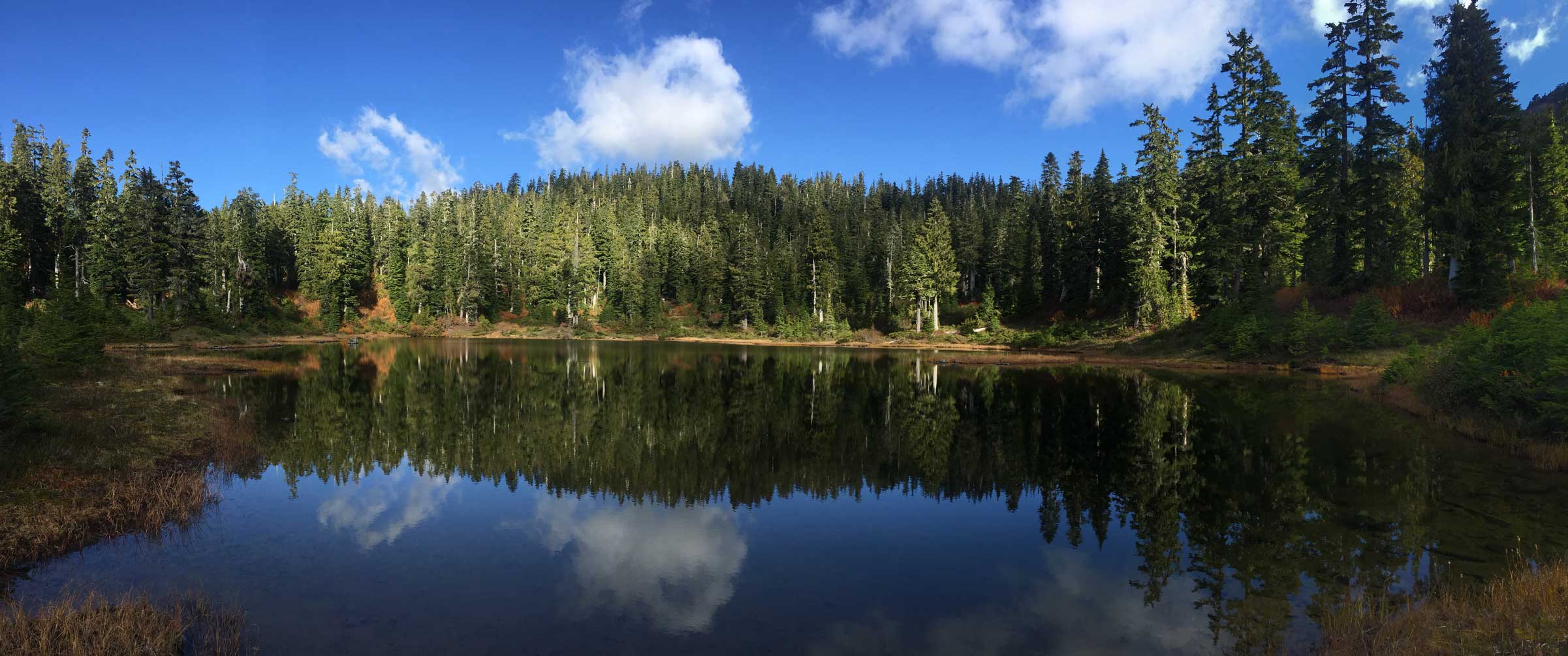
Arriving at the small lake. Click to view large size.
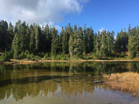
Another photo of this small lake.
Starting to see Mt. Gibson
Chris hiking above the Gibson-Klitsa plateau now
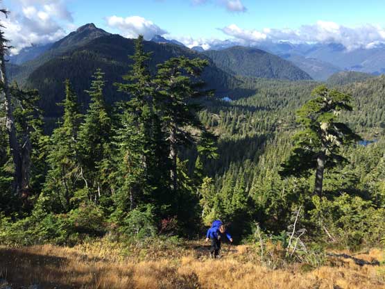
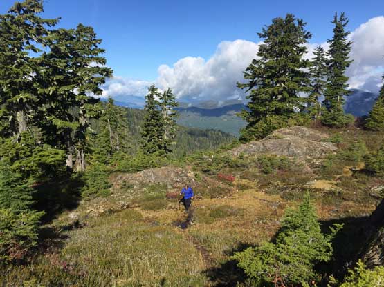
Hiking up the broad west ridge with Adder Mtn. behind
Towards the final 400 m elevation gain we started encountering short steps of scrambling and the trail started to become indistinct at places. The general bearing was very obvious though – straight up aiming for the summit block. We even found multiple flagged routes on the summit block but somehow picked the wrong branch going climber’s right. We realized the mistake after topping on the uppermost south ridge to a large memorial cairn. I knew the summit block was “no harder than class 2”, and the south side scramble appeared at least “class 3” if not harder, but I wanted to explore. I opted to find a way up from this side by traversing a narrow, outwards ledge that quickly became deadly exposed. The farther I traversed the easier the terrain appeared, but the more exposed it became. Eventually I stopped traversing and made a few scrambling moves on “class 3” slabs. Chris followed me not far behind and we soon made the summit. We stayed on the summit for at least half an hour soaking in the views. It wasn’t entirely bluebird, but already better than expected. We could see pretty much everything other than the distant peaks.
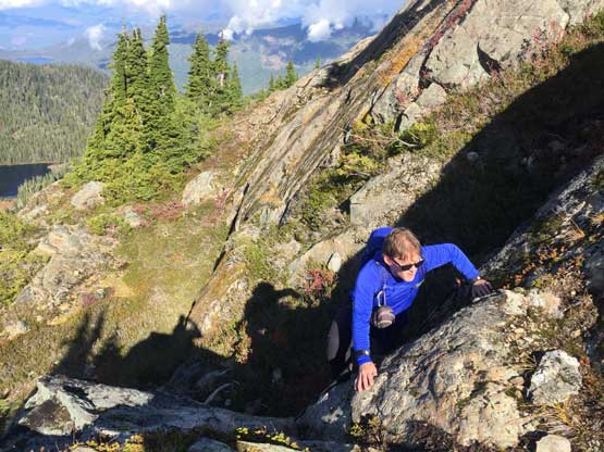
Chris scrambling a short tricky step on the trail

On the upper west ridge much higher than Mt. Gibson now

Plodding up.

The summit block with the correct route shown. We took the wrong line here..

Chris grunting up the steep grade near the summit block
We somehow went to the south side of the block. This is looking back down

The south (wrong) side of the summit block that we scrambled up

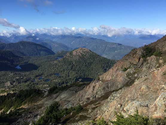
Sproat Lake from the notch on the south side of summit block
This is looking back down into the upper Nahmint River valley

Partial Summit Panorama from Klitsa Mountain. Click to view large size.
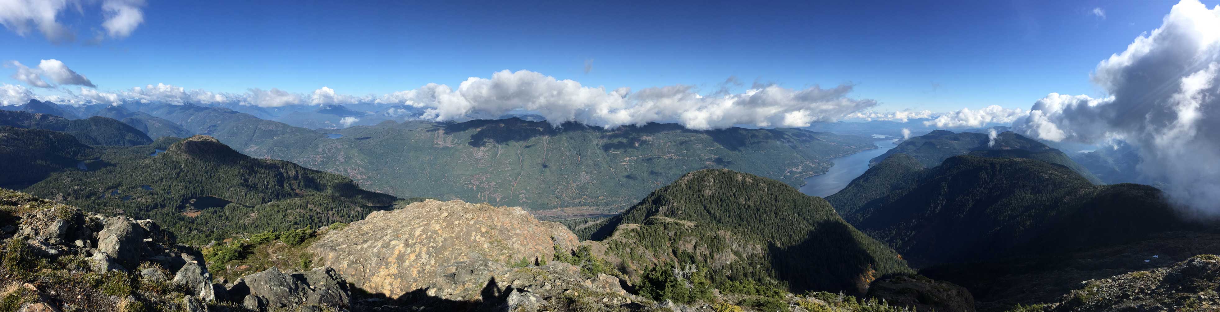
Partial Summit Panorama from Klitsa Mountain. Click to view large size.
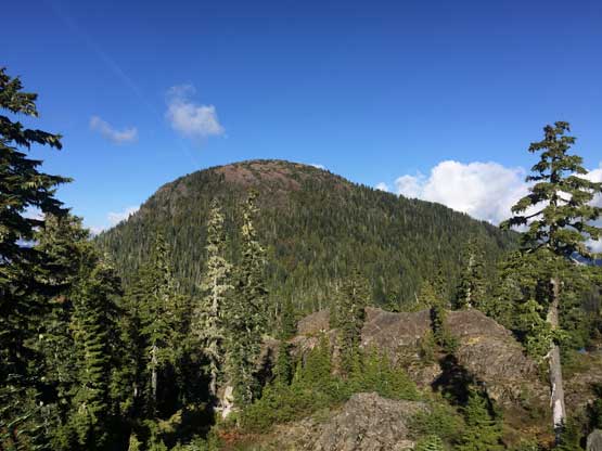
Pogo Mountain is an iconic one along Highway 4 corridor

Mt. Gibson

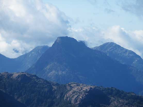
The Cat’s Ears blends with MacKenzie Range behind

This is zooming in towards Port Alberni on the east end of Sproat Lake
Mt. Porter is that wooded ridge looking north
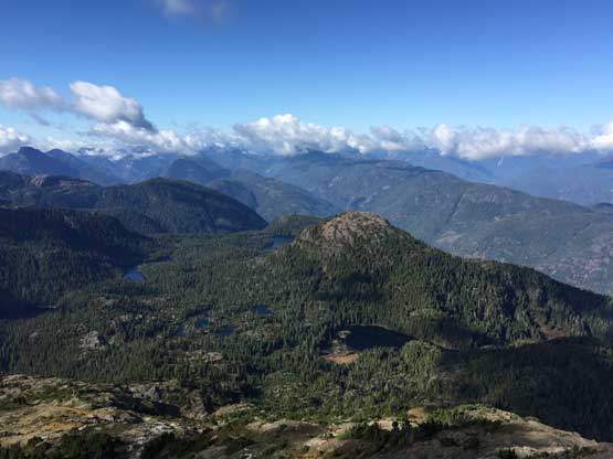
Another photo of Mt. Gibson and Gibson-Klitsa plateau

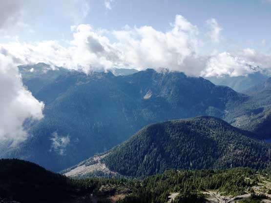
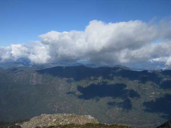
This is looking south from the summit. This side was engulfed in clouds
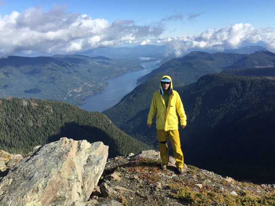
Me on the summit of Klitsa Mountain with Sproat Lake behind

Chris and I on the summit of Klitsa Mountain
On the descent we decided to walk down the north/west side of the summit block but Chris had to traverse back to the south side memorial cairn to retrieve his poles. I had dragged my poles up to the summit because I knew “the other side” would be much simpler and I wasn’t planning to down-scramble the south side anyway. Further down I decided to keep my Trango Ice Cube mountaineering boots instead of swapping for the trail-runners, because the trail was rough and muddy and I wanted some rigidity. In short time we were back to the lake and another half an hour or so later we were back to the old logging road. I did switch my footwear back to trail-runners at this stage.

Chris starting down the correct side of the summit block

A review shot of the summit block scramble. Route goes up the left side

Chris hiking down the typical terrain on the upper west ridge

Much lower down now. The ridge consists of a series of rises and plateaus

One last look at Mt. Gibson

Chris on Brooke George Trail

Traversing back across that small lake

Leaving the lake ready to drop into the dense woods
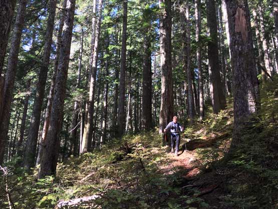
Chris hiking down the lower portion of Brooke George Trail

Back onto the logging road now.

North Face of Nahmint Mountain from the hike-out
Our round trip time was just under 5 hours and that was pretty much exactly as expected. The transition at trail-head was efficient but I had to take a nap along Nahmint Main FSR due to tiredness. I only needed about 10 minutes of napping to get back to “normal” and had no further problem driving all the way back to Nanaimo. In order to not miss the 8 pm ferry (long weekend Sunday) Chris decided to make a reservation. It turned out that the reservation was completely unnecessary so we donated another 15 dollars to BC Ferries. I asked the ticket person and she confirmed that the booking fee was indeed an extra charge. The rest of the way back home was uneventful but long and exhausting. I eventually got back to White Rock at past 11 pm and that concluded another awesome day.
