Mount Harvey (North Ramp)
February 1, 2017
1652m
Lions Bay / North Shore Mountains, BC
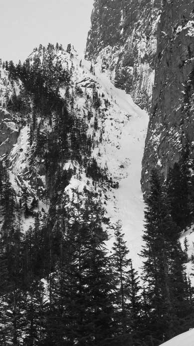
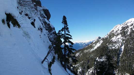
Among the vast majority of peaks in the North Shore Mountains not easily accessible from the ski resorts, Mt. Harvey is one of the most popular for this-or-that reasons. There’s a tourisy trail bringing hundreds, if not thousands of hikers up the mountain via SW Ridge and this same route is also regularly done in winter conditions. More adventurous folks might opt for a traverse from Magnesia Meadows via the E. Ridge which is steeper in nature. The south side Harvey Creek Spur Road has been recently cleared and offers a very reasonable ski tour in the right conditions, while the most aesthetic is by no doubt the N. Ramp which goes at sustained 45+ degree snow climbing for 500 vertical meters long. In stable conditions this makes one of the finest winter mountaineering classics in the North Shore.
An arctic high pressure system settled over the south coast bringing guaranteed sunshine and a freezing level dipped down to sea level. The accompanied NE outflow wind was tolerable, and the avalanche condition was L/L/L so technically there’s no reason to not push hard. I was feeling ill for a few days (couldn’t eat much at all) and didn’t make the final decision until the morning of Wednesday. I felt like maybe only 60%, but with that conditions mentioned above I still made a spontaneous decision to keep the plan. The morning rush-hour traffics through Metro Vancouver was brutal, and I didn’t manage to start the plod from Lions Bay until passing 10:30 am.
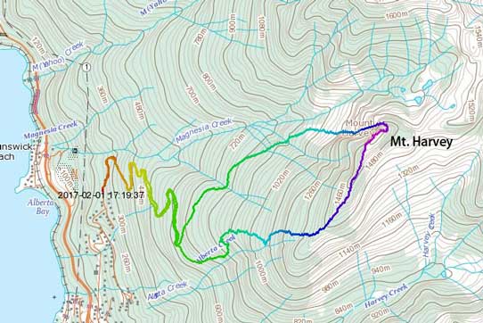
Mt. Harvey via N. Ramp and down SW Ridge. GPX DL
This was my third time plodding up the logging roads from Lions Bay with the first time for West & East Lions and the second time for the south couloir of Mt. Hanover. I was starting to get familiar with those individual zig-zags and turn-offs, but the conditions were very different for the three times I’ve been here. I didn’t encounter snow until passing elevation of 700 m and once hitting snow, the condition was extremely firm (almost too icy). I followed the previous parties’ boot tracks leftwards up the Magnesia Creek Spur. The snow became continuous in another half an hour and then the spur road crossed a major avalanche path. Onwards I soon arrived at the boulder fields at the base of Mt. Harvey’s North Ramp. Given how good the weather and conditions were on Tuesday I was really expecting to have a set of tracks to follow and it didn’t disappoint me. Multiple sets of boot tracks led me all the way up to the base of the actual Ramp where I took the first break of the day swapping some gears.
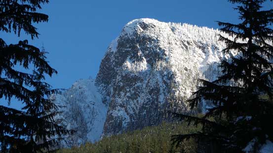
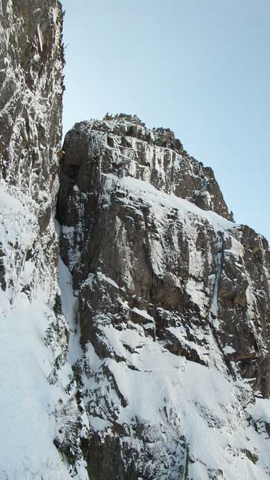
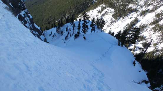
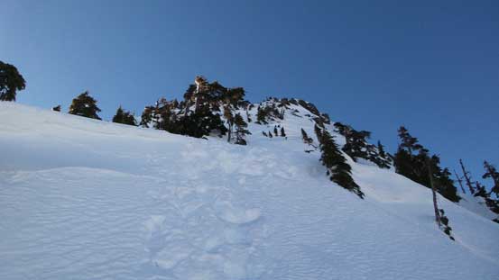
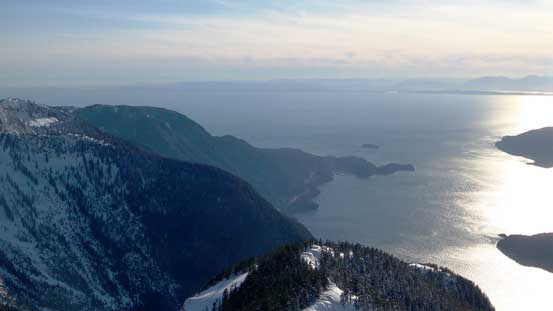
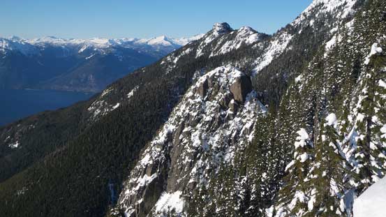
This picture shows the lower route – the ramp itself, and Mt. Harvey the bulk mass
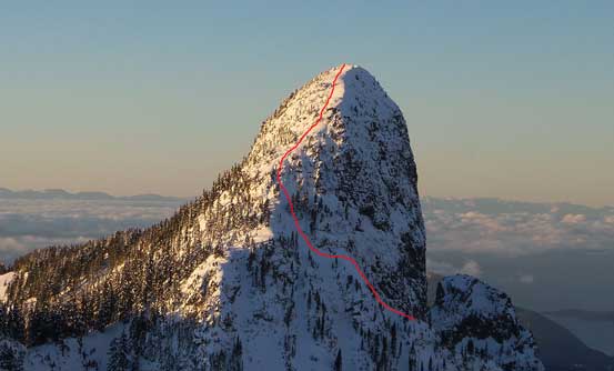
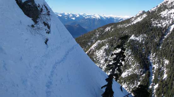
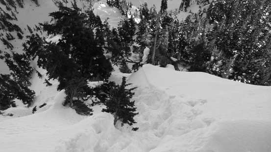
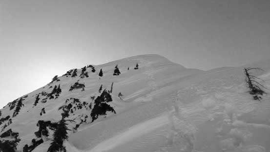
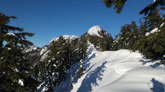
This picture shows the upper route
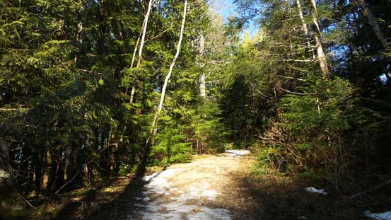
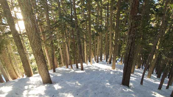
The trip began with slogging up this logging road

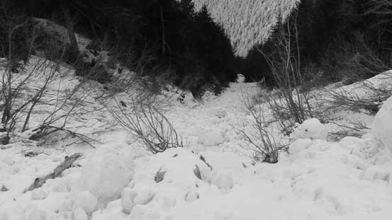
Hitting continuous snow, now up Magnesia Creek Spur

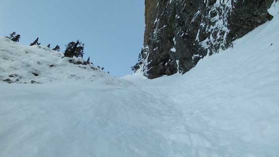
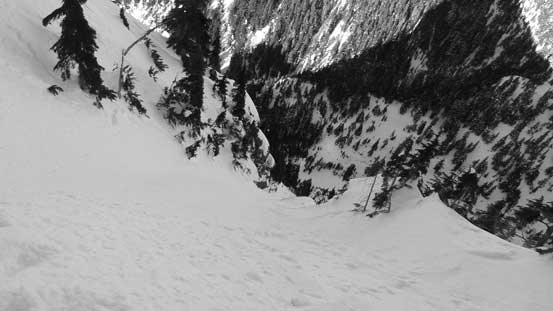
Crossing this big avalanche gully
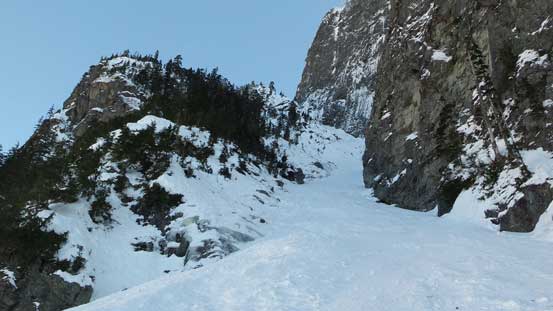
Not the greatest place to have lunch…
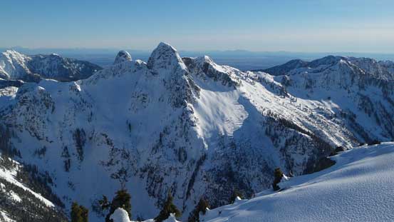
The N. Ramp displaced in front

Exciting time ahead.

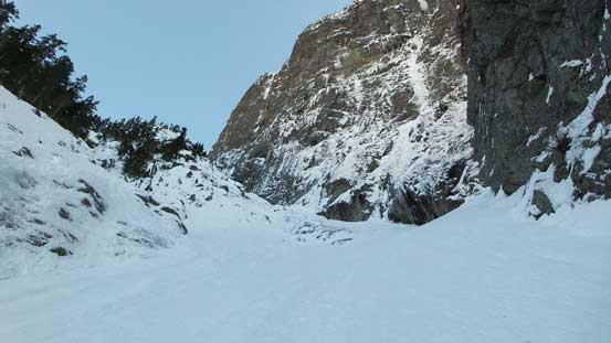
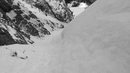
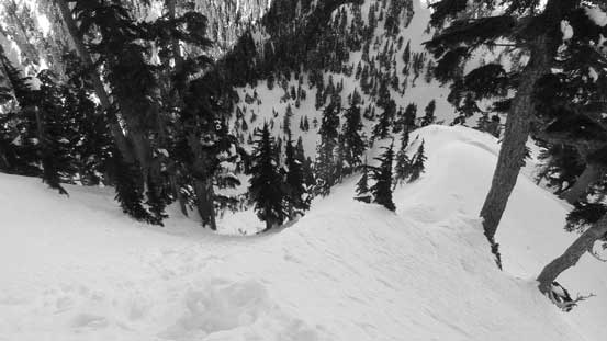
Looking down from the entrance of the ramp.
In terms of technical gears I had brought one mountaineering axe (CAMP Corsa), one ice tool (Petzl Quark), helmet and steel crampons and judging by how firm the route looked I decided to don all the gears. Both poles were stored and the snowshoes stayed in my pack. Despite the multiple sets of tracks below the entrance I couldn’t see a single set of track up the ramp and there’s gotta be a reason. After climbing 20 meters up I soon realized the reason, as it’s looking like I’d have to front-point at least a good portion of this route. It’s been a long while since I swung two axes and I have to say it’s feeling good. I almost forgot my illness and time flee by fast. About halfway up the lower ramp the route took a slight turn leftwards, and meanwhile I started to encounter a few thin and icy spots. The CAMP Corsa axe performed poorly at a couple places making me wish to have brought two ice tools up, but with a bit of patience on foot work I did fine. Higher up the snow condition became a mix of variable surfaces from icy firm to crust to loose snow on top of a firm base. The grade felt like some very sustained 45 degrees with a few steps steeper than that and I’d say even just this lower ramp is a harder route than Aussie Couloir by comparison.
Starting the climb up Mt. Harvey’s North Ramp
This is the typical view looking up.

Just about the ramp turning direction, looking down.
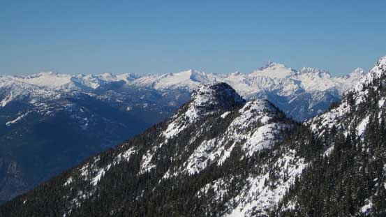
Good perspective of Harvey’s Pup
Grunting up the upper ramp. It’s very foreshortening.
Looking down from just above a thin and icy spot
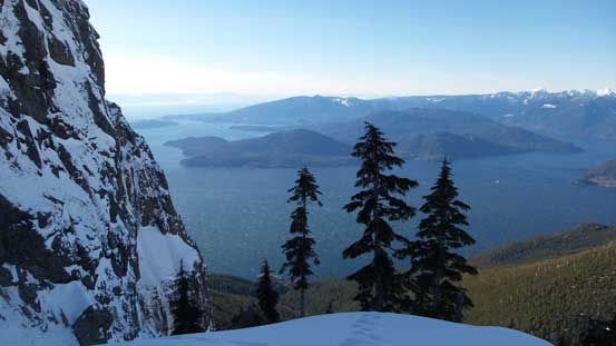
Topping above the ramp/couloir now, looking down at Howe Sound
Topping out above the couloir I was expecting a platform to take a break. It sure had a platform wide enough to drop the pack, but that cold NE wind picked up blowing ice crystals to my face. Instead of taking a break I had to don balaclava and keep moving. The section ahead looked ridiculously steep and it sure was, even with the previous party’s tracks. For the few steps just below the infamous traverse I had to actually stem up against their foot steps and that’s usually an indication the slope angle exceeding 50-55 degrees. The traverse wasn’t that steep, but awkward especially considering the suddenly-increased exposure. It didn’t look too terrifying from above, but a slip is fatal by no doubt as it’s dumping you over cliffs and into trees, so I had to be extra cautious. The tracks went back into “shooting straight up” mode after traversing across the first bowl, as opposed to what others have reported on ClubTread. The grade’s getting steeper again but what actually made it hard was the mixed snow surfaces. I could never get a good rhythm flowing as the conditions varied so much. For many times I had to dig down, swing a few times to get a good purchase on my ice tool and other times I had to wallow up some deep loose pockets of snow.

Ahead is the first very steep pitch leading towards the traverse
Looking down from partway up this pitch. It’s much steeper than looked in this picture.
This is that infamous traverse, which is actually less steep than the previous pitch.
Deadly exposure on this entire upper route.
The grade maxed out near a couple small trees and I felt really good to have reached those “bush holds”. Grabbing the bush and hooking my ice axes onto the trees felt pretty secure and soon enough I managed to stem up that step, then there’s another steep open slope followed by another bushy mini-couloir to shoot straight up before intersecting the upper E. Ridge. The E. Ridge wasn’t tame neither and involved quite a few climbing sections (and with again, some stemming and pulling against bush) before the slope finally tapered off near the summit. It was still windy on the summit so I couldn’t linger too long despite the awesome views.
Finally topping out on the upper E. Ridge, looking down
This picture captures the angle.
The E. Ridge wasn’t easy neither with lots of steep and bushy steps like this one.
Looking down at Magnesia Meadows
David Peak in foreground.
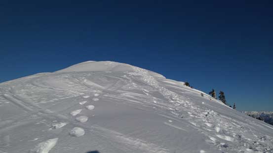
Still going up.
Almost there!
The north side of the Lions
Brunswick Mountain
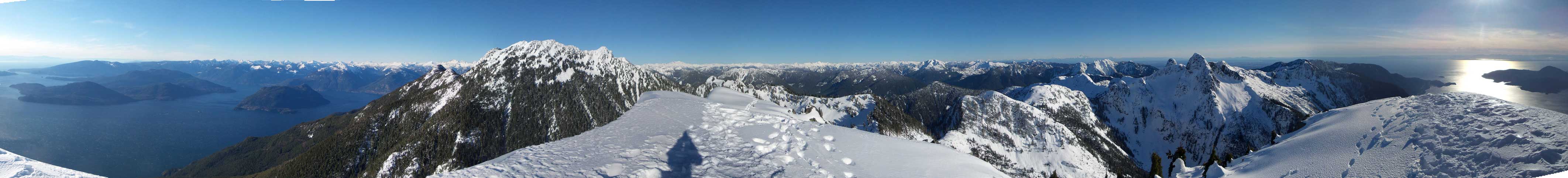
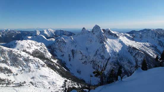
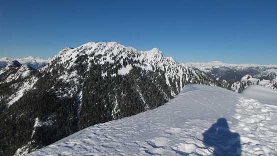
Summit Panorama from Mt. Harvey. Click to view large size.
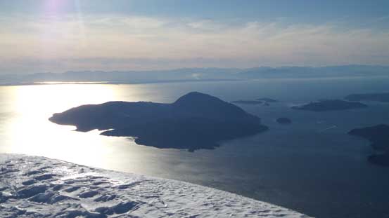
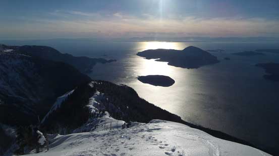
Bowen Island
Tantalus Range pokes behind Hat Mountain
The Lions
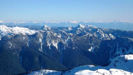
These are the group of peaks on the southern HSCT including the ski resort area

The very classic North Shore winter scenery.

A zoomed-in view of the Lions – East Lion on left and West Lion on right.

Behind Crown Mountain massif is Mt. Baker and the Twin Sisters
This is looking over the Mt. Seymour/Mt. Elsay group, towards distant North Cascades
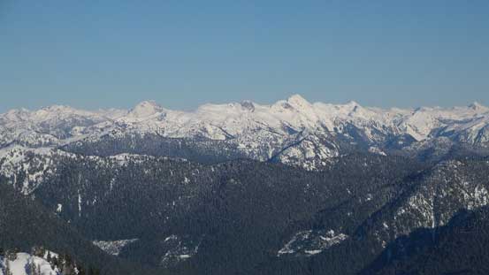
Meslilloet Mountain right of center, behind poking on left skyline is Old Pierre Mountain

Mamquam Mountain and its namesake Icefield

Me on the summit of Mt. Harvey
Nor did I have too much extra time to linger given the lateness. On the other hand considering the amount of traffics and the fact I was armed with someone else’s GPX file down the SW Ridge I shouldn’t worry too much of getting dark, but still, it’s better to be fast than slow. The initial alpine and treeline zones were nice and scenic but the goodness was very short-lived. Once down into the forest it had become a very boring slog. The snowshoes kept staying in my pack and the crampons were kept wearing under my boots. The trail was simply too icy to descend without traction devices. Microspikes might be more pleasant but I did not own them nor did I have any experience with the spikes. Wearing crampons for such a long descent surely made me tired, both physically and mentally. Eventually at elevation just under 700 m I removed them, and leisurely walked the rest of the way back to the parking lot.
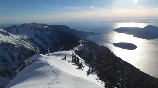
Time to head down the tourisy SW Ridge

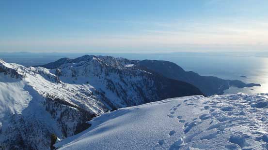
Unobstructed view of Howe Sound and the Sunshine Coast
A zoomed-in view of Horseshoe Bay area
Leaving the summit behind

Harvey’s Pup
Going down the SW Ridge
Cool position.
Hat Mountain behind Harvey’s Pup

Looking back towards the summit
One last review shot of Mt. Harvey’s SW Ridge

One last look at West Lion
Into the forest, this summarizes the descent…

Now onto dry ground. Crampons are off.
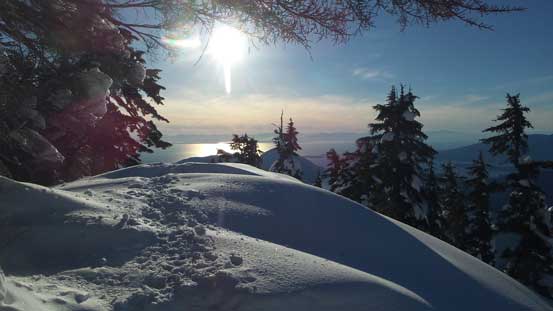
It’s almost looking like summer…
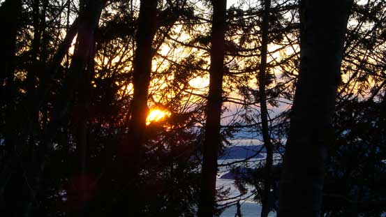
It’s sunset time.. Down to the logging road now.
My round trip time was just under 7 hours and it was a tiny bit slower than expected, partly due to the fact I wasn’t feeling 100% physically, nor mentally, and partly because of the variable snow conditions on the upper route (so I had to be extra cautious on each step). The firm snow conditions surely accelerated my approach and the previous parties’ tracks surely made my route-finding much easier, for both ascent and descent. Now with the N. Ramp of Mt. Harvey successfully down the list I have to say the position and climbing quality of this route surely deserve its classic rating. Apart from weather and stability, the minimal requirement is to be ultra confident and efficient on 45-55 degree snow or otherwise, consider doing it properly with protections and so on (but then be prepared for a 10+ hour day).
