Lady Peak
August 17, 2016
2178m
Chilliwack / Chilliwack Lake Road, BC
Lady Peak is the bigger neighbour of Fraser Valley’s icon – Cheam Peak. For those of you with high clearance 4×4 vehicles, these two peaks share the same approach and make a great combo as a moderately long day-trip. Getting up Cheam Peak is nothing more serious than a hike while ascending Lady Peak would require some class 2 scrambling with route-finding. Earlier in the day I’ve successfully ascended Cheam Peak with my parents and while they took a well deserved nap once back down to Cheam/Lady col, I decided to venture up Lady Peak on my own.
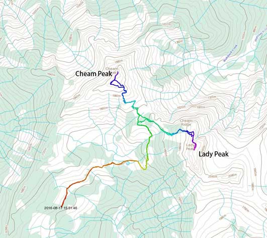
Cheam Peak and Lady Peak scramble route. GPX DL
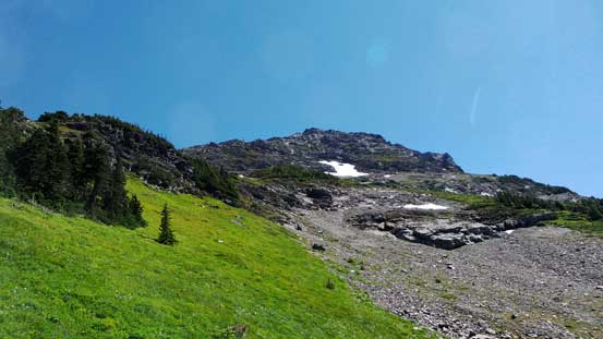
The section immediately above Cheam/Lady col appeared bushy. I briefly searched around but couldn’t find a climber’s path nor cairns so just bashed my way upwards. I took a rising traverse line towards climber’s right following some basic route-finding sense, and not to my surprise, I intersected the path in about 10 minutes. The path led me side-hillling on some steep grassy terrain before coming to the big open slope on Lady Peak’s south-west face. Once onto the talus I could finally see cairns here and there. The path led me upwards towards a cliff band. Upon arriving at the bad I noticed some bypasses on climber’s right side but attacking the band directly looked more fun, so up I went. The grade eased above the band and the next section was a tedious slog up talus and scree to hit the north ridge.
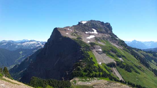
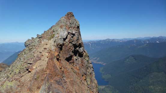
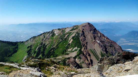
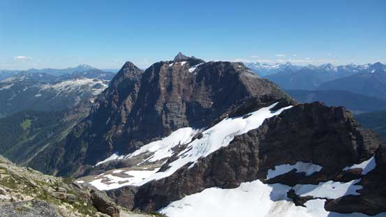
Lady Peak from the slopes on Cheam Peak
Traversing onto the talus. Going up…

Looking back towards Cheam Peak

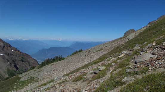
Looking down the valley I approached from. Mt. Archibald at center
Looking across the slope

The typical terrain on Lady Peak..

Looking back at Cheam Peak.
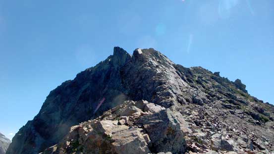
Hitting the N. Ridge now.
The drop-off down the north-east side was impressive as I slowly worked my way southwards along the north ridge. There were a few narrow spots had I stayed on the ridge crest but I chose to circumvent on the climber’s right (west) side. Near a notch there were a few unavoidable scrambling moves involved, although nothing worse than “class 2”. Above the notch there was a snow patch (which turned out more like a snow field upon getting close). The snow was soft enough to kick in and that provided some variety from the never-ending scree and talus.
From where I hit the N. Ridge, looking up
The NE Gully was impressive. Can’t believe Marc-Andre ski’d it in this past winter…
The N. Ridge continued.

Looking back along the ridge. The position was great with awesome views.

Here’s that notch. Jones Lake below
Another look at Cheam Peak
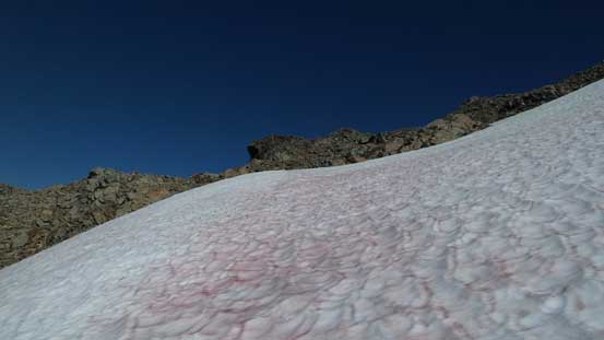
Ascending the snowfield
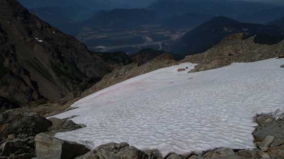
Above the snowfield, looking down.
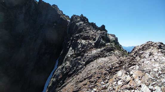
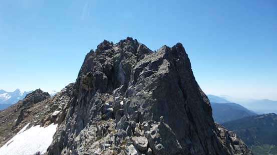
Once above the snowfield it was the final summit ridge. I kept following the ridge southwards, overcoming a few scrambling sections. The hardest part was near the end where I ascended on climber’s left to bypass a tower feature. And then the next thing, I was on the summit enjoying another fine 360-degree panorama.
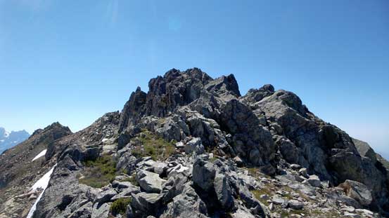
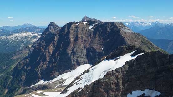
The final summit ridge
The rest of Cheam Range.
Here’s that final steep step to the summit.
Looking down at that crux step.
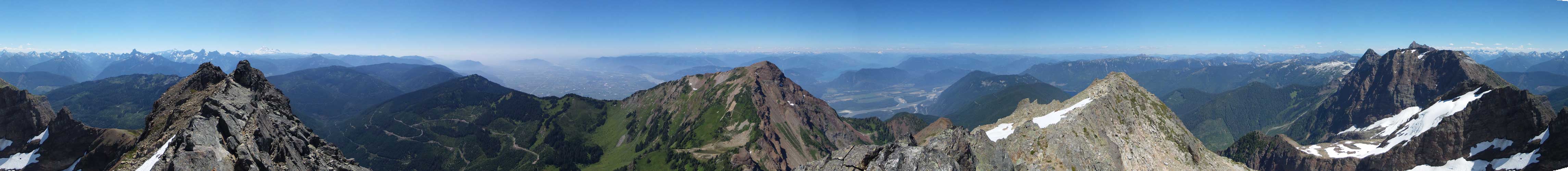
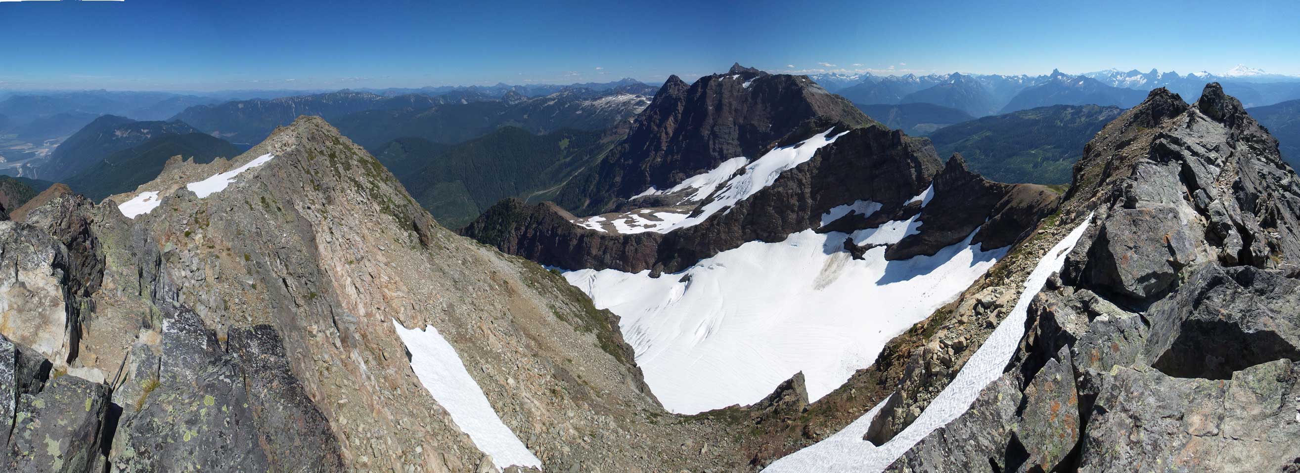
Summit Panorama from Lady Peak. Click to view large size.
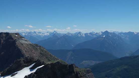
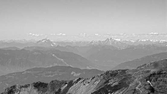
Looking south towards peaks in the North Cascades.
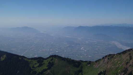
The Fraser Valley. It was hazy…

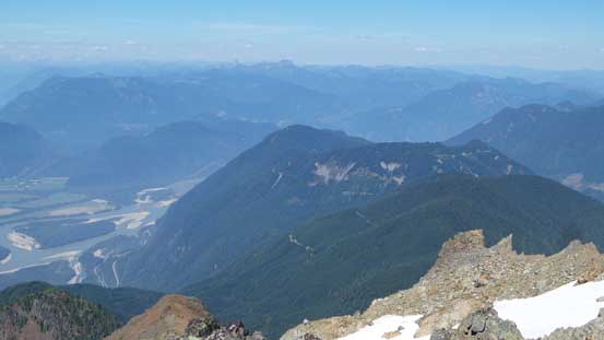
Harrison Lake to the north. Bear Mountain is that bump in front.
That forested bump in foreground is Mt. Ludwig

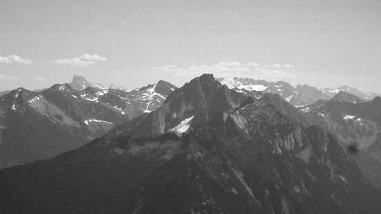
Silvertip Mountain with Mt. Northgraves in front
Mt. Redoubt and Mt. Spickard just south of the border
Mt. Rexford at center, with Luna Peak behind on the left skyline
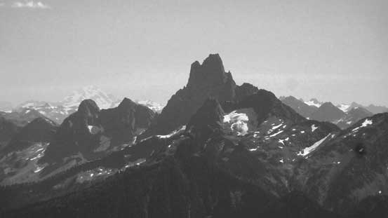
The very sexy Slesse Mountain…

Mt. Baker…
Mt. Robie Reid and Mt. Judge Howay on the skyline
The rest of Cheam Range with Welch Peak being the tallest
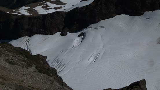
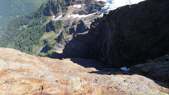
Looking down at a small glacier.
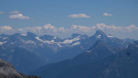
Another panorama from the summit. Click to view large size.
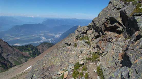
Not doing a ton of lingering I repacked and started the descent as my parents were still waiting for me from far below. For descending the crux I had to face-in and give a few down-climbing moves and then I got to enjoy some fast boot-skiing down the snowfield. The slope became a bit steep near the bottom and not wanting to risk a slip I bailed to skier’s left onto more scree, refilled my water bottle and then there came that notch. This time I correctly located the scramblers’ path traversing on a ledge below the ridge crest, and then continued down the north ridge for a while before bailing down the west slopes. The paths were more obvious from above and the next bit of challenge was that lower cliff band. I opted for more fun again as I carefully worked my way down a direct route. Below the band there’s some nice scree skiing and then I picked up the path, side-hilling back to Cheam/Lady col.
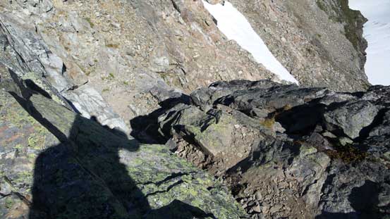
Traversing ledges beneath the ridge crest, to avoid some exposed stuffs

Back to Cheam/Lady col, looking back
I rejoined my parents near the col and it turned out my round trip to the summit and back was exactly 1 hours 40 minutes which was not bad. After another well-deserved rest break we leisurely walked back. The trail seemed much longer than what I remembered in the morning, as usual…
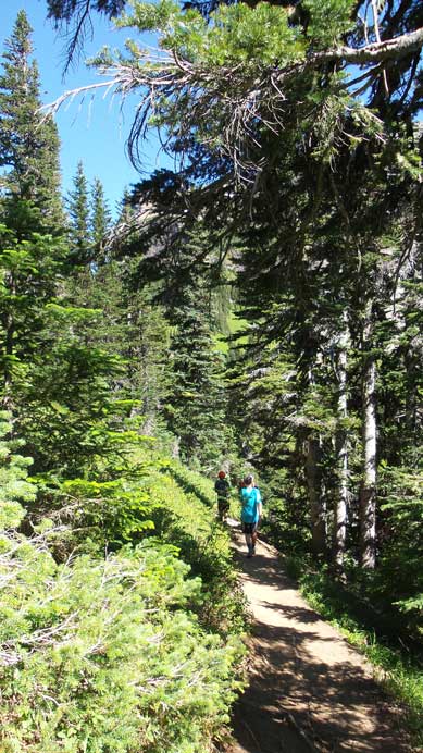
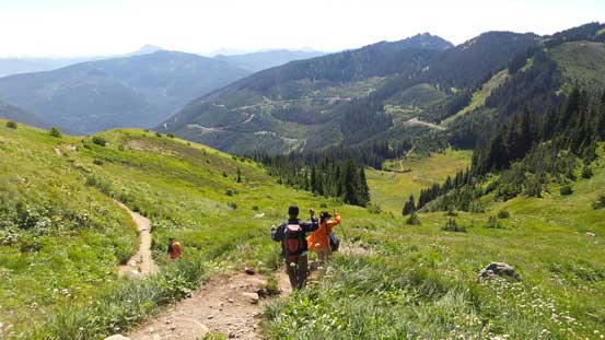
Hiking down the trail

The trail traverses on some neat meadows
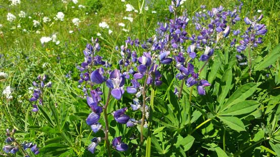
Flowers!
Going home..

It’s that tarn again.

The same tarn.
Back to the parking lot, looking back at Lady Peak
Back to the parking lot I certainly had enough time to knock off Mt. Archibald on this day, but decided against it. This afternoon was super hot and there appeared to have fair amount of bushwhacking involved which I wasn’t particularly keen on this day. Driving down Chipmunk FSR was bumpy but actually quite fun as the Jeep Grand Cherokee handled those waterbars very well. All in all it surely felt great to be back in the mountains again!
