Mount Ronayne
April 26, 2021
2290m
Pemberton, BC
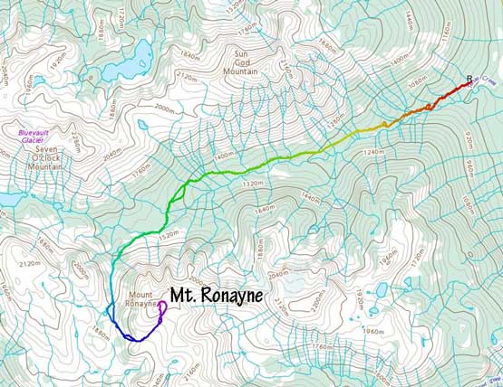
Mt. Ronayne boasts exactly 600 m of clean prominence and sits not far to the north of Pemberton. It has an impressive north face that drops 800 m down into the upper Tenas Creek drainage while a trail traverses reasonably close to its gentle south slopes from Fowl Lake and Owl Creek drainage. The “Y Couloir” on the north face is apparently a classic for the Pemberton-based skiers (especially with a sled-assisted approach) while I’m also sure the somewhat long and contrived trail system on the south side is often used by the local runners in summer. For peak-baggers seeking the most efficient way to tag this summit, the Tenas Creek approach to the west/south slopes had gained some attention in the recent years. The timing is a little tricky as there’s the balance between “having enough snow to cover the bush in the upper valley” vs. “having no snow on the forestry road to drive higher”.
Matt and I had some discussion about this Monday when a single-day weather window showed up in regions north of Whistler. There were a bunch of interesting “P600m” objectives out that way. Matt didn’t want to push another midnight start for an unusual change of pace while I insisted on tacking “easy terrain” thank to the forecasted 30+ cm of fresh snow on the avalanche.ca blog. Mt. Ronayne is the most obvious no-brainer option with these limitations. Matt had even attempted this objective back in last November on snowmobile and skis but turned around due to weather and conditions. Elise managed to jump into the team at the very last minute.
I drove out by myself the night before fearing the COVID road blocks set up by police in the Sea to Sky Corridor but such worrisome was proved unnecessary. None of us saw any police action other than a minor road construction near Furry Creek. The traffic at midnight was non-existing such that I had a cruise sail from White Rock all the way to Birkenhead River FSR. The going up the main FSR was as smooth as one could expect for SW BC standard. I was planning to sleep in my truck at the start of Tenas Creek FSR but the snowline was higher than I thought. I decided to drive up the spur road for as far as possible and it turned out that another 1.5 km was dispatched. I parked at 830 m elevation where I started to encounter large patches of snow. Speaking the timing we were here a little on the “early” side meaning that there’s definitely sufficient snow in the valley to cover the bushes but we had to deal with a longer walk.
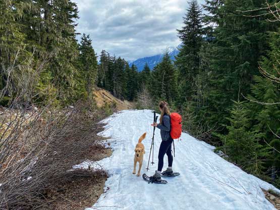
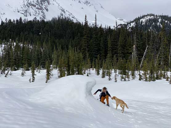
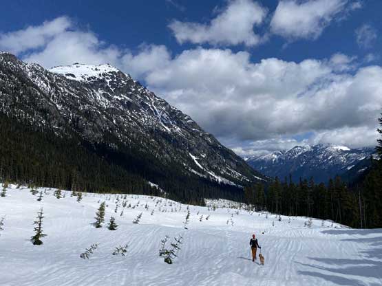
The weather had been cloudier than expected so I went for a leisure routine in the morning. Matt and Elise showed up earlier than I thought just as I finished cooking the Ramen breakfast. Thankfully Matt had some gear transition to do at the trail-head so I didn’t have to rush eating. We discussed pushing a little higher on the road in Matt’s truck but it’s clear that we wouldn’t be able to drive too much further. In fact, we could have saved 10 minutes of walking and that’s it. The snow on the road had undergone some decent overnight freeze and also packed hard by the snowmobiles. Matt opted to wear his ultra-light backpack that didn’t even have straps for his snowshoes, so he carried the snowshoes for a few kilometers up the road in his hand. Elise and I opted to strap the snowshoes on and sure enough, there’s one bare patch on the road on the first switchback. Feeling frustrated I just led us short-cutting this switchback through the bush. Matt somehow was waiting for us out of sight in the middle of that switchback bend but thankfully Twig found us. The elevation gain on this road was steady to around 1200 m where we were greeted by a kilometer of flat section, and after 7 km into the plod we reached the cut-block at the road’s end at 1400 m elevation. We had been plodding at a pace of 4.5 km/h and my legs were very tired.


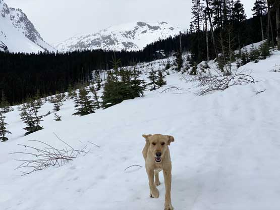
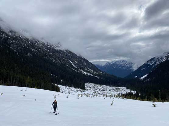

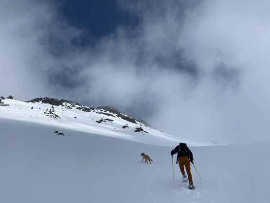
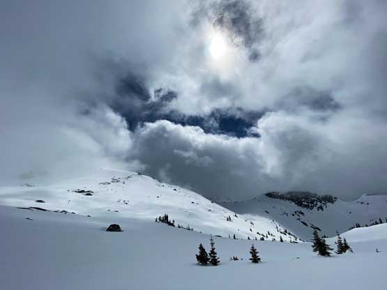
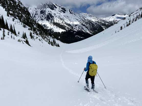
From the end of the road we found the snowmobile tracks continuing into the forest towards the base of Mt. Ronayne’s north face. We resisted the temptation to ascend higher and instead, traversed west into the obvious valley to the west of our objective. Ascending this valley was easier than I thought with mostly gentle terrain. The weather was unfortunately, much worse than forecasted that we even got hit by a couple snow squalls.


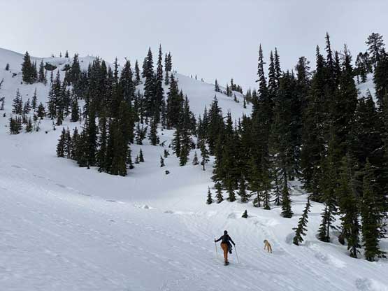
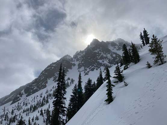


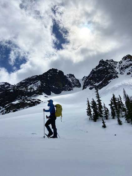
Higher up we veered left towards an obvious “col” on the SW Ridge of Mt. Ronayne. We thought about to ascend the steeper SW Ridge to the summit but the (faint) sled tracks continued wrapping around the peak to the gentle south slopes, so we just followed the tracks. Near the summit we entered a world of white-out and ascended a steeper route up the SE Face that involved some “technical snowshoeing” moves. The summit was cold so we couldn’t afford to linger too long. The weather did not show much of a sign of improving anyway.
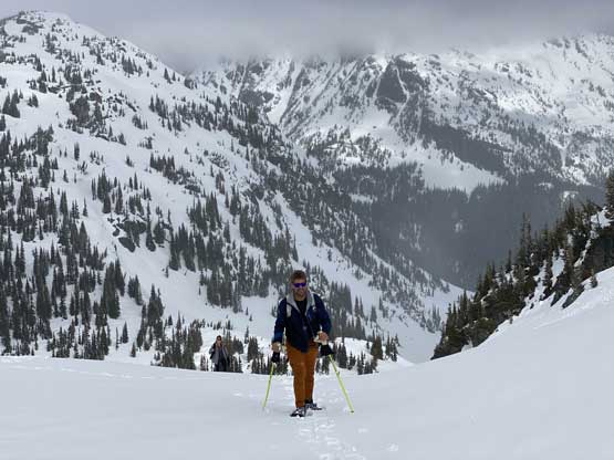


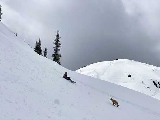
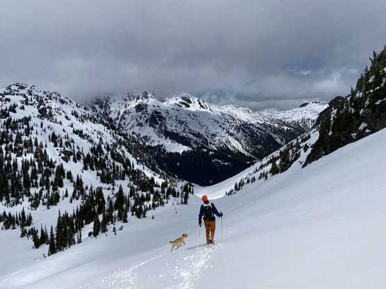
On the descent we went a short ways down the NE Ridge before dropping into the broad and gentle south slopes, much was done in the white-out. The clouds lifted as we wrapped around the SW Ridge to the west side of the peak with more and more blue skies showing up in the next couple hours. It seemed like we were about an hour too fast to reach the summit but oh well. On the descent we got some excellent views towards Sun God Mountain, another “P600m” objective in the immediate vicinity. The 7 km slog down Tenas Creek FSR was boring and tedious, but went by fast.


Our round trip time was exactly 6 hours covering over 20 km of elevation and 1400 m elevation gain. Mt. Ronayne via our route has the potential to become very popular as a spring hike on snowshoes as it’s easy and relatively free or risks. The access does require a decently long drive from Vancouver as well as some logging roads but this isn’t the Rockies so you do have to work for it somehow. On the way back home we stopped in Whistler for some burgers and that was an awesome way to conclude yet another successful prominence-bagging trip.
While driving back into the Lower Mainland I pulled a spontaneous trigger to redeem myself on Snake Rock as the weather was improving and I had a couple hours of daylight time to kill.
