Cascade Mountain
August 27, 2011
2998m
Banff, AB
Taking advantage of the last few days before university life, my parents and I decided to go to the mountains again. This time, we were planning on something bigger, namely Cascade Mountain and Mt. Rundle. Compared to what I had done before these are more technical. Cascade Mountain is my first ever scramble that’s rated as “moderate”.

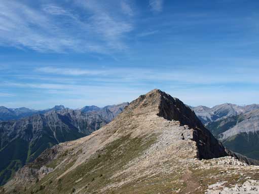
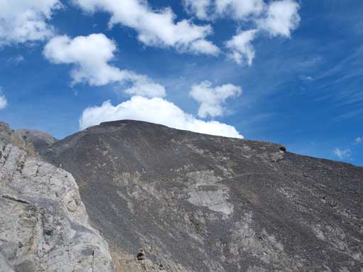
Cascade Mountain standard scramble route
We woke up at 2:30AM and started the lengthy drive towards Banff. Dad and I took turns driving so it wasn’t too bad. We made to trailhead just after 7AM, where we met another scrambler, Judy. Because this was my first moderate scramble, I wasn’t confident on it at all so we grouped together. Judy had done Cascade Mountain 4 times so she knew exactly what we were doing. Plus, being in a group of 4 is much safer in terms of bear issue.
From the parking lot, we had to walk down the Mount Norquay ski resort to its end, Mystery Chair. The trail starts at the back. Initially, we had to lose 100m elevation to Forty Mile Creek. This gave us a quick and easy start, but on the other hand, we had to gain them back at the end of the day… Oh well… What I can remember now is, the trail goes on forever to reach Cascade Amphitheater. It has endless unnecessary switchbacks. I think people who use this trail are all going to scramble Cascade Mountain, so what’s the point of making such a flat trail…
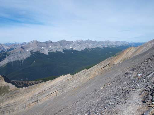
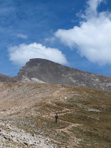
Eventually we made to Cascade Amphitheater. Looking around, there was no bear. Good. We picked up a side trail that looks like the one going up the shoulder. There’re several of them and they all lead up the shoulder. Be sure don’t venture further back into the cirque or you’ll be cliffed out. We followed the shoulder up for quite a while before breaking the treeline. Now we were treated with the view of Sawback Range, Bow Valley, and Mt. Rundle. Louis looks impressive. We took an energy break at treeline.
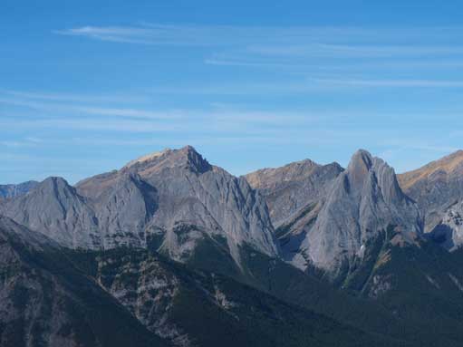
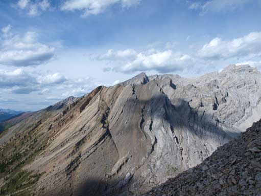
Cory is the tall peak behind. Edith has three summits in front of Cory. Louis is the pointy peak on right.

Another look at these three peaks, and Sawback Range

Mount Brewster on left. These peaks are part of Vermilion Range
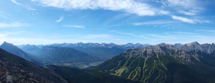
Panorama view towards Bow Valley and Norquay ski area.
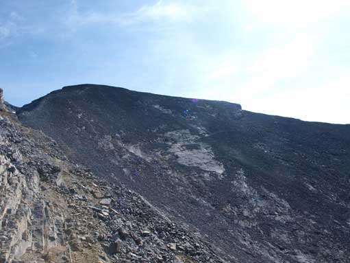
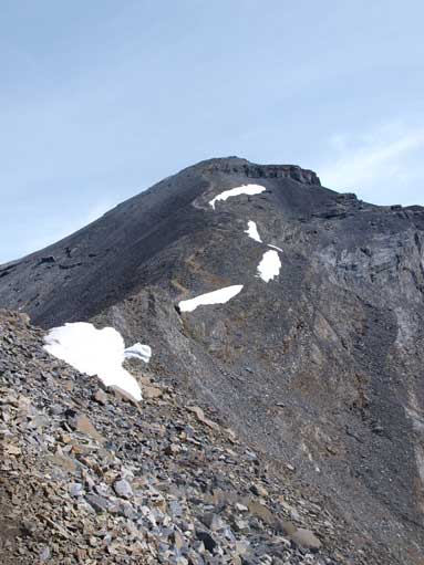
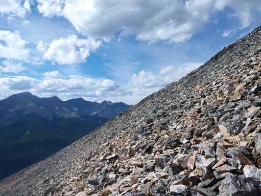
The trail quickly gets faint and eventually disappears into a giant boulder field. The correct route is to ascend the boulder field straight up towards the 1st peak. For us, we followed cairns side-sloping around the peak, over endless boulders. Some of them are very unstable so we had to use extreme caution. This was my first time negotiating boulder field and I wasn’t very comfortable at all. But since I was leading I couldn’t show any fear 🙂 We managed to pick up paths and followed it around the first peak to its back side. Now we were looking towards the false summit. I waited for the rest of the group for about 20min (can’t remember exactly) before re-grouping towards the false summit. We soon separated again as they were getting slower. I was getting more and more comfortable so I did the rest of the ascent by myself. Judy knew the route so she could guide my parents up anyway.. Okay, as a member of a team, you should not leave your companies behind. I did the same thing again on Mount Temple one month later and almost resulted in serious consequence… Okay, back to the trip. I followed paths up the grassy slope towards the false summit. This section is a bit foreshortened, and it took me a good amount of time to get to hidden notch. According to the route description, there’re several short down-climbs involved. Once around a corner, the entire route behind is hidden, and that’s why it’s called “hidden notch”. There’re multiple paths and they all work. Soon I made to the base of false summit, and I could easily spot the horizontal path that I had to aim for. However, to get there, I had to cross a very polished slab section. The path goes right onto the slab and obviously I couldn’t. I wasn’t comfortable at all on terrain without paths. I awkwardly moved up talus slope on climber’s left to avoid the polished part and got back on track. There’re several slabby sections involved after this part.
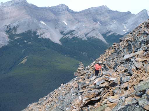
Mom traversing loose terrain around 1st peak
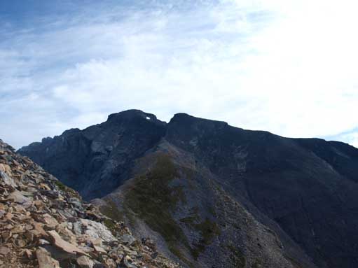
True and false summits from first peak

If you go up and over first peak, you will need to down-climb this. Moderate scramble though
Looking back towards first peak

Once around this corner, the route behind is “hidden”
Looking towards the first part of false summit traverse.
On the first part of traverse. As you can see, there is a trail/path all the way.
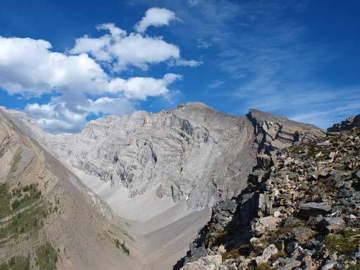
Once around the corner, I could see the normal crux of the route, the second part of false summit traverse. There’s a dirt path goes below the cliff, with steep terrain on the right side. It wasn’t that bad once you get closer though. The dirt ground is a bit slippery and I proceeded with caution. And soon I made through the crux traverse and I could focus on the final summit ridge push now. I climbed up a rock outcrop but had to down-climbed the other side. The path goes on climber’s left of it. The rest of the way is mostly scree slog. Near the summit, the terrain gets steeper and I had to hands-down for balance and crawling. (It’s funny to write trip report for your early age scramble trips, as you have a whole different perspective now but you still have to write based on your experience level at that time)…

Around the corner now, looking at the 2nd part of false summit traverse
Somehow exposed terrain

This is the so called crux. If dry it’s a walk across.

Looking down from the crux.
The summit ridge comes into view

Looking back at the crux traverse

Looking back at false summit
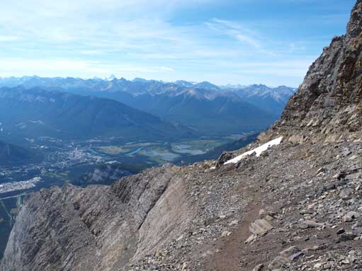
Looking down from summit ridge. You need to be very careful if snowy.
Once at the summit, I could see Lake Minnewanka on the other side. Rundle looks not that big anymore. In the far distance, I could see Mount Assiniboine, Ball, and Temple. I found a warm spot on the east side, and had a summit nap while waiting for my party members. I don’t know how long I waited. There were several groups showed up but eventually my dad and Judy showed up. Mom stopped at false summit traverse as she wasn’t comfortable on exposure.
Mount Aylmer is the tall mountain on right skyline. The pointy peak in foreground is another peak of Cascade Mountain

There was still snow on the top.
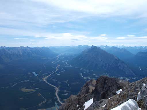
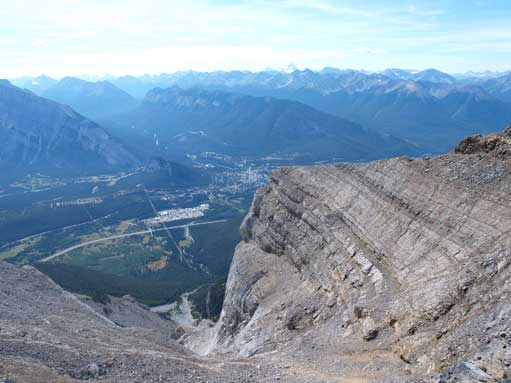
Bow Valley and Highway 1 below

Lake Minnewanka
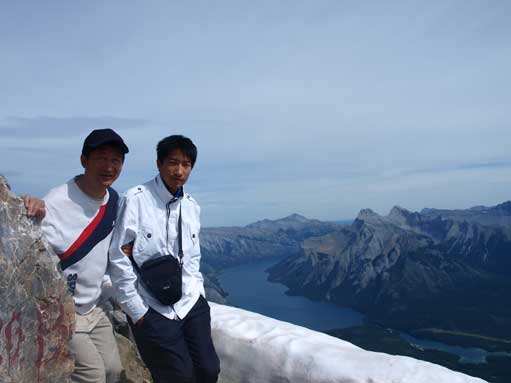
Dad and I on the summit

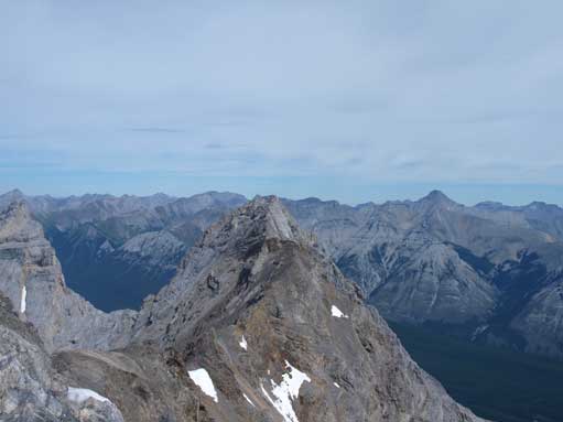
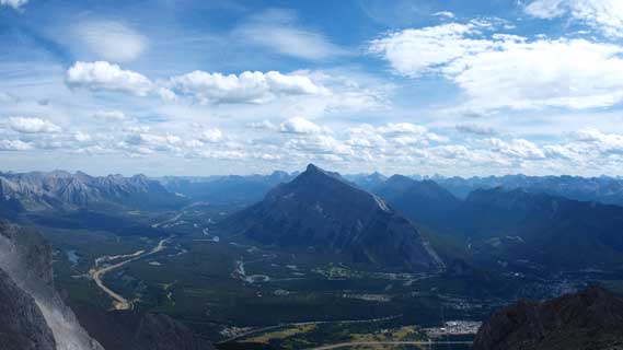
Mount Rundle, which I’ll do the day after.
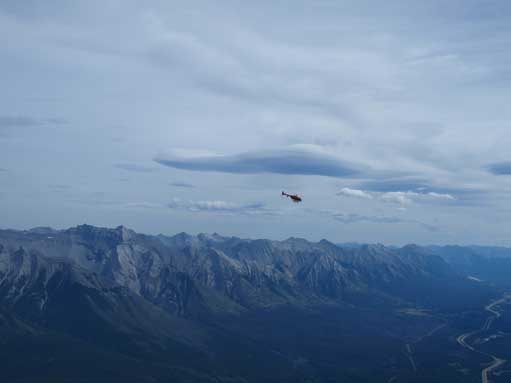
A helicopter hovering around. Fairholme Range behind
On the way down, I tried to scree run the loose summit ridge and it worked really well. Judy wasn’t comfortable doing scree run and it took them forever to get down the summit ridge. We all re-joined together at the false summit corner. Further down, we got off-trail and had to cross some talus slope to re-join the path. The rest of the way down was very slow going as we got pretty beat. Eventually we managed to make to the Amphitheater. We were the first group starting in the morning, and now, almost all other scramblers had passed us on the way down, and we were the last group got down…

Group shot near the crux. Rundle behind

Descending the 2nd part of false summit traverse
Mount Rundle and Bow Valley
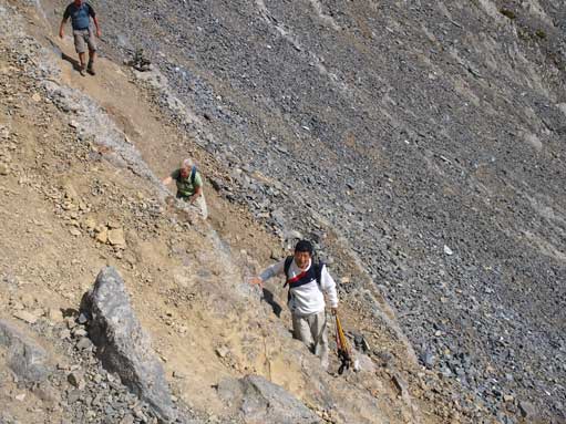
Coming up one of the several hands-on sections
Looking back at the false summit
Following trails down towards 1st peak. Looking back towards false summit
Interesting rock formation. I like the shadow of that cloud

Another view, looking up Forty Mile Creek
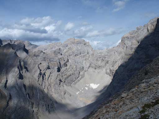
This should be called “Cascade Amphitheatre”
Traversing around 1st peak
Looking back towards our objective.
And the suffering wasn’t over yet, Mount Rundle the next day. We gotta push things on a bit.
