Miette Pass Peaks
February 15-17, 2015
2362m
Jasper, AB/BC
Over the past year or two Ben has been trying to convince me to join him on an exploratory trip to Miette Pass, a remote and seldom-visited, but truly beautiful area on the Continental Divide between Jasper and Robson Parks. I wasn’t fully convinced until this past Family Day long weekend. The weather was good but a special avalanche warning was issued making tricky trip planning. There weren’t many multi-day options but the peaks immediately to the south and north of Miette Pass should be gentle enough to ascend, so I eventually got convinced.
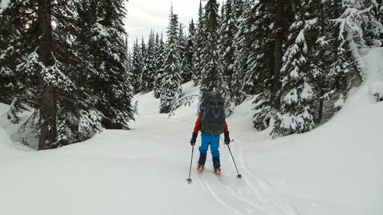
The most logistic way to access this area is by the decommissioned Miette Pass Trail which follows Miette River for more than 20 km. However, this would be too much of a gamble as it’s very likely the trail being very overgrown and hard to distinguish already, making tedious bushwhacking for days. We had to thank the local ski legends (Reiner Thoni, Dana Ruddy and Sean Elliot) for discovering a new route into this area by a highline traverse starting from Yellowhead Mountain Trail. They did it as the start of a 5-day traverse from Yellowhead to Robson. We both agreed to follow their footsteps, avoiding “unknowns” for as much as possible. This route is by no mean easy though. Getting to the planned bivy by South Miette Pass we had to cover more than 20 km distance while overcoming more than 1800 m cumulative elevation gain on “semi-exploratory” terrain. I felt it’s too much of a commitment on skis so decided to stick with snowshoes – something I felt much more comfortable with. Ben, on the other hand, was determined to ski, so that’s it – another trip mixing skiing with snowshoeing. We’d see how well our paces gonna match.
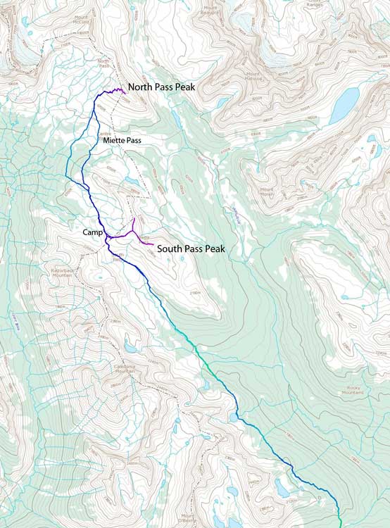
Miette Pass Peaks ski ascent route. GPX DL
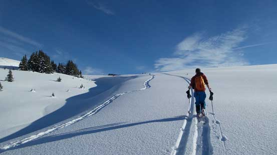
The huge bulk of elevation gain (900 m) would be knocked off right at the first 7 km up the Yellowhead Mountain Trail. The first 1.5 km or so was very rough as there wasn’t enough snow to cover the ground making some interesting grass skiing/snowshoeing… Things improved dramatically once hitting continuous snow and we soon picked up a set of ski tracks! This trail eventually dumped us right at the shoulder of Tete Roche (a sub-peak of Yellowhead Mountain) and it was here that we got caught by a group of skiers from behind. Apparently they were moving very fast and after some quick chatting we realized they were Sean Elliot and Dana Ruddy! It was very nice to meet these guys and I have to make some advertisement here for their project. They are considering building a non-profitable ski cabin by Rink Lake just behind Yellowhead Mountain and I think it’s a great idea. It’s outside the “cariboo closure zone” and this area gets a lot of snow granting some really nice skiing opportunity.
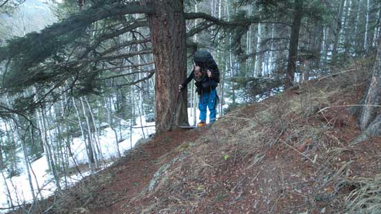
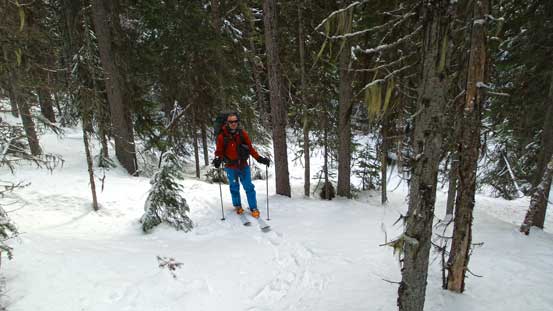
Ben “enjoying” the grass skiing…

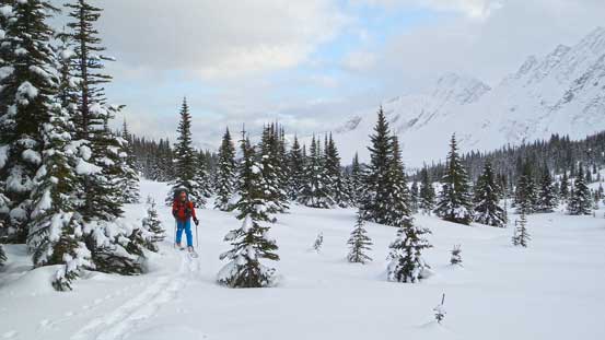
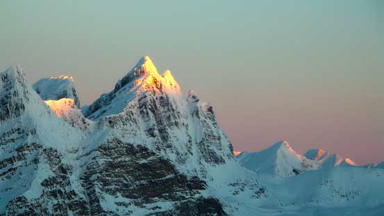
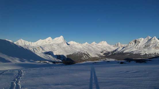
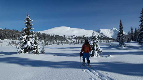
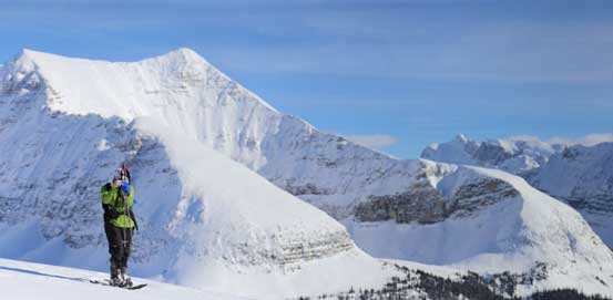
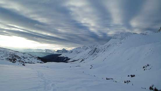
Mt. Fitzwilliam from the lookout at just 1.5 km into the trip

Not the greatest condition at the lower elevation…

From an opening area we got a nice view of the Yellowhead Mountain
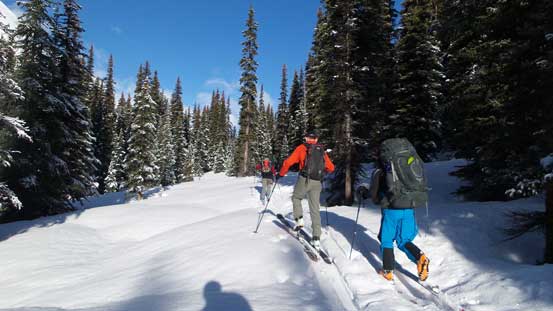
Dana and Sean’s group caught us up from behind
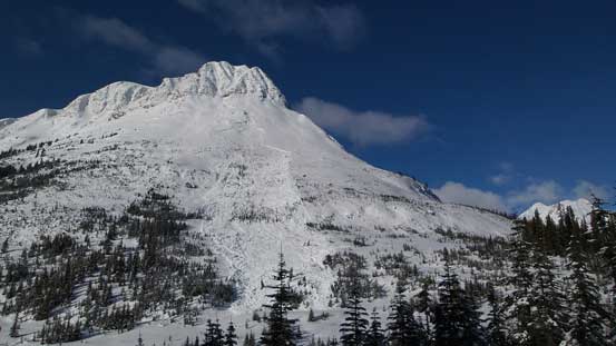
A massive slide on Tete Roche
Up and over the shoulder of Tete Roche we dropped about 130 m height to Rink Creek. Form here on the route basically contours around treeline, up and over 3 to 4 different treed ribs with some huge elevation losses in between. This treeline traverse would eventually dump us at a tributary of Miette River and following this river up we’d eventually hit South Miette Pass which was our final destination of the first day. Overall it was a very tedious process. The unstable weather didn’t help neither as we got flurried pretty much the entire day from here on. At sections we had to deal with steep treed terrain and other parts required some careful GPS navigation. Even that we still had to cross an avalanche slope but it could have been avoided by staying lower. I was just glad the trail-breaking wasn’t that terrible and we were able to maintain a steady pace. Towards the end of this highline traverse we lost about 250 m elevation to the tributary of Miette River and that was quite frustrating considering we’d gain all of them back.

Down to Rink Creek now, looking back towards Tete Roche
Open trees skiing into the “unknown”. Up and over the next rib we’d traverse along a long flat bench.
Here’s the second section of massive elevation loss…
At least the snow condition was quite good.
Around the last rib we’d soon drop another 250 m height…
The tributary of Miette River was pretty much all frozen over so the travelling was easy, but oh man there was still a long ways to go… At this point we were both very tired but we managed to keep marching up. There’s little to describe about this section of the slog other than knowing the return would be super fast for Ben on skis.. Near the pass we ascended a bit more towards climber’s right to avoid a massive hanging cornice on the left side. Up and over the Divide we dropped to the BC side and found a nice little camp spot at treeline. Setting up camp and melting snow also took forever. Ben still had some energy to kill so he did most of the work. I was basically exhausted but on the upside the weather did improve overnight and we could see millions of stars in the sky.
Skiing upwards along the tributary of Miette River. Terrain starts to open up again.

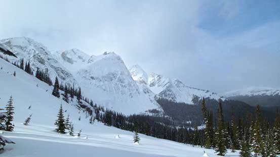
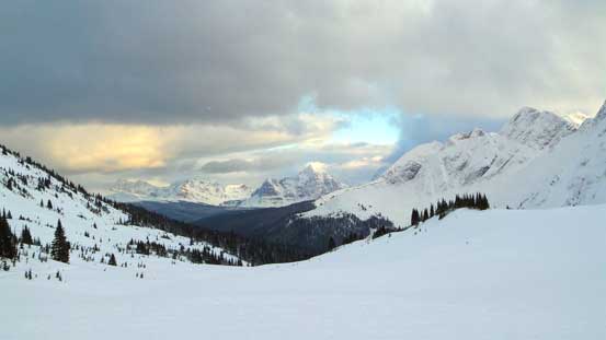
A brief weather window allowed us to catch a view of Caledonia Mountain

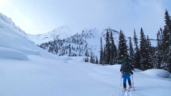
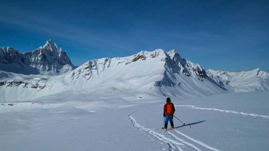
Ben leading towards the distant South Miette Pass
Getting closer to the pass, looking back.
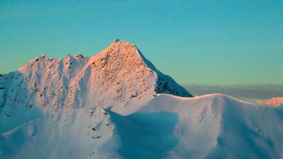
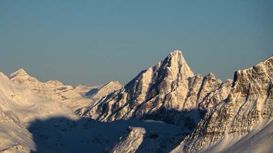
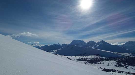
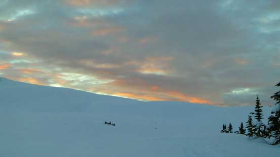
The next morning we woke up early to ascend the nearby “south pass peak”, hoping for a super alpenglow. And we were right, the views were simply amazing. We also did an amazing job predicting the better view from a lower sub-summit rather than the true one. If we went directly to the true summit we’d lose the alpenglow on Mt. Robson.. The ascent of the true summit was as easy as one could expect.

Morning colours on the horizon. Ahead is the summit of the “south pass peak”.

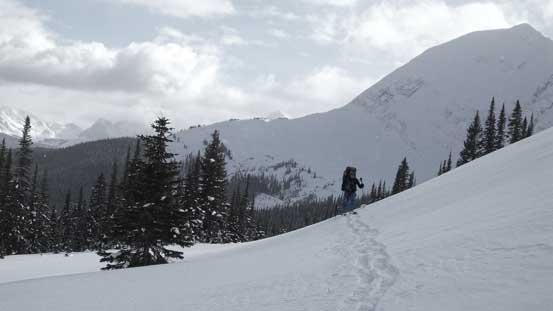
Ben slogging up the typical slopes

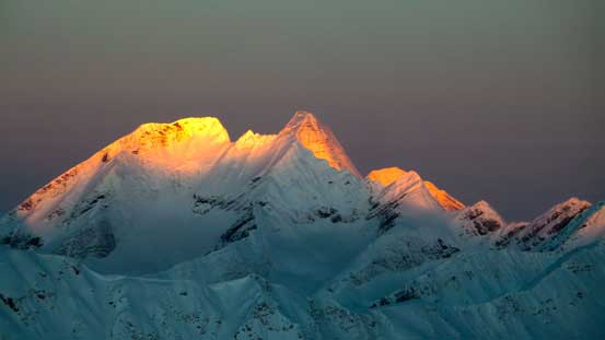
Mt. McNaughton and Mt. Machray at just before alpenglow

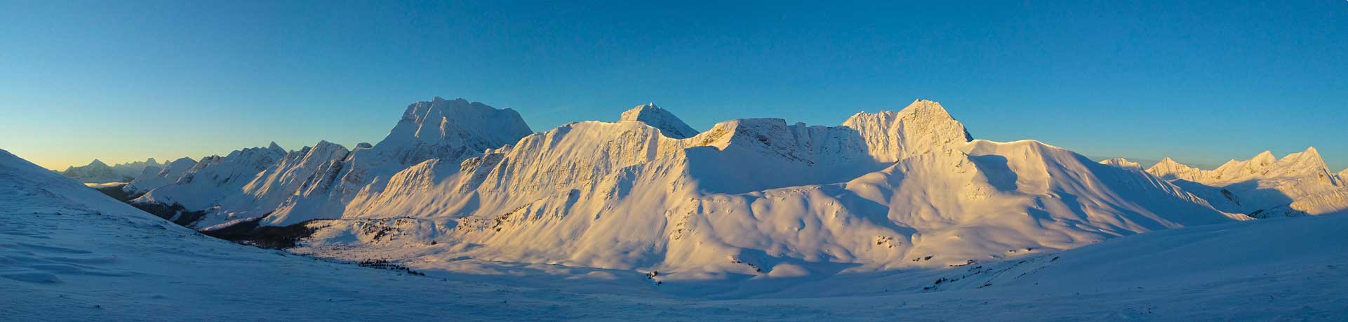
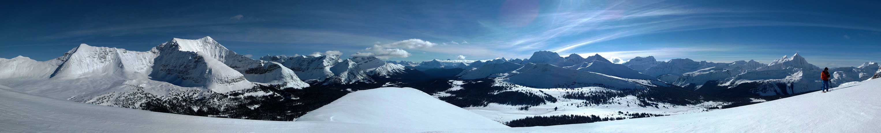
Panorama at just before alpenglow. Click to view large size.
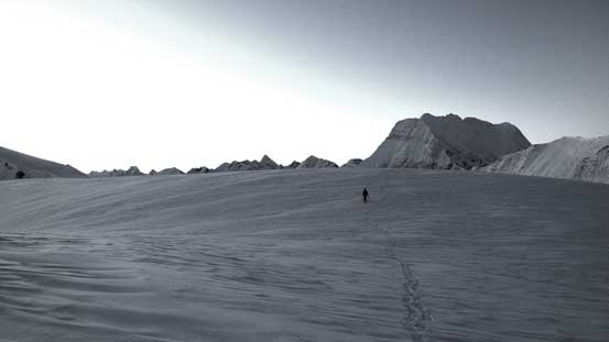
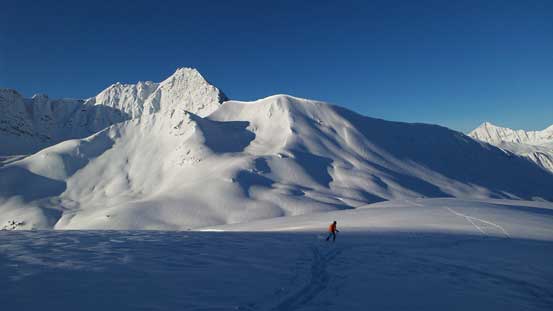
Ben skiing towards a sub-summit

Panorama of alpenglow. Click to view large size.
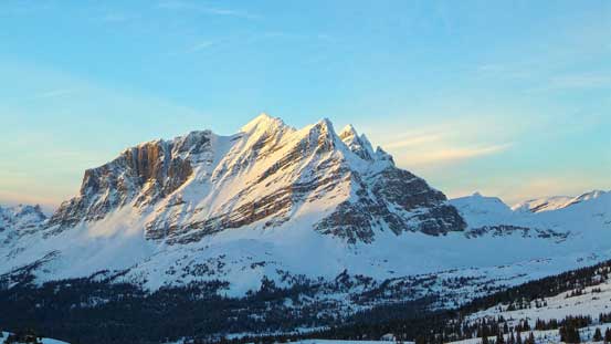
Glow on the distant giant – Mt. Robson.
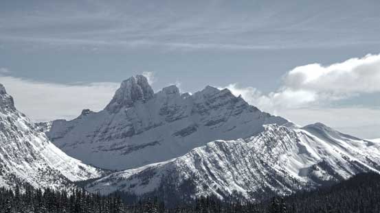
Salient Mountain
Razorback Mountain

Mt. McNaughton on alpenglow

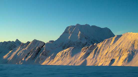
The huge bulk of Salient Mountain

Caledonia Mountain on alpenglow
Caledonia Mountain again, with slightly more lighting
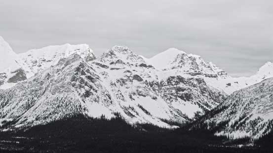
A panorama of Caledonia Mountain, Razorback Mountain and the unnamed peaks along the Divide. Click to view large size.

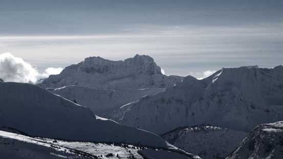
Zooming-in towards Mt. Fitzwilliam and Mt. Geikie
The Colonel is in the middle of nowhere
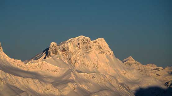
Mt. Machray
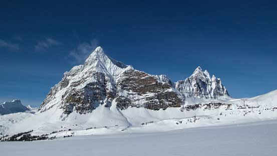
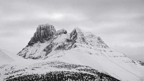
The unofficially named “Derr Peak” or “Mt. Overlord”…

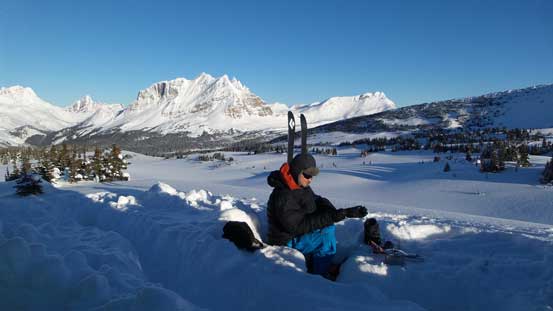
Another picture from the summit of south peak
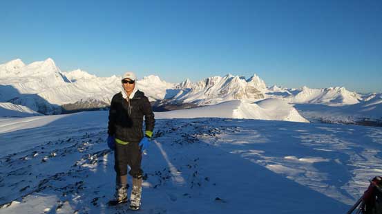
Me on the summit of the south peak.
After taking hundreds of pictures we leisurely went back to camp. We spent the next 2 hours or so melting snow and cooking breakfast. It was surprisingly very time consuming but knowing this day wouldn’t be nearly as long as the previous day it was still okay. Our next destination would be the “north pass peak”. Getting there would require losing about 250 m height to traverse to the central Miette Pass. We didn’t picked the best line on the way there so lost some extra elevation but managed to pick a better line on the way back. The views from the central Miette Pass was also mind-blowing with Mt. McNaughton and Salient Mountain stealing the show.
Another view of Mt. McNaughton
Ben enjoying the fast return. Awesome terrain around!
Back to camp, time to cook for breakfast!

Nice and open terrain
We had to drop another 250 m or so to get around to central Miette Pass
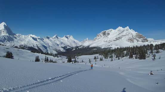
Almost at the central Miette Pass. The “north peak” in front

Ben on Miette Pass
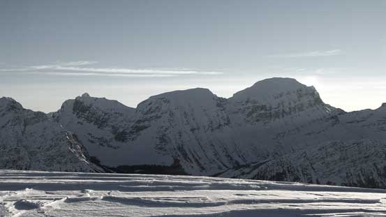
Looking over the pass we could see Mt. Moren, Derr Peak and Mt. Bridgeland
Mt. Bridgeland looks awfully like Mt. Bryce from this angle..

Ben slogging into the alpine. Mt. McCord in front
The super-sexy Salient Mountain
The west slopes of the “north pass peak” appeared to be loaded, but since we were there already we had to give it a try. It definitely felt steeper and “bigger terrain” than we expected and certainly pushed the limit of what we would do given the “considerable” avalanche condition. But nonetheless we made to the summit with no incidence and got some superb views again. Looking north some really remote peaks showed up and I bet not many people have seen those mountains.
A view from the foreshortened slope on the north peak
Panorama from the summit of the “north peak”. Click to view large size.

Mt. Mahood
Mt. Mowat
These peaks further north are probably rarely seen..

The summit of Salient Mountain

Mt. Beaupre looks fairly easy
Me on the summit taking in the views. Photo by Ben
The ski down from the “north pass peak” back to Miette Pass was fast and fun. I was very jealous but at least snowshoeing downhill on nice and soft power was effortless so I wouldn’t complain much. On the way back to camp we decided to use a different line that we spotted earlier to shave off some unnecessary elevation loss and regain as well as bushwhacking. The new line worked perfectly as we managed to traverse around the corner of the long ridge extending down from the “south pass peak” at just below its big slopes and managed to stay high. The rest of the ski/snowshoe back to our camp was relaxing with some million-dollar views all around the place.
Ben skiing down from the summit of the north peak
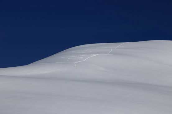
Can you spot me snowshoeing down the slope? Photo by Ben
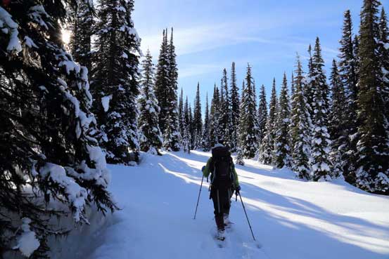
Nice and open forest

Around the corner, more neat terrain ahead
Heaven!
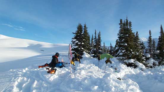
Excellent camping spot to stay two nights!
A bit of evening colours on Salient Mountain
We still had about 1 hour of sunshine but apparently that wasn’t enough to completely dry off our boots, but that’s okay. The night was again, peaceful but a bit cold. The task for the 3rd day was simply returning to the parking lot. We knew it’s going to be another long day but it turned out faster than expected. Without trail-breaking and route-finding we managed to maintain a fast and yet steady pace throughout the depproach. The long section of down-hill from South Miette Pass downwards along Miette River was obviously in favour of skis. The middle section along the highline traverse until the second-to-last treed rib was relatively “equal” for us. The last section from the steep descent to Rink Creek, up and over Tete Roche’s shoulder to the parking lot was in favour of snowshoes due to the steep bush and icy condition. So even though we constantly waited for each other we still managed to finish the entire depproach in 7.5 hours so that was pretty nice.
Clouds were moving in on the 3rd day, but we still got some morning colours

Mt. Fitzwilliam in black-and-white
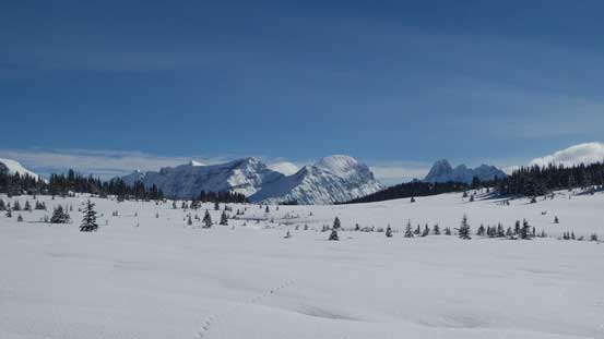
A view from South Miette Pass
Ben skiing down the tributary of Miette River

Back onto the highline traverse
Mt. Bridgeland
Mt. Moren

Some tricky and tight spots for skiing
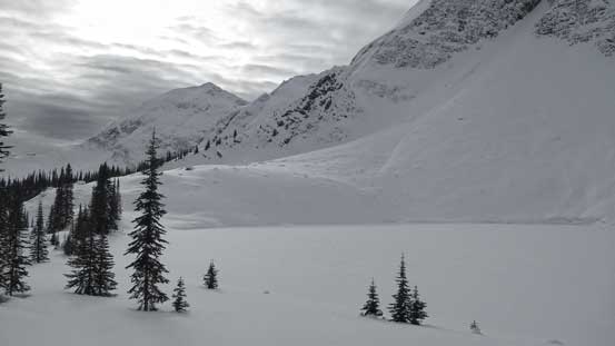
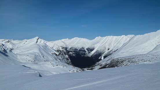
A frozen lake on the traverse
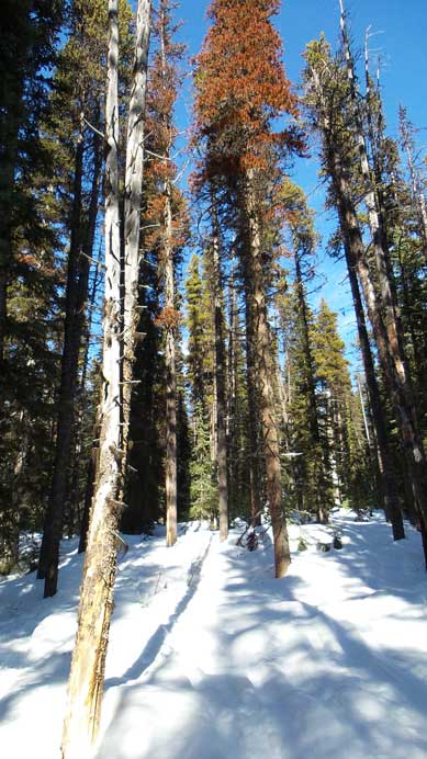
Descending the Yellowhead Mountain trail.

Me on the lookout. Photo by Ben
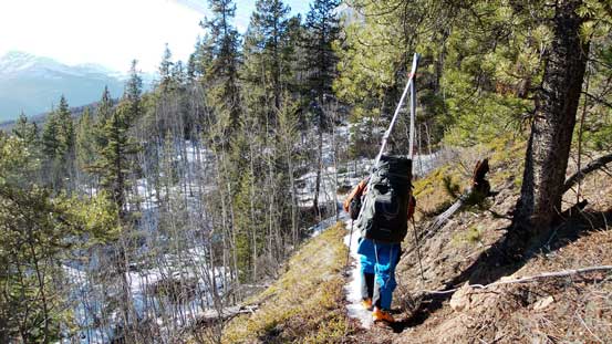
We had to carry our skis/snowshoes for the last 2 km or so.

Can’t believe this is in February in BC….

The final train track crossing. Glad we didn’t have to wait for half an hour like on Elysium Mountain trip…
Overall I’m very glad Ben eventually managed to convince me on this superb trip into an amazing area. The official summits in this area are so inviting that we’ll for sure come back for some real peak-bagging in the summer conditions. Speaking the route we took, it should be a classic for ski touring. There were a few tight spots on the approach but nothing major challenge, and the terrain around Miette Pass was just pure classic for skiing. We managed to finish this trip in 3 days but totally exhausted towards the end. I’d recommend 4 or even 5 days for skiers wishing to explore Miette Pass area.
