Phillipps Peak
July 4, 2013
2500m
Crowsnest Pass, AB/BC
Towards the end of this record-breaking heat wave, Grant (Granticulus), Dan Kim, and I were looking for a trip taking advantage of the sunny weather. Grant gave me the power to pick objectives. Because all three of us are very confident on difficult and exposed terrain, I figured that we should at least do a “climber’s scramble”. Three objectives were proposed, Mt. Ishbel in Banff area, Mt. Dungarvan in Waterton, and Phillipps Peak in Crowsnest area. As the date came closer, weather forecast got downgraded and there was thunderstorm forecast in the afternoon for pretty much all areas. Eventually we decided to meet at the MacDonald’s in Okotoks at 3 am in the morning, and hopefully that’s early enough for Phillipps Peak and Mount Tecumseh.
Phillipps turned out to be easier than expected. It’s still a difficult scramble, but I don’t think it can qualify as a “climber’s scramble”. However, it was relatively unknown because we could only find one detailed trip report of a successful attempt from Sonny Bou’s website. But he did it solo which means we couldn’t get a good perspective from his photos. So Nakagawa attempted this route in winter and we decided to use his approach route because that would bring us closer to our second objective, Mt. Tecumseh. We knew it’s not traverse-able from one to the other, but we’d like to stick closer to the cliffs hoping to find a break somewhere.
Phillipps Peak and Mt. Tecumseh scramble route
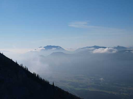
We parked at the Alberta side of Crowsnest Pass using Kane’s direction. It did take us quite a while to figure out which old road was the start. Grant was tempting to drive up this road after seeing the initial bit, but we didn’t, and we made a good call. It’s definitely not okay even if you have a 4×4. It’s not a long walk anyway, and we chatted the whole way up this rugged road. Apparently it got damaged by the recent floods. Near the pass we took an obvious gully and ascended it straight up. It turned out to be a wrong gully but we managed to regain the correct one by briefly losing some elevation. The view was great with a bit of low clouds and a bit of haze at valley floor.
The tip of Sentry Mountain seen from parking lot
We made great timing to be here!
The ever changing clouds made for some great lighting on Sentry Mountain
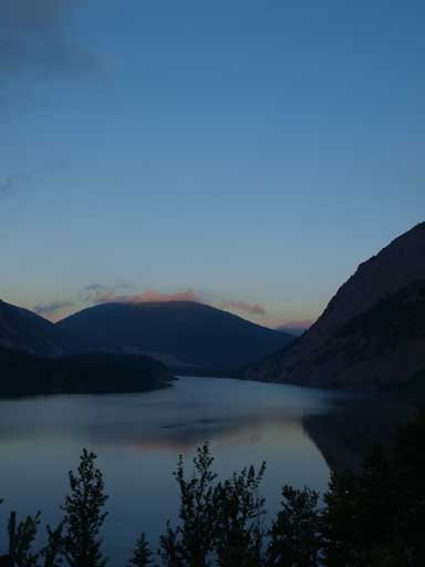
Crowsnest Lake
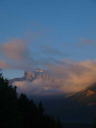
Great morning lighting on Chinook Peak
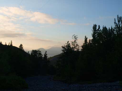
It was a bit hazy in the morning.
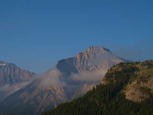
Sentry Mountain again
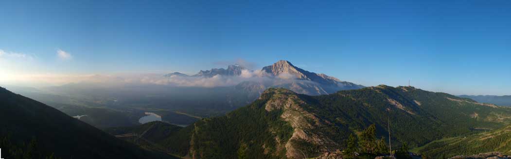
Panorama from the “wrong ridge”
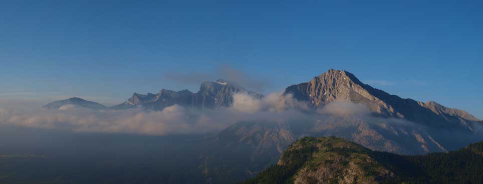
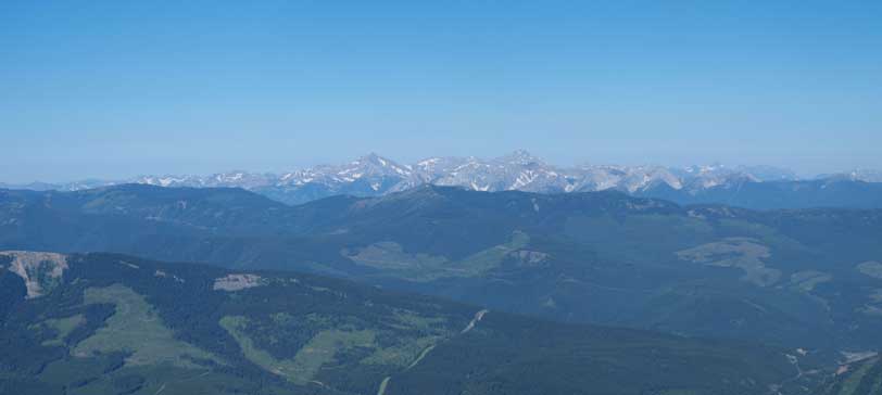
A zooming-in shot of Flathead Range
Looking up from the wrong ridge. Obviously we had to drop some elevation

Grant and Dan searching for a line down resisting losing too much elevation.
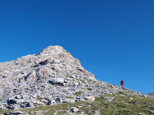
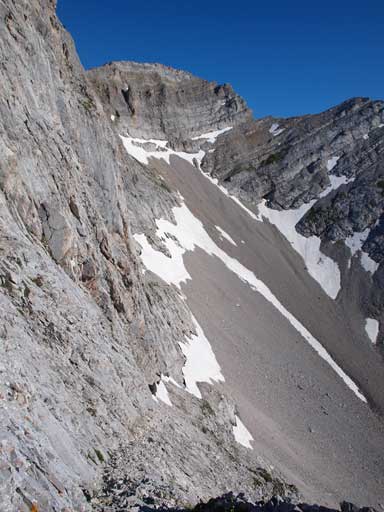
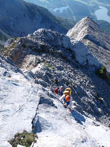
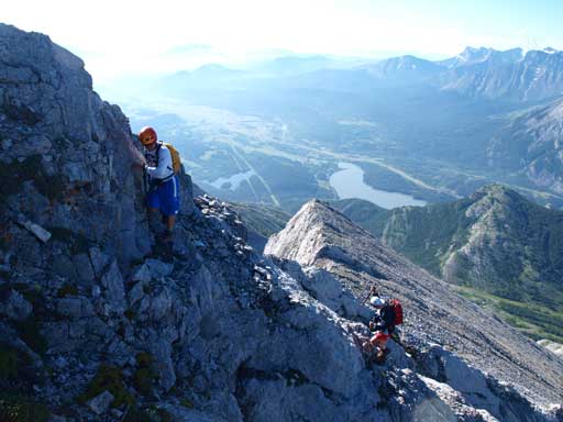
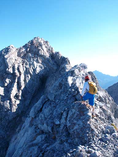
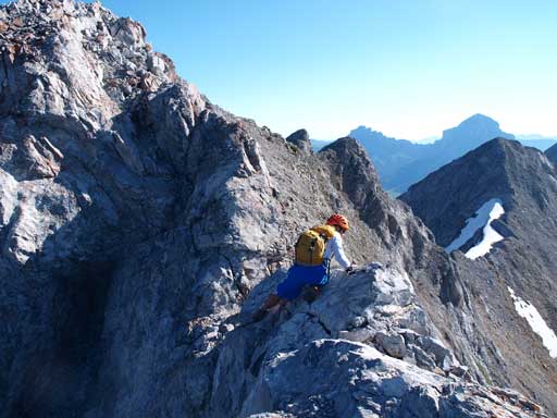
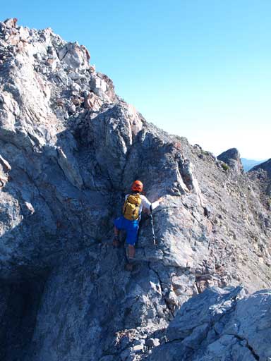
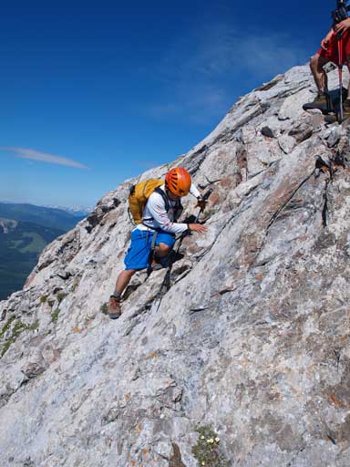
From the main gully we immediately left it to gain a steeper left branch. The main gully goes up to Tecumseh, while this branch goes up to Phillipps. This gully was very foreshortened and it felt like eternity to finally clear it and gain the south ridge. By then the fun part would start soon. To make it more enjoyable, we stayed on ridge crest pretty much all the way up. There were a few difficult sections on solid rocks/slabs. We also spotted a scree ramp that could bring us much closer to Mt. Tecumseh than retracing all the way back to the fork. This scree ramp is very obvious if you go up Phillipps Peak first, but it looks pretty steep from Tecumseh side. The crux was a short exposed dip followed by the short climb on the other side. It’s very near the summit, and like So mentioned, you won’t see it until you’re at there. The exposure is real here, but it’s not too hard when dry. And minutes later we were standing on this summit. Though lower than its neighbour, it’s much more enjoyable than Tecumseh which is just a rubble slog.
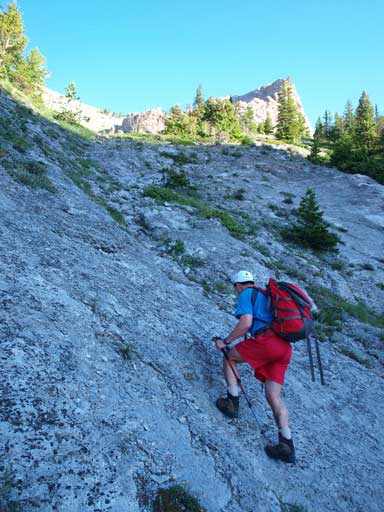
Grant coming up a slabby part in the gully
Zooming-in towards Turtle Mountain

Dan slogging up tedious scree after exiting the steep slabby part
Grant slogging towards the scrambling section
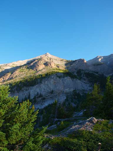
Here we spotted a scree ramp to short-cut the route to Tecumseh. Summit of Phillipps can be seen on this photo.
Mount Tecumseh looks to be pretty sloggy..

Dan and Grant coming up a step. There’re lots of steps like this on this ridge.
Going up a slabby bit
Scrambling. Fun.
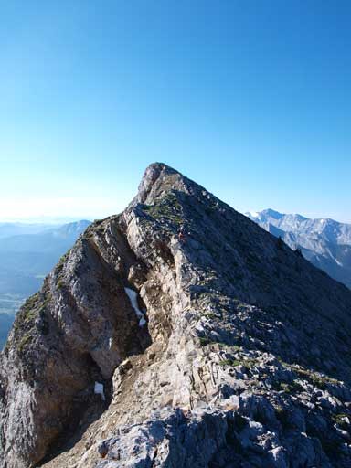
The summit is still quite a way ahead
Grant coming down from a false summit
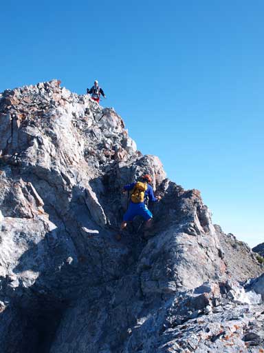
Dan studying the crux dip
Going down to this dip
And traverse to the upclimb part
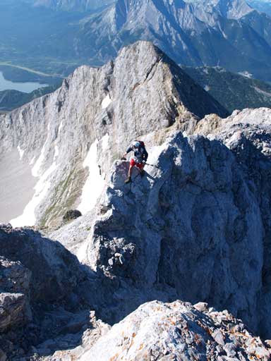
Grant crossing over to the dip. This shot gives a better perspective of the exposure of this crux
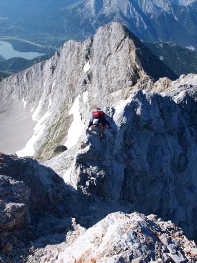
Same as above

Grant on the dip and ready to climb up this side
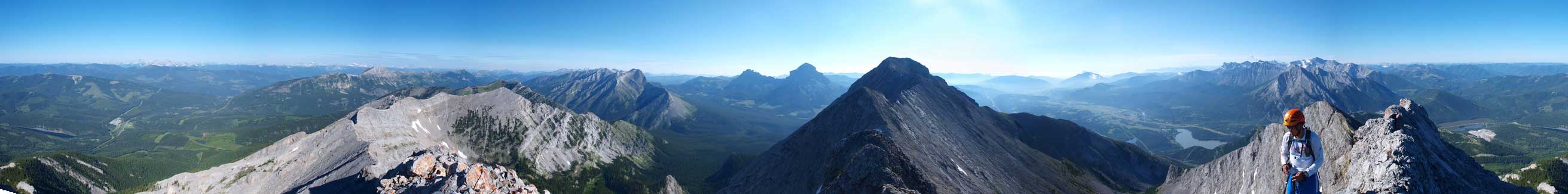
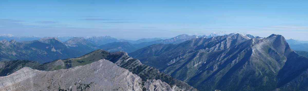
Summit Panorama. Click to view large size.
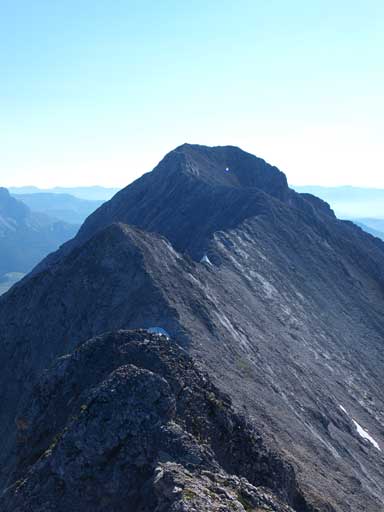
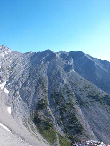
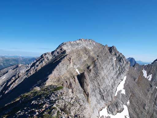
The bigger neighbour, Mount Tecumseh
Towards Fernie area, Mount Bisaro steals the show
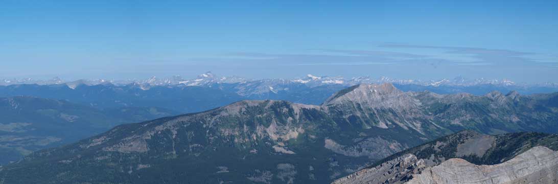
Looking over Mount Erickson (foreground) towards the distant peaks like Mount Washburn
Looking north. If looking closely you can see Tornado Mountain
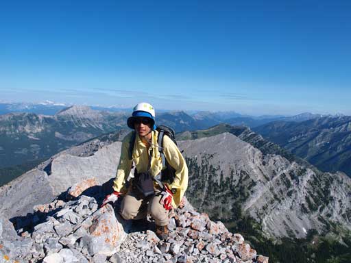
Me on the summit
We spent a good amount of time looking for a possible line straight down the face towards Mt. Tecumseh, but we didn’t find a “for-sure” line, so we decided to go back to the previously spotted scree ramp. Down-climbing the crux felt a bit awkward. This bit deserves more respect and this mountain is definitely not a winter objective unless you want to “mountaineering” this route.
Dan down-climbing the crux move.
Scrambling down some slabs
And, since weather was so far so good, we decided to slog up Mount Tecumseh. It’s right there, so, why not…

[…] by almost everyone who’s done it including Sonny Bou, Dave McMurray and Steven Song. I know all of these folks’ scrambling abilities so I was a bit nervous as I set out on my […]