Mount Washington
August 8, 2016
1917m
White Mountain National Forest, NH
Mt. Washington is known as the tallest peak of the White Mountains, New Hampshire, and is also the highest peak in the entire northeastern United States – east of the Mississippi River, north of North Carolina and south of Ellesmere Island. And probably because of its significant geological isolation Mt. Washington is home to some notorious weather. One interesting fact is that this mountain holds the world’s fastest measured wind speed at 231 mph. But despite that, this is overall the most significant mountain in the New England hence highly developed for tourism industry. The summit is a crossroad for many trails including the famous Appalachian Trail but on top of that, a Cog Railway runs up from the west, and a winding, but paved road brings thousands of tourists up from the east.
I have to mention that this wasn’t on our agenda until Yujia pointed out that one could take a train ride to the top of Mt. Washington. At first I couldn’t believe as I thought the train might be just touring instead of actually going for the summit but after some brief Google search I was instantly game. While making the initial agenda I was indeed aware of this peak’s significance, but neither the Auto Road nor the Cog Railway showed up on topographic map so I pretty much just ignored Mt. Washington, as one promise I made was not planning any “serious hike”. The price seemed reasonable ($68 per person) and with weather on our side (partly cloudy) I was quite excited.

Mt. Washington via Cog Railway
A few days earlier we just came back from a camping trip in the White Mountains so now we were back on the road, northwards along I-93 towards Franconia Notch. This time we’d go past the Notch, turn east onto SR 3 and SR 302, and about 3 hours after leaving Lowell, Massachusetts we arrived at the base station. All looking good except for the summit was engulfed in clouds. Elsewhere was just as sunny as forecasted but oh well… After spending some time in the shop and getting our reserved tickets we were in line for the 11:30 am train. It’s the prime touring season so all tickets have to be reserved otherwise it’d be very hard to get a spot.
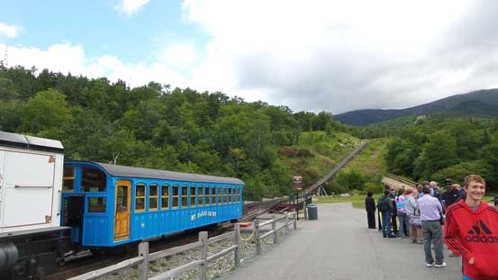
The base station. All ready to go!
Neither of us had ever taken a train ride up a mountain and I don’t think there’s even a service like this in the western Canada. Part of me was excited and part of me was curious about what this new experience would be like. The train was slow, but took a more-or-less direct line up the west slopes and some 30 minutes later we emerged from the mature deciduous forest and came into the sub-alpine. We were slowly getting higher than the distant peaks but with an overcast sky the view wasn’t that inspiring. Once into the alpine we entered the clouds, and the rest of the journey to the summit was in a white-out. The wind gusts was also crazy trying to knock us off the ground.

Ascending into the sub-alpine
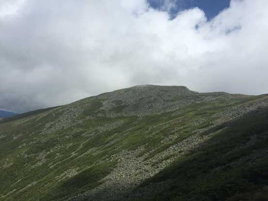
No more trees. We were in the alpine now.
There appeared to have a snack shop nearby but before making our way to the shelter we firstly went down a bit to check out the upper parking lot. On the ascent I noticed many people were driving up (but the road wasn’t showing up on my topo map) so I was quite curious. It turned out to be even a paved road.. It seemed like we took an expensive way up, but quite a unique experience nonetheless. Back up the mountain we went straight into the shelter. It was quite a luxury place with gift shop and all kinds of services. We got some pizza and clam chowder for lunch and before taking the return train down I went out again to check out the summit cairn. It was a very busy place (even in bad weather) as I had to line up for about 10 minutes to take some selfie shots with the cairn…

Me on the summit of Mt. Washington, the highest in northeastern United States
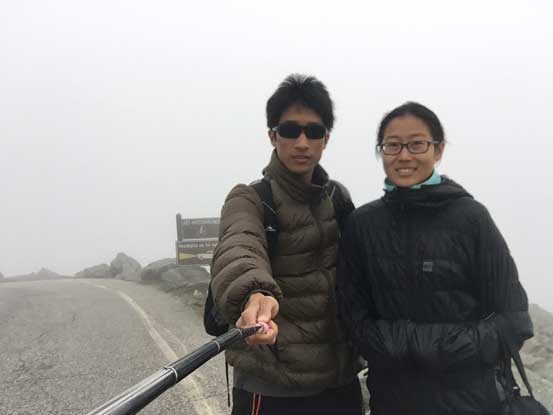
Yujia and myself near the summit, checking out the Auto Road
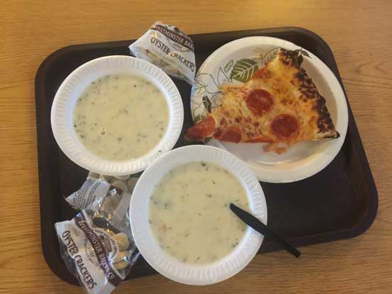
Never thought about having these on a tall peak. Luxury stuffs!
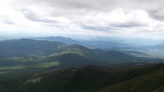
It was 1:00 pm now and the clouds had showed no sign of lifting so we weren’t the lucky ones with views this time. It’s time to take the train down. Thankfully we exited the world of white/grey after descending for about 200 meters and I got some neat pictures looking north, including the other peaks on Presidential Range including Mt. Jefferson, Mt. Adams and so on. There’s not much to document about the rest of the journey down.
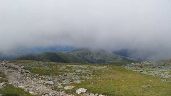
On the descent, we finally got some views
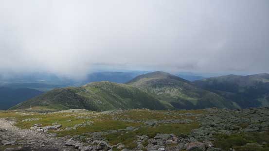
The ridge connects northwards to Mt. Clay and then Mt. Jefferson
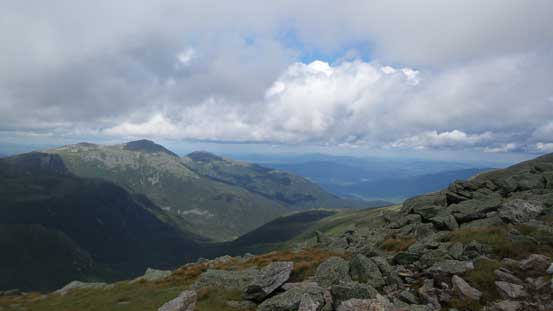
Mt. Adams and Mt. Madison on the northern Presidential Range
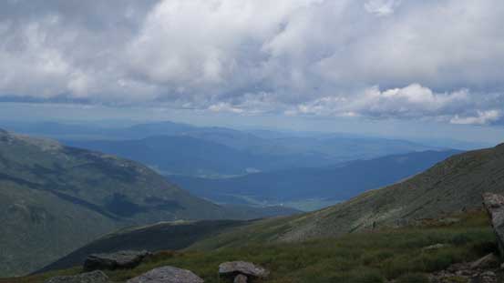
Looking north towards Androscoggin River valley

Another look at Mt. Adams and Mt. Madison
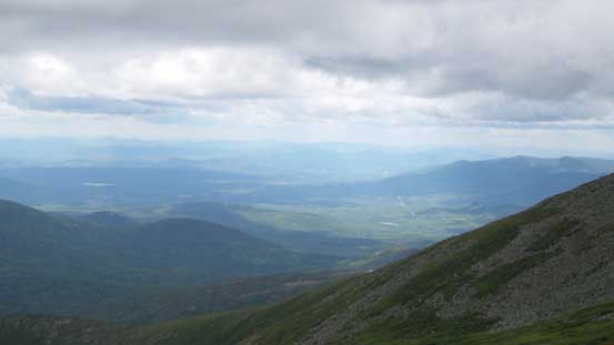
Looking northwest towards Connecticut River valley
All those hills to the west still looked small.
Back to the parking lot what’s left was another 3-hour drive back home. Yujia did a great job bringing us back safely and that concluded another great day out there. Overall I’m not sure how much I’d recommend this Cog Railway but it indeed provides some different experience especially comparing to the usual foot-numbing trips I did in the western Canada. It sure provides a fast way up a prominent summit but on the other hand, one can also drive his/her car up the peak. An off-season ascent also seemed like a good option if you’re a peak-bagger. The weather, on the other hand, is quite notorious and I bet if you want some guaranteed views then wait for a true high pressure system.
