Mount Stephen
August 17, 2022
3200m
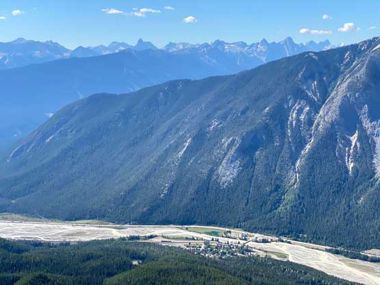
Yoho National Park, BC
Mt. Stephen is one of the “difficult scrambles” in Alan Kane’s Scrambles in the Canadian Rockies that also boasts an iconic profile and a shear vertical relief above the town of Field. The ascent requires almost 2000 m elevation gain but much of the grunt is on a trail. Only the final few hundred meters of elevation is on challenging terrain. This peak had been on my “list” since 2012 but I never got around to actually do it mostly because I was too busy with the 11,000ers list. Another major deterring factor is the paper work required. Mt. Stephen locates in a restricted area associated with Burgess fossils so to climb this peak one must obtain a permit. The permit can be obtained in person in the visitor center or via email. The latter is more tedious than it sounds like as one must scan, print, sign and email in back and forth numerous times and that quickly becomes a pain in the ass. The simplest is to obtain the permit in the visitor center but that basically kills a day (showing up there the day before), so pick your poison.
I noticed a few days of weather window in the Rockies and immediately started to make some plans with friends. I decided the objectives purely based on the availability of friends and the first one to be decided was Mt. Stephen with Oakley on Wednesday, the first of the two days of sure window. The air would be smoking hot but the sky would be guaranteed “bluebird”. Oakley was more excited about this objective so he volunteered to deal with the paper work. That didn’t mean I could skip my part as I still had to print and sign a waiver and then scan it, along with my driver’s license. Taking photos using the phone wasn’t accepted so I had to find friends with scanner and printer to avoid losing money to London Drugs. Tuesday was then spent driving to Golden and that was very much uneventful. I arrived in Golden at around 9 pm and quickly went to bed. The next morning I woke up at 5:30 am, had a breakfast in the McDonald’s and then realized Highway 1 was closed to 7 am. I informed Oakley about the delay and killed an hour in the car, but then the closure was extended to 7:30 am. Eventually they opened at 7:40 am and I showed up in Field almost 2 hours later than planned. The visitor center only issued us an 11-hour permit to complete the trip so now we only had 9 hours left. I estimated that we should still be fine but we wouldn’t have a ton of time to spare.
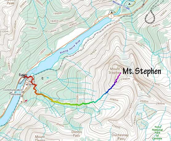
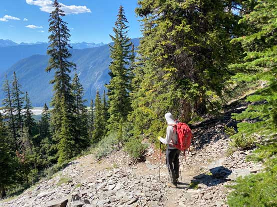
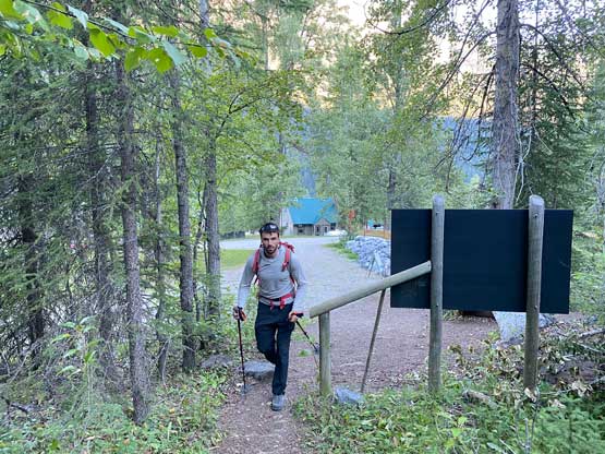
The parking of this trip was actually at the information center as there’s no parking at the trail-head, so we firstly had to walk through the town of Field. We then almost made an error by taking a road and missing the actual trail but I quickly realized it by checking the GPS. We backtracked and found the trail. I think the Parks maintain this trail for access to the Burgess fossils guided tours so the quality of this trail was really good. We dispatched elevation in no time. Upon reaching a fork we took the less-defined path (with a hiker’s arrow) to the right and the “trail” immediately became steep and loose, leading us into the treeline zone. After a while of steep grunting we followed the trail trending climber’s right onto the SW Ridge of Mt. Stephen, about exactly 1000 m elevation gain into the trip. We made here in about an hour and half and took the first break of this day.


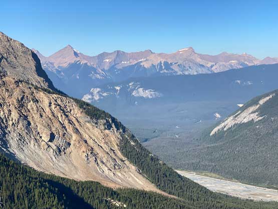


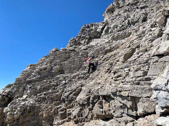
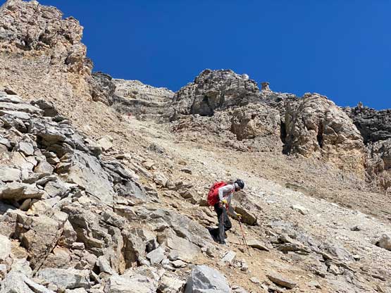
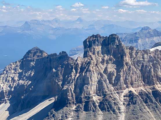
The next stage was a long ass grind up the SW Ridge for about 700 vertical meters to the base of the scramble. For the most parts we were able to follow a path in the dirt and scree but we did have to hop on rubble and boulders at times. There’s also a rock band in the middle of this stretch that we ascended through using a broad gully (class 2 but very loose). The view was extremely foreshortened but I kept checking the GPS so didn’t get fooled.

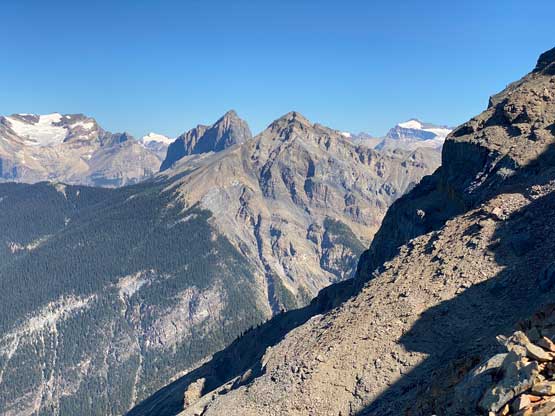


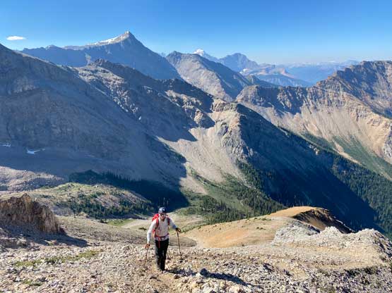


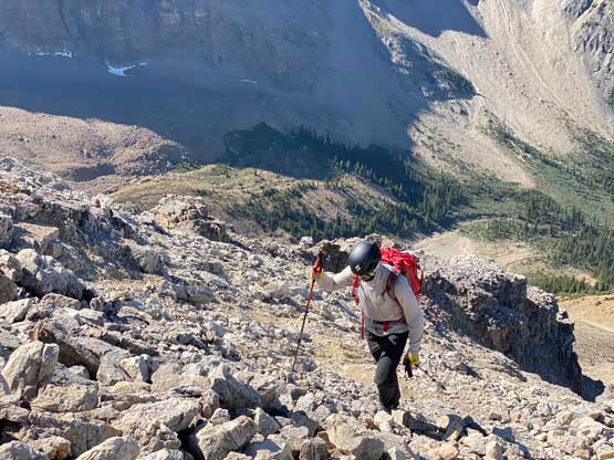


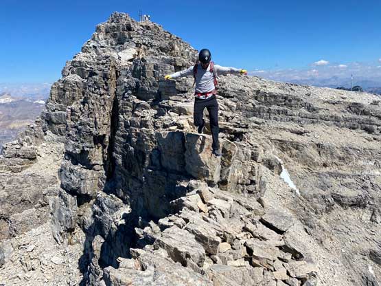
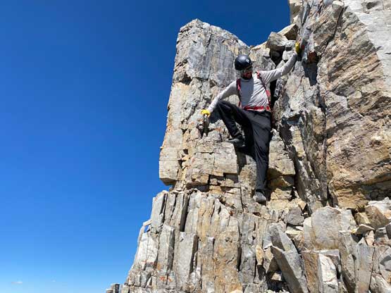
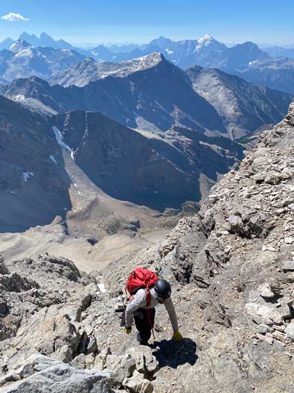
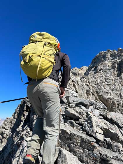
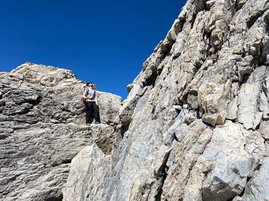
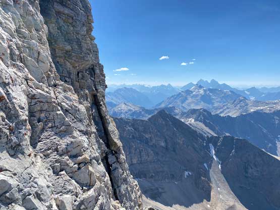
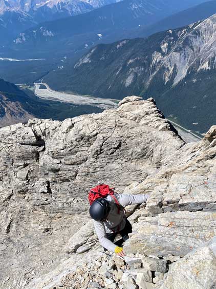
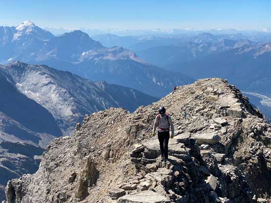
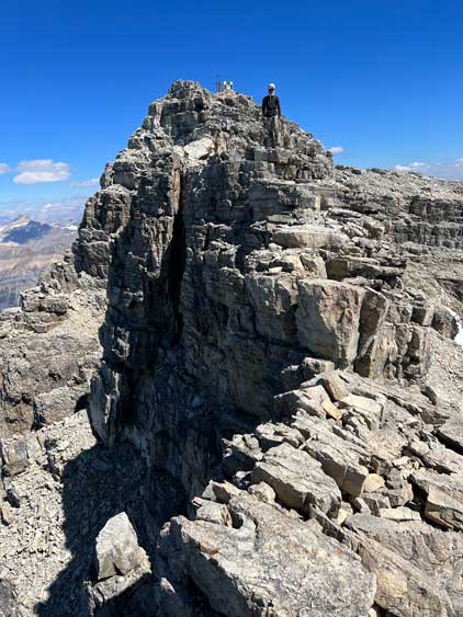
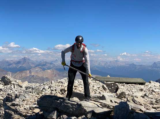
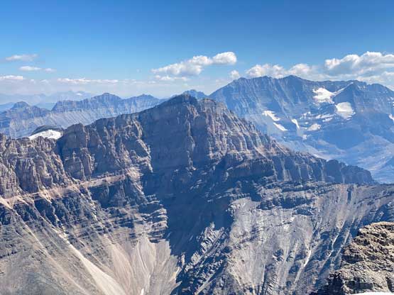
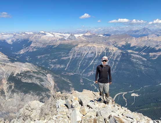
Upon reaching the final scrambling section we each ditched a trekking pole and traversed climber’s right following a defined path. I had done enough research including downloading two sets of GPS tracks along with the satellite images so I knew there were at least three major rightwards traverses each followed by scrambling to regain the ridge. The first of the three was the easiest but also the most tedious with the most amount of loose rocks. The second traverse was on a prominent scree bench and that was followed by some sustained class 3 scrambling on the left side of a snowy chute to the base of the crux wall. I made a short detour into the snow chute to load up a water bottle. The water was dripping on the rocks very slowly so I balanced a bottle with rocks with hope to collect 500 mL of water on the return. The day had been even hotter than expected so we were both running low on water. The crux wall was almost vertical but with good holds (class 4) and after that we made another rightwards traverse on another scree bench. We eventually gained the summit ridge and had a fun scramble along this exposed ridge crest with numerous fun but short class 4 steps to the very summit. The summit itself was anticlimactic with a weather station hut and a helicopter pad.


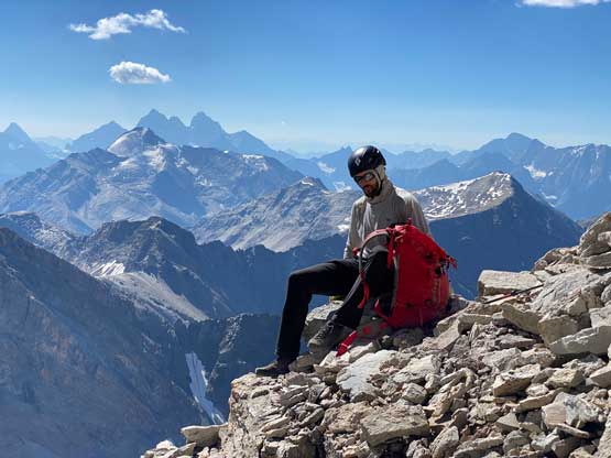


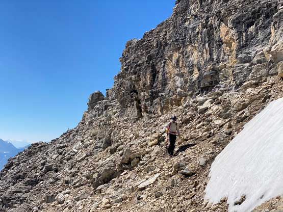


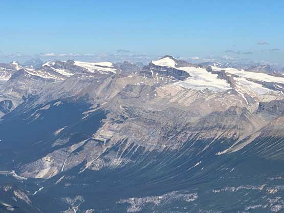
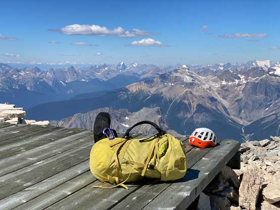

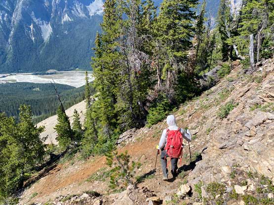
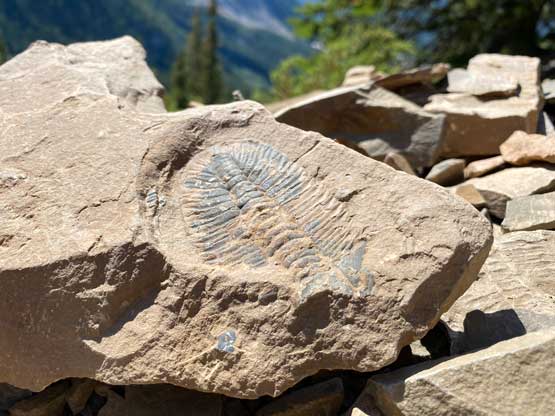
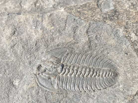
We only stayed on the summit for half an hour as we didn’t have that much extra time to kill. It had taken us under 5 hours to the top and we anticipated about 3-4 hours for the return. We mostly just retraced the exact same route we took and the scrambling never felt difficult. The summit ridge and the crux did feel quite exposed so extra care was required. The 700 m elevation loss down the SW Ridge was quite fast at times when we could scree-ski, but that wasn’t the case on this entire stretch. Lower down we took our time taking pictures of the fossils on rocks that were literally just beside the trail. There were actually a lot of fossils but we didn’t really notice them in the morning as the rocks were in the shades in the AM. The rest of the descent was uneventful and our round trip time was 8.5 hours. I was not feeling tired at all so made the final decision to scramble Chancellor Peak on Thursday. Not wanting to risk getting stuck in Golden again I decided to drive to Canmore to get food this time.