Blue Mountain (Penticton)
November 2, 2021
1392m
Penticton, BC
Blue Mountain is a broad, forested and dull-looking plateau immediately to the west of Penticton that offers extremely minimal recreational interest whatsoever. The area locates in First Nation reserves so I’m sure hunting and mountain biking is prohibited. That leaves the only possible recreational use to be the so-called “stealth peak-bagging”. The highest point of this forested dome boasts over 600 m prominence and name is official so it does draw some attention from the peak-baggers, but still, this peak is rarely ascended and even more rarely reported.
Rob Woodall had published a GPX track of this objective on peakbagger.com but Matt decided against in using Rob’s route after putting in hours to zoom in on various maps and images. Matt proposed the idea to park near the broad pass between Blue Mountain and “Peak 1431” to sneak into the reserves and subsequently bag the two P600m objectives from the same parking spot. I had not done much research about these peaks so I decided to just take advantage of Matt’s work. As usual Matt and I would leave Vancouver very early in the morning to make the full use of the day. I woke up at 2 am and we departed Abbotsford an hour later in Matt’s mini van. Matt was able to cruise down the Coquihalla Highway and Okanagan Connector in 150 km/h on average such that by the time we made to Penticton we were still in the pitch dark. I fell asleep on the second half of the drive and I was not very stoked about having to wake up and start the hike in the dark. We found a small pull-out to park the vehicle just before the road’s bridge to cross Shingle Creek.

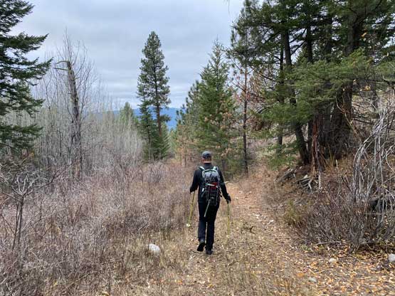
Matt said we should carry snowshoes because there was “a lot of snow” on the higher elevations of the Okanagan Connector. I wasn’t sure about this decision as the area around Penticton is usually much drier than the area further west but then I figured that we came here for some exercise so we might as well carry some training weight. In the pitch dark we dived right into the grasslands straight up the south slopes of Blue Mountain. The steepest parts of this ascent was at the beginning and in half an hour we gained 400 m elevation. We crossed one road but decided to follow the second road for a short while before turning onto the smaller, third road. We used this road for a little bit and then did our own short-cuts and that brought us to another (bigger) road at around 1200 m elevation. The next road branch was marked by a cairn and brought us to very close to the summit. We took the final left turn onto a smaller spur road but then we made the not-so-smart decision to leave this road to aim directly at the summit. We were punished by some bushwhacking but nothing’s really worth noting. The summit had some communication structures but minimal views.


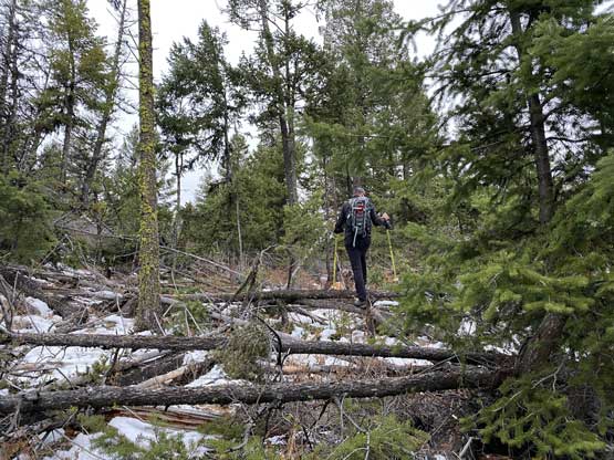


The rough idea of this route was based off Matt’s study but the navigation was mostly confirmed by my “Backroad Mapbook” layer on the premium version of Gaia. This map layer had most, if not all the spur and unnamed roads labelled and they were impressively accurate. The summit was chilly and the weather was 100% overcast so we didn’t linger any longer than necessary. On the descent we mostly followed our own track but did some variations here and there. For the lower 400 m elevation we ignored our route and explored more of the grasslands. The ground was nice and soft and the hiking was fun. We finished the trip in 2.5 hours and just when we were about to leave for “Peak 1431” a guy in an unlicensed vehicle came down the adjacent private road and yelled at us. We thought we were in trouble. This guy was the manager and guard of these Native areas but he wasn’t here to kick us out but he did say that we were in their private properties. We actually told him that we just hiked Blue Mountain and we were going to hike the next peak on the south side of the highway and he seemed cool with it, so we carried on.