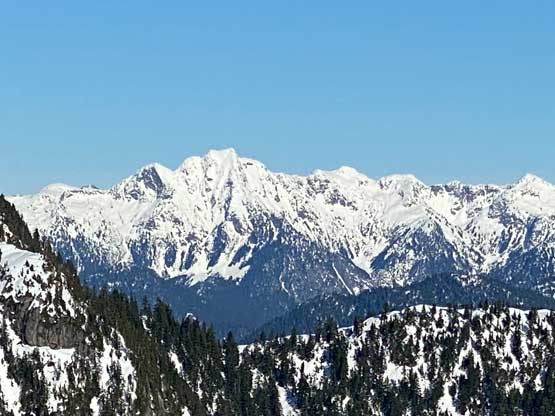
Mount Elsay
January 27, 2022
1419m
North Shore Mountains, BC
Mt. Elsay behind Mt. Seymour is a decently popular objective in summer facilitated by some steep and unofficially maintained trails, but rarely sees winter ascents. For years I had been wishing to climb Mt. Elsay and Runner Peak in winter but such outing required an absolutely stable and firm snowpack. Whenever that rare window happened I always ended up on something more major. Last year I had already scrambled Runner Peak in summer but I left Mt. Elsay behind, partially on-purposely as my vision of its winter ascent was still calling.
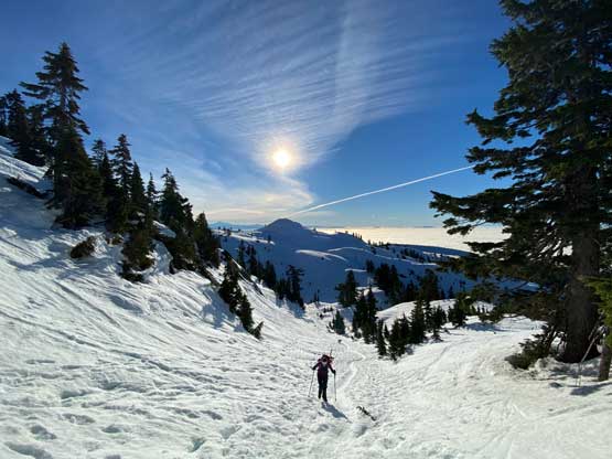
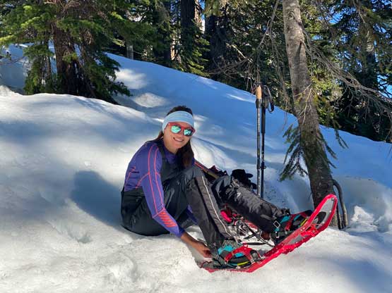
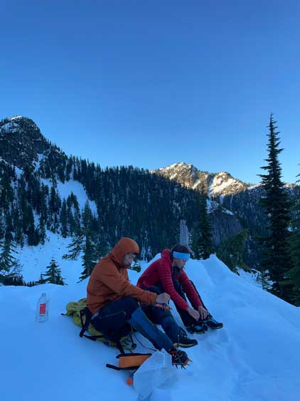
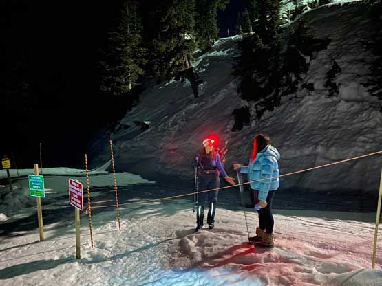
The late January of 2022 saw a week-long high pressure system bringing in some spring mountaineering conditions into the South Coast Ranges. I decided to take Thursday off as I needed to take advantage of this rare window one extra time, especially that Holly was able to accompany me. I was struggling to find an “epic” objective for the two of us simply because I had already done most, if not all of the classic winter mountaineering ascents in the day-trip range. In the end we settled on Mt. Elsay. This peak never sounded too exciting, but did need such a bomber window for its winter ascent. Holly did the logistics and got us a parking pass which is a new pain required to get into Mt. Seymour Provincial Park these days, thank to the population growth. In the morning I picked her up from downtown at 6:40 am and eventually started the day about an hour later right after sunrise. In terms of gears we brought two ice axes, steel crampons, mountaineering boots and snowshoes. Some of them turned out to be crucial and some were overkill.
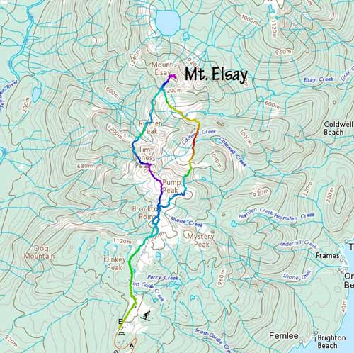
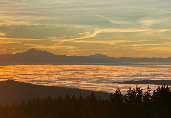
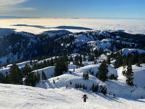
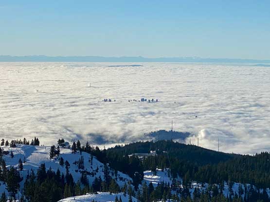
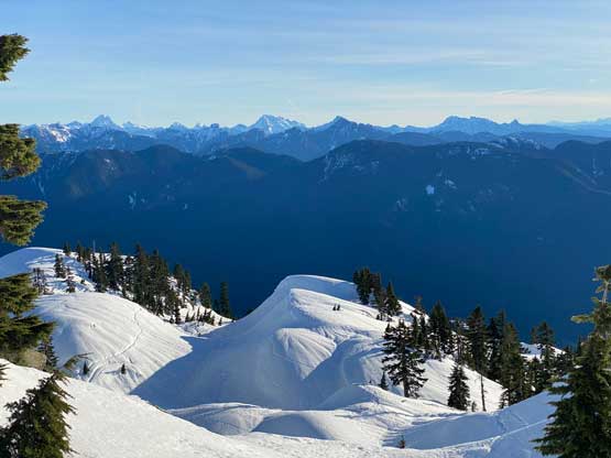
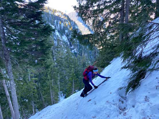
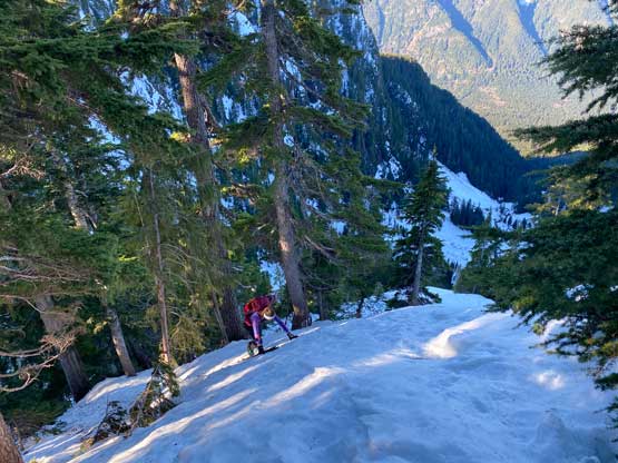
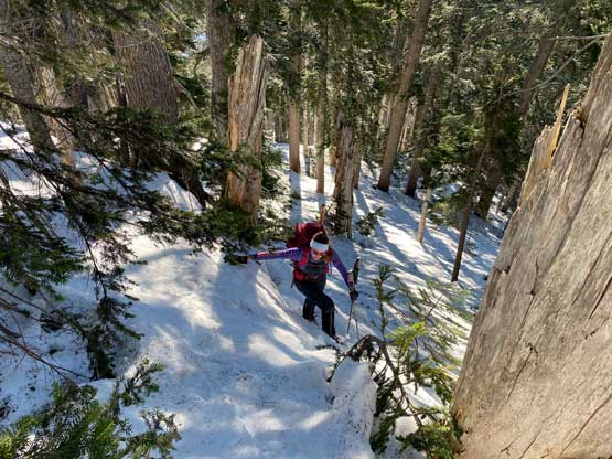
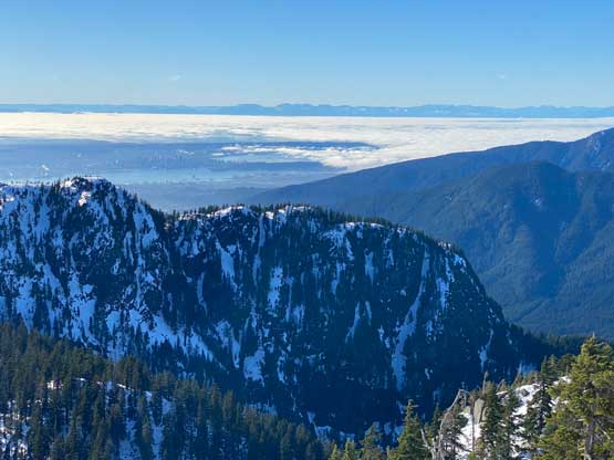
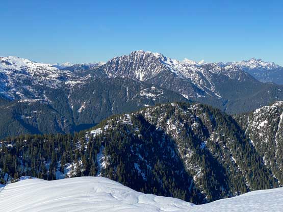
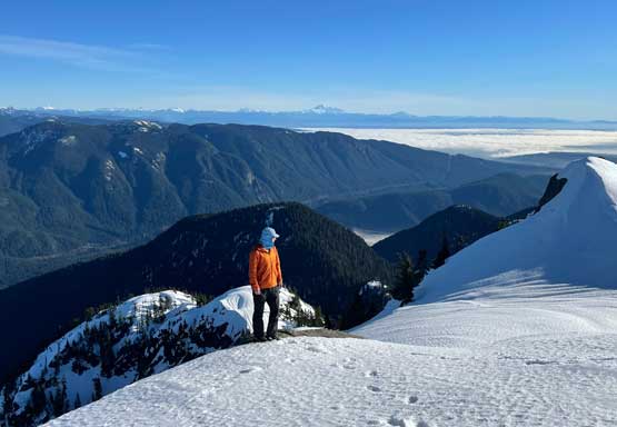
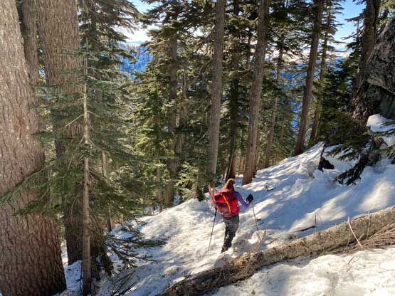
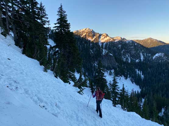
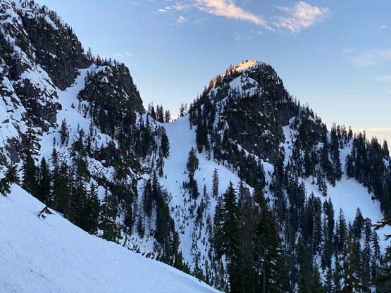
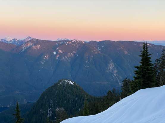
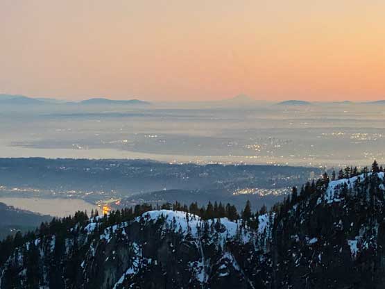
The hardest part of Mt. Elsay is not the ascent itself, but rather the approach around Mt. Seymour and Runner Peak. The more undulating but more scenic option is to traverse around the west side of Runner Peak, while the slightly more straightforward option is to take the Elsay Lake trail that plunges steeply down from Pump Peak’s shoulder for 300+ meters into Coldwell Creek. Our plan was to take the high road on the way in, and the low road on the way back to make a loop. The parking for Mt. Seymour’s backcountry use had been pushed almost 1 km back from the main skier’s parking lot, so unfortunately we had some extra distance to cover. The hike to Brockton Point via the main trail was uneventful and then we spontaneously decided to climb the south face of Pump Peak. The main reason was to short-cut some distance but the real treat was the expansive views of the inversion layer. We had to don crampons for this steep ascent. I had brought the heavy Petzl Lynx crampons to compensate the lack of rigidity of the Trango Tech mountaineering boots, and the theory seemed to work well.


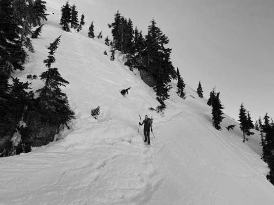
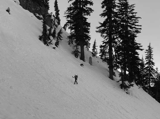
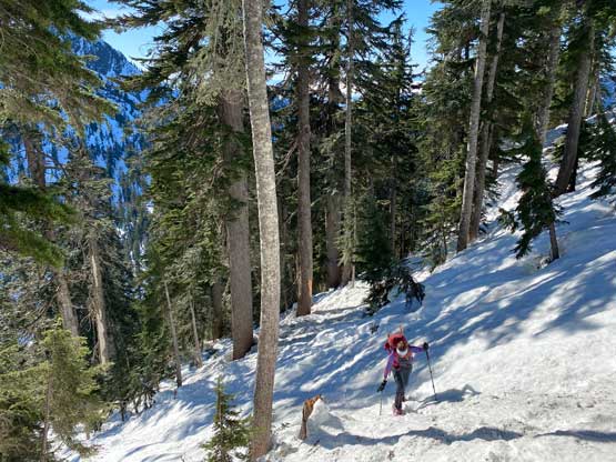
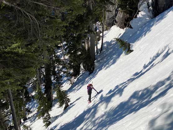
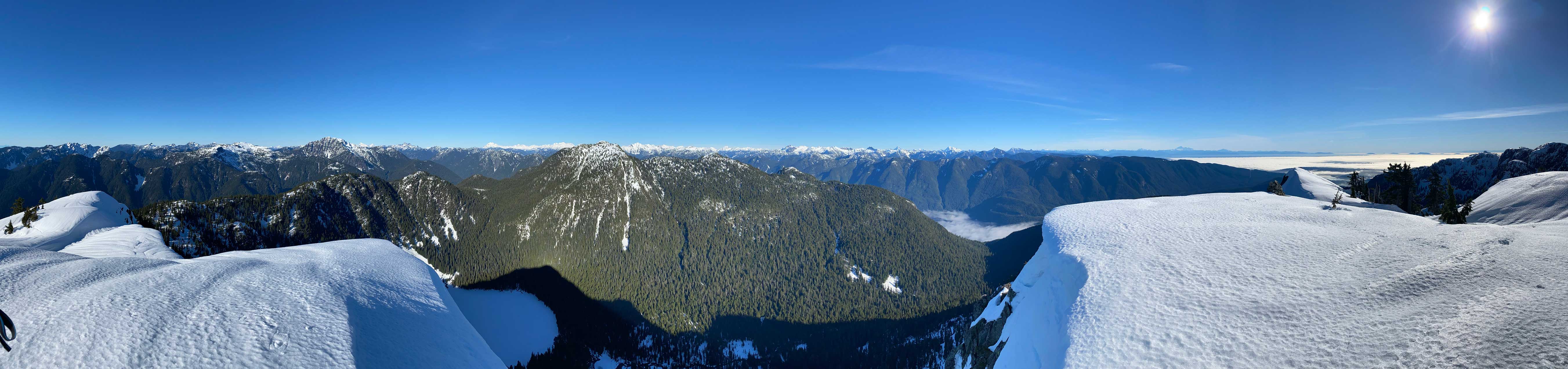
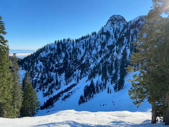
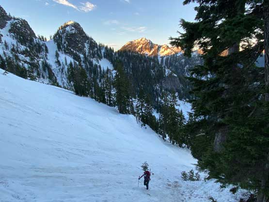
We bypassed the very summit of Pump Peak on the east side and then easily plodded to the shoulder of Tim Jones Peak, which we bypassed on the west side. The steep side-hill into Tim Jones/Seymour col was packed by foot traffic but only one set up foot prints continued down the direction we wanted. That set of tracks led us around the first section traversing the west side of Mt. Seymour. There was one minor up-hill climb to a shoulder on the west ridge of Mt. Seymour before another 100-m drop to the base of Runner Peak. We could not see any track in this stage and the terrain was sustained steep traversing (40-45 degrees) with the only break being that west shoulder. The snow conditions were favourable such that we both managed to use only crampons and poles. The snowshoes and ice axes stayed in the backpacks. The steepest section of the traverse came when we wrapped the west side of Runner Peak. The snow was very firm and the exposure was decently severe and the route-finding was not that straightforward as I had to check GPS a dozen times to make sure we stayed on the least steep traversing bench.


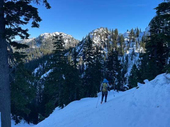


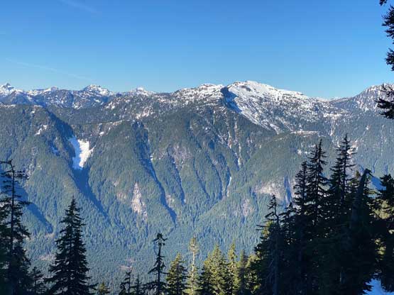
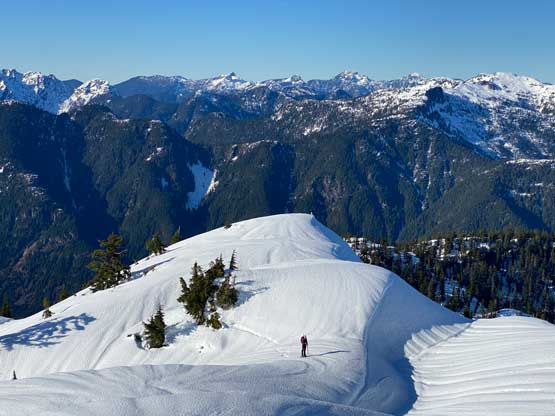
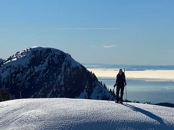
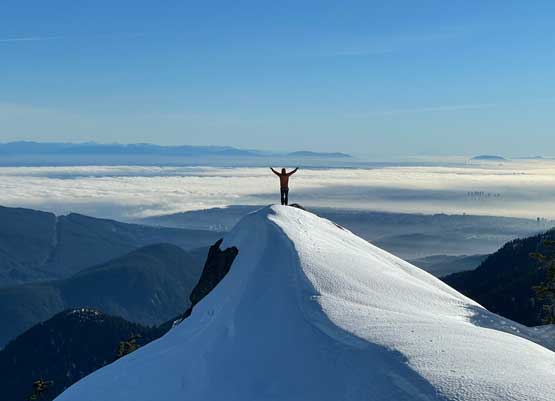
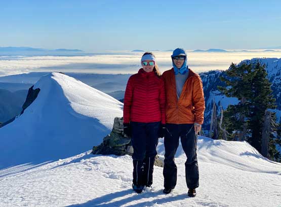
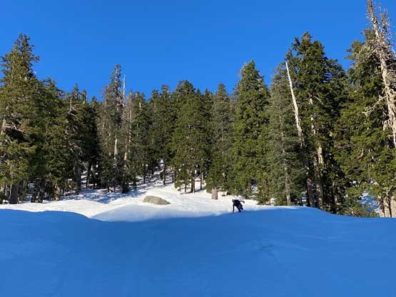
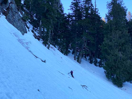
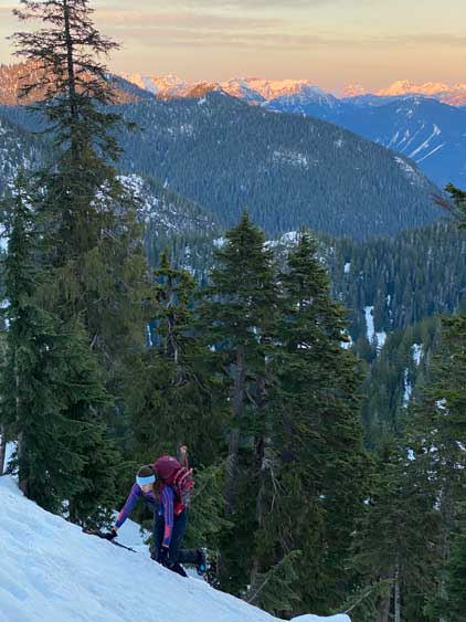
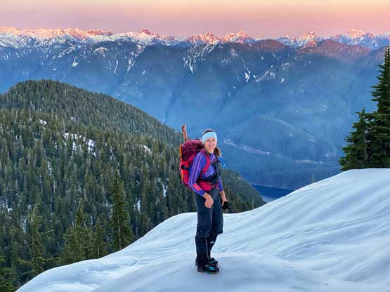
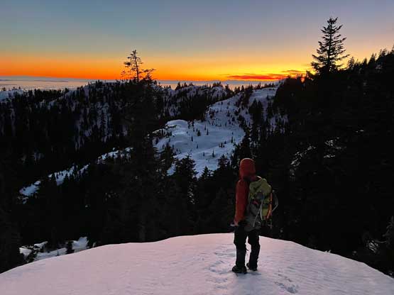
By the time we finally traversed to the north side of Runner Peak we still had a section of undulating ridge before dropping into Runner/Elsay col. The snow had become soft enough to warrant the use of snowshoes, so we took our time in the transition. The ascent of the south side of Mt. Elsay started off easily but the mid-zone was quite steep. We made some hard work wallowing up a 45-degree zone on snowshoes that proved to be avoidable on the return, but the diagonal traverse under some cliff faces were unavoidable. That zone was steep and awkward enough to test our technical snowshoeing skills. Once the traverse ended we still had to ascend a steep section before reaching the mellow slopes under the summit. The views were awesome as expected. Holly wanted a nap but we couldn’t linger too long on the summit as it had taken us over 5 hours to get here.


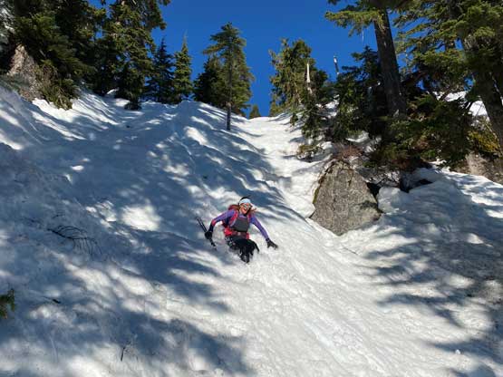
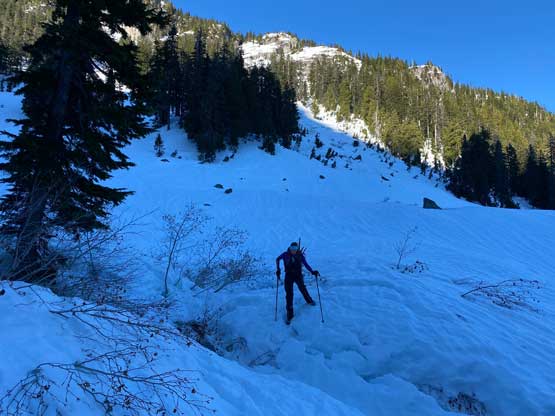
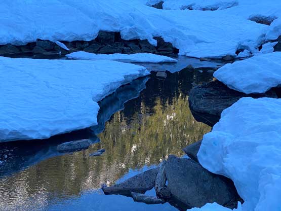
To descend the steep south face of Mt. Elsay we opted to plunge in boots, which had some knee+ deep post-holing along that steep traversing zone. We made the call to strap the snowshoes back on once that traverse was over, and then used a combination of plunging and glissading to get off the forest. We veered skier’s left lower down to short-cut into the valley and made another couple (icier) glissade to descend to the south branch of Elsay Creek. We took the snowshoes off as the snow was firm and icy, but had to strap the snowshoes back on while traversing/descending into Coldwell Creek. The traversing started to become extremely annoying that I made the call to ignore the (invisible) summer trail and bail an additional 50 m into Coldwell Creek, which was the lowest point in this hike including the parking lot. From there we took the snowshoes off again, crossed the creek on firm snow bridges and made a gradual ascent (in boots) to the west shoulder of “Theta Peak”. Another 50 m of steep ascent later we rejoined the invisible summer trail and took the last energy break of this day.
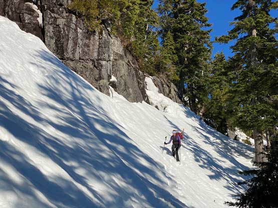
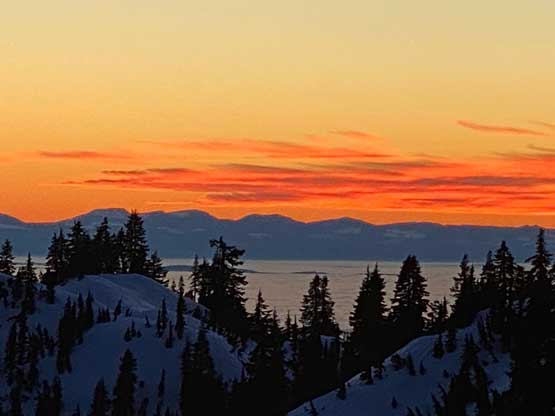
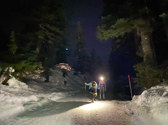
We strapped the crampons on for the 300-m committing climb to the shoulder of Pump Peak. This zone was steep enough in summer and felt even steeper in winter with considerable exposure given the firm snow. About halfway up this zone we picked up a set of foot tracks and used them. The foot tracks were apparently made in some softer conditions. The plan was to get back to Pump Peak’s shoulder for sunset but we were about half an hour late for that. The sunset we watched from just below the shoulder was still an incredible show, so we took our time to appreciate that. Eventually we still had some steep climbing on the east ridge of Pump Peak to get back to the trail. The rest of the hike-out was done with head-lamps on and our round trip time was 11 hours on a very leisurely pace.


I didn’t feel like driving right away so we sorted our photos at the parking lot. The traffic back into downtown wasn’t too bad. After dropping off Holly I had to drive into Richmond. I needed to drop the snowshoes to Vlad’s home, but before that I needed a proper dinner in a Shanghai restaurant. I eventually got back home at almost 10 pm, a wee bit late for a small summit in the local hills.
