Nordheim Peak
November 29, 2020
2041m
Manning Provincial Park, BC
“Nordheim Peak” refers to a somewhat interesting summit in Manning Park but the name originates from bivouac.com without much historical or local reference. The name however, has gained some popularity in the last decade on the internet so I’ll stick with it. The term “interesting” is also relative as this is still just a partially forested summit that boasts zero mountaineering or technical interest. Most peaks in Manning Park are rather “gloried forested hills” but this particular one involves a long and scenic ridge traverse to get to, hence “relatively interesting”… This is pretty much solely a winter objective on either skis or snowshoes when the thick snowpack covers the underbrush. There might be a route by ascending directly from Highway 3 but such route lacks information and looks bushy and steep on the maps. The out-and-back traverse from Mt. Kelly is the no-brainer option as it’s simple enough that avalanche terrain and bushwhacking are both non-existent. The ridge traverse is very indirect indeed, but at least there’s decent view for most parts of the ridge. About 5 years ago I had come here to ski Mt. Kelly but the weather was crappy and “Nordheim Peak” wasn’t on the agenda. Ever since then I had wanted to come back for the main objective.
Al and I had been tossing around ideas in the last few days and we eventually settled on this no-brainer option. Al still wanted to explore and proposed an alternative descent route to use one of the south-facing forested ribs short-cutting straight down to the highway. I wasn’t keen on that but reluctantly agreed. A few days later our group had grown to a size of 8 (Al, Katie, Jenn, Ilia, Alana, Sean, Winnie and myself) and we agreed to meet at Allison Pass’s salt shed at 7:10 am in the morning. We all drove separately and made to the trail-head at Allison Pass salt shed 5 minutes later than the scheduled time. It wasn’t very obvious where exactly to park and while attempting to park a bit out of the ways, Katie’s SUV ended up getting stuck in the snow. We tried a few strategies including padding the tires with tree branches to increase friction, to no avail. None of us had a shovel. Thankfully a skiers’ party happened to be around and kindly offered their avalanche shovels and the problem was eventually solved.

Nordheim Peak via Mt. Kelly. GPX DL
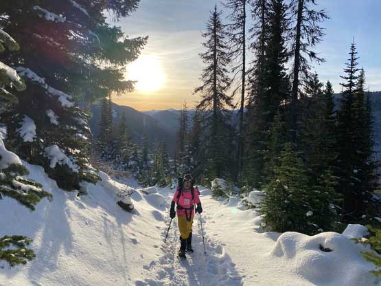
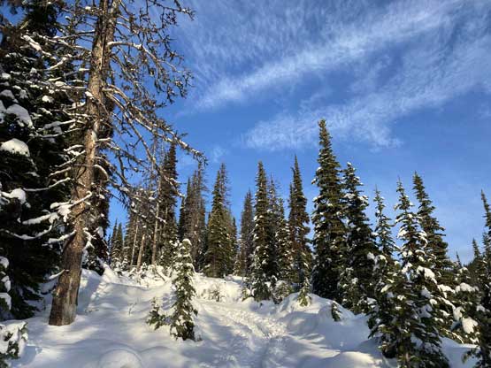
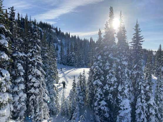
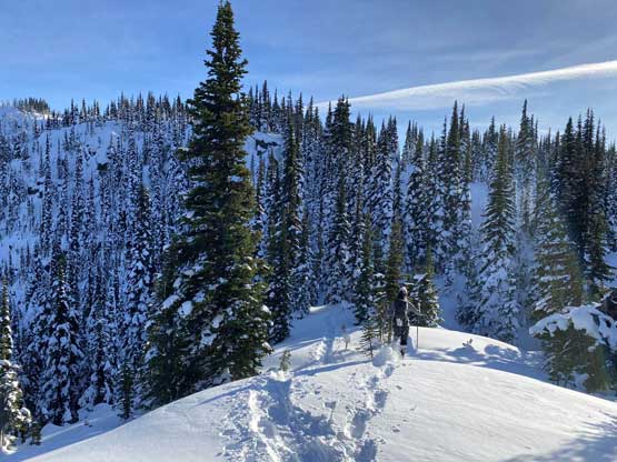
While driving to the parking lot we all paid attention to the conditions of our alternative descent route. It’s clear that the snowpack wasn’t thick enough to cover the bushes, so the final decision was to traverse the entire Kelly-Nordheim ridge out and back so we no longer needed to do a car drop. The ascent of Mt. Kelly could be broken down into two stages. The first stage was plodding up the Telecom road with sporadic views. The trail was heavily packed by all forms of traffic that a few of us didn’t even bother to use snowshoes. I strapped my snowshoes on nonetheless because I preferred to have some added traction. The second stage was a forested slog up the south slopes to the forested summit, with minimal views. We all plodded at our own pace.

Katie’s car got stuck at the parking lot…

Katie snowshoeing up the Telecom Road

Winnie snowshoeing up the Telecom Road

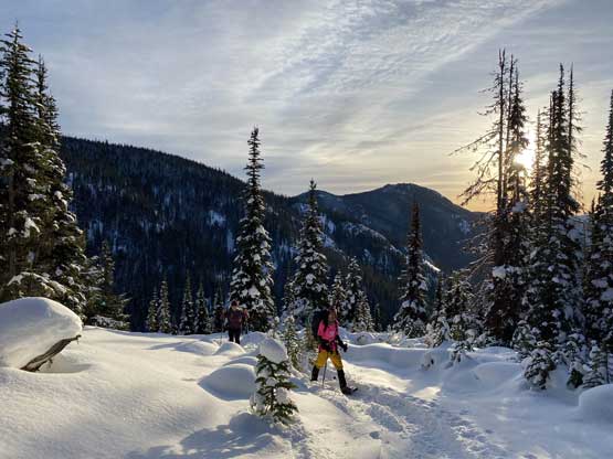
Al and Jenn coming to the first opening area for some views
Al plodding up the road with the morning sun behind
It’s shaping up to be a gorgeous day!
Another photo of Al plodding up the Telecom Road

Following the tracks

Katie and Ilia almost on Mt. Kelly
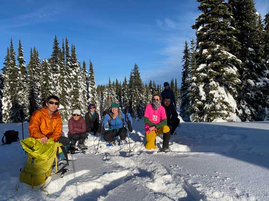
Our group shot on Mt. Kelly. This was my second time here

Virgin snow on Mt. Kelly
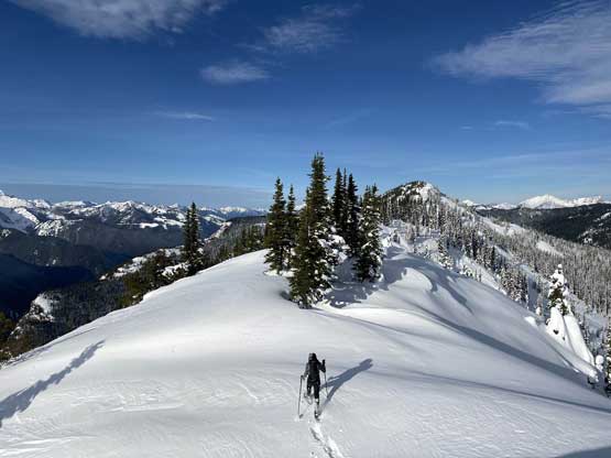
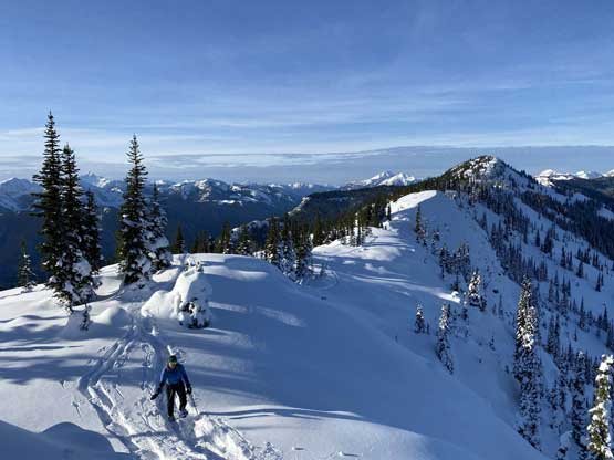
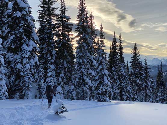
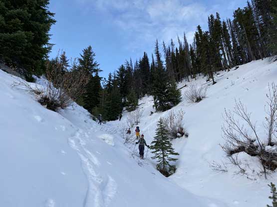
After taking some obligatory “victory” shots we followed the tracks traversing to the true summit of Mt. Kelly and then descended ~50 meters to the first saddle. The tracks still continued towards the direction we wanted so we took advantage of that. The tracks led us traversing around two bumps on the ridge. Somewhere in this stage the snowshoe tracks stopped but the skin tracks still continued. We plodded on the skin tracks to rejoin the ridge after bypassing the second bump but anther 1-2 km later the skin tracks also stopped. At this point we were about halfway between Mt. Kelly and Nordheim Peak and we had to break our own trail for the rest of the ascent. The ridge was exactly as expected, wide and mellow but with a shit ton of up-and-downs…

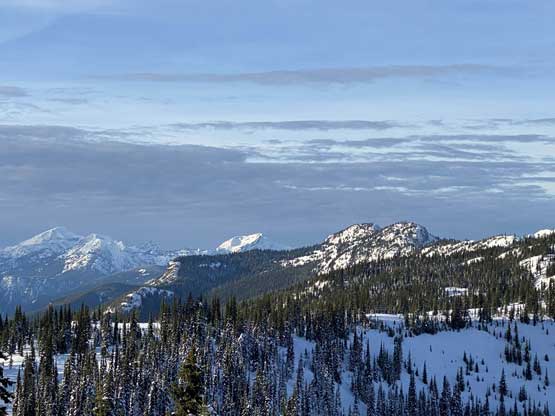
Our first unobstructed view of Hozomeen Mountain

The tracks continued well past Mt. Kelly for us to use

Winnie leading the way
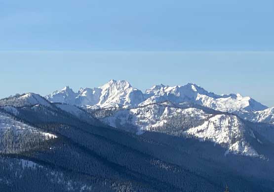
The group of “Chilliwack Bulgers” – Mt. Spickard, Mt. Custer etc.
Looking back at one of the first few bumps
Rejoining the ridge here
As typical as it seemed…

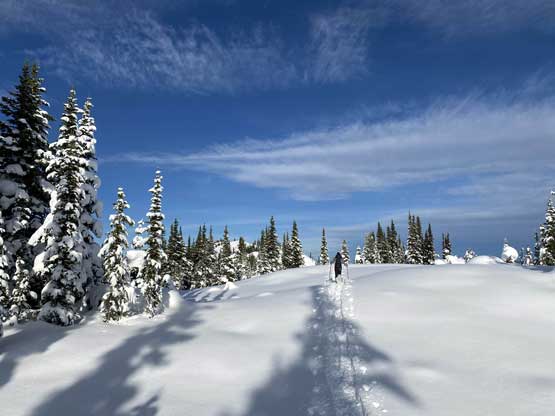
Winnie breaking trail on the fresh power now
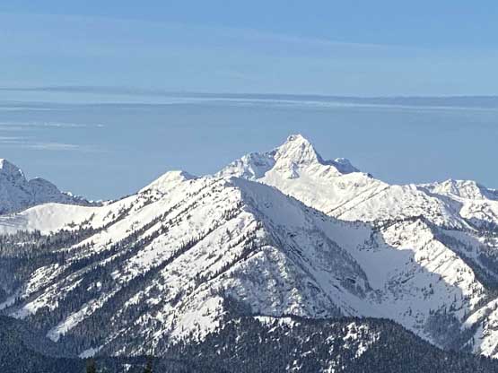
A zoomed-in view towards Silvertip Mountain

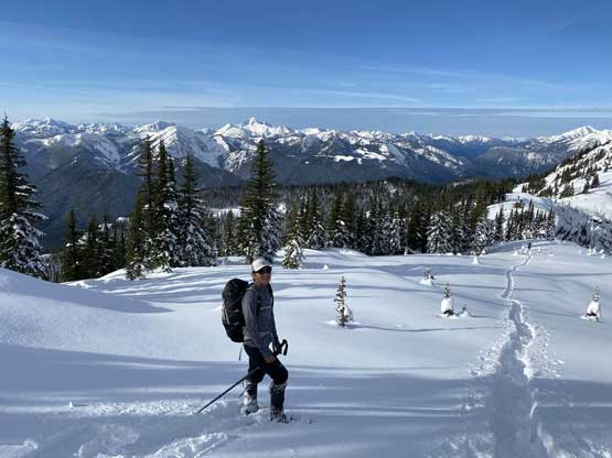
Looking back at Alana, Katie and Sean coming up

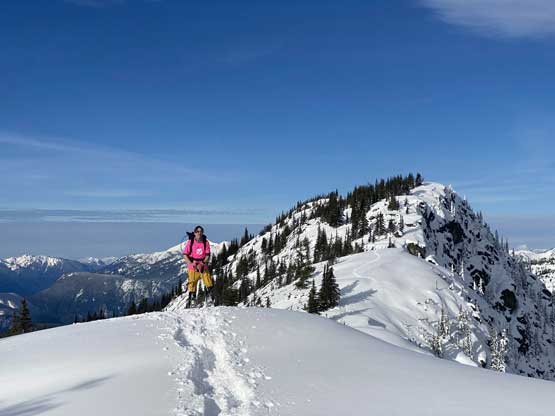
Winnie posing for a photo..
More about Winnie breaking trail ahead.
After a couple more kilometers of hard work I needed to stop and eat some food at the saddle just before the false (east) summit of Nordheim Peak. This turned out to be a decent spot to take a break as we still had fair amount of distance to cover. The view looking ahead was a bit foreshortened. Meanwhile Katie, Alana and Sean took over the trail-breaking duty. The ascent onto the east summit took a while and the traverse to the true (west) summit was also longer than expected with a substantial elevation drop in between. Our ascent time was just under 4 hours. We did not push the speed on the way up Mt. Kelly but we all worked pretty hard traversing this ridge to Nordheim Peak. The summit was nice and calm so we lingered for over an hour soaking in the views.

Al coming up

Ilia descending the false summit into the last saddle
Winnie descending the false summit
Al posing in front of the true summit
Portrait mode for Al…
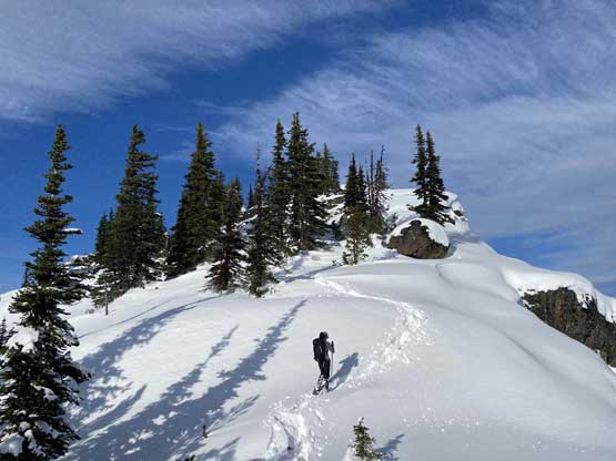
Winnie approaching the summit of Nordheim Peak

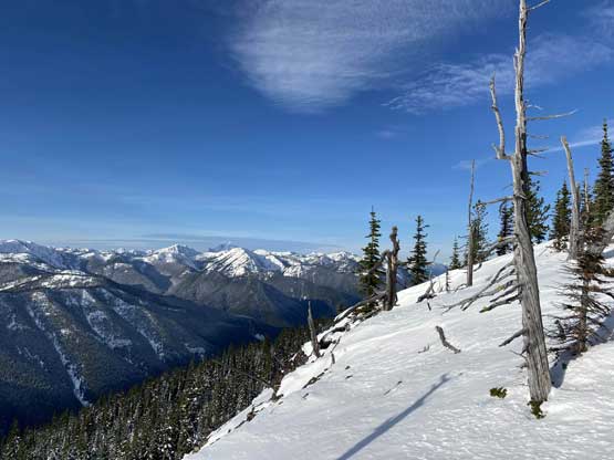
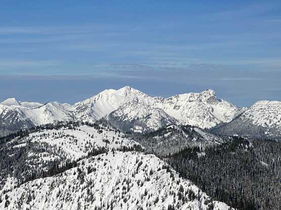
Partial Summit Panorama from Nordheim Peak. Click to view large size.
Snass Mountain and Snazzy Peak

Mt. Outram to the west
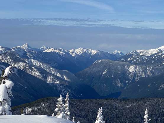
This is looking down the valley that Highway 3 travels through

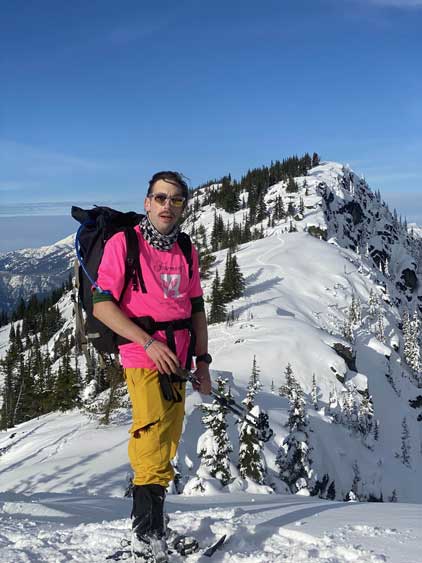
Me on the summit of Nordheim Peak

Our group shot on the summit of Nordheim Peak
There’s not a ton worth noting about the long plod back to Mt. Kelly other than we all zoomed pretty fast. I ran out of gas while traversing the second-to-last bump and needed to take a additional food break. Once back to Mt. Kelly we decided to short-cut the Telecom road switchbacks by descending a steep gully on the south side. I had skied this gully on my previous trip Mt. Kelly so I knew it’s not too bushy. The descent was steep and involved fair amount of side-hilling and a bit of bushwhacking, but still fun and efficient. Our round trip time was just under 8 hours and that included the hour-long summit stay.

Plodding back towards the false summit
Skiers for the first descent?

Katie plodding back up the false summit

The typical slog…

Al and Sean plodding…
Three Brothers Mountain to the north
Alana slogging back up another bump on the ridge

Winnie descending another bump
As typical as it seemed like…
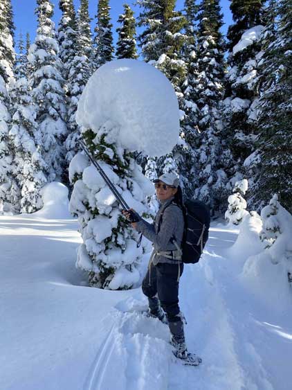
Winnie trying to dislodge this tree bomb

Our snowshoe tracks were huge…

A mandatory dick-on-snow art…
Looking back towards the summit (right of center)
Winnie descending Mt. Kelly now

Plodding down the upper slopes of Mt. Kelly
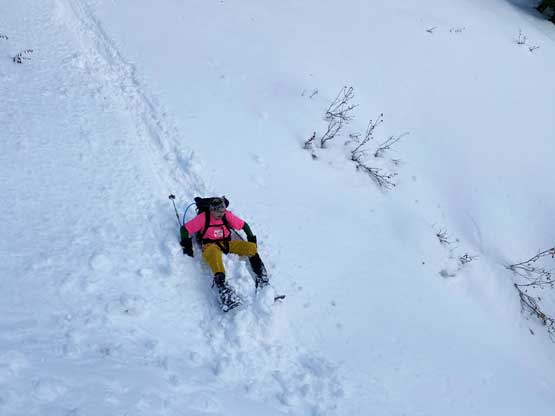
Al taking a short-cut

Our massive short-cut down this gully
The typical conditions in this gully…
We all lingered for an hour at the trail-head before resuming our own ways back home. The drive back home was pretty exhausting thank to the lack of sleep. I needed to take a few breaks but the dinner of Donair in Abbotsford was great. Overall this was a fun trip with great company and good views. The plodding was a bit monotonous but I would still recommend this snowshoe hike to fit parties.
Make sure to check Al’s video on Youtube…
