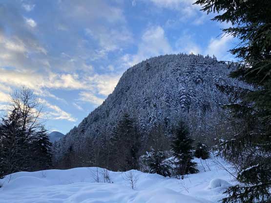
Mount Coulter
March 1, 2020
2006m
Hope / Sunshine Valley, BC
Mt. Coulter locates on the south side of Highway 3 directly across from Hope Slide on Johnson Peak, a few kilometers west of Sunshine Valley in Ferguson Creek drainage. This peak is very obscured and rarely climbed despite its proximity to the highway, for several obvious factors. The peak it guarded by steep forest on all sides and there’s no “trail” whatsoever to facilitate an approach. Having climbed the peak I can say with confidence that this forest is one of the steepest and the most sustained among the hundreds of ascents that I did on snowshoes. The summit itself is rather dull and significantly lower in elevation comparing to some of the more “classic” ascents nearby such as Mt. Grant and Mt. Outram, that nobody gives a damn care about Mt. Coulter except for the stubborn peak-baggers that are keen to explore lesser-known summits. In the past decade, there are probably no more than a handful ascents published on the internet. I remembered reading Simon’s trip in May 2017 and that’s pretty much the only beta I was aware of.
I had thought about repeating Simon’s route for several years but this was not a peak high on my radar so I never ended up doing it. This was no longer the case until I suddenly saw a text from Alan Blair that “trail up Mt. Coulter was broken” and that was on last Friday. I instantly made my plan for Sunday. There had been several ideas for this Sunday but with the tracks on Mt. Coulter already set the decision was an easy one. A few hours later I managed to convince Mel and Vlad to join even though I wasn’t expecting them to come. Both Mel and Vlad like to tag “big and aesthetic peaks” and Mt. Coulter is neither “big” nor “aesthetic”, not even close… For the next day I refreshed the weather forecast and avalanche reports a dozen times as I wanted to make sure that our objective was still safe. The peak had likely seen over 20 cm of fresh snow at Friday night through Saturday and the avalanche rating had increased to “Considerable” at the last minute. Thankfully the main problem was mostly limited to wind slabs, something that we could sort of manage by careful terrain reading. At 5 am Mel and Vlad showed up at my home in White Rock and by 7:30 ish I had parked my truck at the start of Ferguson Creek FSR in front of the Sunshine Valley’s waste dump and treatment. The treatment plant was gated with big signs of “no trespassing” so I just parked outside the gate. It looked a bit iffy to just leave the truck there and besides that, there were only two spots that I could park without blocking the road.
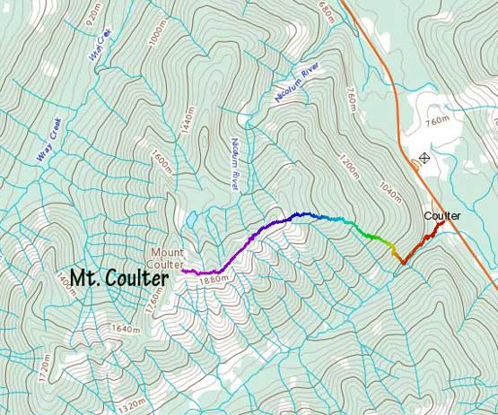
Mt. Coulter from Ferguson Creek. GPX DL
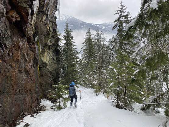
The morning was cold so we spent as little time as possible to do the trail-head transition. We then hopped over the gate and walked to the end of pavement while carrying snowshoes on our hands. We instantly located Al and Katie’s tracks, strapped the snowshoes on and into the woods we went. The tracks were covered by at least 10 cm of fresh snow even at the parking lot elevation (750 m) and we wondered how bad the condition would be up high at 2000 m… The start of the very deactivated Ferguson Creek Road was confusing judging by the meandering tracks made by Al and Katie. They simply didn’t manage to find the road’s entrance and started bushwhacking right off the bat. We followed the tracks and entered the bush as well, but a while later we did join the old road. The road was still in a walkable shape and the next 300 horizontal meters was a cruise sailing. We snowshoed passed some overhanging cliffs following the partially covered, but still visible set of snowshoe tracks as well as the GPS track given by Al.

A view of Hope Slide from the parking at Sunshine Valley waste dump
The lower end of Mt. Potter’s NW Ridge.
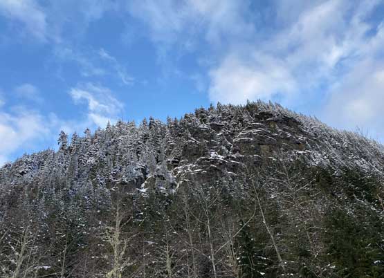
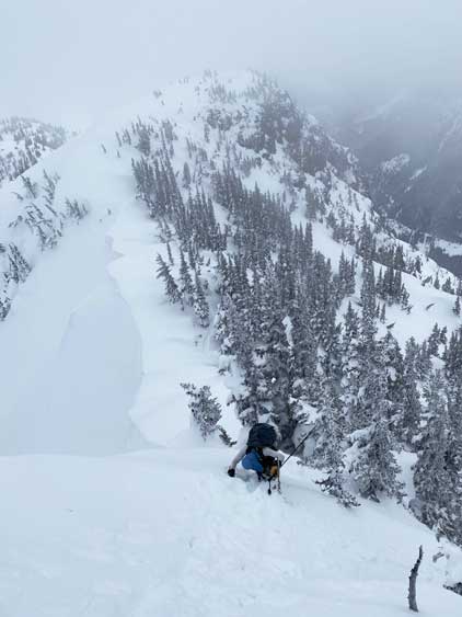
The lower end of Mt. Coulter’s east ridge is almost vertical…

The bushwhack started right off the bat…

After a while we merged onto this deactivated logging road

Looks like maybe some ice climbing oppourtunity…

Continuing down Ferguson Creek FSR
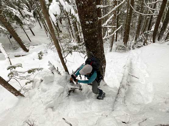
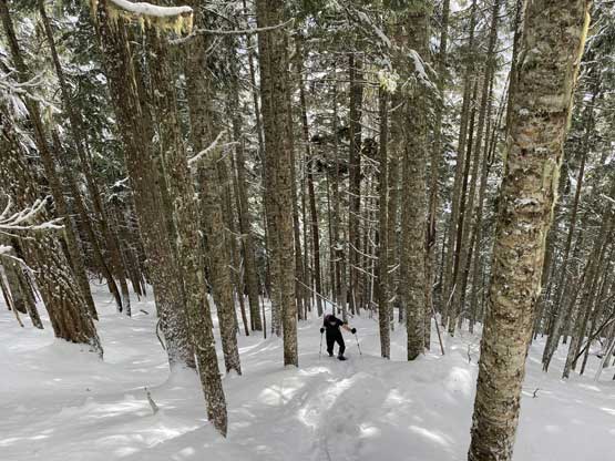
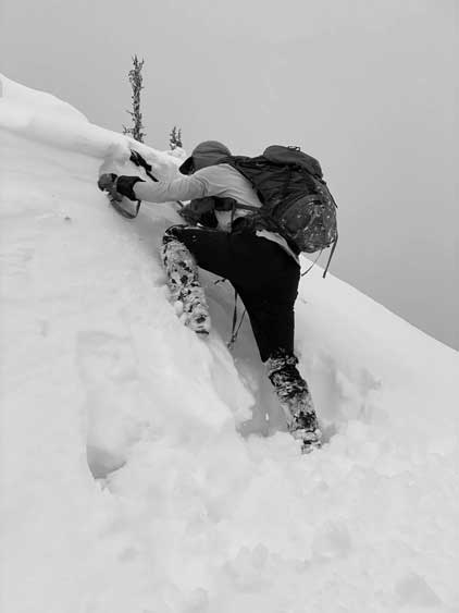
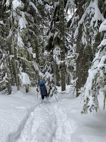
It seemed like Al and Katie opted to bail the road into the forest at the exact same spot as Simon’s trip report suggested. We followed the tracks up the edge of a landslide path, and then traversed some steep dirt (with snowshoes on) to get into the forest. The going became a steep grunt in absolutely no time, as we found ourselves trudging up the 40-45 degree forest with some light bushwhacking and a lot of annoying side-hill traversing. I invented the term “technical snowshoeing” for this type of terrain. The snow was too soft for boot-packing, but to keep snowshoes on one needs the best gears along with years of experience. My Lightning Ascents could tackle firm, 40-degree slope with the right techniques. I thought the worst would come to an end soon but I was wrong. The same type of terrain lasted for more than 500 vertical meters, until at around 1300-1400 m where the grade finally eased off to 30 degrees ish (yes, it’s still steep)… The challenge gradually shifted from the steepness to the increasing duty of trail-breaking. At this elevation there was at least 20 cm of fresh snow and we had to break trail on top of Al’s tracks, and the going was tough.

We left the road and snowshoed on the edge of a landslide path
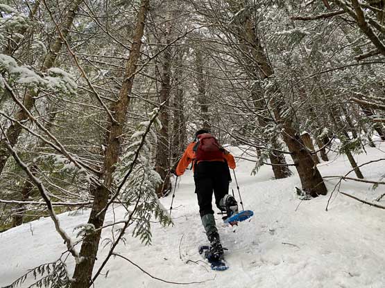
Vlad in the mature forest with his brand new Lightning Ascents

Mel demonstrates what I meant by “technical snowshoeing”…
Just a microscopic section of the whole bottom 500 m

The grade eased off. Mel in charge breaking trail
Vlad following up.
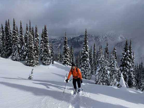
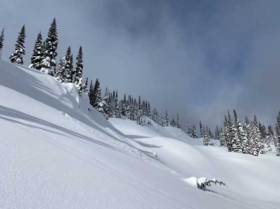
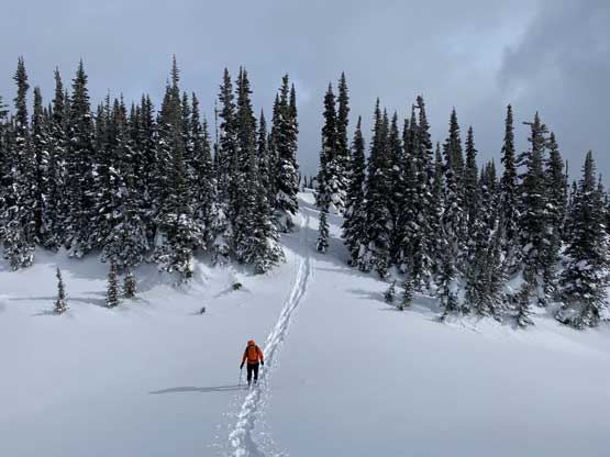
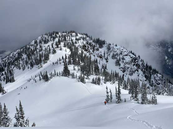
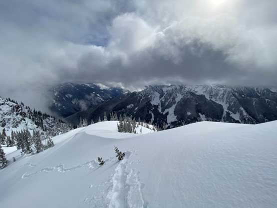
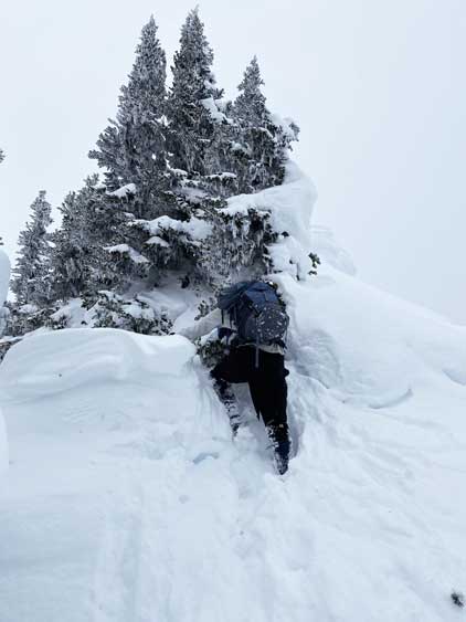
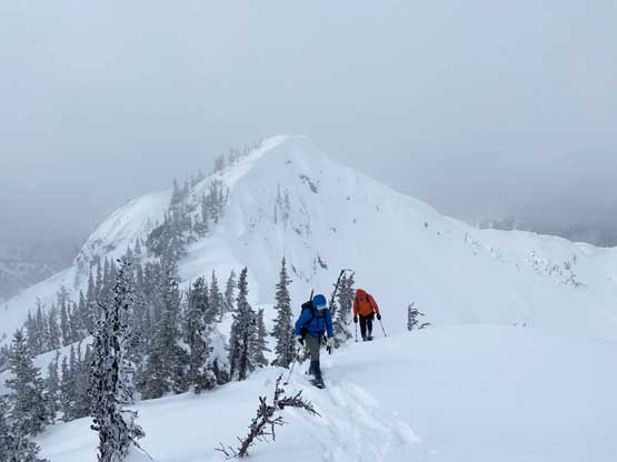
Another hour later we were in the treeline zone, breaking trail in heavy powder with no sign of Al’s tracks anymore. The weather was garbage compared to what the forecast promised. It was 100% overcast with intermittent white-outs. To reach the first of the several false summit we traversed across an undulating sections and then ascended the first steep slope, 35 degrees or more. Mel had a lot of energy and led us all the way through this treeline zone past the first false summit and down to the next saddle. The descent involved at least 30 m of annoying elevation loss. The next summit appeared dauntingly steep and exposed with cliffs on both sides. It turned out not as bad as appeared but still, more than 35 degrees and an avalanche on that final slope could have big consequences. Thankfully we only found wind slabs on the lower half of the grunt.
Arriving at the treeline zone.
We had no more than 5 min of sunshine in total on this day
The long and broad ridge had endless up-and-downs
Mel charging up the first steep slope

Mel continuing leading the second steep slope towards the first false summit

The north and west side had moody views the whole day
Knee deep post-holing in the fresh powder… Mel is still charging

Mt. Potter across Ferguson Creek would be another top quality sufferfest
Vlad and a false summit behind
Our tracks and the very limited views and sunshine

Vlad following up the second steep slope

Ahead would be the steepest roll, towards the second false summit
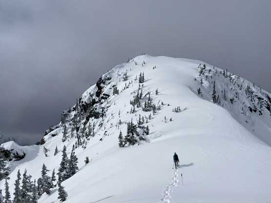
Mel starting up the second false summit

Above the roll now looking down at Mel and Vlad
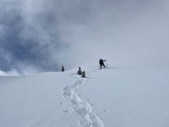
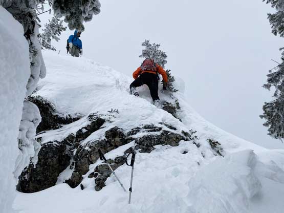
The next highpoint would be the true summit and the ascent wasn’t easy neither. First we had to lose another 20 m down to the saddle and the going soon became interesting. The ridge narrowed down with steep trees on climber’s left and massive cornices on climber’s right. It wasn’t very obvious to see the edge of these cornices so we opted to weave around in the trees. From the saddle onward I led the first steep step while keeping the snowshoes on, and then made the call to ditch the ‘shoes to swap for ice axe. The second step involved some trenching and hauling and then I veered slightly climber’s left to access that “vertical step” mentioned by Al. The crux step was surely steep, but I could grab some veges and the ice axe planted in nicely. Above the step we had one short, but 45 degree snow slope to ascend and then we topped out on the summit, with very limited views thank to the clouds.
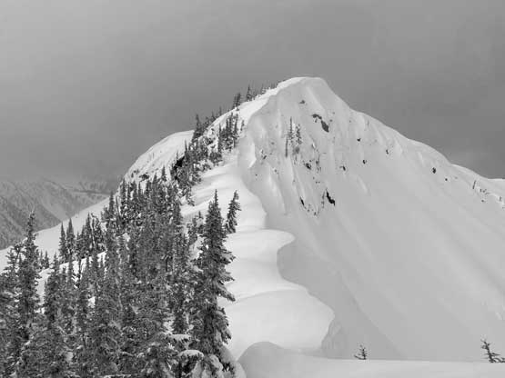
The summit ridge and the true summit ahead
Me technical-snowshoeing on the edge of cornices…
Me starting the boot-packing… It was steep…
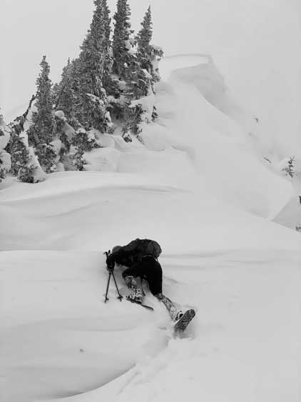
Me trenching a tunnel to access the vege belays
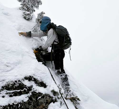
Me at the crux step…

Mel and Vlad climbing up the crux
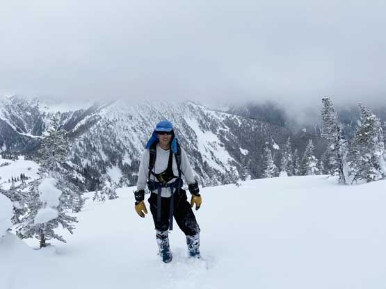
Me on the summit of Mt. Coulter
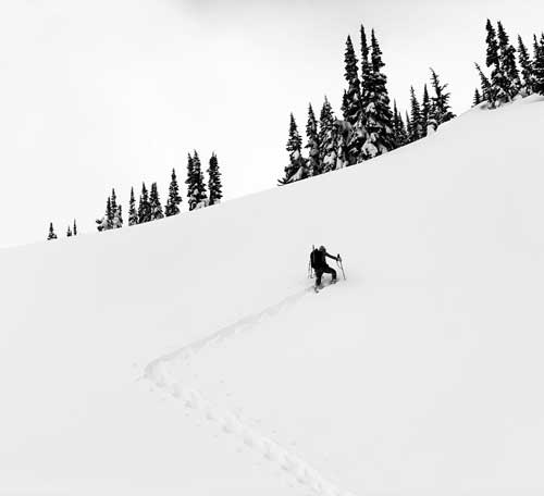
We reasoned that the chance of clearing is zero so didn’t even bother to drop our backpacks. We immediately, but carefully down-climbed the ridge and then took a long break at our snowshoes. The snowshoes were strapped on and we had a trouble-free descent back across the false summits and then down into the woods. The snowshoeing was fun with the foot-deep powder, but not so much anymore once the powder ran out and the grade picked up. We kept our snowshoes on and practised that “technical snowshoeing” all the way down to within 500 vertical meters from the road. We then removed the snowshoes and post-holed and slipped like being drunk. It appeared that Al and Katie went for some glissading but such was impossible for us because the snow stayed frozen solid the whole day. Their glissade tracks were particularly icy, that we actually had to avoid them. The snow was however, not entirely supportive for boot-packing and we often discovered holes up to our waist. Needless to say it was such a shit show, but we were all experienced in this type of shit, so still managed to descend in a timely manner. Once dropping down to the road we strapped the ‘shoes on and easily reversed our tracks back to the truck. It also appeared that Al and Katie went down a different route near the end, maybe to find where actually that Ferguson Creek FSR started. However, at this point we just said “fuck it” and retraced our own snowshoe tracks for simplicity and less mental work.
Me down-climbing above the crux.
Vlad down-climbing the crux
Mel and Vlad back on the second false summit

Vlad plunging down the steepest slopes on the ridge
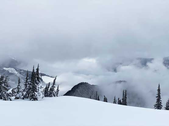
Quite some unique views with the low clouds

Me plodding back across the long and undulating ridge

Sunshine Valley where Highway 3 travels through

An unusual view of Hope Slide
Me plunging into the forest

An idea of the shit show in the lower forest

Vlad trying to maintain balance while I down-climbed facing in sometimes

Finally down to the road and time to put snowshoes back on
Me plodding down the road. Almost done…
Our round trip time was 6 hours 50 minutes thank to Al and Katie’s work. The weather fully collapsed once we got back to the truck and it rained pretty hard as we entered the Lower Mainland an hour and half later. Our experience on Mt. Coulter confirmed its “rarely ascended” status. It’s not a fun peak, not at all… However, with good company it’s still a great trip and I actually enjoyed it.
