Mount Fisher
August 17, 2014
2846m
Cranbrook, BC
Not to be confused with the Kane’s scramble – Fisher Peak in Kananaskis, this horn shaped peak is located in Cranbrook area in the southwest corner of Canadian Rockies. Though not very high in elevation by Rockies’ standard, it towers above adjacent peaks by 300 m and is the landmark of Cranbrook area. To reach its summit is a popular scramble for the locals, but for folks like myself, the length of the drive combined with the lack of technical challenge has deterred me from planning this trip. But on the other hand, the lack of technical challenge means it can be done in less than perfect weather, so in this past weekend, with gloomy weather forecast Kevin Barton and I figured it’s eventually the time to tick this one off our list.
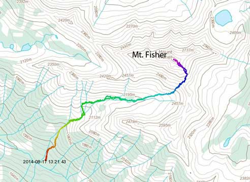
Mt. Fisher scramble route. GPX DL
Our plan was driving to Kevin’s house at Fairmont in the previous evening, wake up early and hopefully get up and down the mountain before afternoon thunderstorms come. We left Calgary by almost 9 pm on Saturday and made to Fairmont by midnight. Kevin’s house was a luxury place compared to my car and I got a few hours’ nice sleep. We woke up by 4 am. The drive from Fairmont to the trail-head was surprisingly long and complicated, especially the last bit on Maus Creek Road. There was a not-so-obvious sign indicating leaving the main road but we missed it and ended up driving into someone’s farm. We wasted about half an hour searching around and eventually figured out the problem. So we backtracked and found the turn-off, but the road soon got ridiculously rough. This is a road you definitely want to have a high clearance 4×4 and Kevin did an excellent job getting us to the trail-head. This road brought us high above the floor of Columbia Valley.
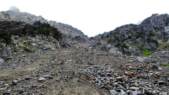
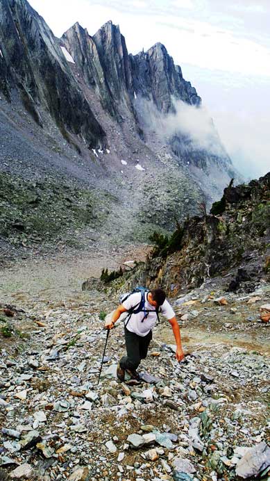
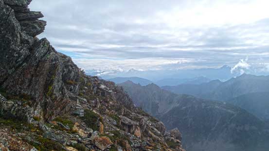
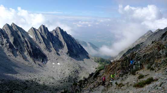
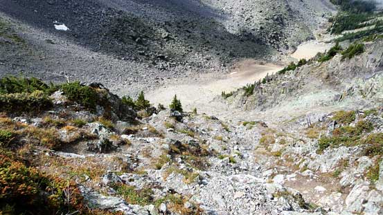
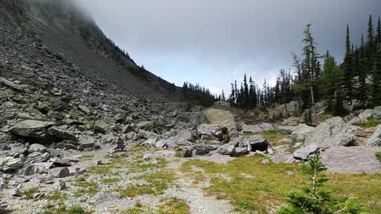
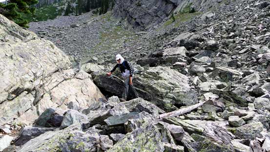
Despite the rough road, the trail was in an excellent shape. Except for a few boulder fields we had no problem following it from the parking lot to where scrambling started. The initial part was grinding steeply up the forest. Unlike the trail on Mount Nelson, this one had some switchbacks and the forested section was not nearly as long. We quickly made to what’s often called lower bowl. From this bowl the trail ascended the left side of the headwall before reaching the upper bowl. We lost the trail briefly on a boulder field but quickly corrected ourselves. There was an excellent camping spot in the upper bowl for folks planning to ascend this peak over 2 days. Passing this camp site we entered another field of boulders. On the opposite side of this boulder field we picked up the trail/path again. It led us to the base of a steep gully that would eventually bring us to a col high on the mountain. The gully was not as steep as it looked and there were multiple paths leading the way. We generally could stay on firm ground so rock fall was not a huge concern neither. But the gully was foreshortened as usual, so it took us quite a while to crest the col. Form the col we got an excellent view towards the other side including The Steeples – a group of peaks towards south.
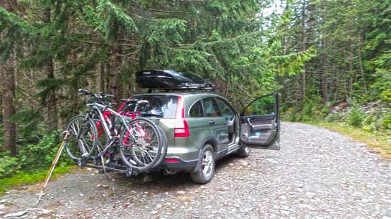
Kevin did a great job driving to the parking lot..
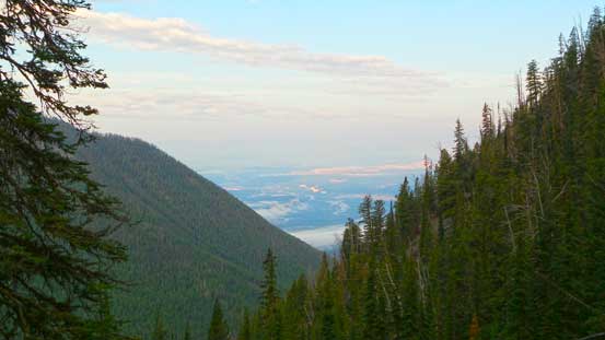
After gaining steeply up the forecast for a while, we could see the Columbia Valley down below
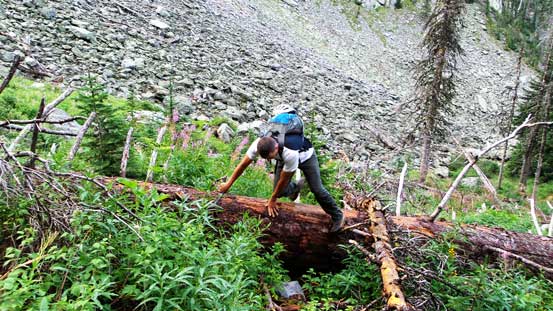
We got off-route briefly but managed to correct ourselves

Trail goes up climber’s left of the head-wall
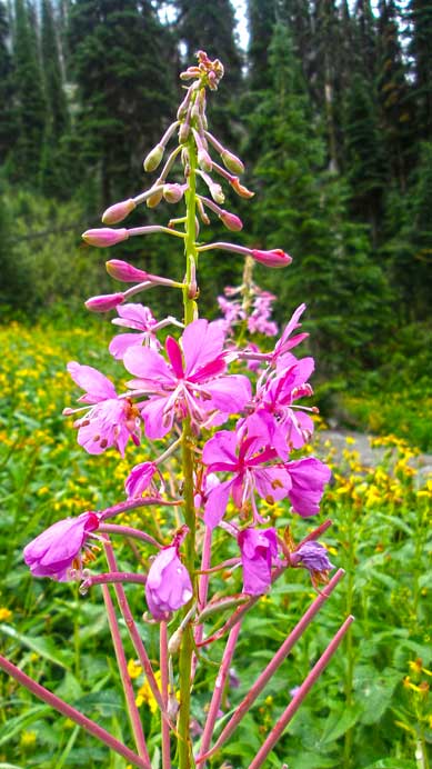
Fire weeds all over the places

Flowers
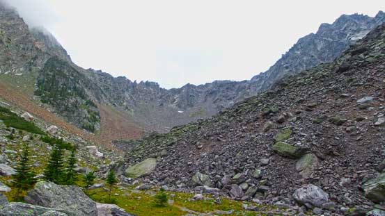
The upper bowl. the steep gully leads climber’s left of the col

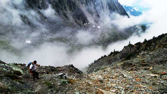
Clouds were rolling in and out
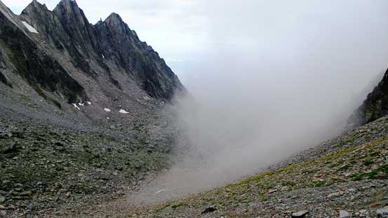
This bowl traps clouds
Looking up the steep gully
Kevin grinding up this gully
Neat clouds
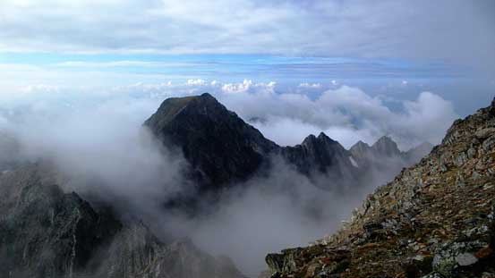
At the col, looking towards the other side – my first time seeing these peaks
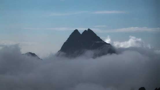
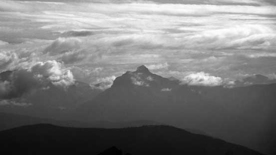
The Steeples poking through the clouds, looking south
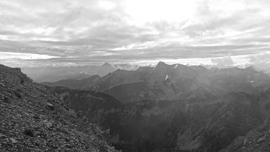
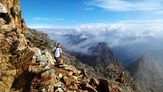
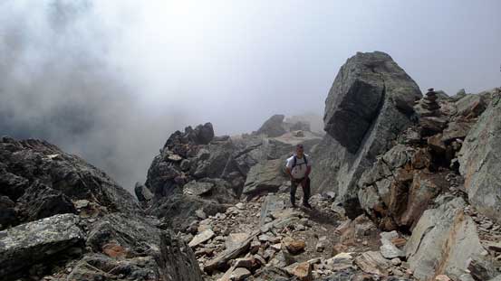
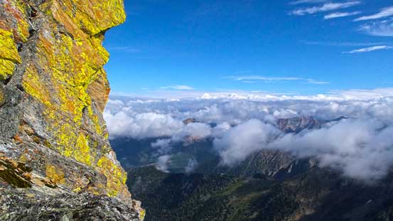
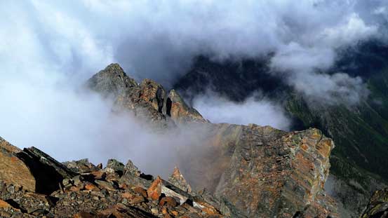
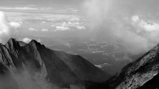
The route now turns leftwards up steeply towards the summit. Just as below, we were able to follow paths and markers and it’s hard to get lost. Higher up the terrain became bouldary and some brief route-finding was required. It’s mostly class 2 terrain but there’s a short class 4 step near the summit. At the crux we noticed a bolt with an ancient ring hanging on it and some crampon marks on the rocks – someone must have rappelled off this section in bad condition. Shortly after that we arrived at the summit, 3 hours after leaving the parking lot, and to our surprise we broke through the cloud layer. We couldn’t see many other peaks though but we did stand above the clouds with sunshine on our faces – something we did not expect for this trip at all.
Took in some views before clouds rolling in
I think it’s Mt. Washburn to the west, but not 100% sure
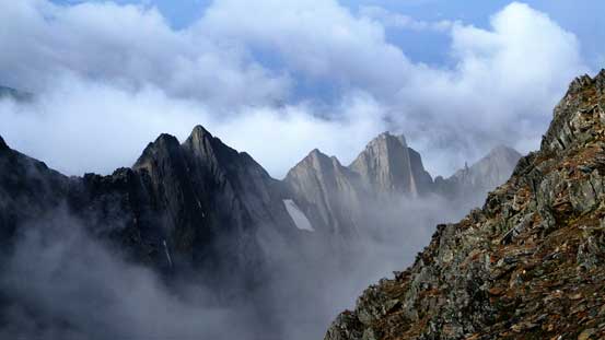
Cool looking peaks, all unnamed
The Steeples
Another unnamed peak just to the south of Fisher

Looking up the ascent slope

Kevin on the ascent
Beautiful views behind

The last bit, we entered the mist again
Kevin on his way up
Cool colours on the rocks

Kevin climbing up the last few steps
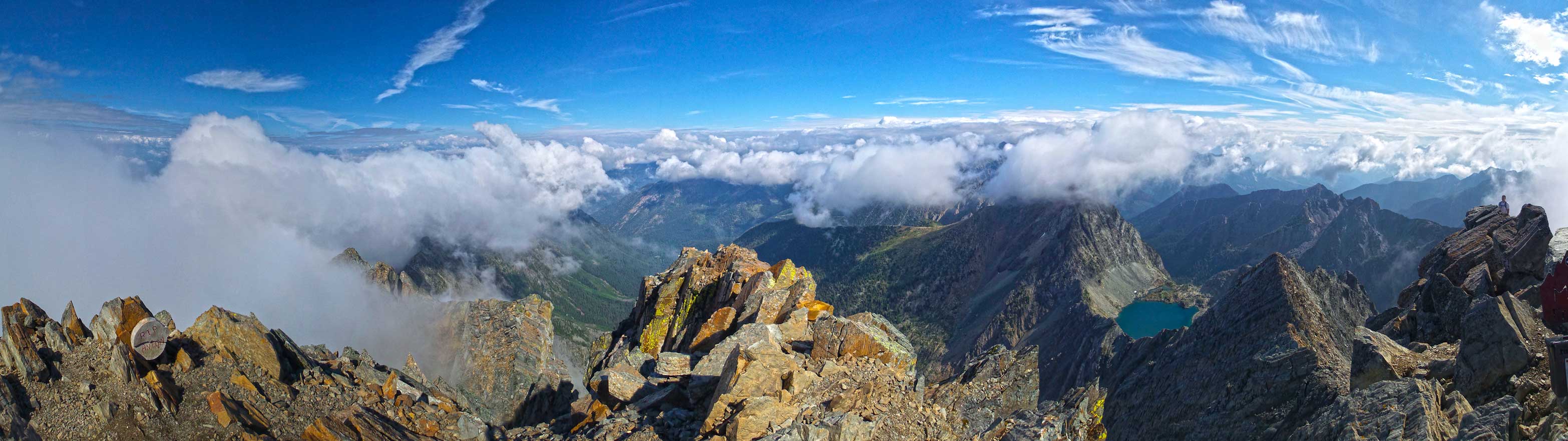
Summit Panorama. Click to view large size.
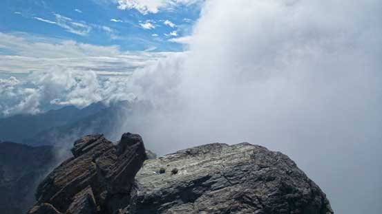
Clouds rolling in and out from the west
Cool clouds
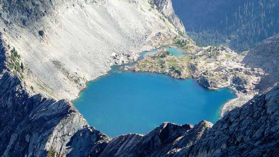
A neat lake on the west side
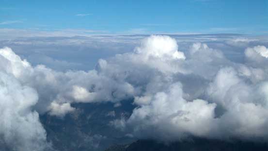
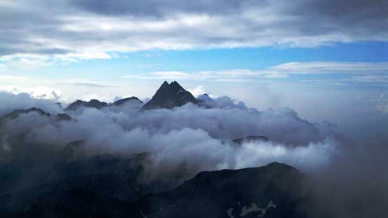
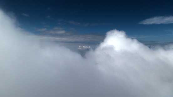
We couldn’t see even one peak, but a sea of clouds is pretty nice too.

Another ocean of clouds
Neat views created by the clouds
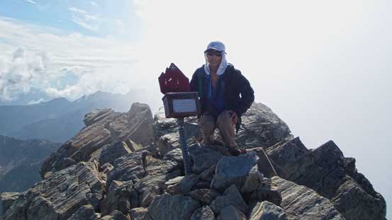
Me on the summit
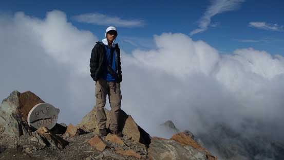
Me on the summit again
After a lengthy break on the summit we started the descent as clouds rolling in creating temporary grey-out condition. The route was straightforward to navigate down and we lost elevation in no time. In short period we were down most of the face/ridge and noticed more people coming up. After wishing them good-luck we continued the descent. Down the gully was easy as we managed to stay on loose ground. Back to the trail, the rest of the way back was steep, but went by fast. Our round trip time was about 6 hours.
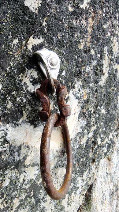
A new bolt with ancient rings… Interesting
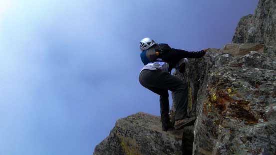
Kevin down-climbing the crux step
A view of Cranbrook area from the descent
Another group of scramblers on their way up
Descending the gully
Back to the upper bowl. This is a nice camping spot
Negotiating a boulder field
The rest of the way back home was not as fun though. I did enjoy the part from Fort Steele (Cranbrook) to Invermere as I never even been to this area before, but other than that it was a long haul – I’m slowly pushing the limit of what can be day-tripped from Edmonton… Back into Alberta we noticed the forecasted rain didn’t quite fall so we could have succeeded on more challenging objectives. But given the forecast (cloudy with 40% of shower with risks of thunderstorms) we just couldn’t plan technical ascents. In any case, both Kevin and I had been wishing to ascend Mount Fisher for a while already and we felt happy to have it successfully bagged on this day.

Enjoyed your post as we will be up from the states next week to do this hike.
Nice post, great pics.