Escalante Butte
March 10, 2017
1992m
Grand Canyon National Park, AZ
The weather forecast was downright dreary for our local SW BC and at the same time, avalanche problems had culminated to “historical” across the entire western Canada making me to thick twice about my vacation in the spring break. A quick search about the weather in Phoenix saw me locking my plan almost spontaneously. The idea originated from tagging two of the state highpoints down that way – Humphreys Peak for Arizona and Guadalupe Peak for Texas, but since I was there anyway I had to check out the world class Grand Canyon. Little did I know how this trip would turn out exactly but having wifi access for pretty much everywhere anywhere I’d let the story to unfold itself one day at a time. Including the driving I had about 18 days and given the vast amount of peak-bagging opportunities in the States I was confident that something’s gonna work out, one way or another.
I also thought about taking a flight and renting a car but given the two-week time frame it’s actually cheaper to drive. But it’s actually the lack of flexibility that made me abandon the idea of air travel. I really hate to have a “schedule” to follow and especially not a fan of paper work of any kind, so unless it’s an absolute must I’d go for an alternative. Driving would be around 8000 km round trip but “long drive” has never been an issue for me and I consider the road trip as part of the adventure anyway. Leaving home at about 11:30 pm on Wednesday night I made some quick work down south across the border, down I-5 to Everett, I-405 to Bellevue and then I-90 up and over Snoqualmie Pass. The condition was terrible and many cars were parked thank to the heavy snowfall, but I made through nonetheless in my new Toyota Corolla without winter tires nor tire chains. The snow had finally stopped once I got far into the lee side of the Cascades and at about 30 miles pass Ellesburg, WA, I decided to take the first nap.
A couple hours later I woke up and although tired, I had to keep going. The Waze app in my iPhone led me down south-east along I-82 and then SR 221 into the state of Oregon. Then onto I-84 I drove through the cities of Pendleton, La Grande, Baker City and then Ontario, OR into the state of Idaho. There were a couple mountain passes to drive up and over and thankfully I did not have to deal with snow anymore. The most boring part of this road trip was actually the stretch across Idaho. There’s nothing to see from Caldwell to Twin Falls, ID, but the upside was that 80 mph speed limit. Time flee by fast and darkness started to fall once I passed the small town of Tremonton into the state of Utah. Driving all the way through the urban gong show of Salt Lake City wasn’t too bad in the evening hours but this section felt like a long stretch given the size of that city.. I took a short dinner stop in one of the Subways in Provo, UT and then resumed the drive down south onto I-15. More than 200 km later I exited onto SR 20 which was narrow, winding and unprotected from the wildlife. After seeing at least 5 groups of different animals I decided to pull over at the junction with US-89. And that concluded this productive 23-hour Day 1 of the trip.
A couple hours later I woke up again and it was still pitch dark. I could not fall asleep anymore as I was really excited about seeing the Grand Canyon, so resumed the drive down south to Kanab, UT. I took a nap somewhere there as I was getting tired really fast. Then eastwards into the state of Arizona I took a couple tourism stops but thank to the lack of research I was completely not aware of the infamous Horseshoe Canyon so missed it out. The section from Page, AZ to Cameron, AZ felt like forever but once onto SR 64 westwards towards the Grand Canyon South Rim my motivation got a second boost. Eventually by about 2 pm on Friday I finally parked at Lipan Point.
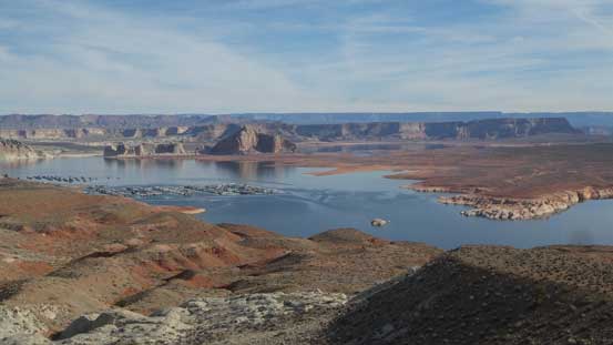
Lake Powell from a lookout just after crossing the state border into Arizona

This is Glen River Gorge

A side detour to check out Little Colorado River canyon which is well worth the spent
Regarding the objectives on this day, the traverse of Escalante Butte to Cardenas Butte is a fun scramble but not very often done at least according to the registers. They both see about a dozen visits per year and consider the popularity of Grand Canyon this is certainly off the beaten path. For some obvious reasons the peak-bagging in Grand Canyon has not taken off yet and you really have to dig down on the internet to find information about anything. The access of these two buttes is via Tanner Trail from Lipan Point and comparing to the congested Bright Angel / South Kaibab trails this is also on the quiet side of the rim.
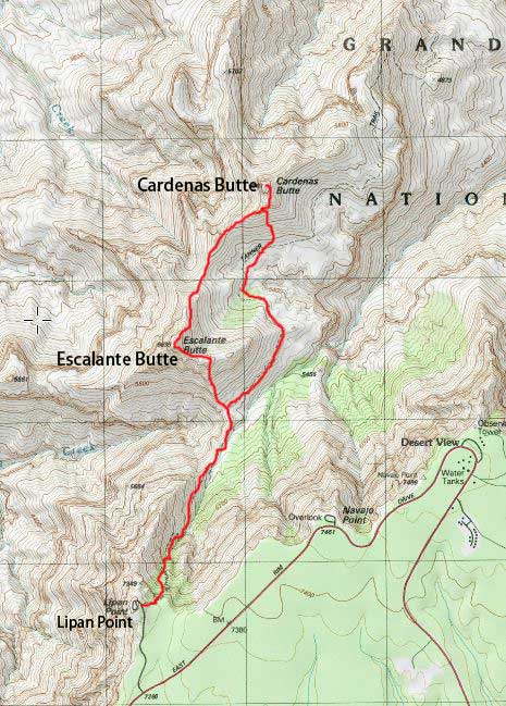
Scramble routes for Escalante and Cardenas Buttes. GPX DL
Of course the ascent started from the tourism thing at Lipan Point. This was my first ever time seeing the Grand Canyon and I have to say it should be on the bucket list for at least once in lifetime for everybody who’s into nature. Having two peaks to do I did not linger long at this crowded place, so once locating the trail-head for Tanner Trail I made some quick work down into the switchbacks. Right off the bat I encountered patches of snow and ice. I did bring my brand new microspikes for this trip but forgot them in the car, but got down the treacherous part fairly fluently nonetheless. As I dropped elevation the snow/ice disappeared and then it’s a pleasant hike down to the Tanner Saddle, although with more than 300 m elevation loss I wasn’t quite looking forward to a couple hours later…

First view from Lipan Point
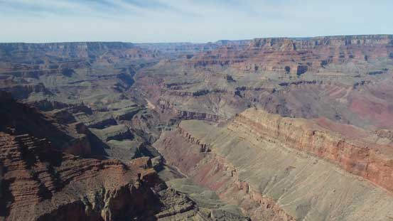
Grand Canyon from Lipan Point. That view was expansive
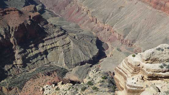
A zoomed-in shot of one of the tributaries going down into Colorado River
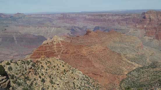
In foreground – Escalante Butte which is the white-capped and Cardenas Butte behind
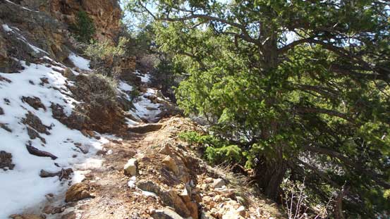
The upper stretch of Tanner Trail is very shaded, and hence, icy…
More about descending the upper stretch of Tanner Trail
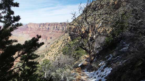
Down, down and down, for more than 300-400 vertical meters…
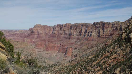
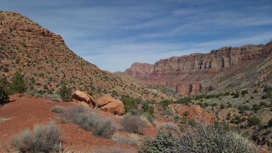
Looking at Comanche Point and Palisades of the Desert.
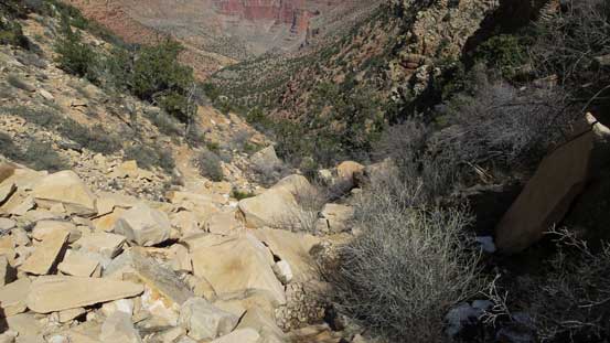
Still going down…
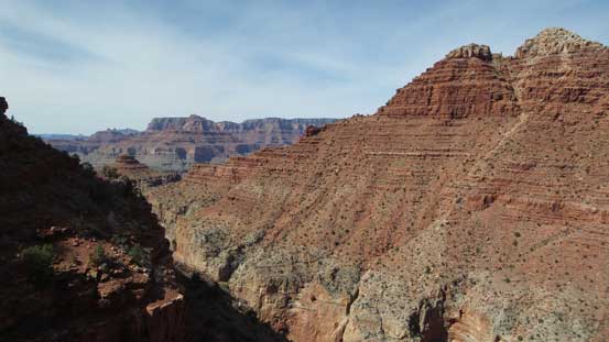
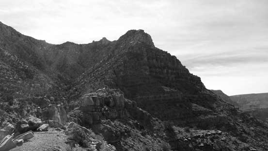
Looking sideways across Escalante Butte. The summit is on the top right corner
Almost down to the saddle now.
One more picture of this section of Tanner Trail.
Looking back at Lipan Point and it shows the grunt a couple hours later…
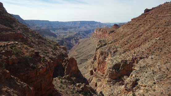
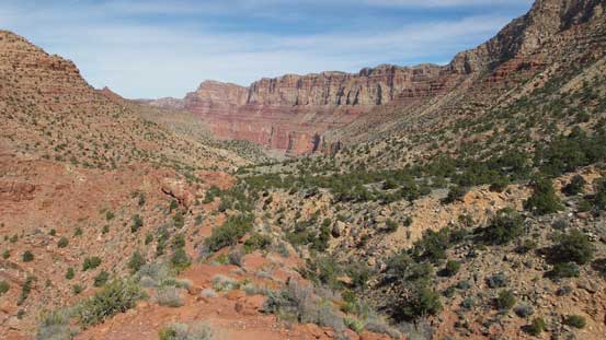
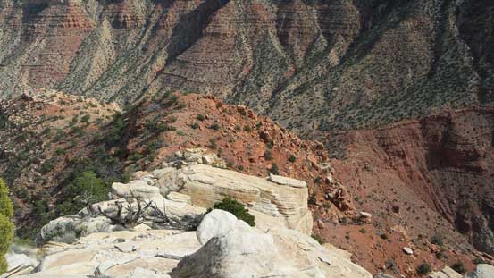
Looking down the Seventyfive Mile Creek drainage into Colorado River
At the saddle I took a very needed break as I was really not feeling well, partially because of the lack of sleep and partially due to the dry climate. As I started going up the broad south flanks of Escalante Butte I could not pick up any rhythm and my pace was probably only half of my “normal”. I had to take a couple additional breaks along the way but overall this wasn’t a long ascent so my progress was still fine. Eventually I crested the broad east ridge and followed it trending westwards and it’s here that the geology transitioned from the red blocks of Supai sandstone into the white Coconino sandstone. Upwards and onwards into the white blocks the boulders had suddenly become huge. It’s mostly a class 2 scramble to the false summit with a few class 3 sections if not on purposely selecting the easiest line, but once there I found there’s actually a sting in the tail.

Looking up at Escalante Butte from the Tanner Saddle.
One more view looking towards Comanche Point far to the north-east
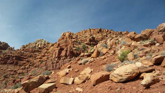
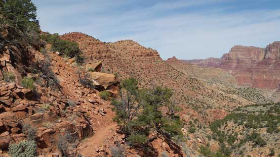
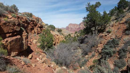
The typical terrain going up the broad south flanks of Escalante Butte

Looking down..
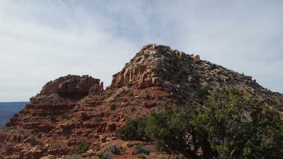
Cresting the broad east ridge now, looking ahead
This shot clearly shows the transition of rocks from red to white.
The boulders are huge
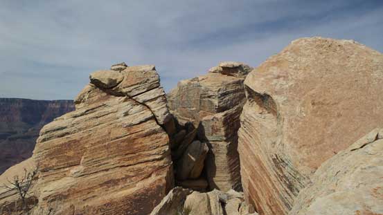
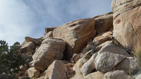
This is the summit block…
The summit block consists of a couple huge boulders and searching around I could not find an easy line to get on top of the highest one. I settled on the second highest boulder and even that required a few exposed 3rd class moves. This boulder is only probably 1 feet lower than the true summit and by standing on top of it I was actually higher than the “summit cairn” and this is more than “close enough” for me. However, I still wanted to get on top of the higher boulder. There were basically only two options. On the far end you can jump across a 1-m gap with down-sloping landing on both sides, and if you screw it up, you die. The other option is to climb the corner on the near side and is reported to be “high end class 4” by the local Arizonians. Either option was not impossible and had I have bigger balls I’d jump the former and had I brought rock shoes I’d climb the latter, but on this day I did not have any so decided to chicken out. I climbed back on top of the second highest boulder and got a couple selfies and that’s it.
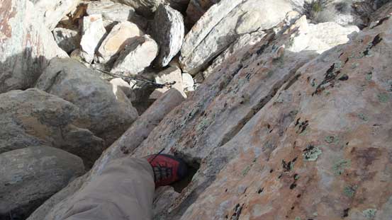
3rd class scrambling going up the second highest boulder.

The highest boulder was touch to reach and out of my league on this day…

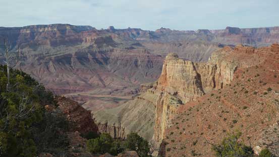
Summit Panorama from Escalante Butte. Click to view large size.

Grand Canyon from this viewpoint

Looking downstream, Vishnu Temple and Wotans Throne almost blend together
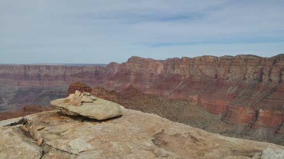
This shows that by standing up I was definitely higher than the summit cairn.
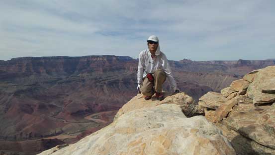
Me on the summit of Escalante Butte
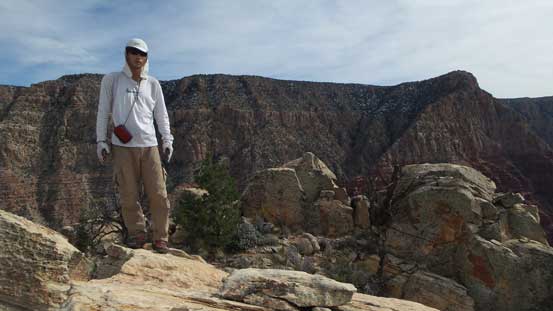
Another picture of me on the summit.
The lingering, trying and hesitating on the summit took about an hour and now time was really getting on and I had to keep going. Descending off the north ridge of Escalante Butte I stayed initially more on the NE Face to avoid some huge chucks of white boulders but lower down I cut left and merged onto the ridge proper.

Started to descend the north ridge now.
The lighting was getting better and better.
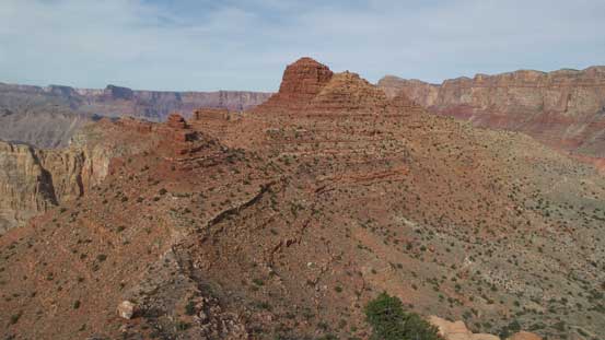
Cardenas Butte ahead which would be my next objective.
Once getting down to Escalante/Cardenas saddle it’s time to focus on my next objective – Cardenas Butte.
