Mount Fox
July 29, 2012
2973m
Kananaskis – Kananaskis Lakes, AB/BC
Andrea Battistel and I had a big plan on this past Sunday. We agreed to do a long and difficult mountain, but not exactly sure about our objective. I wanted to do Mt. Smuts and The Fist, the “supposed” most difficult scramble in Kane’s book. However, I wasn’t 100% confident on the snow condition as the descending gully might still have snow or ice which would make the climb tricky. Andrea threw out her objective – Mt. Fox. Okay, that’s an equally exciting mountain, therefore I agreed. According to both Vern and So, Mt. Fox is as difficult as Smuts and Northover. (I haven’t done them so I can’t make detailed comparison now).
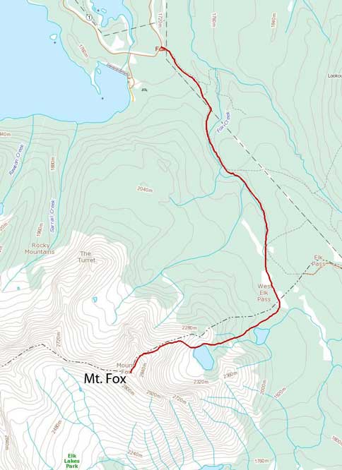
Mt. Fox scramble route from Frozen Lake. GPX DL
Our day started shortly after 8 am from Elk Pass trail-head. The forecast was calling for a sunny day so we didn’t actually need to start early, but we did want to see the calm Frozen Lake in the morning. Andrea has done lots of cross country skiing in Kananaskis Lakes – Elk Pass area, so she knew exactly where we should go. We set up a blistering pace and arrived at Frozen Lake in under 1.5 hours. We passed several large meadows where we could see the entire scramble route. Glad we left our ice axe in my car. It was bone dry.
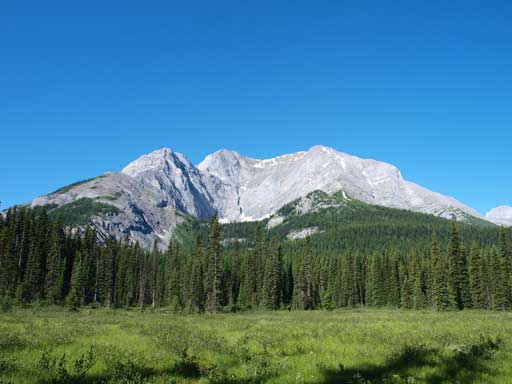
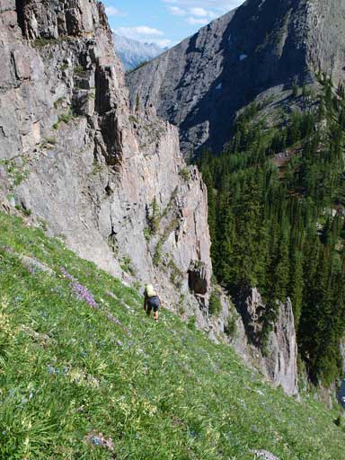
Mount Fox seen from the approach trail.
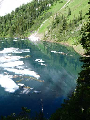
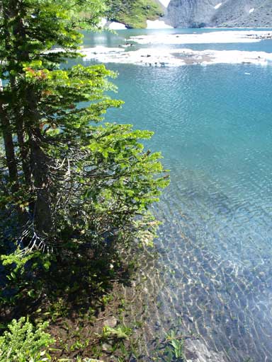
Now I knew why this lake is named Frozen Lake. It’s late July and the Lake was still partially frozen… We did get the calm water but due to the ice bergs we didn’t get a good view of the reflections…
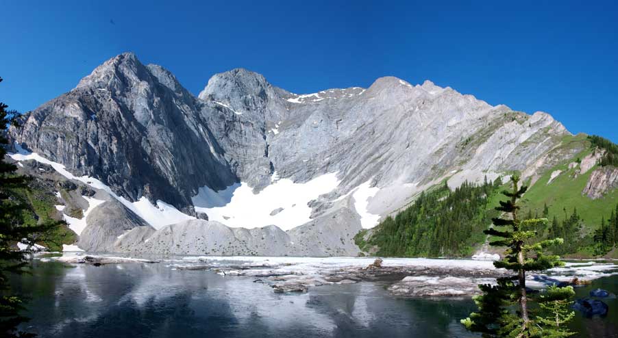
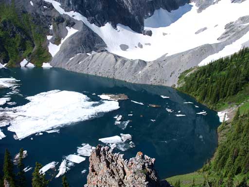
Mount Fox rises behind Frozen Lake
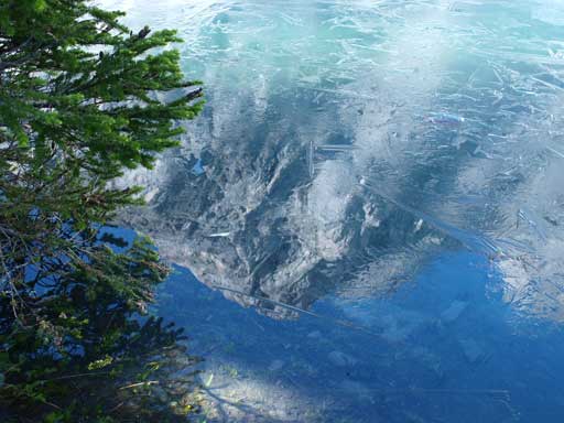
Apparently the previous night was cold. There was a thin layer of ice
One more photo of Frozen Lake
We followed a trail skirting around the lake, soon we were facing a steep gully. Andrea took the bypass which was side-sloping on steep grass slope. I wanted some warm-up so I chose to ascend the gully. Man it was so loose… I should just follow Andrea to the grass slope but on the other hand, I’m glad she didn’t go up the gully with me. It’s unavoidable to kick down rocks to each other, especially on the upper part. We re-grouped at the saddle above the gully. A faint trail/light bushwhacking brought us to the treeline.
Looking down to Frozen Lake

Interesting vegetation.
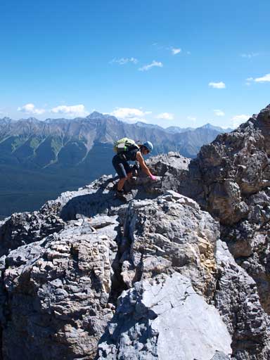
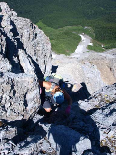
The mosquitos kept us going uphill without taking a necessary break at this point, and we soon started the initial moderate scrambling on steep grass and rock. The scramble got more and more involved as we went up. At one point, Andrea lost her camara bag and it slid down the south slope for a long distance. She did go down to find it but failed… I think she was more concerning about the upper slope so she didn’t search carefully (she got it on the way down). As the scrambling became more serious, we put our helmets on, and poles in pack. A slight overhanging 1.5 m step marks the official start of difficult scramble. From here to after the crux, it’s sustained serious hands-on scrambling. You don’t want to make any mistake in this long section both up and down. Exposure is not bad as a fall would be on the previous step or the rubble slope on both side. And I don’t remember any technical move involved neither. Therefore I say this long part is easy side of difficult. But as I mention above, it’s sustained at difficult scrambling level for a long ways. This reminds me the east ridge of Pierre Elliott Trudeau, but easier than that one. Trudeau involves several quite technical moves and the exposure is more severe…
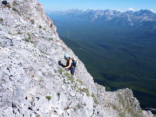
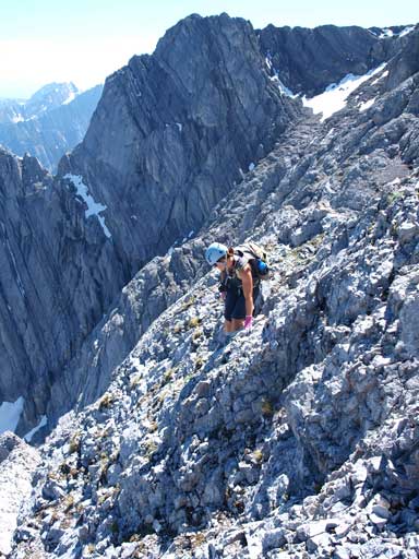
Andrea scrambling up typical terrain
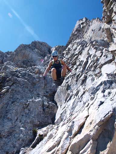
looking up. This is what you will see on this mountain.
Andrea posing on an exposed part
Typical scrambling
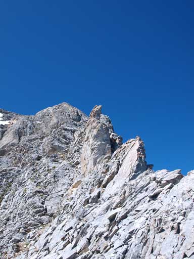
Looking back down at a pinnacle we just bypassed
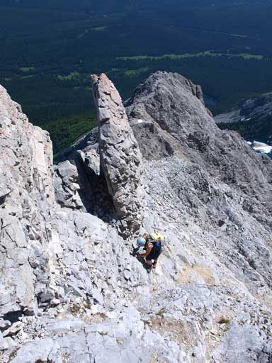
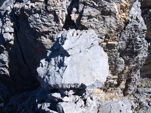
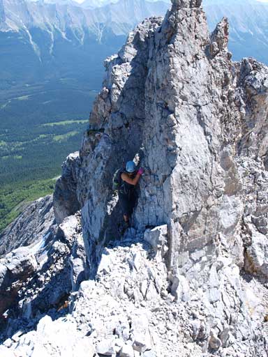
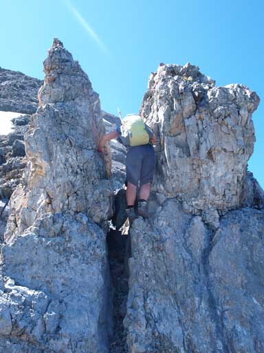
Two famous rock pinacles indicate the crux step. I gonna separate the crux into several small pieces:
1. Balance over a 5 m long exposed ridge
2. Step over an exposed rock (crack below) to the base of chimney
3. Climb up the chimney
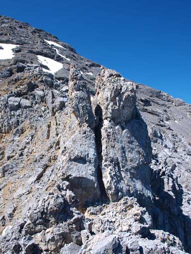
4. Drop down the other side of chimney sligtly, look for a rock window on skier’s right
5. Squeeze through the window
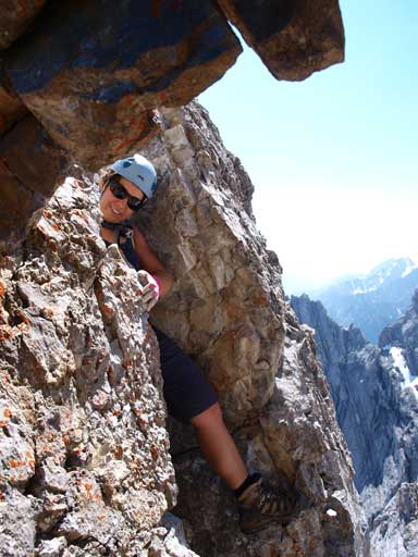
6. Climb down the other side of window, traverse over exposed ledge to safer ground.
Non of these requires technical moves, and the exposure is tolerable. The chimney and window might be tight especially with a large pack, but still managable. This part is definitely not easy side of difficult, probably the middle to upper range of difficult. I haven’t done Smuts nor Northover so I can’t do more comparison. (Update from a year later. After finishing both Northover and Smuts, I can say this one is definitely easier. Maybe the rocks are looser but the exposure and climbing difficulty is much less).
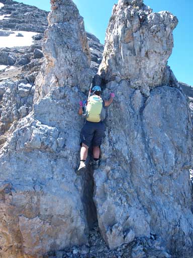
The crux ahead. You need to climb up this chimney
Andrea balancing on the exposed part just before the crux
Going over this chockstone
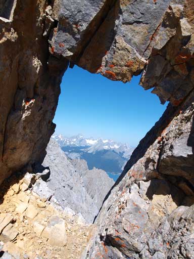
And then go through this rock window
Looking back through the window
Andrea finishing the last bit of the complex crux.
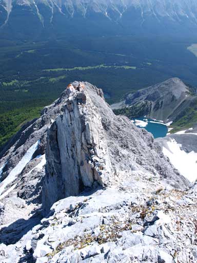
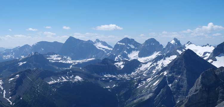
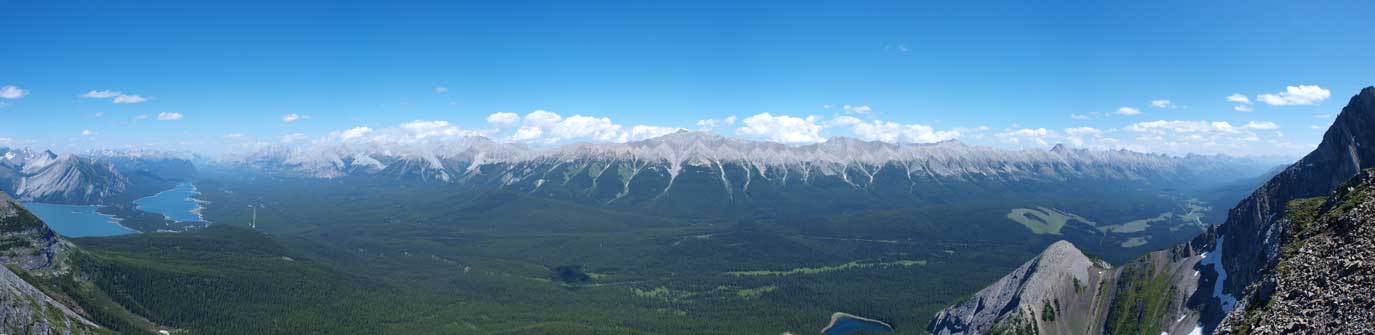
After the crux, the difficult scramble section is almost done. The rest of the climb to the summit is just easy to moderate. However, the looseness of the ground makes this part as demanding as the hands-on section… Tediously tedious rubble slog. A pair of ski poles helps a lot. The high point you see from below is the false summit, which is only 5 min away from the true summit. The view is excellent towards each direction. British Millitary Group – Kananaskis Lakes – Kananaskis Range – Opal Range – Elk Range (All of the Highwood scrambles in Kane list are visible) – Petain Glacier & East face of Joffre. Too many names to describe. Assiniboine is also visible. We could see the mountains south of Joffre. I don’t even know their names as they’re rarely seen. The next high mountain west of Fox is Mount Foch, which looks scramble-able. In between Foch and Sarrail we could see the Royal Group in the distance. The old register was brought up by Alan Kane. Apart from him, there’re lots of familiar names: Dave, Raff, Vern, Marko, Wil, etc.
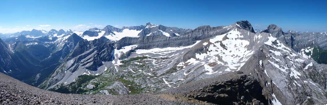
Panorama of the other side of Fox. The big peak in the far distance is Mount Joffre. And the big peaks on right side are Foch and Sarrail.
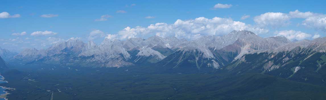
Looking East, Mount Rae, Storm Mountain and Mist Mountain poking behind Elk Range
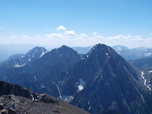
Looking South towards Mount Aosta (right)
Abruzzi Group in the background. Mount McCraig is the pyramid shaped peak in the foreground on right side.
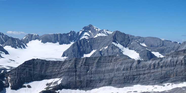
The East face of Mount Joffre, with Mount Petain in front of it.
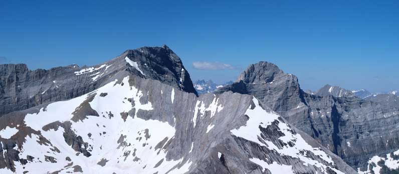
Mount Foch and Mount Sarrail
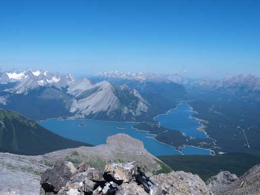
Kananaskis Lakes. The rock in foreground is The Turret
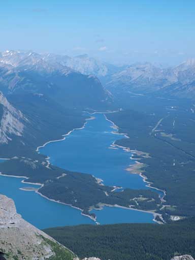
Zooming-in towards Lower Kananaskis Lake
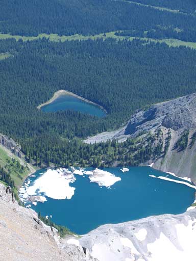
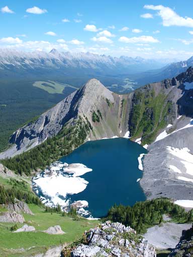
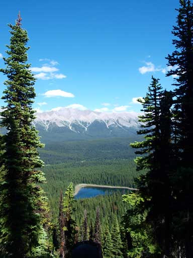
Looking down towards Fox Lake (small one) and Frozen Lake (big one)
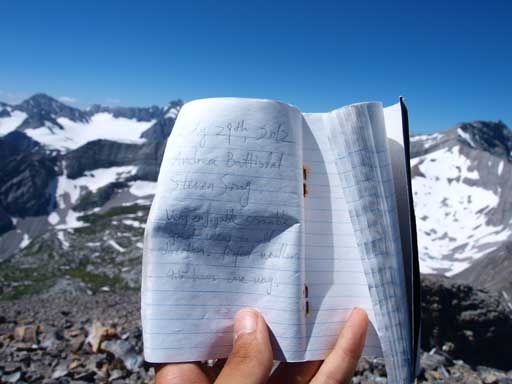
The register and our entry
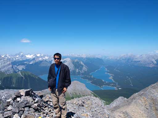
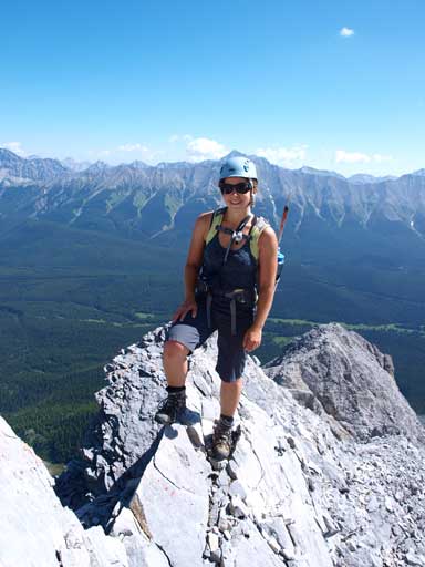
Me on the summit
We stayed on the summit for more than 1 hour. Before getting down, we said to each other to take our time, no rush. Coming down was very tedious. Except for the crux, most of the terrain is same. We had to repeat the same type of movement again and again. I got mentally exhausted, not to mention that any error wasn’t allowed. We also had to keep our eyes on the route. Sometimes we had to traverse slightly to skier’s left to overcome more difficult terrain. Generally the ground is loose which didn’t help especially on the way down… Once done the difficult stuffs, Andrea managed to get her camera bag back! Going down the lower steep grass wasn’t easy neither. Grass was more slippery than rock, and I had to be extra careful not slipping (don’t know how easy to stop a slide on steep slippery grass)… Okay, we took our time here. On the lower part, I followed Andrea side-sloping on the grass slope. This route is for sure better than the loose gully but still not easy.. Then we got back to Frozen Lake. We took another energy break at the Lake, and soon set a fast pace down the trail. We almost went all the way down to parking lot without a break.
Andrea, just about to down-climb the chimney
Andrea down-climbing the chimney
Loose terrain, typical on this mountain
Typical scrambling
More scrambling. It was like this for 500 vertical meters…
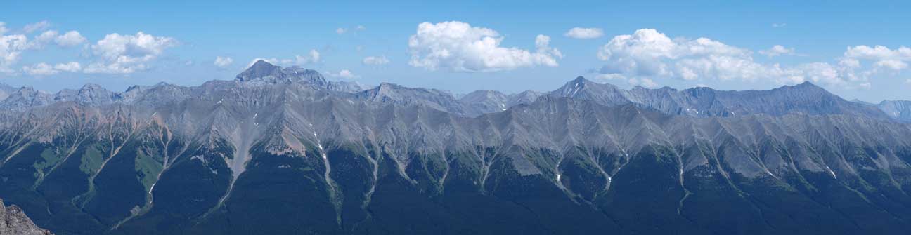
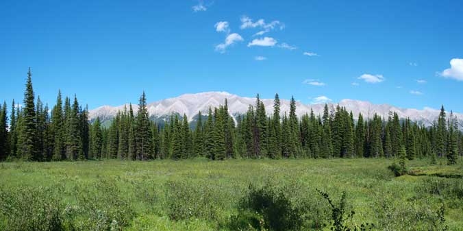
A panorama of Opal Range (Left) and Elk Range (Middle and Right)
Opal Range
Frozen Lake looks more like a volcano crater
Side-sloping on grass isn’t my favourite.
Back to Frozen Lake. It felt more like summer now than in the morning.
This pond is actually Fox Lake
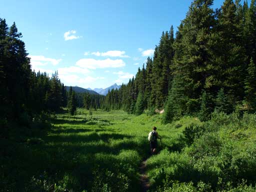
Back to the meadows, looking towards Elk Range
Time to go home (for Andrea). I still had Niblock to do on Monday.
Overall, Mount Fox is actually easier than my expectation. However, it’s definitely a great scramble that experienced and confident scramblers will enjoy. The scenery is also good and you’ll see lots of obscured peaks in Elk Lakes area (in BC). In particular, the Abruzzi group stands out and I’m sure one day I’ll go there to bag more peaks.
