Mount Price
March 10, 2019
2052m
Garibaldi Provincial Park, BC
Mt. Price is a dormant volcano in the heart of Garibaldi Provincial Park rising off the south shore of Garibaldi Lake. This peak is not nearly as popular as the nearby Panorama Ridge or The Black Tusk but offers equally, if not better views. The standard route goes up its wooded NE Ridge and there’s an unmaintained trail for most of the way starting from the outflow of Garibaldi Lake. The same route can also be done in winter on skis/snowshoes but a more efficient winter route ascends directly up one of the few northern gullies. The access is smoothed out because one can easily ski or snowshoe across the frozen lake instead of dealing with the undulating nature of the forest. Despite the easiness of access this is by no mean a short trip – 28 km with over 1500 m elevation gain. An additional 5 km is added in the dead winter when the access road isn’t maintained, which was exactly the case of last weekend.
I had been saving Mt. Price (and Clinker Peak) for one day that I was lack of creativity in coming up with an objective. This is one trip that requires no planning whatsoever other than the common sense of winter mountaineering, but as mentioned earlier this wouldn’t be an easy outing by any measure. The route also does cross some avalanche terrain and the traverse to Clinker Peak isn’t often done in winter conditions as far as I know. The plan of this past weekend changed a dozen times and eventually it was Tiger, Milan, Mel and myself heading for Mt. Price and Clinker Peak. This would also become my 800th unique summit to celebrate although such wasn’t how I decided on the objective. At 6:00 am (right after the time change) we all piled into my Tacoma and headed up the Sea to Sky Corridor. A while later we turned off the Rubble Creek road and not to our surprise we had to park almost immediately off the main highway. This meant an additional 2.5 km with some elevation gain right off the bat before even reaching the trail-head.

Mt. Price and Clinker Peak winter route. GPX DL
There’s a huge Chinese group from crossna.com that did Mt. Price via winter route on Saturday and they gave us a ton of fresh beta. Based on what they reported Mel and I decided to hike the entire approach to Garibaldi Lake on trail-runners while carrying boots and snowshoes, and instead of hauling the 30′ Lightning Ascents I opted for the 25′ pair. I normally do not trust the 25′ snowshoes in the dead winter but given that at least 8 snowshoeers had made an ascent a mere day ago I wouldn’t expect any form of trail-breaking. There’s literally nothing worth documenting about the death march approach – 2.5 km to the parking lot and then 9 km to the lake with about 1000 m elevation gain and minimal view… Our group was fast and I had to push myself in order to keep up the pace. We made to the “6 km Junction” in 2 hours and after a short break to regroup we spent another hour to reach the lake, crispy and very cold…

Crossing the frozen Barrier Lake

Side-hilling across Lesser Garibaldi Lake
Me almost arriving at Garibaldi Lake. Photo by Mel O.

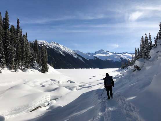
The outflow of Garibaldi Lake. It was freakin’ cold here…

Finally into some sunshine!
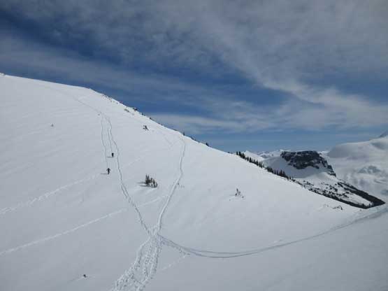
Once onto the frozen lake we took the first lengthy break to don some gears. Mel and I took the runners off in trade for mountaineering boots, and then ditched the runners (and microspikes) right beside the trail thinking that nobody would bother steeling the smelly boots… We all strapped the snowshoes on and continued into the next stage of plodding – about 3 km of monotonous plod on the frozen Garibaldi Lake. The slog was boring as fuck, but let’s face it. We managed to pick up the massive set of snowshoe tracks and the next stage was a steep grunt up the west of the two “north flanks gullies”. After a while the slope mellowed out and we entered a “bowl” feature.
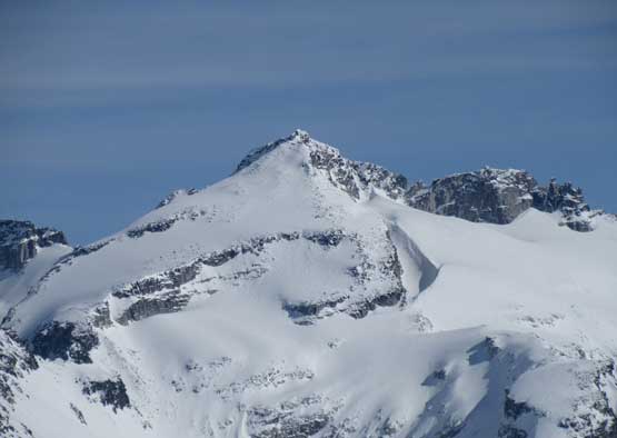
Tiger, Milan and Mel gazing at our objective – Mt. Price

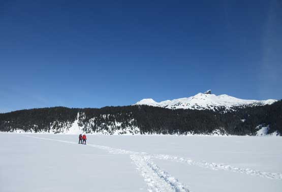
This is the classic Garibaldi Lake view
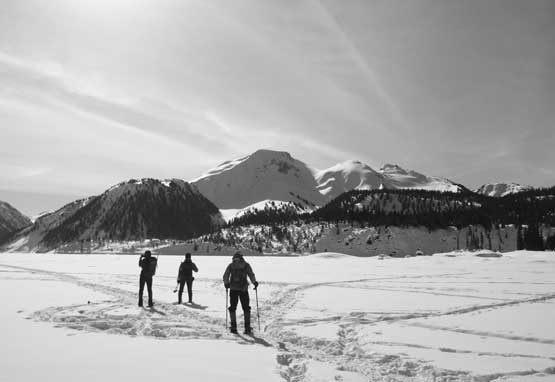
Tiger and Milan snowshoeing across the frozen lake

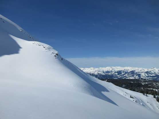
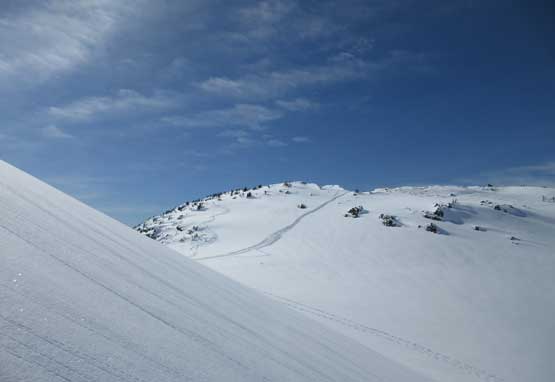
After a long while we were finally heading for the gullies
Partway up the gully, looking back

This is the typical terrain in the lower zone

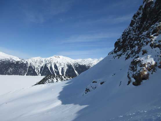
Looking down from above the first steep roll

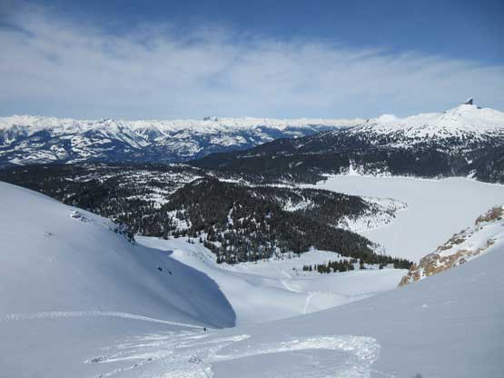
Entering a flat zone and heading for the “middle bowl”

Mel plodding up.
Resuming the ascent the slope angle increased again towards the distant Price/Clinker col. The steepest stretch was right below the col that I estimated the slope was at least 35 degrees. The Lightning Ascents could barely made a straight-up style of ascent even with the previous tracks. Above that section we took a line angling climber’s left following a set of ski descent tracks. This direct route certainly cut some distance but involved more steep slopes. Mel was strong and broke trail for the entire way and I couldn’t even keep up. The summit of Mt. Price was as large as a soccer field so we had to wonder around in order to soak in all of the views. There went the 800th summit of mine.

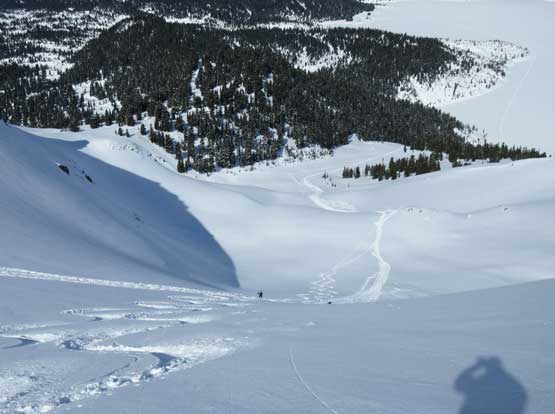
Mel following the highway of snowshoe tracks into the upper zone
Gorgeous terrain. No wonder why this route is called the “ski route”…
Looking sideways across the north face
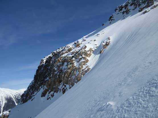
The north face of Mt. Price is quite steep as you can see.

Mel ascending steeply up this huge alpine slope
Looking back at Milan and Tiger making their way up
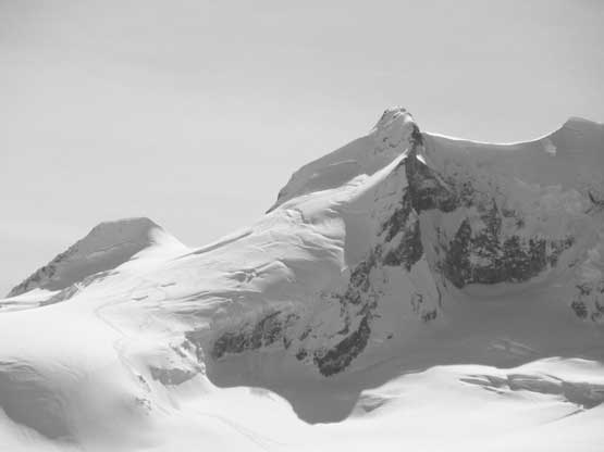
This ridge is the unnamed bump between Mt. Price and Clinker Peak
Another photo of looking back from partway up this steep slope

Partial Summit Panorama from Mt. Price. Click to view large size.
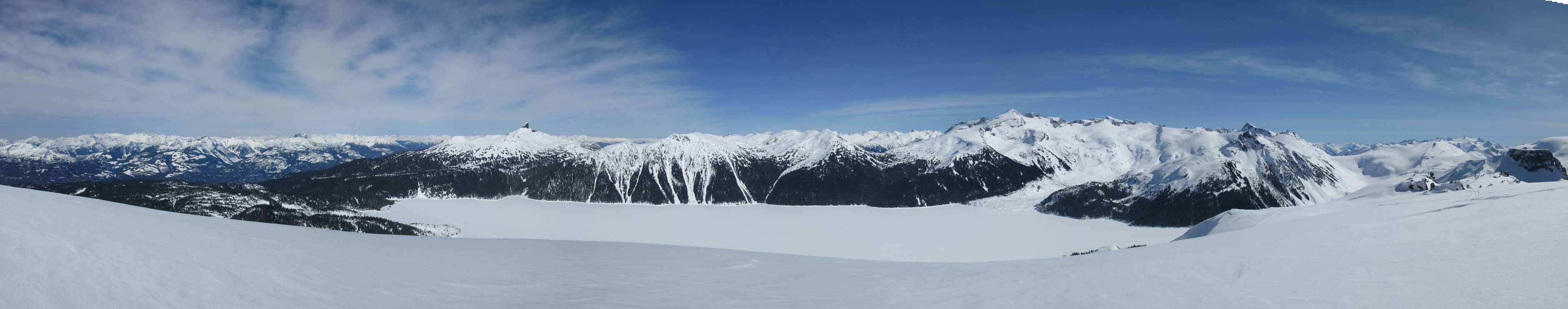
Partial Summit Panorama from Mt. Price. Click to view large size.
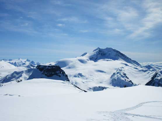
Mt. Garibaldi and The Table are the two icons of Garibaldi Provincial Park

The rugged Tantalus Range with the bump of Clinker Peak in front
Omega, Iota, Pelops and Niobe on the southern Tantalus Range

Alpha Mountain and Serratus Mountain
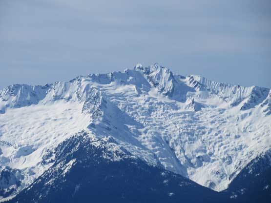
Mt. Tantalus and Rambling Glacier on its east face

The Table has seen probably only half a dozen ascents to this date
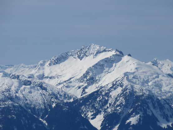
Mt. Garibaldi and the broken glacier on its NE Face standard route

Tiger approaching the summit of Mt. Price

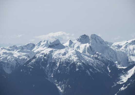
The classic view of Castle Towers and Sphinx Glacier

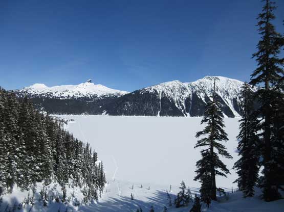
The Black Tusk rises above the frozen Garibaldi Lake
Pelion Mountain in the northern Tantalus Range
The west peak of Castle Towers

Mt. Carr

The Sphinx with Guard Mountain in front

Far in the distance is Mamquam Mountain. Glacier Pikes in front

The massif of Sky Pilot – Ledge – Copilot
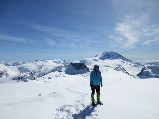
Me on the summit of Mt. Price – my 800th summit
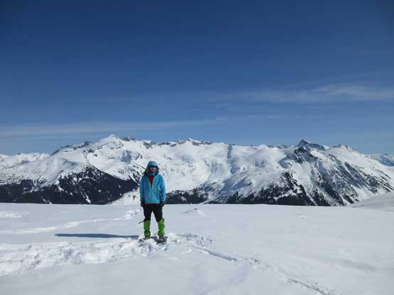
Another photo of me on the summit of Mt. Price
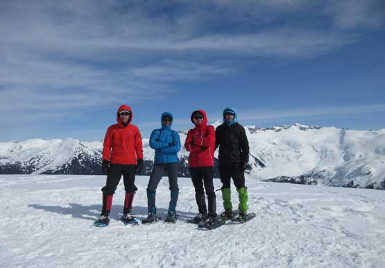
Our group shot on the summit of Mt. Price

Me heading down. Photo by Mel O.
Descending towards the first of the two cols in between Mt. Price and Clinker Peak
We stayed for almost an hour on the summit before making the descent. The small summit of Clinker Peak looked to be more involved than anticipated with some cliffs guarding the block, but at this point we had no excuse but finding a way there. The avalanche condition was Low/Low/Low so I was willing to tackle some steep shits, if needed. Tiger and Milan decided to slowly hike back while Mel and I pressed on with an ascent of Clinker Peak.
