Shawatum Mountain
December 5, 2020
2156m
Manning Park / Silver-Skagit Road, BC
The double-summit massif of Shawatum Mountain is somewhat obscured but locally prominent and eye-catching. It locates about 50 km down the Silver-Skagit Road on the boundary between Skagit Valley Provincial Park and Manning Provincial Park in the BC portion of the North Cascades. The “standard route” seems like a steep bushwhack via the SW slopes and West Ridge but recent trip reports and condition updates were lacking. The most recent beta that I could find dated back to 15 years ago and in fact, there were only two or three trip reports of this peak on the internet anyway. I had also thought about to ascend the gigantic “north gully” in between the two summits on snow, but the access of that gully, the Shawatum Creek FSR was a big question mark. I had no doubt that one could no longer drive that spur road and I actually thought it might be already too overgrown to even walk on. Because of the obscureness this peak had been eluding me for years. My first time seeing it was from Silverdaisy/Claimstake/Hatchethead in 2015, almost exactly 5 years ago. There were a couple times that I thought about it but never pulled the trigger.
The first week of December had seen some unseasonably sunny and warm weather. When Al tossed around the idea of ascending Shawatum Mountain I was very excited but they picked Friday that didn’t work for me. I also had no idea of what to expect on Silver-Skagit Road in winter, and the avalanche hazards associated with the heat wave also scared me. I did, however, moved some of my Saturday’s work into Sunday to take advantage of the last day of this sunny stretch in case Al’s group did make the summit. Winnie and Alex agreed to join me. When Al’s group finished the trip I got some crucial first hand condition update at around 6 pm on Friday evening. First the road indeed had zillions of potholes in addition to snow and ice but there’s enough traffic to put in tire tracks. An SUV would get high-centered but my Tacoma should have no problem. There was also no avalanche activity despite the warm temperature, and the bushwhacking was very open and easy. It took them under 4 hours to reach the summit including trail-breaking, so contrary to what I was expecting this seemed rather a sweet and short trip. The drive wouldn’t be as short though so we still needed to wake up early. We made to the logging road’s turn-off at around 5:30 am and didn’t manage to start the ascend until almost 7:30 am. I drove very slowly and cautiously despite I had a Taco with all terrain tires. The visibility in the darkness wasn’t that great and I got surprised by a few deep holes. It also seemed obvious that this road doesn’t get maintained/plowed in winter so I bet Shawatum Mountain or anything beyond Grant/Eaton area would be nope in winter months.

Shawatum Mountain via SW slopes and West Ridge. GPX DL
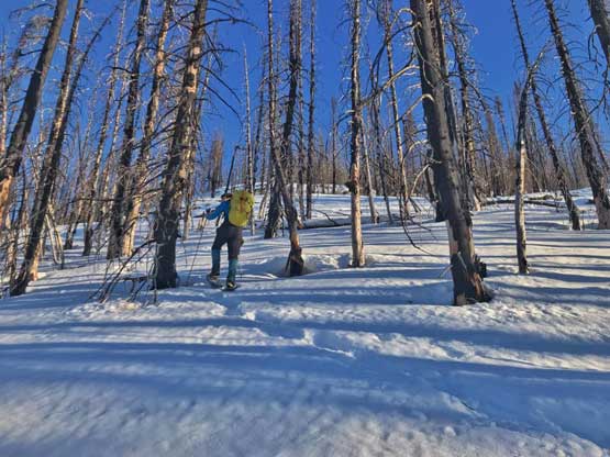
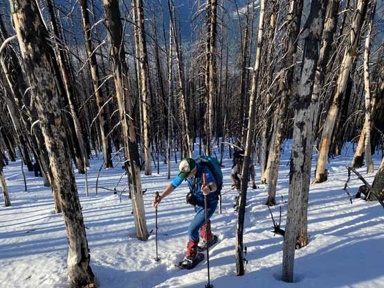
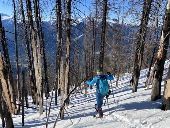
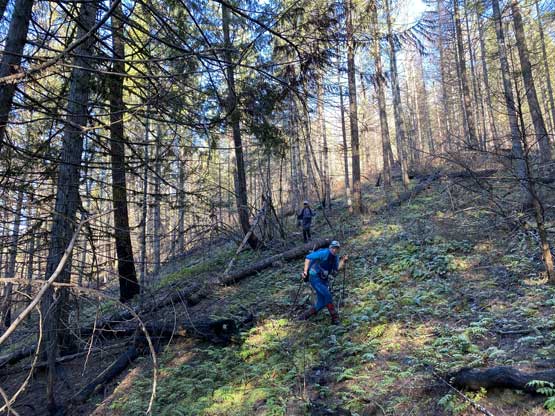
The spot where the GPS track sent by Al’s group started looked a bit bushy but as usual, the strategy of my trips was always to go with the known, so we parked at the exact spot where their GPS track started. We started the ascent when it’s just bright enough to not need head-lamps, so roughly half an hour earlier than their previous day’s trip. The bushwhack turned out to be easier than it looked and in short time we were in some open forest with a bit of underbrush and some dead-falls. I wouldn’t say the bushwhacking was “negligible” because I’m someone with a strong Rockies’ background, but by SW BC standard it’s indeed very easy. I did the GPS navigation and I did not let our line to deviate from Al’s track for more than even 50 meters because the words from multiple members of that party was to “follow the ascent track and ignore the descent track”. After a while the terrain became steep. The footings were slippery and the underbrush started to have some brambles but again, by SW BC standard this would still be considered “open forest” so there’s nothing to complain. We eventually hit snow at around 900 m and at around 1000 m we came across the previous party’s snowshoe tracks and did our own gear transition as well.

The typical “bushwhack” of the lower forest.

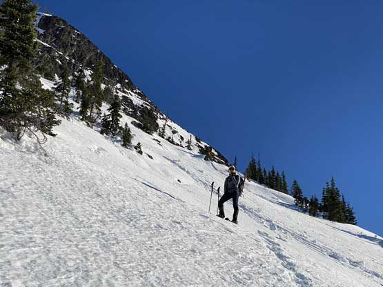
Winnie taking a short rest break in the relentlessly steep forest

A zoomed-in view of Devil’s Tongue and Mt. Rahm in Washington state
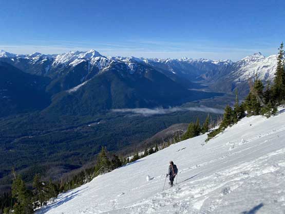
From here onward towards treeline was a easy but numbing game for the three of us as all we needed was to put one foot in front of another following Al’s snowshoe tracks. There was no route-finding nor decision making whatsoever. I led the pace plodding faster than what I normally would do because I still had a bit of concern of this heat wave and wanted to get to the summit rather quickly than leisurely. The terrain in the forest had a few steeper rolls so it wasn’t reluctantly steep the whole way. At the treeline zone we did our second (also the last) break on the ascent donning sunscreen and sunglasses. We all brought avalanche gears but didn’t bother to turn the beacons on as the snow at this point was rather icy than slushy. There’s a moderately strong wind keeping the surface of the snow cool. Winnie then took over the lead plodding at a pace that reminded me Connor McEntee and in no time Alex and I were falling behind. I tried to just snowshoe up the middle of the Al’s glissading runnels to short-cut some distances but soon gave up on that idea as the runnels were too icy even for my Lightning Ascents snowshoes. Alex and I then went back onto the ascent tracks and the three of us regrouped near the crux zone just under the west ridge.

Our first taste of the December sunbeam

Alex and Winnie just after strapping snowshoes on

Another photo of the sunbeam through the burnt forest
Me charging up the typical burnt forest. Photo by Alex R.
Alex and Winnie plodding up

Yet another photo of Alex plodding up…

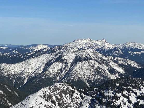
Our first unobstructed view of Silvertip Mountain
Winnie plodding into the steep treeline zone
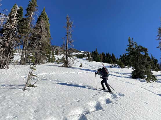
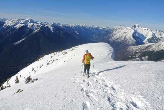
Alex onto the big open slope at treeline
As you can see the treeline zone is definitely steep enough to slide

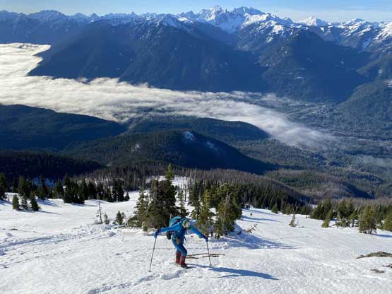
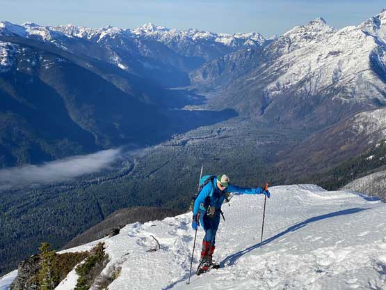
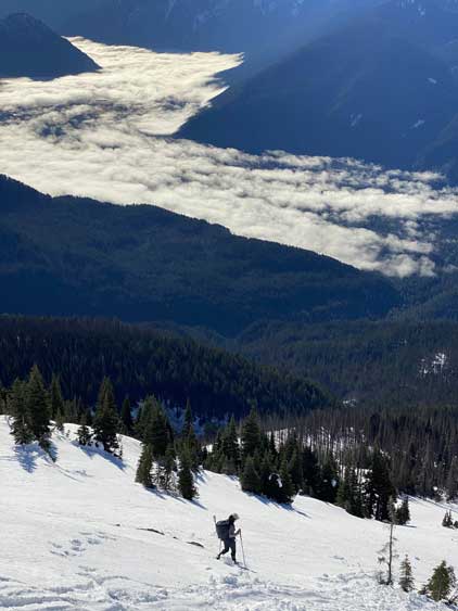
A zoomed-in photo of Alex plodding up above the valley fog
More about this section. It was a long haul…
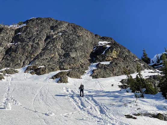
Winnie approaching the cliff face just under the crux area
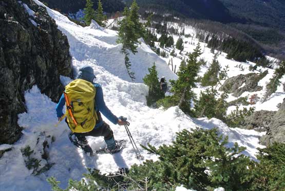
The crux zone involved a sketchy rightwards traverse under a cliff face then ascending a steep but somewhat bushy gully. This entire stretch was about 40 degrees steep but there were enough tree branches to offer some vege belays so we had no problem ascending on snowshoes. Without the vege belays we probably would have needed crampons as the snow was very firm. Onto the west ridge the rest of the ascent was rather simple although we did have to pay attention to the large cornices dangling over the north face. The last roll before the summit was a bit steep but again, with the snowshoe tracks already set the game was very easy for us. We made to the summit in under 3 hours 30 minutes, impressed by the previous party’s 3 hours 50 minutes time (with trail breaking).

The bushy but steep crux gully
Alex just about to ascend the steep gully

Winnie charging up the first steep step on the west ridge

Alex plodding up the typical terrain on the west ridge

The upper west ridge.
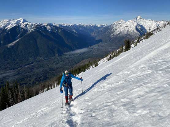
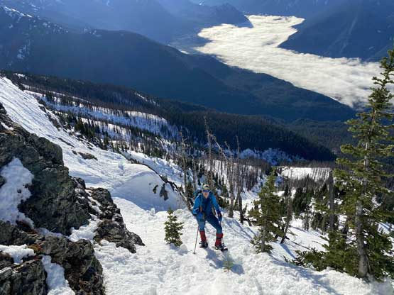
Alex ascending above the Skagit River valley

Another photo of Alex ascending high above Skagit Valley

Winnie on the last push towards the summit

Alex traversing the ridge bypassing a gigantic cornice

The December sun is low even at 10 am

Another photo of the aforementioned cornice

Alex on the last steps below the summit with some big terrain behind

Partial Summit Panorama from Shawatum Mountain. Click to view large size.
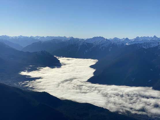
Ross Lake and Skagit River still covered in valley fog
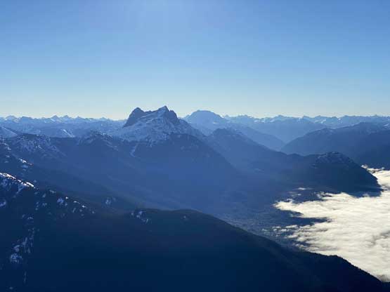
Hozomeen Mountain looming to the south

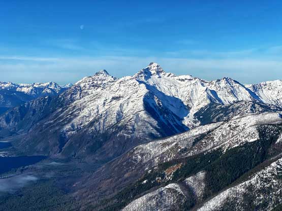
Mt. Spickhard, Devil’s Tongue and Mt. Rahm/Mt. Custer in WA

Whitworth Peak is another interestingly-looking but obscured peak
Castle Peak and “Full Moon Rising” center shot

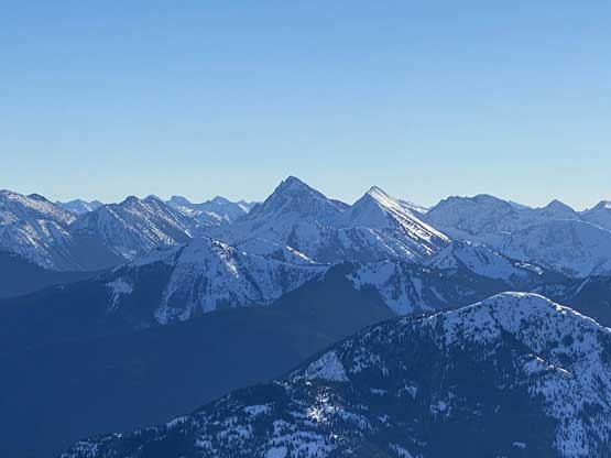
A zoomed-in view of Silvertip Mountain and Mt. Rideout

The lower north summit of Shawatum Mtn. is probably very rarely ascended
Snass Mountain and “Snazzy Peak” in the far distance
The south slopes of Mt. Brice
Mt. Outram in the distance; Marmot Mountain in middle ground on far left

Me on the summit soaking in the incredible views

Our group shot on the summit of Shawatum Mountain
The cold wind had kept the snow surfaces frozen and firm well into noon, but also forced us to not linger any longer on the summit than necessary. In short time we all became cold so we reluctantly started the descent despite the awesome views. Descending the summit ridge took us no time and despite the firm conditions we all just went down the crux zone on snowshoes. The snow conditions had become softer at this point but was still too firm for a comfortable glissade so after a few failed tries we just plodded down that big open slope on snowshoes. Once back into the trees we followed the previous party’s descent tracks trying to utilize untracked snow for as much as possible, but the condition was still a bit too crusty for comfortable plunge-step, so the descent was a bit tiring on my knees and wasn’t as fast as I was hoping for. Lower down we started to get surprised by weak spots and holes hidden by the dead-falls so just followed their tracks merging back to the ascent line. Once running out of snow we took the only break on the descent taking snowshoes off, then bolted down the forested slope. The footings were not as slippery as in the morning (thankfully) but we had to check GPS millions of times. I again, led the GPS navigation retracing our exact route and in under an hour we popped out on the road only 2 meters from my truck.

Descending the steep pitch off the summit
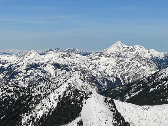
Silvertip Mountain and Mt. Rideout
Me plodding back across the west ridge. Photo by Alex R.

Winnie posing for a photo just before committing to the crux area

Alex dropping in the crux gully
Me snowshoeing down. As you can see, it was awkward
Winnie starting down the big slopes around treeline

After trying to glissade we decided to just plod down, slowly and steadily
Another photo of Winnie above the clouds
Alex plunging back into the burnt forest

Me descending the typical forest. Photo by Alex R.

Running out of snow now

Me descending. Photo by Alex R.

We had some dead-falls to negotiate
The lower forest was still icy and slippery thank to a temperature inversion

Me checking GPS to make sure we were on track. Photo by Alex R.
Our round trip time was just under 5 hours 30 minutes and we finished the trip at 1 pm. This seemed a bit odd given that we didn’t even use head-lamps in the morning… The drive back out of the Silver-Skagit was still a slow crawling mostly because of the zillions of pot-holes. I eventually got back home even too early for dinner.
