Gauguin Peak
July 1, 2017
2064m
Lillooet River / Garibaldi Provincial Park, BC
Towards this past July long weekend a long stretch of good weather kicked in and it’s time to think about some bigger trips. A lot of plans could have worked but in the end I decided to join Alex, Ben and Daniel for a 4-day exploration in the remote east side of McBride Range. The access is by some gnarly spur roads from Little Lillooet Lake which itself is reached by a close-to-40-kilometer ride on the bumby Lillooet West FSR from Pemberton. If not because of Alex’s suggestion I would never thought about accessing this group of peaks from the east so that tells how remote and rarely-visited this area is. The primary objectives would be Nivalis Mountain and Mt. Sir Richard.
Apart from the two big ones which are ironically, more often ascended thank to their proximity to the McBride Range ski traverse route, there are 5-6 smaller peaks further to the east that caught our interest. “Gauguin Peak” is the unofficial name of the rounded summit between Gauguin and Tuwasus Creeks on the far south-east corner. It is the lowest and the least interesting objective in this group so we decided to knock it off on Day 1 when we were still fresh.
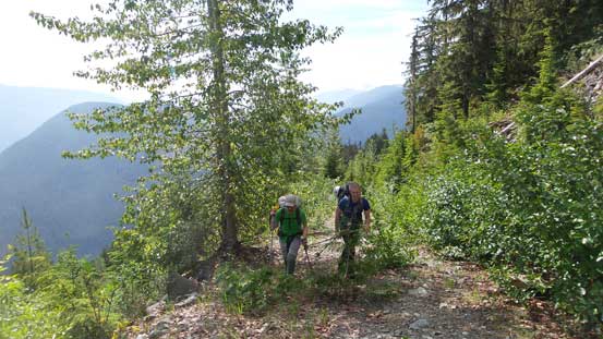
All set by 5 am on Saturday morning we somehow managed to squeeze all gears in Daniel’s Tracker and then up the Sea to Sky Highway we went. This was my first trip with Daniel and my last time going out with Alex and Ben was more than a year already so it’s good to finally connect with friends. Time flee by fast and soon enough we passed Pemberton and turned onto the Lillooet Lake Road. About 20 km of ride later we crossed the Tenas Narrows and another 10 km or so down Lillooet West FSR we reached the very-easy-to-miss Flood Creek spur road. We knew it’s the correct one only because of the modern technologies (aka. the GPS navigation). This spur road is more like an ATV track and a small, but high clearance 4×4 along with an aggressive driver who doesn’t mind the vehicle’s paint work is a must. We drove about 4 km up and parked at elevation of close to 800 m. This is as high as any vehicle can get to.
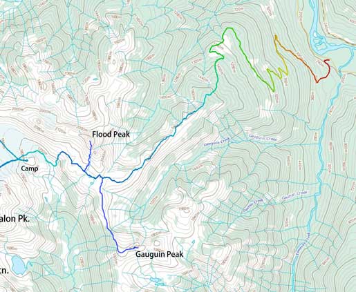
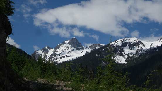
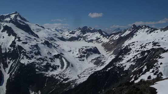
Ascent route for Gauguin Peak and Flood Peak from Lillooet River
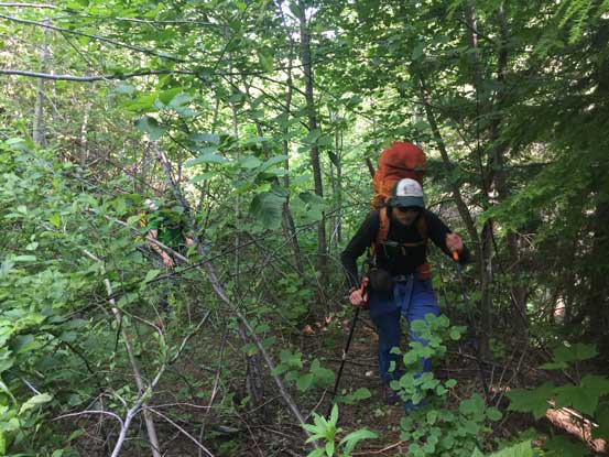
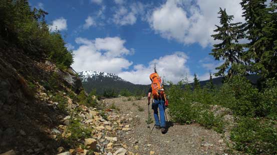
The mosquitoes were terrible so it didn’t take us long to get going. Right off the bat there were dead-falls and alder bashing but as far as the west coast standard goes this road was a fairly smooth-sailing on foot. The only exception was near a creek crossing where it’s difficult to even tell where the road was, but then it’s smooth-sailing again. We followed this spur road to pretty much the end of it at elevation of 1300 m. After a short but very needed break we entered the bush. By skirting around the left edge of the clear-cut we managed to stay in the old growth forest and the bushwhack was not bad at all. A couple hundred meters later we hit snow and it soon became continuous. Although sections were steep and other parts required some strenuous transitioning from snow to grass and back onto snow, the travelling was much easier than anticipated and our next stop was at treeline near the top of the first bump already.
The start of the hike up Flood Creek FSR. This is elevation of 800 m ish.

Gunsight Peak looks superb from this angle
Daniel and Ben hiking up a good stretch of this road

This is the bad stretch…
Alex marching up
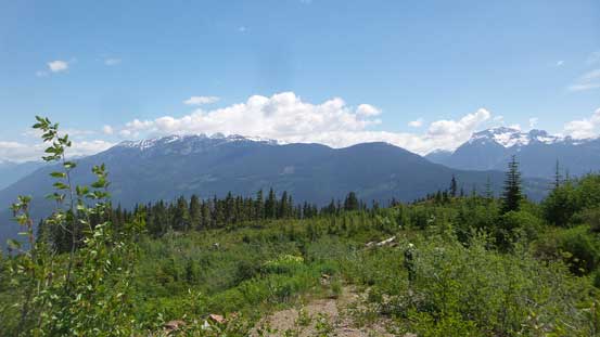
The first sight of Flood Peak way in the distance
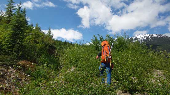
Overall the logging road hike wasn’t bad
Coming to this large clear-cut area
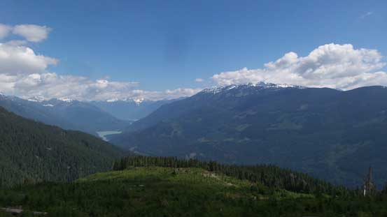
Looking back down at Lillooet River Valley
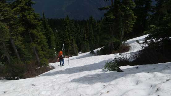
After about an hour in the bush we hit continuous snow

The forested travel was nice and open
The next stage would be an undulating traverse due SW towards the broad pass between Gauguin Peak and Flood Peak. This section looked simple on paper, but once there we knew it’s going to have a lot of up-and-downs. The good thing is that much of this would be on snow so it’s not a difficult task to maintain our fast pace throughout. The post-holing was pretty averaged although we sank knee-to-waist deep occasionally near the rock outcrops or bush. After traversing two or three minor bumps we stayed towards climber’s left side of the main crest although never deviated too far from the ridge-top, and a couple hours later we made to the Flood/Gauguin pass.

Ascending onto the ridge crest. Lillooet River behind
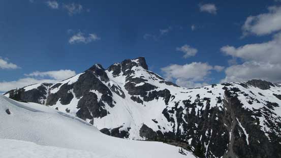
Flood Peak looks big from our approach

Upwards and onwards.

The north face of Gauguin Peak – our first objective

At Flood/Gauguin pass now, looking ahead to Nivalis Mountain and our playground
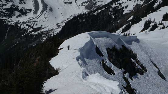
Here’s our first decision point, and after some debating we agreed to drop our packs and do Gauguin Peak first. It surely didn’t look like having much mountaineering interest but we knew it’s not a often-ascended peak plus this was my first time in this area so I was pretty motivated. Having the entire backpack dropped was a bonus too as I was already tired from carrying the 4-day loads. Our first business was dropping another 100 m or so down to the lowest saddle (which was easy-going). And then up the other side things got narrower a bit but never imposed any problem. We altered between ascending on snow and staying on dry grass/rock and soon enough the grade tapered off.

Ascending out of the low saddle up the N/NW ridge

Alex leading the way staying mostly on snow
Ben following up
The true summit was a couple hundred meters east of the false dome-shaped summit. Not doing any unnecessary lingering we started the traverse. Getting down into the saddle required a brief detour around a cornice and scrambling up the true summit required some brief bushwhacking on krummholz field. The best thing about this summit is that we discovered the first ascent register placed by John Clarke which felt like opening a time capsule.
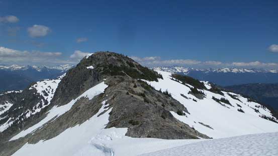
The true summit from false summit.
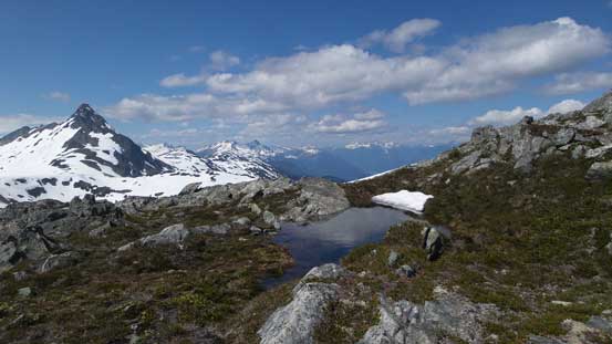
A cool tarn en route to the true summit of Gauguin Peak

Alex on the summit
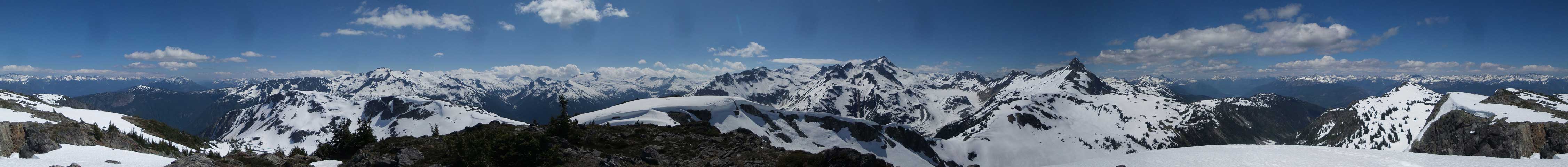
Summit Panorama from Gauguin Peak. Click to view large size.

A register note from 1999
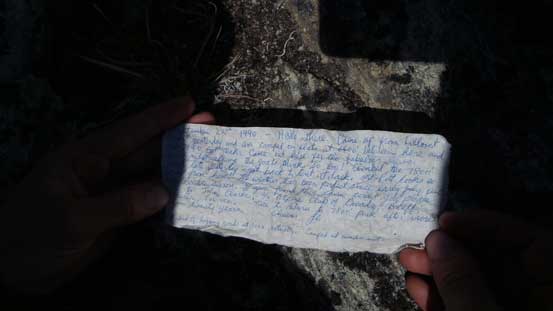
John Clarke’s first ascent note from 1990

Fire Mountain down Lillooet River valley

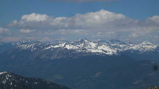
Gowan Peak and Livingstone Peak across Lillooet River in some very remote places
Cloudraker Mountain which we ascended in December of 2015
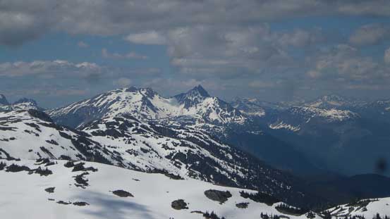
Gunsight Peak

Flood Peak and its south ridge
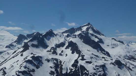
This is the majestic Nivalis Mountain
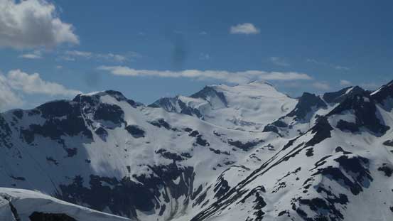
Mt. Sir Richard rises behind the shoulder of Adieu Mountain.
Looking south towards the remote Snowcap/Misty Icefields

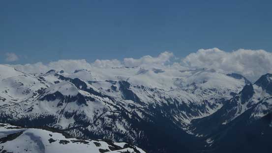
Greymantle and Greenmantle Mountains on Icemantle Glacier

Mt. Pitt

Our group shot on the summit of Gauguin Peak
After a short break soaking in the views we reversed our route down. There’s not much worth noting other than staying on our tracks and in short time we were back at Flood/Gauguin pass.

Going back
This is a head-on shot showing where we’d descend towards.
At this point we were doing excellent on time so the decision was to increase our ambition on Day 1, bagging Flood Peak via south ridge before carrying the camp down to the glacier. Speaking the objective we just did, Gauguin Peak offers more than what I thought it would. It turned out to be a good short side-trip and I’m very glad we didn’t skip it. Finally, Gauguin Peak can be easily day-tripped for those interested in doing peaks that way.
