Mount Lincoln
February 19, 2018
670m
Yale / Fraser Canyon, BC
Not to be confused with the 14er Mt. Lincoln in Colorado or the infamous Lincoln Peak in Washington, this is rather a lowly, but locally prominent forested hill in the middle of Fraser Canyon about 25 km north of Hope, B.C. The base of this peak sits the small town of Yale and the whole area was firstly explored during the gold rush times. The peak was also named during that time but the status remains unofficial till today. A rough, steep trail that goes up the SW flanks brings hikers and adventures to the summit. This was a very last minute decision between Chris H. and myself because of the spooky avalanche conditions, fresh snow down to sea level and the sketchy road conditions. Our choices were limited to those lowly, forested bumps in Fraser Valley but the weather was too good to pass.
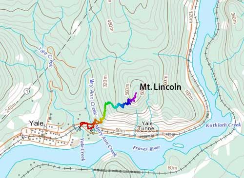
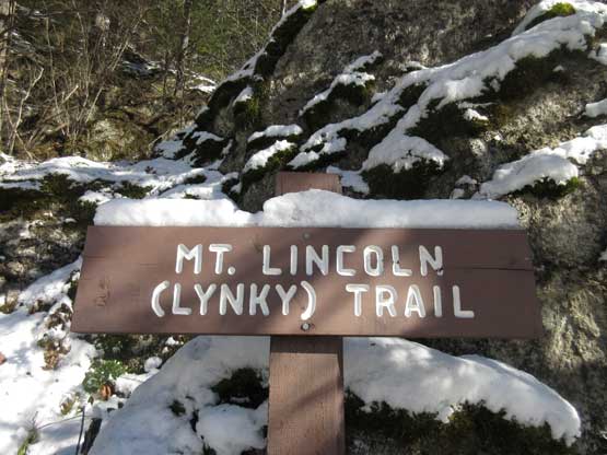
Mt. Lincoln via “Linky Trail”. GPX DL
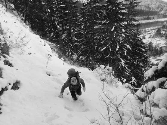
To locate the trail-head one needs to do at least some form of research. I did zero homework but Chris has done this hike several years ago so we were OK. The parking lot is actually a large pull-out that seems more like a turn-around spot for large trucks but we parked nonetheless. I had the feeling that the “trail” might be harder than expected with the amount of fresh snow so opted to wear Nepal Evos and bring steel crampons which turned out to be an excellent call. And then up we went into the forest. Nobody had hiked this trail since the dump of snow but the direction was obvious. The first crux came earlier than expected. About 1/3 of the way up we encountered a full pitch of very steep and slippery “trail” (slabs under snow) that seemed very awkward to climb up. I managed to stem a few meters up and then discovered a buried fixed rope in the snow. Even with the rope some strenuous moves were required.

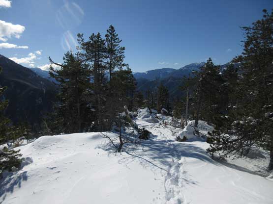
The start of this trail was very easy to follow

Crossing an open area.
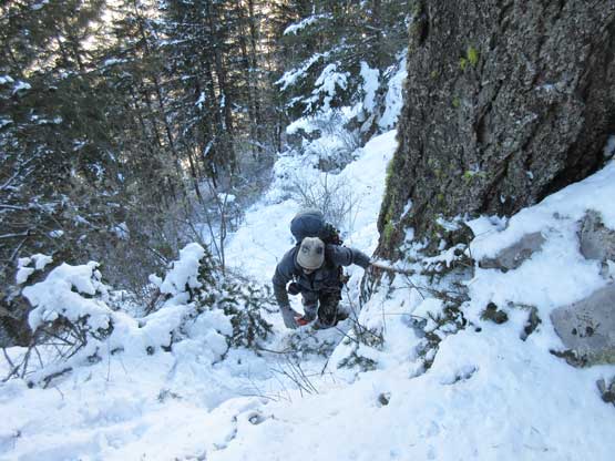
The grade starts to pick up.
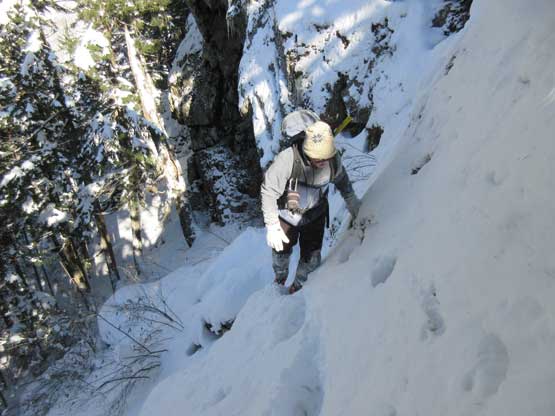
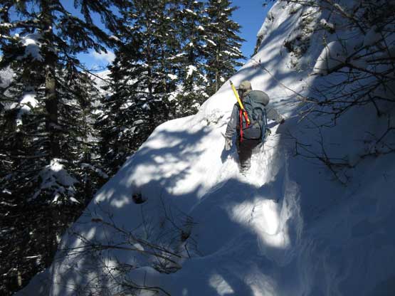
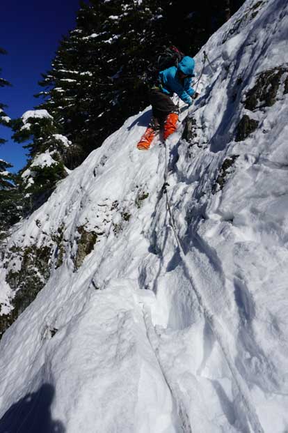
Batman up a fixed rope with very slippery footings
This is Chris near the top of this long pitch of fixed rope.
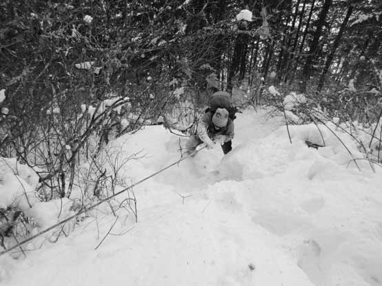
The going was tough especially with the increasing amount of post-holing. The route-finding was getting trickier too as we started to lose the trail under that deep drifts of snow. The upside was a couple viewpoints but then we were facing the next challenge. The main “path” seemed to traverse climber’s left into some steep and bluffy terrain which didn’t make too much sense. We checked out the other direction but it came to a dead end albeit a decent viewpoint so after snapping a couple photos we turned around to explore the left side. The farther we went the worse it seemed but we charged on nonetheless. I led across an exposed step onto a narrow ledge in knee deep snow and then guess what? There showed up a fixed anchor and then I dug out a series of fixed ropes. I then pulled them backwards and the ropes actually connect all the way back across the previous exposed step. I yelled to Chris that the “trail” indeed goes this way so he came over, but the sight of the next step was intimidating to say the least.
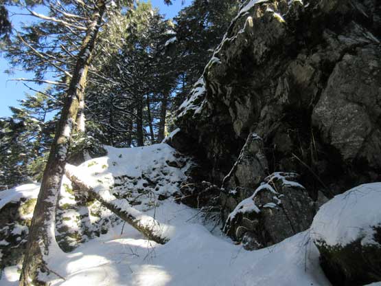
Terrain is steep and bluffy and it’s important to stay on path.
The trail crosses a steep gully here.
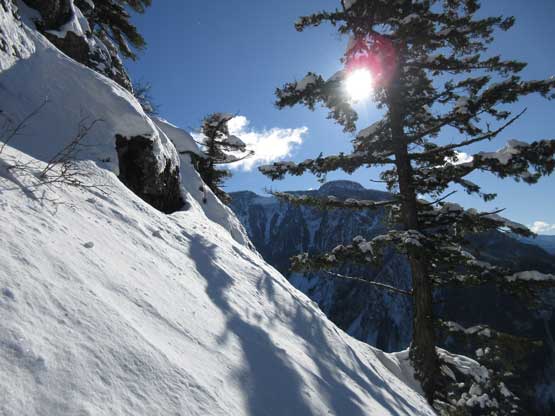
Then it led us to a decent viewpoint
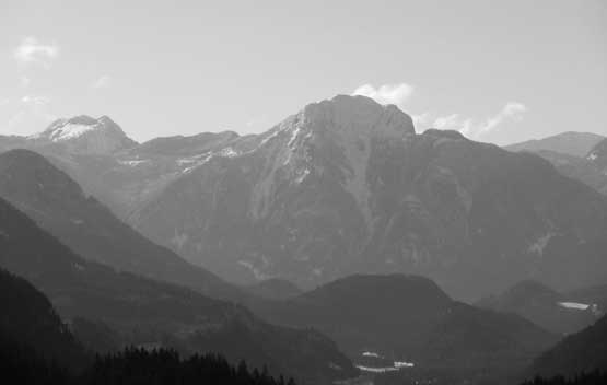
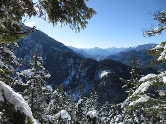
Good perspective of the north face of Hope Mountain
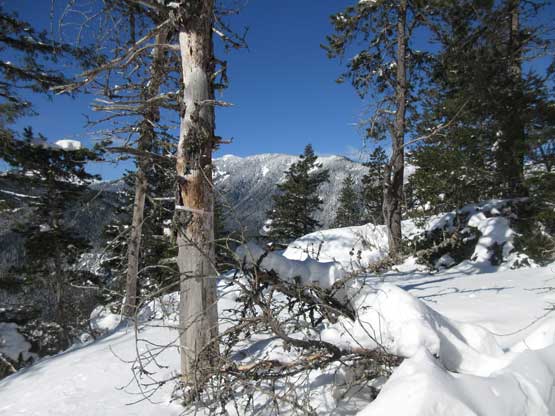
Higher up we checked out this viewpoint too.
Chris charging across the exposed ledge. Note the deep trail-breaking.

This is another perspective for the first part of this ledge traverse.

The most exposed part was actually protected by a fixed rope.

This is the actual crux…
I wasn’t so sure what to do but first of all I would have to don crampons and take the ice axe out. Chris decided to call it a day which was understandable. Immediately ahead was a 3-meter mixed climbing step with some moderate exposure but a fixed rope. The hardest move was actually getting into the line but once started the going was not nearly as bad as it looked. I made some quick work up the crux but then I still had to traverse a (now very exposed) upper ledge but again it was assisted by a fixed rope. The rope wasn’t obvious but having the previous experience I knew it must be buried somewhere underneath and it sure didn’t disappoint. Higher up the flagging got me into a steep gully where I had to wallow up some waist deep snow. The last stretch was characterised by some crotch deep post-holing in deadfall fields (fun, uh) and ironically the true summit is heavily wooded with no view.
The deadfalls on the upper mountain was super annoying

Almost there.. But still fair amount of post-holing to deal with

A bit of views looking east across Fraser Canyon.

Me on the wooded summit of Mt. Lincoln
The summit was actually quite nice and warm but knowing Chris was still waiting on that ledge in the shade I didn’t do too much of lingering. Retracing my steps down the upper slopes was easy and fast and then I had to down-climb the crux step. I used the ropes as a hand line and then did a few long reaches on foot holds and it worked. One of the bolts worked perfectly as a foot placement (with crampons). I continued down with crampons for a while but took them off after passing the next stretch of fixed ropes. The rest of the descent was pretty easy going sans the lower fixed rope. I actually chickened out as the rope was completely iced up so offered no grip. Chris did a controlled butt slide but I like to keep things completely static so down-climbed in the bush beside that “trail”.
Time to start descending..
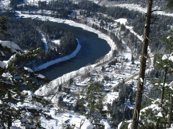
A view looking down at Yale and Fraser River

Me traversing the exposed upper ledge back into the crux. Photo by Chris Hood
Me down-climbing the crux. Photo by Chris Hood
Fast forward. Back to the trail-head now.
Despite the winter conditions this was nonetheless a short day. We were back at the truck at 1 pm which meant we would be back home before the evening rush hours. As a perfect plan as it was.
