Isolillock Peak
July 20, 2021
2090m
Hope, BC
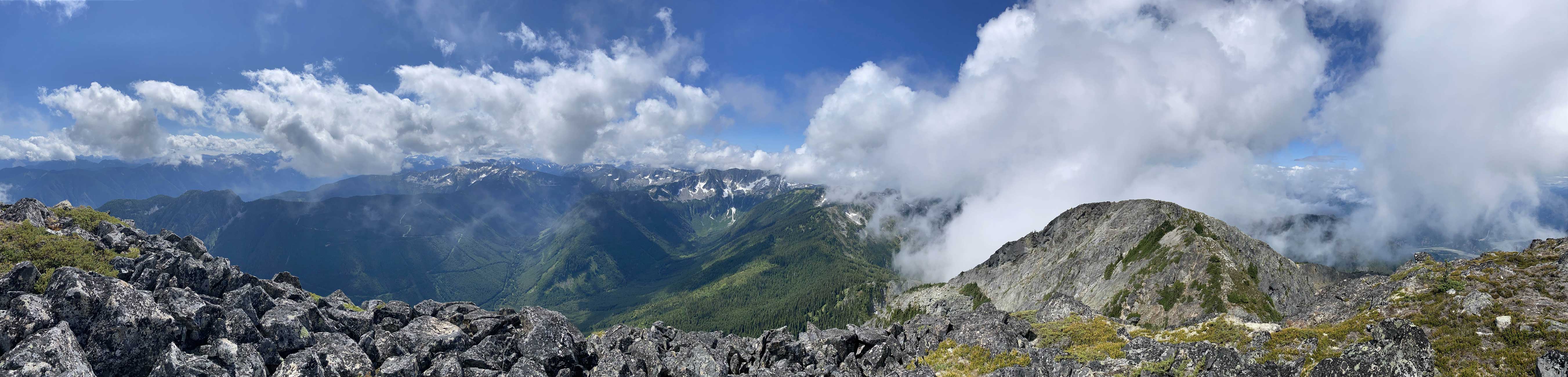
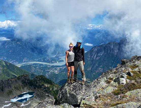
Isolillock Peak is a decently iconic massif that’s extremely visible while driving down the Fraser Canyon road from Yale towards Hope. It rises directly above the town of Hope and the mighty Fraser River for over 2000 m elevation. The ascent is however, not nearly as difficult as it looked from below. This peak was more often done from Sowerby Creek but these days with the beta-sharing of new era is ‘clear that the better attack is from Eureka Mine Road from the north. This approach also gives oppourtunity to combine Isolillock Peak and Silver Peak is one outing. The north ridge is the most logical route on the north side but recent reports had indicated that a direct ascent from Silver/Isolillock col was also very feasible. Christine and I decided to take advantage of all these “beta” to ascend Silver Peak and Isolillock Peak in the most efficient fashion. We drove up Eureka Mine Road to above 1500 m elevation and firstly made an ascent of Silver Peak. Now at Silver/Isolillock col our plan was to traverse Isolillock Peak to make a loop.
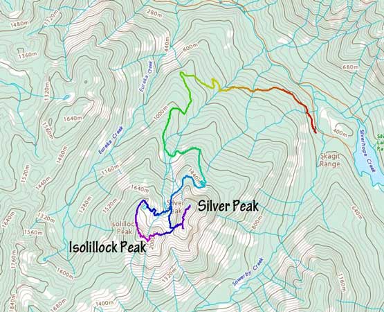
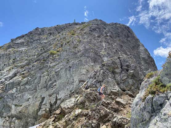
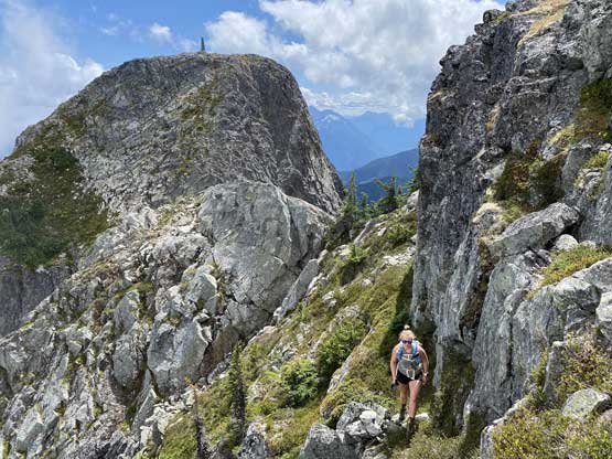
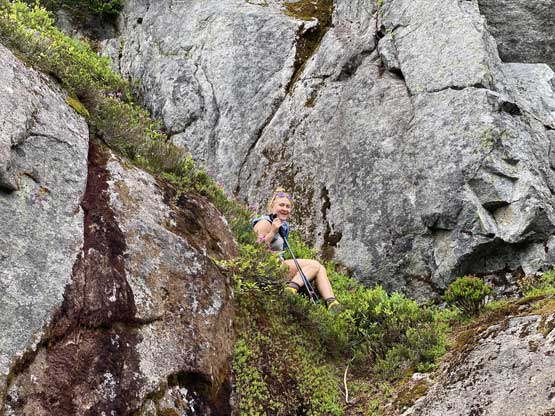
The ascent from Silver/Isolillock col might appear daunting and bushy but in fact it’s neither difficult nor thrashy. We did have to grab some bushes but I would not call this route a “bushwhack”. There were also spots with seeping water on granite slabs but any difficulty could be avoided with some route-finding. I managed to lead us up this ridge keeping the terrain well within “class 2” so any scrambler should be able to do it. Higher up we ascended a mellow field of snow then attacked the summit block via the right hand side skyline ridge. The advantage of this route was that we popped out onto the true summit directly without having to traverse over that sub (west) peak.
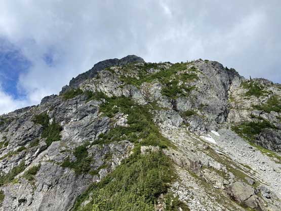

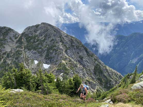


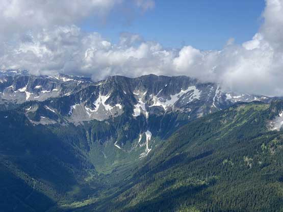


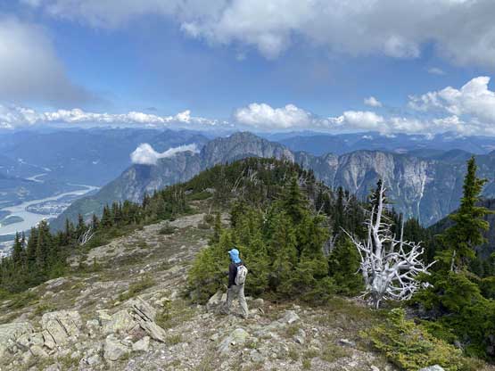
The easiest way down would be to reverse our route but we wanted to get the most out of this peak, so the decision was to traverse the north ridge. The down-climb into the true/false col was mostly class 2 except for one step near the end. Looking back I’m sure we did not find the easiest route but it worked for us so why not. We then easily slogged to the top of that false (west) summit for completion, before descending the easy and gentle north ridge towards a partially thawed tarn. Unfortunately we were mostly in fog in this stage.


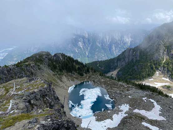
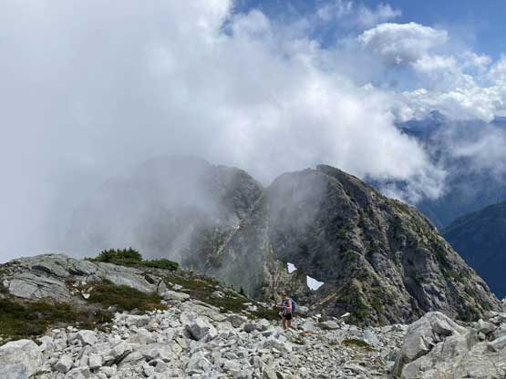
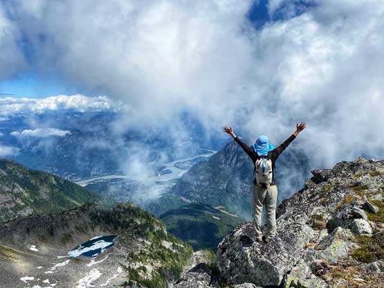
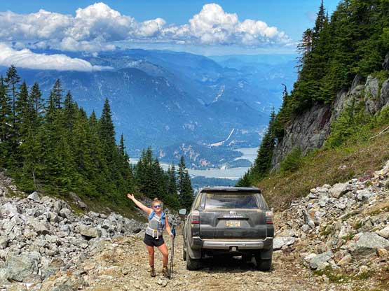
We did not do much research about how to get down from this spot, so I essentially just found our own route based on what we could observe. There’s a bit of bush thrashing to descend to that tarn and from there we stayed a bit too far skier’s left and had to deal with more bush thrashing and tricky down-climbing. After a few ledges I made the call to traverse hard right into the main drainage and from there we had no further difficulty to get down. Christine wanted to go for a swim in that lower tarn but it looked too cold for me, and we were getting hungry. Our trip wasn’t over yet as we still had to drive down that steep road. The worst would be to encounter someone driving up. We did meet one guy but thankfully he’s in his dirt bike. Otherwise this would turn into a nightmare.


While driving home we noticed that there’s another massive accident on Highway 1 with at least 30 minutes of delay, so we directed our bearing into Chilliwack for a late lunch. After the lunch we hopped back onto the highway and the traffic was consistently heavy from there all the way to Abbotsford. There’s no more accident, but the volume of the traffic was beyond crazy, considering this was only a weekday. Thankfully I was able to get off the highway soon by taking Fraser Highway and 16th Ave into White Rock but even so, it was a slow show.
