Deroche Mountain
November 19, 2015
1419m
Mission / Fraser Valley, BC
With a 4-day high pressure system forming up towards the second half of last week I was busy making some plans. For the first day (Thursday) I wanted to do something not overly strenuous but with decent views and checking what I’ve done so far in the SW BC I decided on the peaks north of Fraser Valley. This is one area that I hadn’t visited yet. Deroche Mountain is the highest by its immediate vicinity and has a good logging road system to access. There’re a few trip reports on ClubTread for reference and the usual approach is via Norrish Creek FSR followed by the deactivated Hanson Creek FSR from the north. It seemed to be just the “short day” I was expecting.
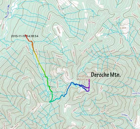
Deroche Mountain from Norrish Creek. GPX DL
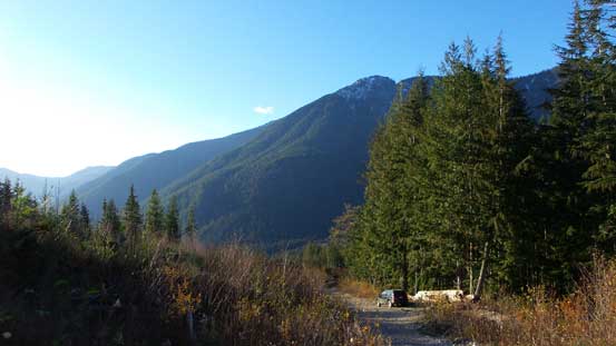
With an early start to avoid Vancouver’s horrible rush-hour traffic I made to Mission by breakfast time. The forestry road (in a total of 11-12 km) was in a good condition although there’s a few steeper and rougher places. The first kilometer or so up Hanson Creek FSR was also drivable but started to get very rough (loose rocks) with some waterbars. A relatively large pull out marked a good place to park. Two trucks from forestry company went further up the road but they didn’t gain too much of an advantage (only less than 10 minutes of walking) before having to stop too – no vehicle could get across the massive ditch ahead. To cross the creek in that ditch wasn’t even easy on foot.
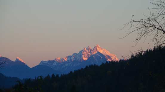
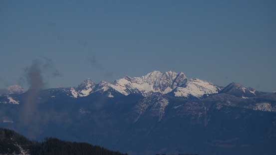
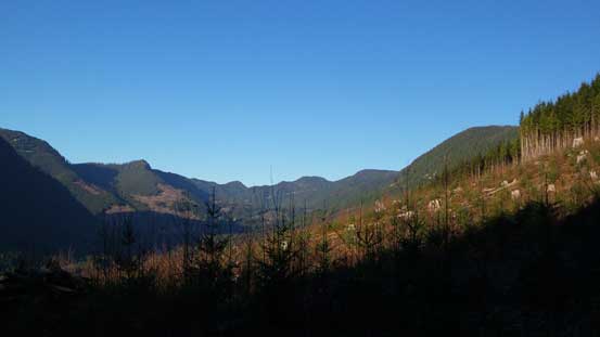
Alpenglow on Mt. Judge Howay from Highway 7 east of Mission
Hanson Creek FSR is a steep road that brings hikers up high quickly, from around 500 m (the start elevation) to above 1200 m. There were lots of large ditches though – not particularly tricky to cross but do add some variety to this otherwise mundane road walk. The annoying section was a few “re-sloped” stretches that traversed on a sloped angle and with fair amount of deadfalls to hop over. Snow didn’t start until elevation of 800 m and never got too deep until near the summit elevation, but the breakable crust combined with those deadfalls did create some tedious work for me. Not deep enough to cover the bush (thus snowshoes on), and yet deep enough to make lots of post-holing. I followed the main branch of this road making a large curve to left (north), ignoring any spur that branches off, and eventually at basically the broad pass between Deroche NW1 and Deroche SW1 I started the bushwhacking.
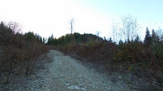
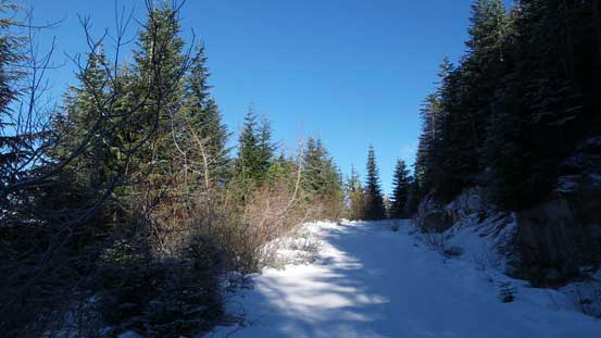
Hiking up Hanson Creek Road
One of the many ditches

The “re-sloped” section
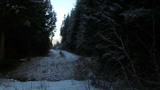
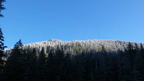
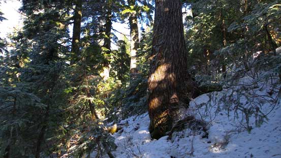
Further up there’s a continuous snow coverage, but very shallow
Immediately ahead there’re two small lakes and getting around these lakes was the worst section. Again, the snowpack was not deep enough to cover the bush and yet, deep enough to make arduous trail-breaking especially on those breakable crust. I put snowshoes on initially but had to remove them soon as there were a few massive deadfalls requiring some interesting moves. Further up the travelling condition improved once the terrain got steeper and I strapped my ‘shoes on again. But then I made a mistake of going too far on climber’s left – ended up on some very steep forested ground. Near the top it got so steep (and slippery) that I had to haul myself up while grabbing tree branches or grass and it was pretty sketchy. Thankfully the summit wasn’t too far away once I made through this crappy section. The broad ridge was easy to traverse and I was soon at the base of the final summit block.
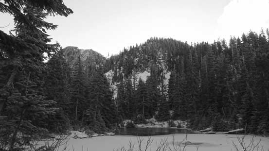
Ahead is the first lake. The bump behind is Deroche SW1
Walking around the lake
Could see the ridge and the summit from here.

Bushwhacking up the forested slope
Gaining some height.

Cresting the ridge now, looking ahead
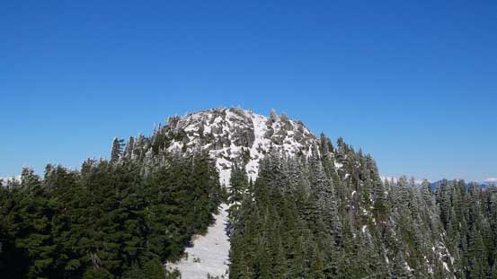
A zoomed-in view of the summit block
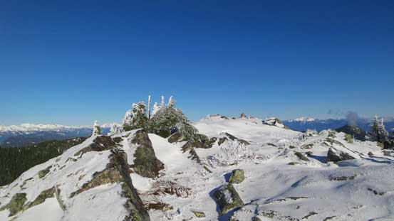
The summit block appeared to be steep and tricky but actually not, although the slope was still fairly steep leading to the rocky step. I removed my snowshoes for the step and soon after that I was standing on the top. There’s no trees on the summit and this is a great place to observe the Fraser Valley from a birdeye perspective.

The rocky step on the summit block
Almost there..

A view from the summit plateau

Summit Panorama from Deroche Mountain. Click to view large size.
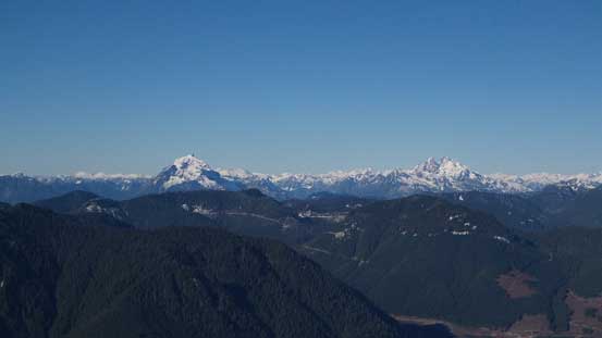
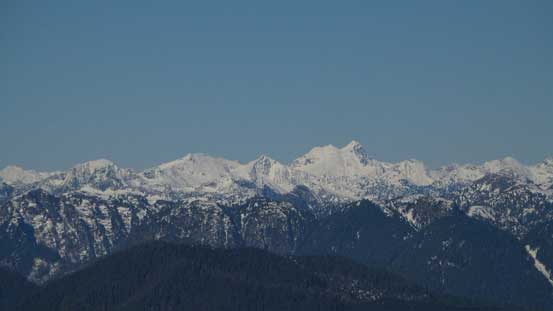
Mt. Robie Reid and Mt. Judge Howay stand out from the horizon
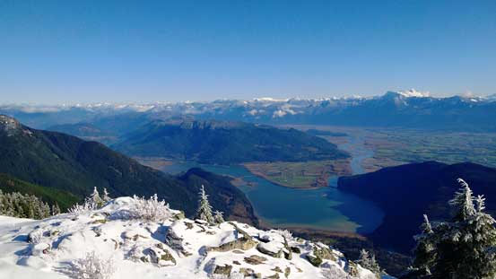
Looking down at Fraser Valley

Mt. Robie Reid

Mt. Judge Howay
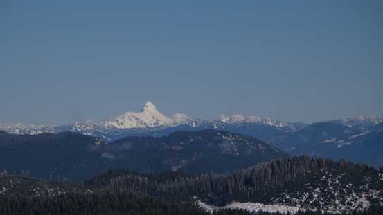
The rarely climbed Robertson Peak
Mt. Clark area west of Harrison Lake
Mt. Urquhart sticking out
The Old Settlers

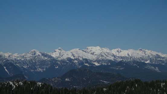
The peaks on Cheam Range

Mt. Baker with Colfax Peak and Lincoln Peak on its right shoulder

Slesse Mountain is that pointy peak right of center
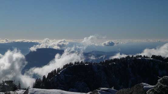
Looking towards the Lower Mainland and some low clouds
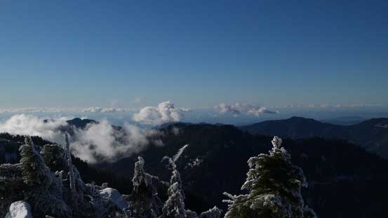
Another view of some low clouds and some forested peaks

Harrison Bay
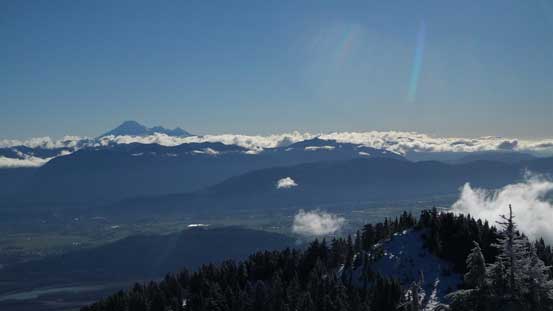
Mt. Baker on the horizon, looking way south into Washington State
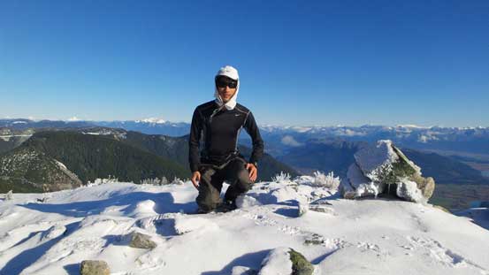
Me on the summit of Deroche Mountain
I didn’t linger too long on the summit as I wanted to be back home before dinner time. I followed the broad summit ridge down, up and over a bump and stayed well to down-climber’s left of the section I went up. The terrain was indeed way less steep. The snow was still crusty though so I didn’t bother with snowshoes and just plunged/post-holed down. Once I rejoined my uptracks it’s basically putting one foot in front of another, although the re-sloped zone on that Hanson Creek road was just as tedious as what I remembered from a few hours ago…
Descending the summit block
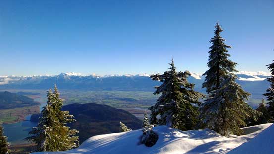
One last view of Fraser Valley before dropping into the forest
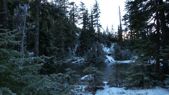
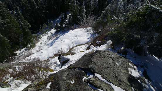
Part of those lakes was frozen already
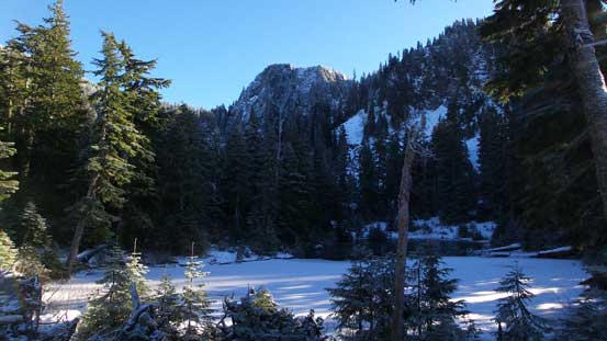
The same lake
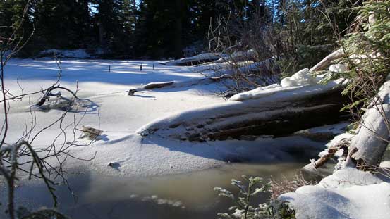
Typical view of the Norrish Creek drainage
Done…
Back to the Jeep I saw quite a few trucks parking at various spots beside the road. This area was a bit more popular than I thought. The gas was cheap by Mission but it’s so close to the border that I just drove down south for (even cheaper) gas. Back home by dinner time and then it’s time to get ready for the next trip…
