Mount Rahm
July 10, 2018
2585m
Depot Creek / Chilliwack Lake Road, WA
Mt. Rahm is rather just a bump on the far NE end of Custer Ridge north of Mt. Spickard very close to U.S./Canada border. This peak does not have 400-feet prominence to quality a “separate summit” for those into prominence kind of thing, but is officially named on the topographic maps and is fairly visible. Canadians know it because of the inclusion in John Baldwin’s Exploring the Coast Mountains on Skis and in fact, the northern approach was once the shortest and the most aesthetic way to tag this summit. The maze of logging roads are too overgrown now and the status of those roads are very obscured. The peak of Mt. Rahm is also included in the famed Bulger list so I don’t have an excuse to play laziness. This has to be done one way or another. The standard route involves an arduous side-hill trudge on the bench above Silver Lake followed by a loose 3rd class gully. The modern approach to Lake Ouzel takes a full day for averaged parties and to make it more memorable the approach starts from Chilliwack Lake Road in Canada…
There’s no way would Eric G. and I come all the way this far to only do Mt. Rahm. Earlier in this trip we had already grabbed Easy Mox, Mt. Redoubt, Hard Mox and then Mt. Spickard. This is the 5th objective out of the 6-pack. It’s getting late in the day but again we just had to man it up. How bad could it be…
Mt. Rahm standard route from Depot Creek and Lake Ouzel
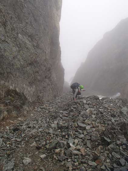
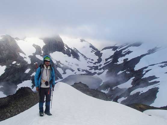
After coming down from the standard south side route of Mt. Spickard we immediately resumed the plod up and over Silver Pass. Much of this stage was done on snow but there’s annoying talus field to negotiate near the pass. And then we were engulfed in another white-out and there came the staring-at-your-phone kind of navigation, except for Mt. Rahm we no longer had a downloaded track. However, we did come prepared with Steph Abegg’s route photos so combing with the detailed Gaia GPS map we still had a chance to figure out the route despite the limited visibility. First of all we scrambled up a series of loose but up-sloping ledges to gain the wide bench at around 2300 m elevation. Then there came that 3-km long side-hill bashing across this bench, thankfully mostly on snow. This stage was tedious as fuck and I seriously thought about turning around for a couple times. It’s past 6 pm and I thought we’d have zero chance to get back to camp before dark. But I forgot the spirit of this trip was to simply man it up, so we resumed..

Scrambling the loose ledges above Silver Pass
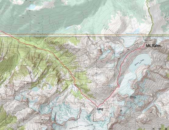
Me somewhere along the 3-km bench traverse with a view of Silver Lake.
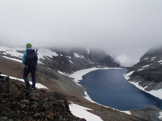
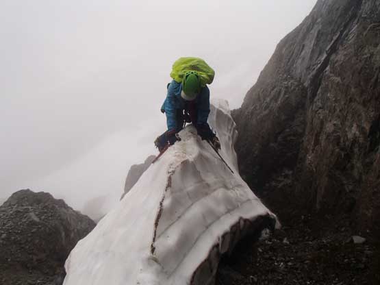
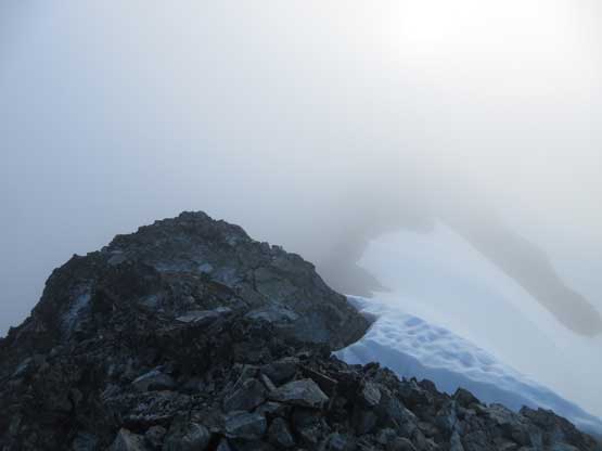
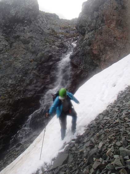
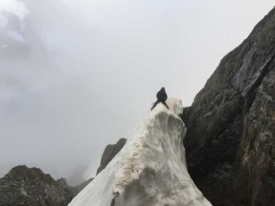
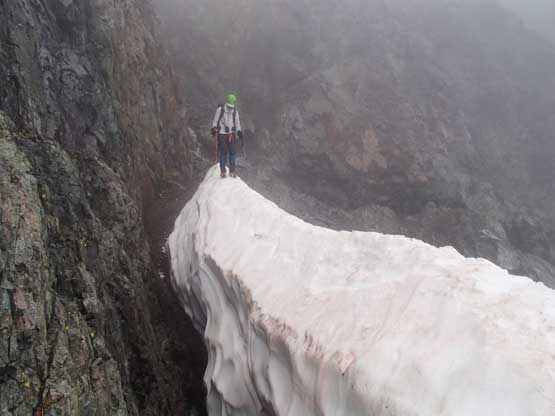
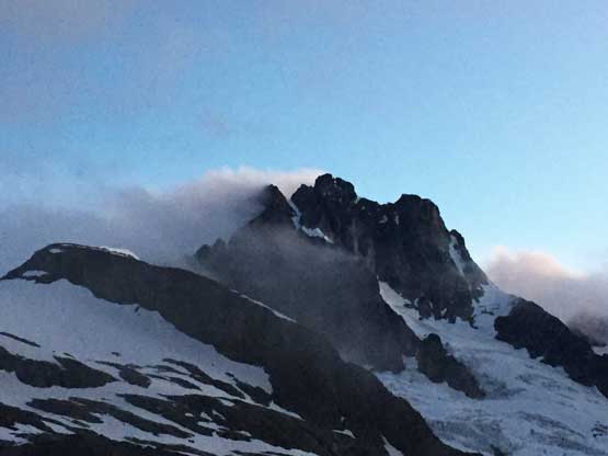
Our aim was that “long and looser but 3rd class gully” and it was disorienting with the next-to-zero visibility. I had to consult with Steph’s photos and our GPS maps various times to decide whether or not we had traversed far enough. In the end I figured out the solution. If you can still traverse on snow then you haven’t gone far enough. Once entering that gully it’s very obvious. It’s a large one with waterfalls running in the middle, and getting into the gully provided a bit of difficulty. There’s a sharp knife-edge snow arete that we started from front-pointing on the side but opted for au-cheval. To me this is the highlight of this entire day. Climbing the gully was barely 3rd class but chossy as famed. Eric again bolted up on full force and I somehow managed to keep up. Beyond the gully we veered climber’s right on easy snow to get onto the south ridge. No more difficult was encountered anymore and the summit was right around the level of cloud’s top. The weather’s apparently clearing but not enough for us to see anything, literally.
We were surprised to encounter this snow arete. Eric led across

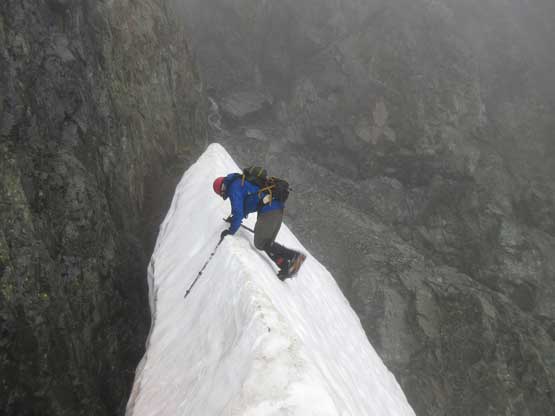
After a while Eric decided to au-cheval which was safer
Me au-cheval across the snow arete. Photo by Eric G.

Ascending the typical terrain in the loose 3rd class gully
Me partway up the gully
After a long while of plod we arrived at the summit

Me on the summit of Mt. Rahm
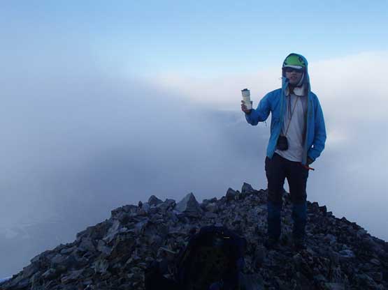
Another photo of me on the summit of Mt. Rahm

Just a shot of the register to prove we did make the summit…
It’s well past 7:30 pm now so we didn’t have any extra time to linger. We still lingered for about 20 minutes on the summit because the weather really started to break, but eventually we came to the conclusion that any further waiting would be foolish so started the descent. The new plan was shooting to get back to camp before headlamps time. This seemed totally unreasonable but I again forgot why we came here – to simply man it up and turn the impossible into possible… The weather broke partway down the south ridge and we got treatment with the gorgeous Silver Lake. And then we surfed down the loose gully in literally 5 minutes. Back to the snow arete we practiced transitioning gears for as fast as possible and then Eric led a blistering pace traversing back across the long ass bench. About halfway across we took off the crampons and changed ice axes for poles. The terrain’s too lame to need that extra safety factor of self-arresting. Down-climbing the loose ledges required some caution but then we pretty much ran down from Silver Pass on talus and snow and you guess what, we indeed beat headlamp time. We even earned an extra half an hour’s time to cook dinner before it’s too dark to see… It’s past 11 pm when we eventually turned in..

Time to leave the summit behind. This is the upper mountain’s scree

Me descending the south ridge. Photo by Eric G.
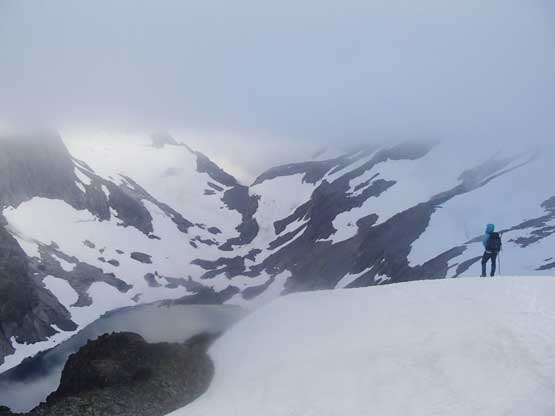
Dropping back onto the snow we got more views. Photo by Eric G.
Me with Silver Lake basin behind. Photo by Eric G.

Another shot of the Silver Lake basin with part of Mt. Spickard behind

Ready to enter the loose gully
We bolted down the gully
Back across the au-cheval snow arete
I didn’t want to wet my pants to opted to walk across…

Just a shot from the long ass bench traverse.

At least we could get occasional glimpses of Silver Lake
Back to camp now and Mt. Redoubt’s clearing up
It’s tempting to play the laziness game on the 4th day but I’ve learnt that the hard way from my Twins trip on the Columbia Icefield. Do NOT ever leave an important peak behind. It’s more than three years since that trip and guess what, I still had to go all the way back up there for the stupid Mt. Kitchener. I knew how shitty Mt. Custer is but that’s included in the Bulger list. Many years later I might come close in finishing and by that time I would hate having to redo this approach for just Mt. Custer. The solution? Man it up and bag them all.
