Eddys Mountain
December 1, 2022
479m
Acme, WA
Eddys Mountain is a forested pimple on the north slopes of Lyman Hill not far from the small village of Acme. I noticed this objective because of its official name and then I realized logging roads extend basically to the very top of the “mountain”. I have no idea about the gate status as online “beta” was lacking, so I needed to plan for the worst. Assuming the roads are gated from the bottom I would be looking at about 12 km of round trip distance, but the satellite images suggested that I could bike most, if not all of the roads as they looked rather “clear”.
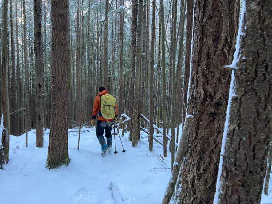
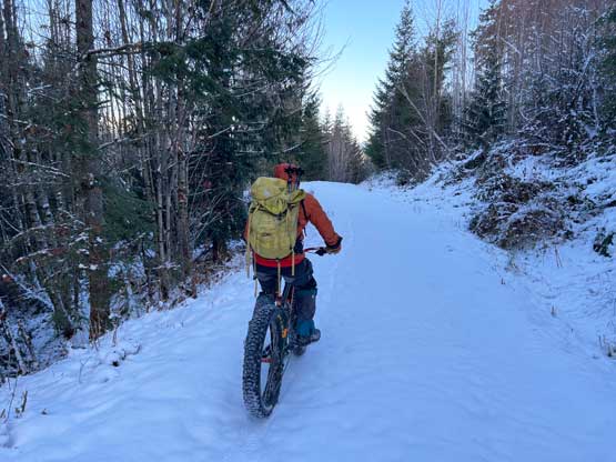
Phil and I made the spontaneous decision the day before to take advantage of a brief mid-week weather window. The downside was the fresh dump of snow down to sea level so we really needed to pick a low-key objective. The cold Arctic air mass seemed to be lingering for quite a while so the roads were extremely slippery. I threw out a few suggestions and we picked Eddys Mountain. There were only two ascents on peakbagger.com and none of them had provided a “trip report” so we had to face the unknowns ourselves. I decided to bring the fatbike while Phil opted to walk, and we collectively decided to leave the snowshoes behind and that proved to be mistake. The decision didn’t cost our summit, but did make the trip more treacherous than it should be. I was positive that a peak under 500 m elevation wouldn’t be requiring snowshoes but I was being too optimistic.
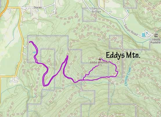
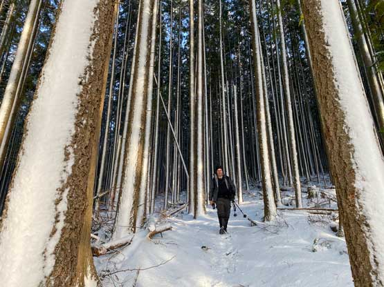
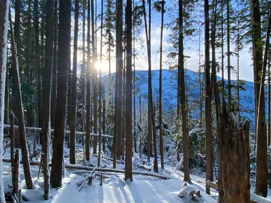
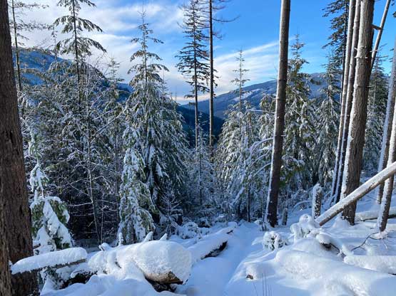
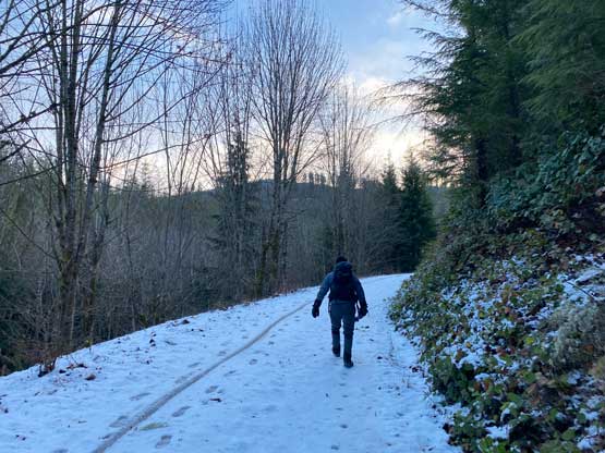
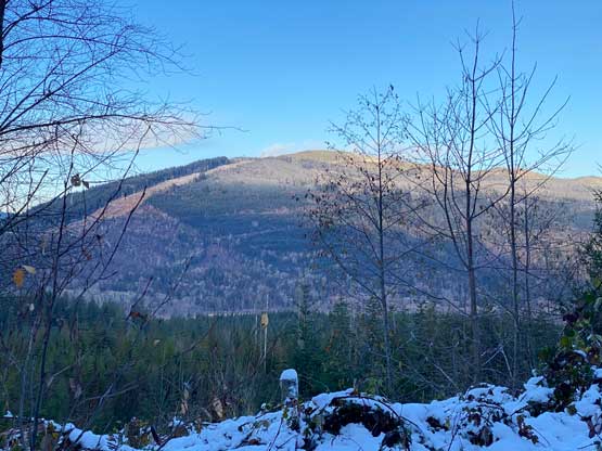
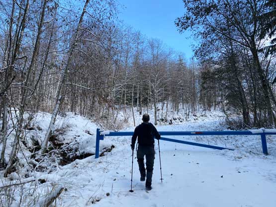
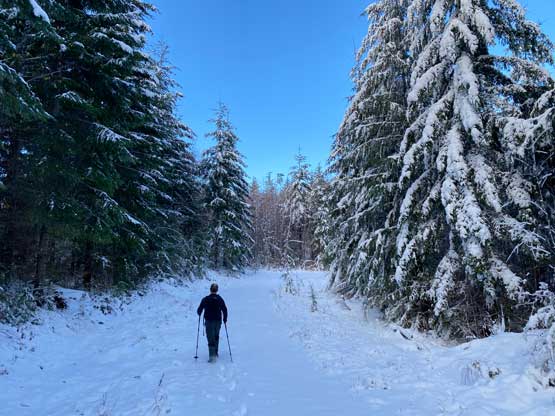
We left White Rock at 6:40 am and followed Google’s direction to the logging roads south of Acme and learnt that the gate was actually open. We turned around and parked the truck in front of the gate anyway as we came here rather for exercise. The riding was not as simple as I thought as I underestimated the amount of snow. The first few kilometers were definitely easy as the fatbike could handle compact snow but starting from that long northwards switchback I started to sink in. Once the tires started to sink the riding would become exponentially difficult. Eventually at around 330 m elevation I called it and ditched the bike. At this point Phil was already dealing with ankle-deep post-holing. This was a good call as the snow conditions did not improve higher up. Snowshoes would have made things much simpler but with perseverance the job could be done without the snowshoes. We got glimpses of views from the upper road on the east side of the peak but the true summit was completely forested with no view. We also had to deal with a short section of bushwhacking to find the absolute high point.


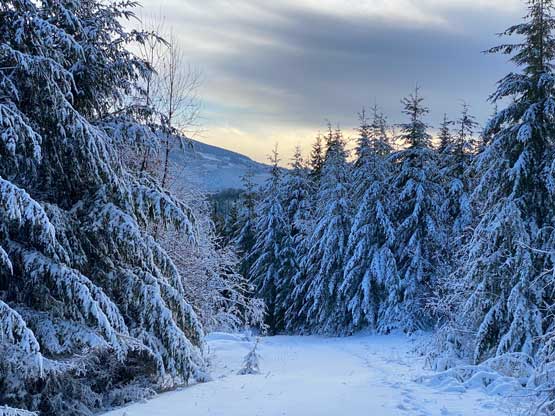


While wondering around to find the “true summit” we discovered a snow covered mountain biking trail heading down southwards. Instead of retracing our own steps we opted to take the exploratory descent and this trail did eventually aim at the direction we wanted. The trail also utilized the forest more than the openings so the post-holing was actually not too bad and it brought us back to the logging roads close to where I ditched the bike. This trail was in a good condition, but not labelled on the Gaia map. The riding was still challenging for the first kilometer as I constantly sank in, but then the downhill grade really kicked in I was able to finally start cruising. After loading my shits I turned the truck around and drove 1 km up the road to grab Phil and then we leisurely drove home. I made home just in time for lunch and earned myself a couple extra hours’ of napping before the afternoon/evening work routine.