Mount Harrison
August 30, 2014
3359m
Bull River (East Kootenay), BC
Mount Harrison is the southernmost 11,000er in the Canadian Rockies and has been on my radar for quite a while already. For climbers seeking technical challenges this peak is more famous for its north couloir but if your main focus is simply reaching the summit, then the easiest line, SW Face, is merely a loose class 2/3 scramble in dry condition. For that reason it wouldn’t be our primary plan if condition is in for bigger and harder objectives. However, in this past weekend, with the forecast in favour of southern Rockies but still with possibility of rain, Eric, Ben, Vern and I decided to finally give Harrison a shot. Having 3 days we’d also attempt the nearby Mt. Folk and Smith Peak using Rick Collier’s route description.

Scramble routes for Mt. Harrison (SW Face) and Mt. Folk. GPX DL
The crux for Mt. Harrison? No doubt would be the drive… We knew quite a few groups attempting Harrison last year and earlier in this year and the most important message was the damaged bridge on the standard approach road (White River FSR). We had to use the alternate approach, Bull River FSR starting from near Fort Steele which involved a far longer drive. We had to drive down south to Crowsnest Pass, westwards along Highway 3 almost to Fort Steele and finally up about 100 km one way on logging road with the last 12 km being the roughest I’d ever been on. Time wise it’s about 10 hours one way from Edmonton and definitely one of the most remote places I’ve ever been to. Eric, Ben and I drove down to Okotoks on Friday evening and met Vern the following morning. Vern volunteered to drive and did a fantastic job getting us to the trail-head. We were very pleased to have his truck (high clearance 4×4 was a must to overcome obstacles including a fallen log, a creek crossing and numerous wash-outs).
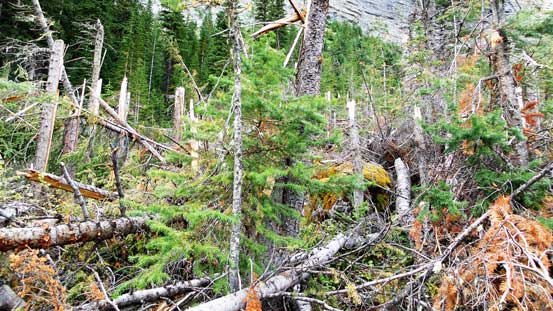
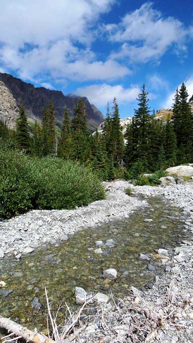
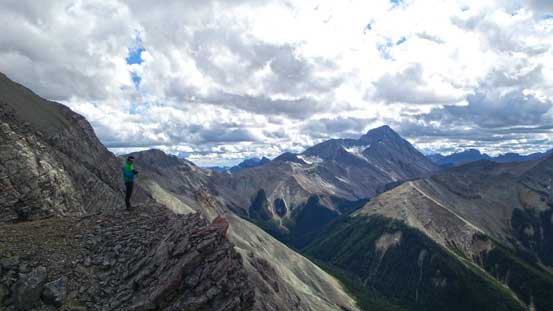
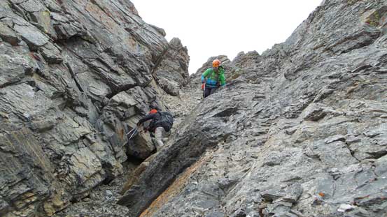
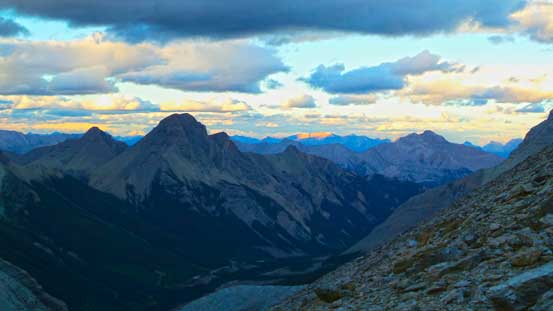
The next crux was not losing the trail. Thank to the avalanche debris this had become impossible. We initially followed some flags up climber’s right side of the creek and soon entered a field of dead falls. Negotiating the avalanche path was miserable to say the least hoping over hundreds of logs and bashing through alders. The correct trail which we discovered on the way down was on the opposite side but still, involved a section of very nasty bushwhacking. After this pile of mess we picked up an intermittent trail on the right side of Harrison Creek steeply up a bank, then joined the main trail on the left side. Not far up on the main trail we could see Harrison/Folk col ahead which didn’t look to be very far. We also noticed there’s no water source at the col at all. Given the unsettled weather we all agreed to set up camp lower down when there’s plenty of water and no wind. There were numerous prime bivy spots. In retrospect we could have gone a bit further up and camp by the big cliffs but speaking the big picture it’s the same. About 2 hours from truck to camp it’s definitely one of the shortest approaches I’d done speaking overnight trips.
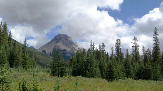
A view of the unofficially named Mt. Splendid from the parking lot.
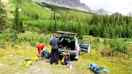
Gearing up
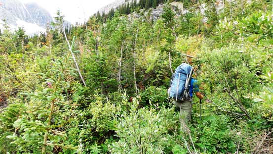
Alder bashing…
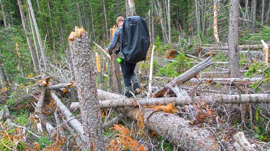
Deadfall hopping…
Not the greatest way to start a day…
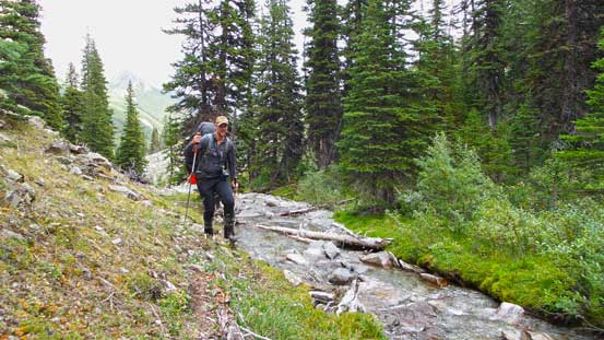
Happy to be back on trail.
Continuing up in gloomy weather
But weather soon improved. This is looking towards Harrison/Folk col
We chose here to bivy. Lots of water source
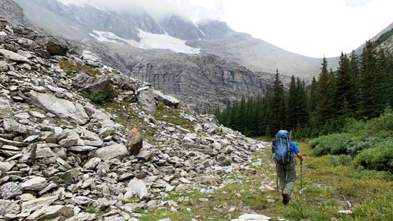
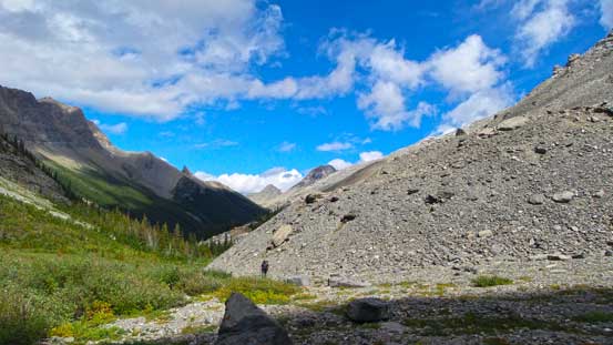
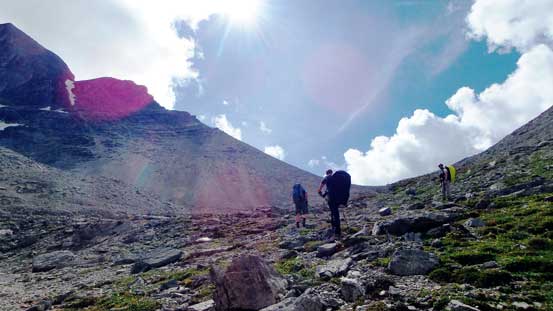
After setting up camp we decided to give Mt. Folk a go, but we also brought up snow gears just in case we wanted to bag Mt. Harrison on this day. The slog to Harrison/Folk col was long and foreshortened and seemed to drag on forever especially the last part which seemed to be flatter but was a lot longer than appeared. Once we made to the col we noticed there was no weather moving in. Judging my our experience we figured it’s better to do Harrison right now even though we were all very tired. In unsettled weather period you just cannot trust “the next day”…
The place where I took this photo was another great camping spot.
Mt. Splendid came into view again
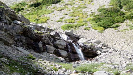
A mini waterfall higher up

Ben hiking up the typical terrain
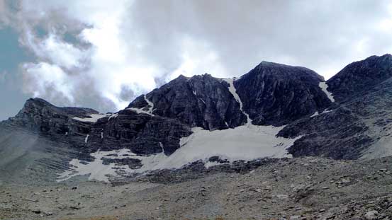
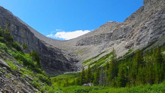
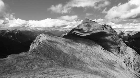
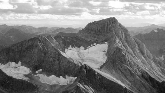
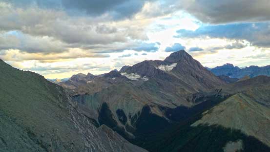
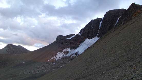
Soon we arrived at the base of Harrison’s north face and north couloir
The foreshortened way towards Harrison/Folk col
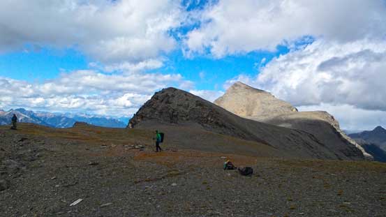
Arriving at the col, looking towards Folk
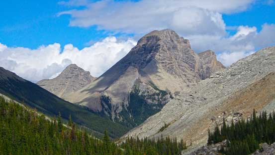
A closer look at Mt. Folk
Vern checking the view, Mt. Mike in the background
Ben taking in the views from the col
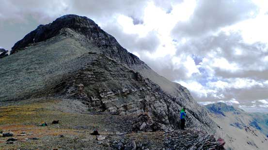
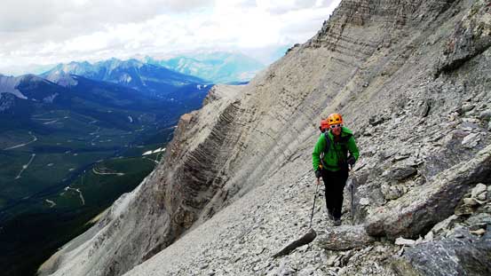
Looking upwards – Harrison’s SW Face is a massive slog…
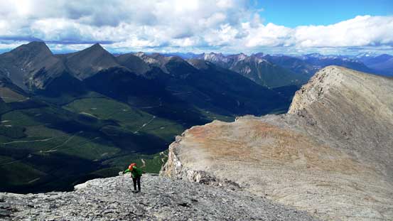
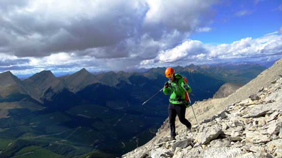
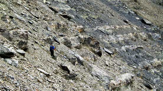
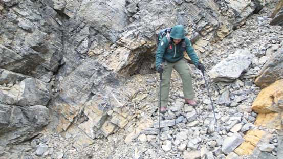
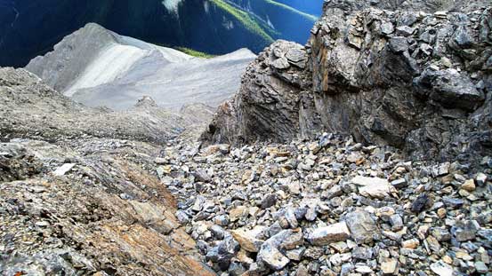
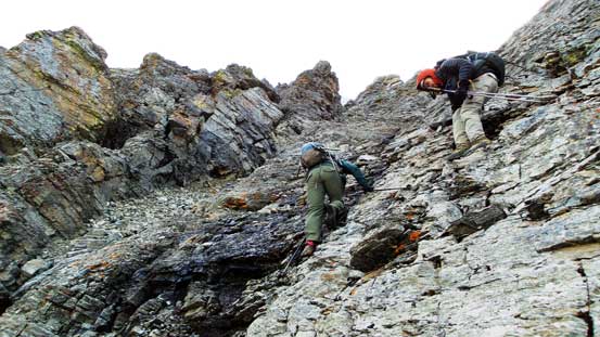
Up we went, we followed a path for a while before starting the long side-hill bashing across 3 bowls. The first bowl was the easiest as we could stay on a reasonable path and soon we arrived at the second bowl. This one was the longest and most tedious since we lost the path and had to bash our own way across. We had So Nakagawa’s GPS track armed with but still aimed a bit lower than his path. To access the 3rd bowl there’s a short moderately exposed scramble section involved. We then went straight up for a long section before aiming climber’s right to the ascending gully. The route didn’t seem to be obvious but once getting higher it became pretty clear – basically aim for the easiest looking gully. Terrain in this gully reminded us Catacombs and Fortress Mountain which we did last year – not difficult but horribly loose. We had to stay very close to each other or climb parallel to each other to minimize rock fall danger. Knocking down rocks was unavoidable. Despite the recent rain fall and the cold weather this gully was bone dry so we should have left the snow gears in the truck…
Vern starting the trudge. Harrison/Folk col below
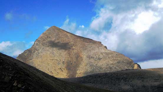
Mt. Folk – our objective for the next day
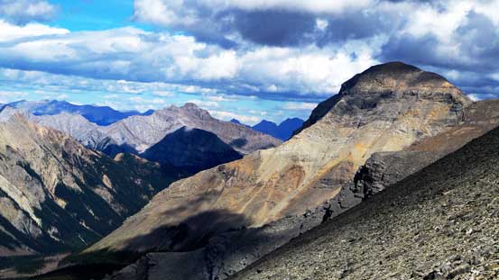
Smith Peak – our objective for the 3rd day

This is the second bowl – long and steep…
Vern finishing the traverse of 1st bowl
Eric starting the 2nd bowl
Vern finishing the 2nd bowl

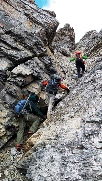
Transitioning to the 3rd bowl – this move was a little bit awkward
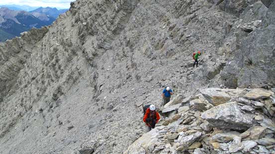
Ben, Eric and Vern in the 3rd bowl

Traversing around a corner
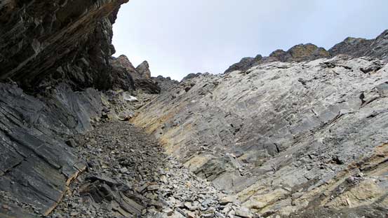
Looking up the ascending gully
Grinding up the gully…
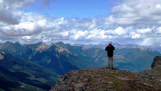
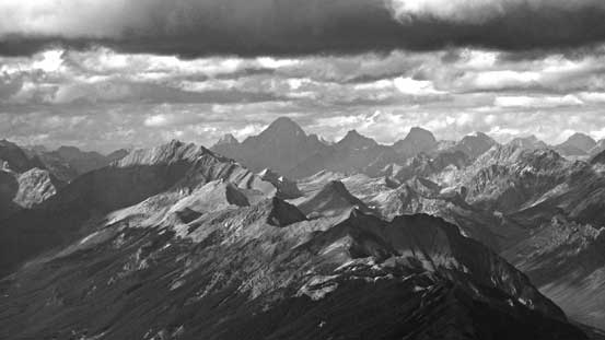
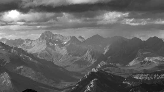
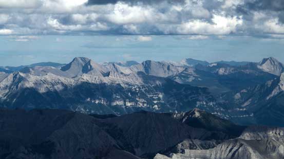
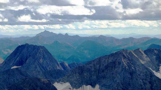
This gully also dragged on for a long time before we topped out on the summit plateau. There’s still a bit of height gain to the summit but all on easy terrain. Though cloudy, the view from this lofty summit was incredible towards each direction. Many of the peaks nearby were totally new to me but I did manage to correctly identify some including the nearby Mt. Mike and the distant Mt. King George which was our previous 11,000er. The afternoon lighting was in favour of looking eastwards and we could see the whole stretch of High Rock Range on the Continental Divide with Tornado Mountain being the highest.

Ben arriving at the summit
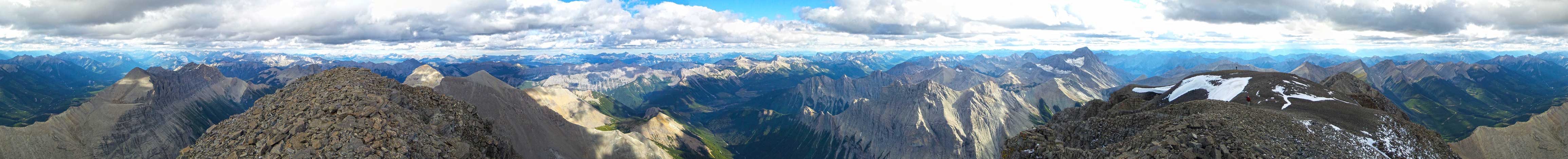
Summit Panorama. Click to view large size.

Looking north over the summit of Mt. Folk
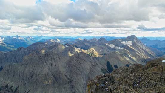
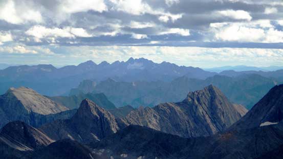
Looking south, Mt. Mike must be very close to 11,000 feet, if not more than that…
Mt. Assiniboine and Mt. King George looking north
Mt. Abruzzi
Mt. Sir Douglas and the British Military Group
The unusual view of Mt. Joffre
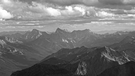
Mt. Gass on the High Rock Range
Mt. Lyall on the High Rock Range

The Elevators – cool looking summits
Mt. Erris on left – one of the many peaks in High Rock Range
A close-up view of Mt. Mike

Mt. Washburn is a major summit in this area
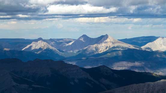
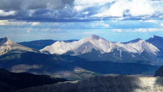
Looking way south towards The Steeples
Three Sisters, Mt. Bisaro and Mt. Klauer in Fernie area
Mt. Fisher which I did two weeks ago

In the distance we could see Crowsnest Mountain. In the foreground is Phillips Peak

Way in the distance we could see Flathead Range including Mt. Ptolemy
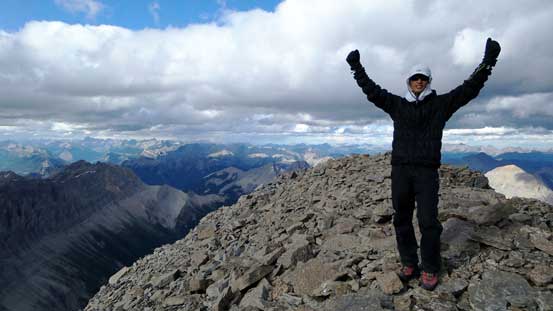
Me on the summit of Mt. Harrison, my 15th 11,000er!
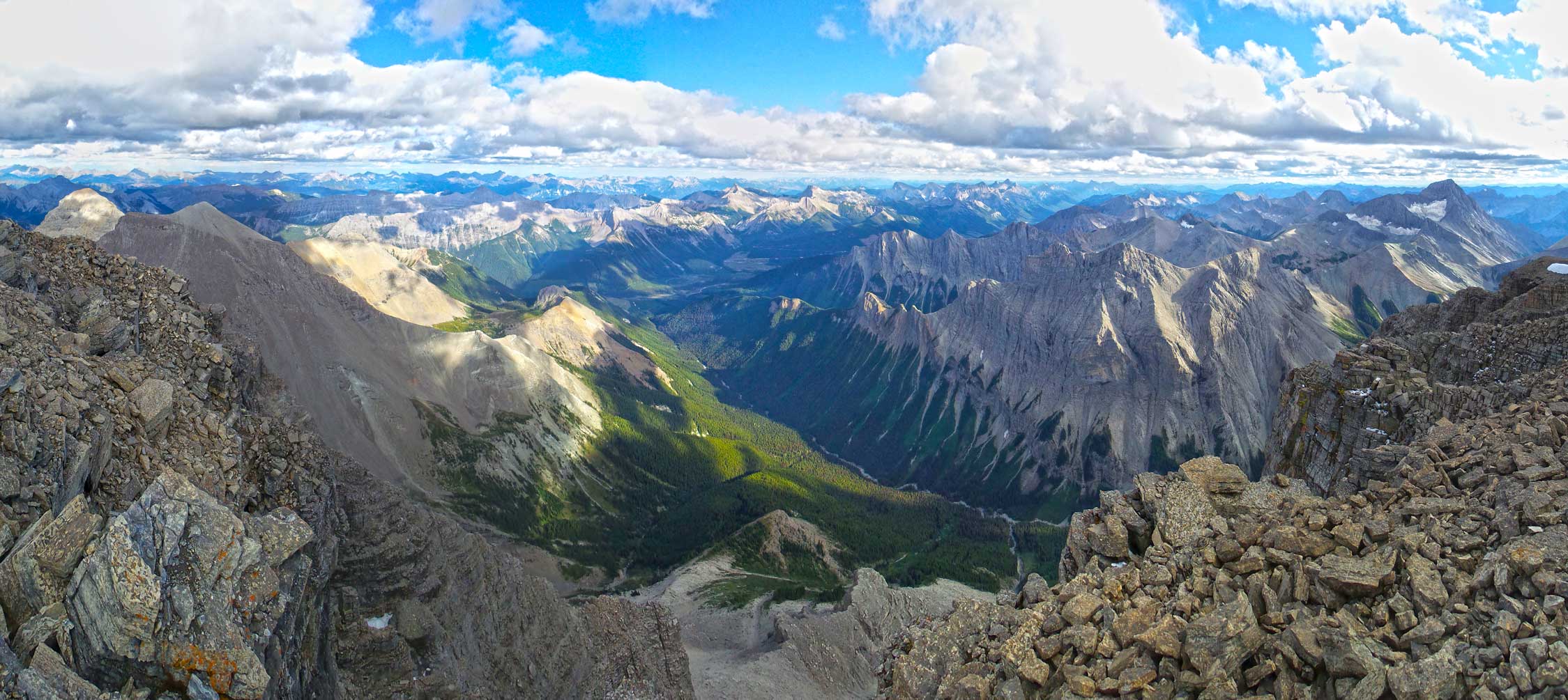
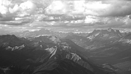
Panorama view of the deep greenish valley to the south. Click to view large size.

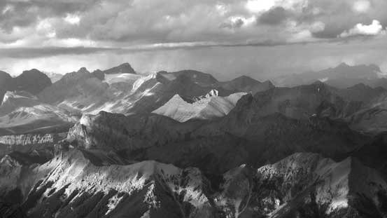
Another panorama from the summit. Click to view large size.
Due to the coldness and the lateness in the day we didn’t linger any longer after signing the register. Descending the gully was fast thank to the looseness but again, we had to stick very close to each other. Bashing across the bowls was not nearly as fun as scree running though, but still went by quickly. In general the terrain on Harrison was not very bad for descending but oh man, that was quite a pile of scree on the way up… By the time we got back to Harrison/Folk col it had become obvious we wouldn’t have the time to grab Mt. Folk on this day, so we leisurely went back to camp, hundreds of meters down. Darkness was falling at a rapid pace and we made back to camp just before head-lamp time.
Eric descending the loose gully
Ben and Vern descending
Looking down this shooting gallery…
A trickier spot we had to down-climb facing inwards
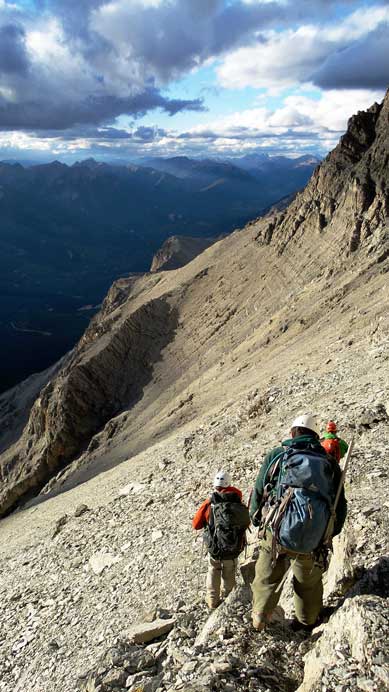
Back to the long side-hill bashing
Mt. Mike was always steeling the show
Evening colours over the horizon. Mt. Splendid on the left

Sunset over a group of unnamed peaks
One last look at Harrison’s north face
It was very satisfactory to have Mt. Harrison bagged on our first day – a day we didn’t expect to summit the major objective. Now the pressure was off and we managed to enjoy a evening with lots of chatting around a camp fire. We still wanted to do Mt. Folk so that would be our objective for the following day.

Great read, and great photos as well. Looks like an awesome climb but I’m curious, how would you rate its difficulty in comparison to fisher peak?
I’d say Fisher Peak (Kananaskis) is harder. Mt. Harrison is mostly about managing loose rocks and some route-finding. I can’t remember anything super strenuous nor exposed.
Hi Steven, fantastic read. I am planning a trip way up the White River FSR, North Fork, into a valley just west of the Limestone Lake area. You mentioned a missing bridge on the White River FSR? Can you tell me which bridge was out? Any idea if it was replaced since you did this trip?
Hey Greg,
I’ve never driven up White River FSR but I do know the status of that road is on-and-off in the last several years. In terms of what and where exactly I don’t know. As of August 2017 people still had to access Harrison via Bull River FSR from the south (known this from a friend) but I have no idea of this year’s status.
It’s currently accessible from the bull river service road. I was up there 2 weeks ago. Harrison creek turns off at the 98km.
Fyi white river bridge at the 44km has been repaired, as well bull river road is fixed up.
Cool. Thank 🙂