Sauk Mountain
October 11, 2016
1689m
Concrete / North Cascades Highway, WA
Sauk Mountain looms one vertical mile impressively above the North Cascades Highway and Skagit River Valley and yet, thank to a well-engineered logging road more than 3/4 of the elevation gain can be easily dispatched if one has a high clearance vehicle. With only less than 400 m height gain to get a fine 360-degree panorama, the effort required is literally nothing by the North Cascades standard. And on top of that, the trail is also well-maintained and thus, brings hundreds, if not thousands of hikers up the hill in the prime season. Most folks do not venture to the true summit though as to do so requires some short “moderate scrambling” with exposure.
The statistics suggested Sauk Mountain as a lame before-work objective but once browsing on the topographic maps I noticed the nearby bump along the ridge also had an official name – Bald Mountain. That’s not a sexy name but still, it would count. The traverse between the two would require fair amount of elevation loss (and regain), as well as some bushwhacking but I figured with a pre-dawn start I could still tag both together as a before-work trip.. To make that happen I just had to knock off the drive in the previous evening and then car-camp at the trail-head. The weather for this past Tuesday looked solid and I did manage to leave home by 10:30 pm on Monday evening. The border crossing had no delay and then the logging road was in an excellent shape and imposed no problem to my Jeep. In less than 3 hours I made to the upper parking lot and it was so high that I already had some great night views.
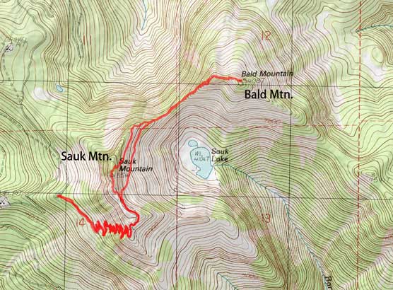
Sauk Mountain and Bald Mountain scramble route. GPX DL
I woke up at 5:30 am but it was so cold and windy that I decided to sleep in a bit, but by 6:20 am I did manage to get going. Head-lamp on and up I went. The trail was essentially a huge switch-backs system grinding up a gigantic avalanche path, but very well built and maintained. The grade never got too steep even for hiker’s standard and although narrow at places, it never felt exposed. About 2/3 of the way up those endless switchbacks it’s getting brighter so I did a short break, switching head-lamp for my camera, and then resumed the ascent shortly after. It didn’t take me long to arrive at the high shoulder on the S. Ridge of Sauk Mountain.

Cresting the high shoulder on the south ridge

The trail on the shoulder.
From the shoulder the trail descended a little bit down the other side and then traversed over to the next rib before circumventing around the east side. Around the next corner I could finally see the summit crags and this was also the end of the official trail. Ditching sneakers and donning boots I wasted no time and went straight for the summit ridge. There’s little scrambling required and soon enough I was standing on the false summit. I made there just in time for the alpenglow on the surrounding giants and spent at least 15 minutes, if not more taking pictures.
The summit crags in sight now. True summit is the far one.

Mt. Shuksan pre-dawn view

Arriving at the first false summit now. It’s time to shoot the morning glow!
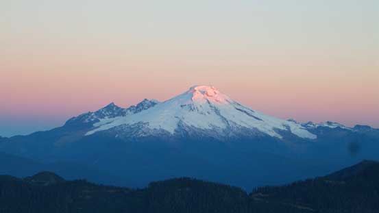
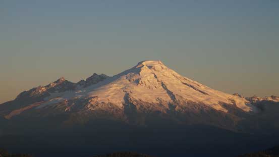
The tip of Mt. Baker just started to glow!

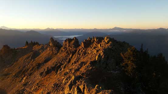
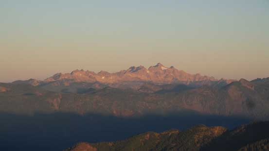
Looking at the southern horizon – Pugh, White Chunk, Sloan, Kyes and Columbia Peaks
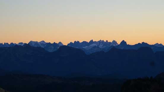
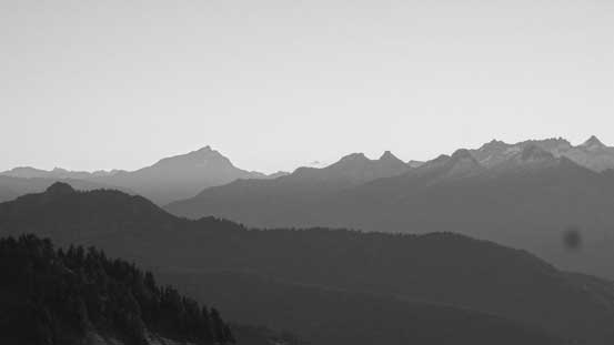
The very rugged Picket Range in the North Cascades

Glacier Peak is another volcano nearby

Mt. Rainier is visible looking far down south. Jumbo Mountain in the foreground on left
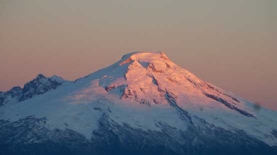
A zoomed-in view of Mt. Baker

Whitehorse Mountain
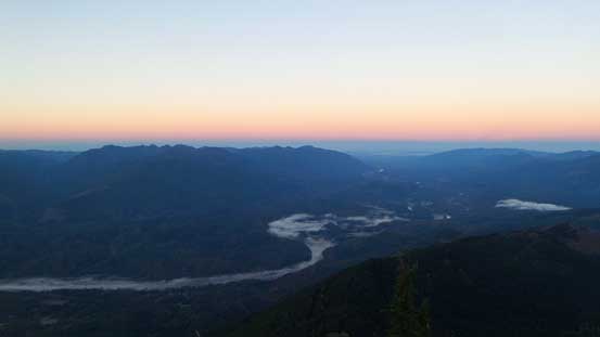
The Skagit River Valley

Valley fogs
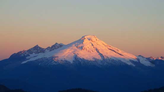
Another look at Mt. Baker. The Easton Glacier is that strip of white on the left skyline.
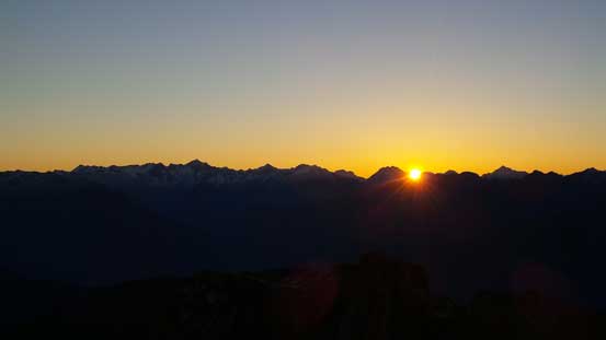
It’s sunrise time! Eldorado Peak and surroundings on the horizon

The tip of Twin Sisters Range just started to glow

Another look down at the Skagit River valley

Twin Sisters Range with South Twin being the highest

A closer look at Puge/White Chunk, and Sloan Peak. Way in the background is Mt. Stuart
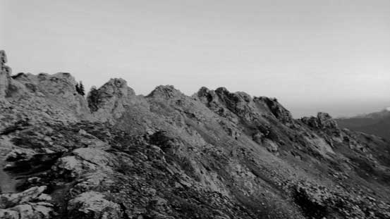
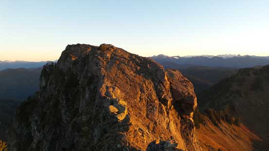
Getting to the true summit required some “moderate scrambling” – mostly class 2 but one spot might dip into the class 3 category mainly because of the exposure. After making my way down to the first saddle beyond the false summit I attacked the next highpoint mostly head-on, but slightly to the climber’s right side. There were a few slabby moves required but nothing too difficult. And then traversing to the last, also the true summit involved that knife-edge crux. There’s a layer of frost on the rocks which made things slippery so I had to be extra cautious about my footings, but otherwise it should be an easy going for experienced scramblers.
This is the second false summit along the ridge
Looking back at the first false summit where I took all those previous pictures

The true summit ahead

Bald Mountain in the foreground – my next objective
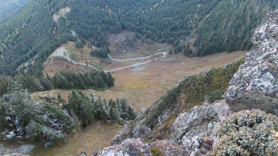
Looking steeply down the west face towards the winding road and the parking lot.

It’s very steep down the east side too!

Looking back at the previous false summits from the true summit now.

Partial panorama from the true summit. Click to view large size.
Mt. Baker
Twin Sisters Range

The broad Bacon Peak with Mt. Blum poking behind its left shoulder
Jack Mountain is that big one looming behind

A closer look at Mt. Shuksan. It’s south side is the least steep side but still, very impressive

Me on the summit of Sauk Mountain
The views were awesome just as advertised, but I still had another peak to do so didn’t linger too much longer on the summit than necessary. I did spend some time taking pictures and eating some food but that’s it. I had previously spotted a route down directly from the true summit towards Sauk/Bald saddle so down I went…
