Mount Downing
December 8, 2019
1504m
Chehalis Lake / Harrison Lake West, BC
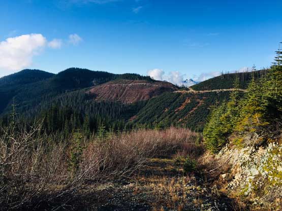
Mt. Downing is a rather dull-looking wooded summit that’s heavily logged on all sides, sandwiched between Harrison Lake and Chehalis Lake although the summit appeared open enough to provide at least some partial views on the satellite images. There had been zero information about this peak online. For some reasons I actually had done quite a few wooded summits in this zone – Mt. Davies and Mt. Keenan to the south in Hemlock Valley, and Mt. McRae immediately to the north earlier in this year from Harrison West FSR. My plan for Mt. Downing was the south ridge bushwhack accessed by Fleetwood FSR from Chehalis Valley, because the south side forestry roads appeared the most “open” on satellite images. I wasn’t expecting to drive much further along the spur roads but who knows.
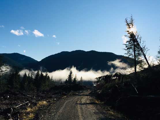
This ascent had been on my mind for a while but the decision for this Sunday was a very last-minute spontaneous one. The original plan was something up by Lytton area but due to some last-minute cancellations I was down by myself. I wasn’t motivated to drive that far solo so opted to sleep in and hike up Mt. Downing instead. I still set the alarm early because I didn’t know what exactly to expect on those logging roads. In the morning I drove out of White Rock in light rain but the weather gradually cleared as I drove eastwards into the hills. This was also my first time driving up the Chehalis FSR and the condition of that road was better than expected. It was an easy cruise to ~km 20 before I turned right onto Fleetwood FSR. I had some concerns that this road might be gated by the worrisome proved to be unnecessary. I actually was able to drive 11 km up this road shaving a great deal of road walking. The road deteriorated rapidly beyond km 10 and I parked my truck after negotiating three major ditches.
Mt. Downing via Fleetwood FSR. GPX DL
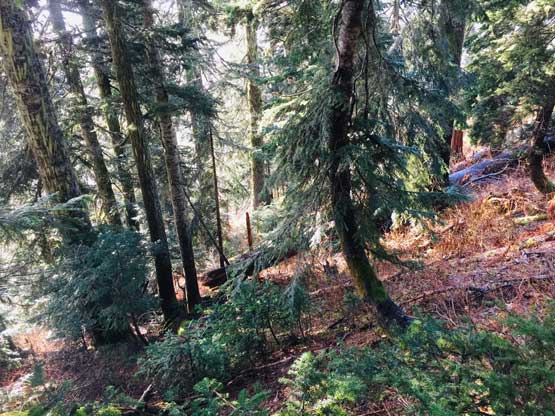
Those with a lifted truck or Jeep can probably drive another 2 km but being alone in such a remote place I had no desire to risk any further. It also appeared that all snow had melted in the immediate vicinity including the peak I was going to ascend, so both snowshoes and crampons stayed in the truck. I opted to wear trail-runners and carry mountaineering boots for the short bushwhack, and packed my microspikes just in case. The logging road had lots of confusing branches that even with a detailed Gaia map I still briefly got off-route at a three way junction. It was just so confusing. Thankfully I happened to check the GPS again and realized the mistake. The correct spur road beyond that 3-way junction was no longer drivable by any vehicle but dirtbikes or ATVs, and only for another one or two switchbacks. Towards the upper end of the logging road system I had to deal with at least a kilometer of alders. It wasn’t terrible by BC standard but annoying to say the least in the winter temperatures. Thankfully the sun’s out and I could just use my hat and sunglasses to protect my eyes and face. To my surprise the alder thrashing actually didn’t last long as the brushes had magically disappeared towards the very top of the road. I had no idea how would that happen though.
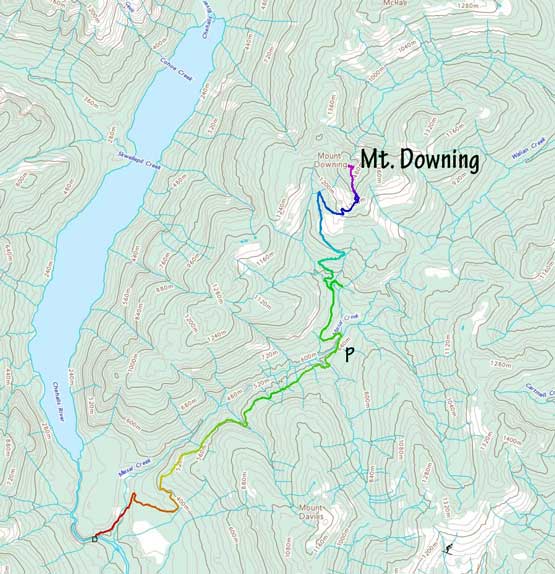
Mt. Downing from just after crossing Maisal Creek on the road
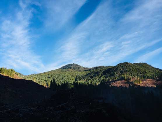
The sun rose behind the hills not long after I started the hike
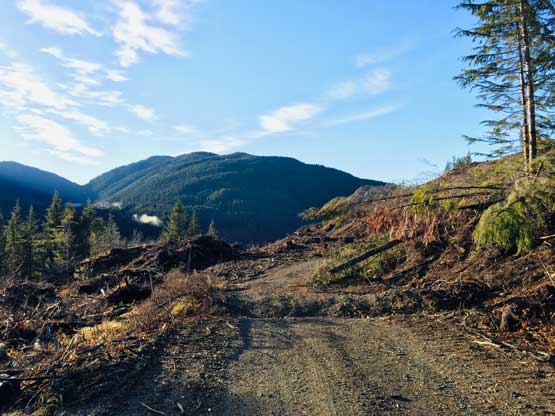
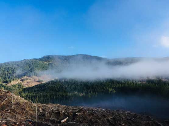
The typical conditions of the lower road with Mt. Davies behind

The road was in a great shape if not because of those huge ditches

Already on the upper road now.

It’s getting increasingly narrow and bushy

I had to deal with a while of alder thrashing..
Thankfully the road was back to “normal” towards the upper end
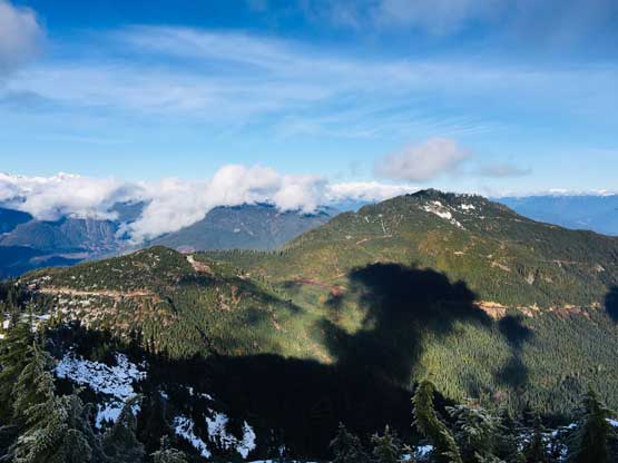
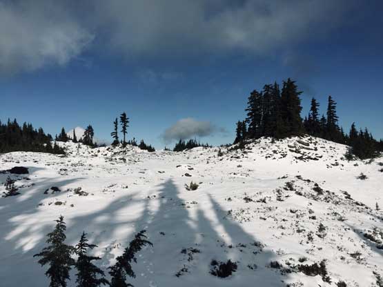
I took a long break at the end of the road and then swapped my footwear to start the south ridge bushwhack. I didn’t pick the best spot to enter the forest as I had to deal with a good amount of brambles type of brushes on the initial 100 m up. I was also too lazy to don gloves so had to be very careful no grabbing the wrong branches. The slope was relentlessly steep and the ground had becoming increasingly icy and frozen that I had to stop and don gloves at last, because other than vege-belaying I had no other way to stay balanced in such terrain. Thankfully the terrain’s grade did ease down towards the uppermost 100 m elevation gain and gradually I was stepping onto continuous, semi-supportive snow. It’s obvious that it rained all the way up to this elevation but the snow had undergone some degree of freezing at night. I had to suffer a bit from post-holing while traversing the large summit plateau/meadow towards the highest point. The views were much better than expected with the north side completely unobstructed.
Time to bushwhack up the south ridge

The terrain was steeper than you might think and very slippery

A brief opening in the woods
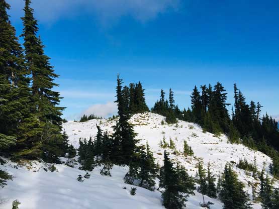
About 200m gain later I was pretty close to the summit
A glimpse of Harrison Lake to the east

This is a southern view from near the summit.
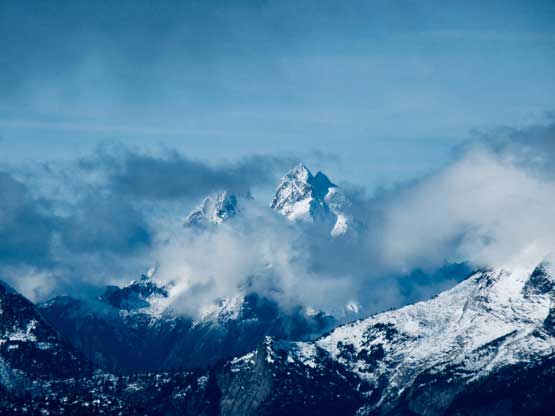
The higher Mt. McRae to the north
Another photo of Mt. McRae

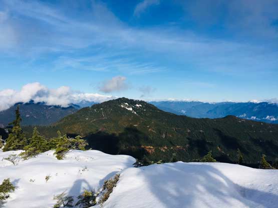
I wondered around on the summit plateau

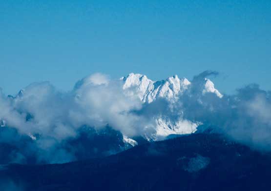
The north faces of Cheam Range peaks
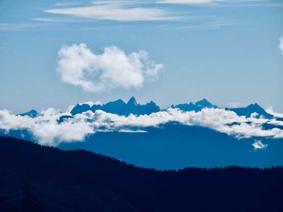
The triple summits of The Old Settler
Mt. Breakenridge to the north
A glimpse of Mt. Judge Howay to the west

Mt. Judge Howay is so iconic that I had to take two photos of it…

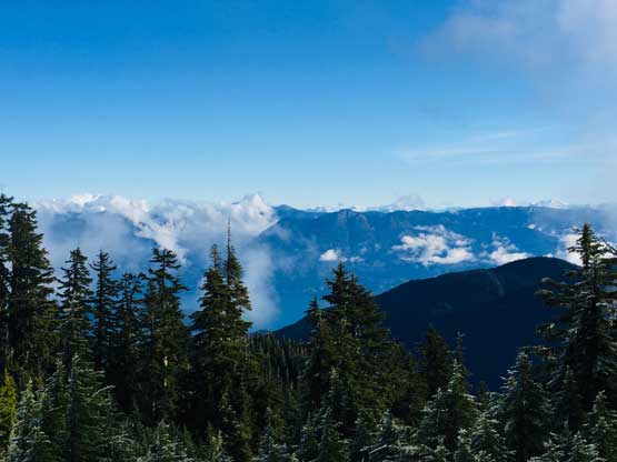
The “core” Chehalis Group on the horizon, to the north-west

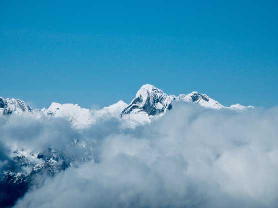
Viennese Peak was hidden in clouds but briefly showed up

Nursery Peak
The uber-remote Grainger Peak

Mt. Urquhart looks equally striking

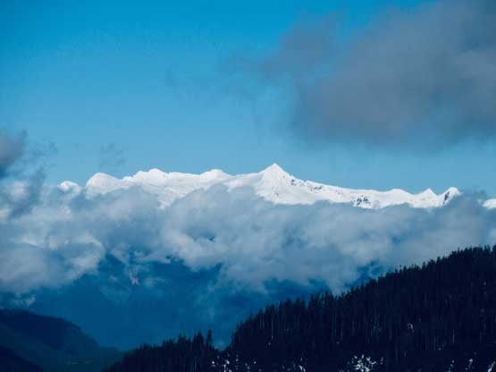
Isolillock Peak by Skagit Valley

The fang of Slesse Mtn. sticking out of the Chilliwack horizon
That striking peak in the distance is American Border Peak
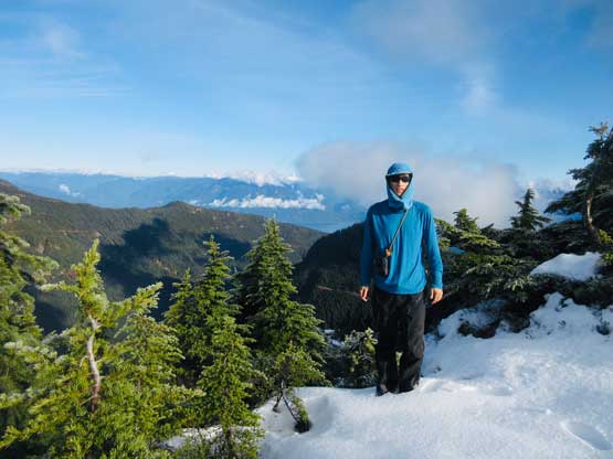
Me on the summit of Mt. Downing
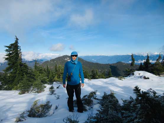
Another photo of me on the summit of Mt. Downing
I stayed on the summit for about half an hour before starting the descent. The snowy sections were very fun to plunge down but the steep and slippery bushwhack required lots of care. I stayed a bit further down-climber’s left and managed to avoid the brambles plants, but had to pay close attention to not overshoot the road. Had I stayed further left I could have missed the roads and that would not be fun at all. I kept my mountaineering boots until the alders ran out before switching back to trail-runners. The rest of the road walk was boring but went by fast. I did not meet a single soul on the entire hike and that’s pretty much as expected. While driving down the Fleetwood FSR I did meet a group of 6 or 7 ATVs driving up. It’s apparent that these roads were maintained by the local 4WD enthusiasts.
Time to head down.

The uppermost switchback of the road was free of alders

The alder bashing only lasted for about 20 minutes

The lower road was all cruise sailing
Mt. Davies ahead
Descending back into the fog layer.
The rest of the way back home was uneventful except for that Chehalis FSR seemed to drag on forever. Later after checking the maps again I realized I had driven close to 60 km on logging roads this day.. The Chehalis Valley offers much more oppourtunity to explore than I had imagined, although I did notice that most of the side spurs had gates and more than half of them were locked.
