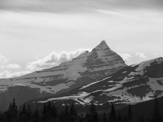
The Helmet
June 15-18, 2018
3418m
Mt. Robson Provincial Park, BC
Among the 11,000ers in the Canadian Rockies I think The Helmet has the least number of attempts for various obvious reasons. First of all with just over 100 m prominence The Helmet is considered as nothing but part of Mt. Robson massif to many climbers and secondly the climb is pretty much just as long/difficult as Mt. Robson itself. Those willing to put that much of effort into the trip and yet technically capable to climb The Helmet are probably having their sights on Mt. Robson instead. Very few are interested in The Helmet and even fewer set out to attempt. Ben and I had already climbed Mt. Robson in July 2017 so when it comes to this area we no longer had that struggle with objectives. For both of us this peak is considered as one of the remaining cruxes to finish the 11,000ers list.
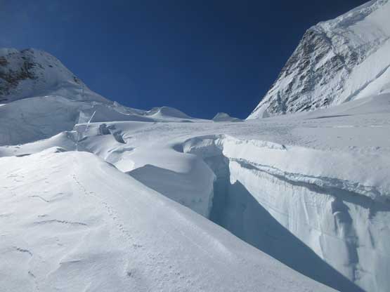
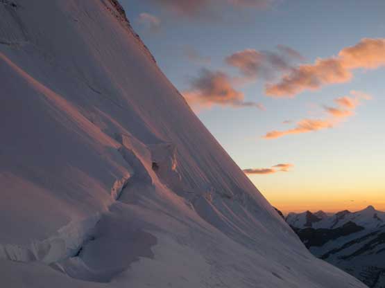
What makes The Helmet difficult is the complexity of glacier travel. The standard route (S. Ridge) requires a long trudge up Berg Glacier which itself is by no doubt the most broken glacier among the 11,000ers family. The chasms and crevasses on this glacier will make some Alaskan giants like a walk in the park and I’m not kidding. If you can thread a line up The Helmet then you can climb Mt. Fairweather with one eye closed and I’m not exaggerating. In some years the glacier is broken enough that no climber is allowed to pass through (hence a complete shut down for Robson N.F. and The Helmet). The climb on south ridge itself isn’t trivial and often required several pitches of belayed ice climbing as well as a long, corniced traverse. Getting onto the south ridge from Robson/Helmet col is often barred by an overhanging bergschrund spanning across the entire slope. And finally to get to the base camp at Rearguard Meadows one would have to hike all the way around Mt. Robson and then cross two stretches of Robson Glacier and that approach itself takes two days for most parties except for the fittest… And don’t forget the notorious Robson’s weather.
Our preferred strategy was making an ascent in April or May on skis/snowshoes to minimize the crevasse/bergschrund problem but things didn’t pan out in the last couple months. Then it came to June and we still thought about hauling the skis/snowshoes in but eventually decided not to. It would be over 30 km hauling both ways just to put them on and they might or might not going to help. We also watched closely the weather window, refreshing all models of forecasts multiple times each day. There had been a full week of cold and dreary weather with at least over a foot of fresh snow dumped in the alpine. Most of the precipitation concentrated on the Continental Divide further south so we really didn’t have much of an idea. The temperature was cold enough that the main snowpack would be bomber solid hence the snow bridges must have been strengthened. Friday and Saturday were the transition kind of days and then a big, warm high pressure ridge would kick in starting Sunday. The short window for us was aiming to summit on Saturday while it’s still cold (and hopefully not too cloudy) and that meant a miserable hike-in on Friday in the rain..
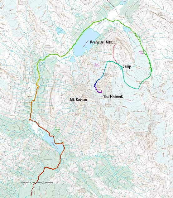
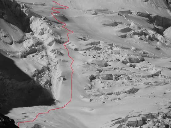
Ascent of The Helmet and Rearguard Mountain via standard route. GPX DL
I struggled a few hours on Wednesday to pack things up and also made a trip to MEC Langley. In order not to haul the heavy RescYou device I had switched my system to the micro Traxion pulley but that’s expensive – over 160$ was spent for just one pulley.. The whole Thursday was spent driving from Vancouver to Jasper. The weather was miserable the whole way with some areas pouring cats and dogs. The weather improved north of Valemount and I actually got a couple photos of the mighty Mt. Robson. Then eastwards into Jasper the weather wasn’t too bad. Ben and I did a quick review of crevasse rescue using the Traxion pulley system, had a dinner in the LouLou’s and then drove back to Robson’s parking lot and slept in car. We really wouldn’t get much of sleep since our plan was to hike all the way to Rearguard Meadows on Friday and that meant a 2 am wake-up time right from the parking lot…
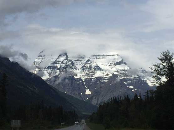
Mt. Robson briefly showed up as I drove past Valemount
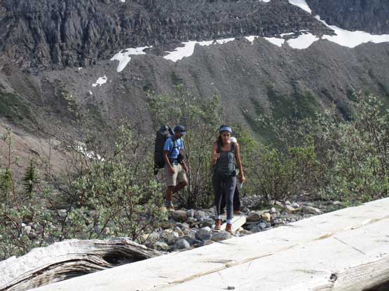
The 2 am (Alberta time) came and it was pouring cats and dogs. None of us was motivated enough to start out in rain so we slept in. An hour late it seemed like the rain stopped so we got up and stuffed in the leftover pizzas from yesterday’s dinner. Most of the gears were already packed so it was quick going at the start although the packs were heavy as fuck. Ben is a machine in hauling gears (capable to haul 100+ lb backpacks) so I let him to carry the 70-m rope and stove/fuel for at least the approach hike. The trade-off is that I would volunteer to lead the glacier crossings and all of the post-holing duty. That seems like the standard whenever I go out with Ben as this is the way to utilize our individual strengths. The rain had held off for our 4-hour hike to Berg Lake. We had been marching on full force with minimal break and thank to the darkness and cloudiness I didn’t even bother to take the camera out. The flat section just before Berg Lake is annoyingly long and then we got to meet a large group of students hiking out. I had no clue why they would be up this early in the dark cuz most campers we past were still in their sleeping mode. The Hargreaves Shelter is a nice place but we didn’t bother to stop. The clouds had unexpectedly lifted up and we got to see the massive north face of Mt. Robson looming above. This was Ben’s 5th time here in the past year alone but it’s my first ever time seeing Berg Lake’s postcard scenery in person, despite the fact I had already climbed Robson, Resplendent and Whitehorn…
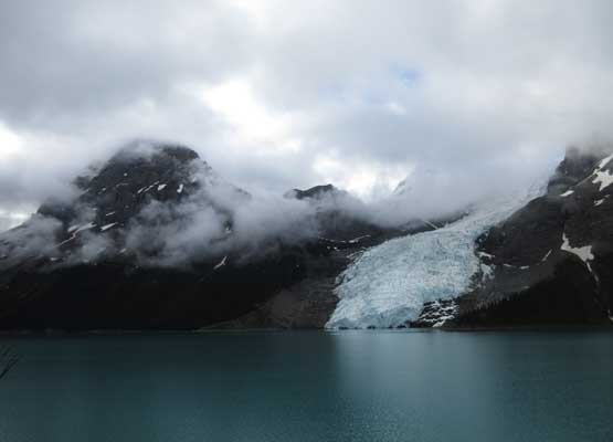
The classic tourist’s view of Berg Lake. Not so scenic on our hike-in
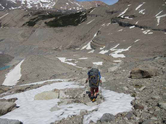
We were over 21 km into the march but we still felt strong. Onward towards Snowbird Pass the trail is well signed and easy to follow. We still had a couple km to go before reaching the end of trail on a lateral moraine. This whole stretch was incredibly scenic thank to the blue skies above us. Ben knew exactly where to leave the trail to head for the lower Robson Glacier. We tried to minimize elevation loss/regain but the trade-off is at least a kilometer-long side-sloping on loose moraine. The lower Robson Glacier was dry as expected so fast travel with just crampons. The ascent on lower Robson Glacier was very foreshortened and we actually gained fair amount of elevation here. At some point we followed Ben’s instructions and got off the glacier, crossed a stream with a glacier cave to our right and then ascended onto more loose moraine to gain the bottom of Extinguisher Tower. The terrain was ugly to say the least while weather moved in. In a fraction of a minute we were engulfed in a blizzard. It started out with rain and transitioned to wet snow that we actually pitched the tarp out and waited it out for an hour. It did pass and we were treated with again, blue skies at Extinguisher Tower. The campsite is nice but too far from our objective so let’s push on.

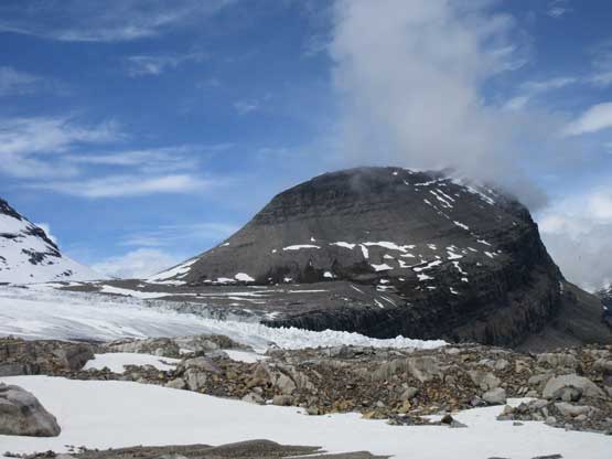
Around the north corner of Rearguard Mtn. we got to see Extinguisher Tower

This is a beautiful tarn at the toe of Robson Glacier

Hiking on the moraine beside the tarn. We were still on trail now
The next stage was to traverse onto lower Robson Glacier
Crampon-ing up the dry ice

This glacier is foreshortened and we still had a lot of elevation to gain

There’s a cool ice cave and another tarn

Ben hopping across the tarn’s outflow
At Extinguisher Tower’s camp now. Mt. Robson cleared up after a storm
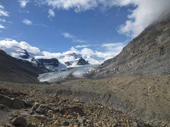
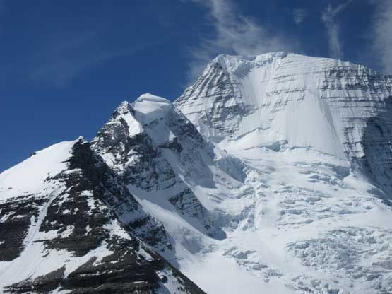
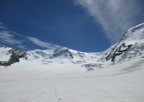
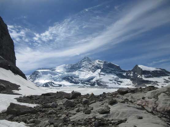
Rearguard Mountain with our destination on its left col
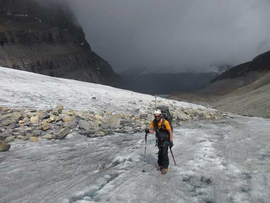
Crossing the upper Robson Glacier involved a lot of post-holing but nothing outrageous. The average was shin deep mostly because of the afternoon heat combined with the thin snowpack. Most part of the glacier had only a foot or less snow coverage and much of them had gone isothermal. Several crevasses had to be negotiated near the start and end but the flat section was just a mundane plod. It’s a long haul across the glacier though. Once near the base of Mt. Waffl we turned northwards aiming at the slopes below Rearguard Mountain and made to a half-frozen tarn just about another snow/rain storm closed in. None of us had any desire to push further in the weather so we set up camp in a hurry. That night we pretty much stayed in tent waiting out storms after storms. It snowed pretty heavily for a while and didn’t stop raining/snowing until the next morning. The sky was still overcast and our motivation was low.

Ascending onto the upper Robson Glacier. Titkana Peak behind
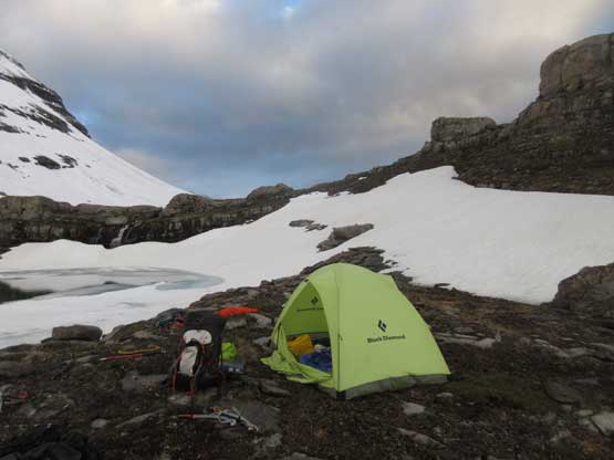
Home sweet home. It’s going to be rainy for a while..
By 5 am or so we got out of the warm sleeping bags and decided to go for the peak nonetheless. The forecast was calling for clearing by noon and we just hoped that’s correct, and we did see some patchy blue skies towards north and west and that’s surely a good sign. Ben had previously attempted The Helmet in this past April so he knew the exact way to access Berg Glacier. There’s some up-and-downs across the meadows but mostly on pleasant terrain and then there came a steep snow slope to side-hill across at the end. Just before gaining the glacier we roped up with me leading the sharp end. The post-holing wasn’t too bad initially but the higher we went, the worse it got. The lower snowpack was bomber as predicted but there had seen a hell lot of fresh snow in the past week. At elevation 2500 m ish we were post-holing a foot deep in the fresh snow and we knew it’s only going to get worse.

This is that lovely tarn we camped beside

Passing another tarn while traversing across Rearguard Meadows.

This is that big tarn on the far side of Rearguard Meadows.

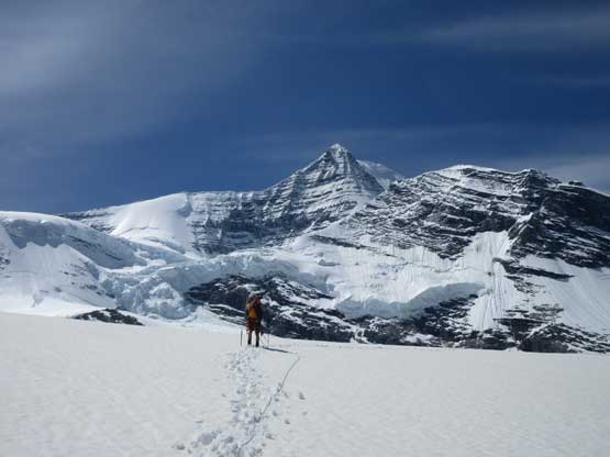
We geared up before ascending onto Berg Glacier

The lower section of Berg Glacier was just an easy stroll albeit with trail-breaking

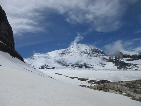
As predicted the weather finally cleared up. Mt. Robson is huge
The weather’s totally clear now, still aiming at Mt. Robson’s N.F.

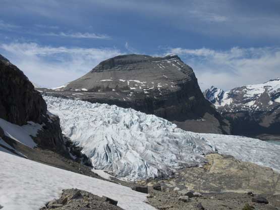
There’s a maze of crevasses to negotiate on the lower glacier. Easy peasy.
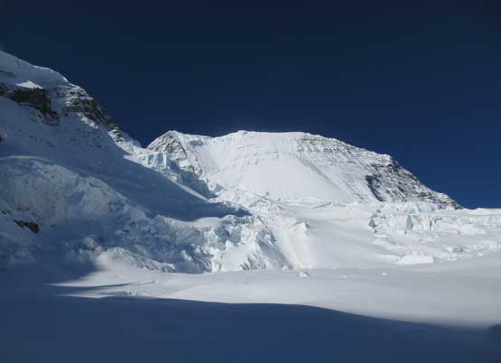
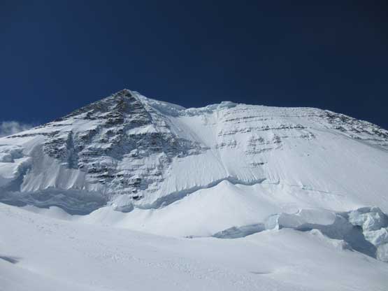
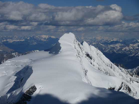
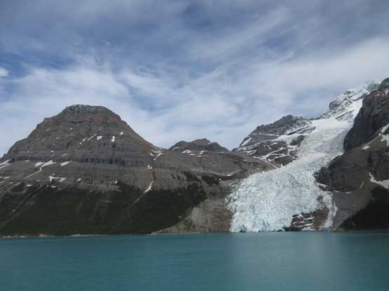
This is looking at The Helmet which surely looks like a Himalayan giant
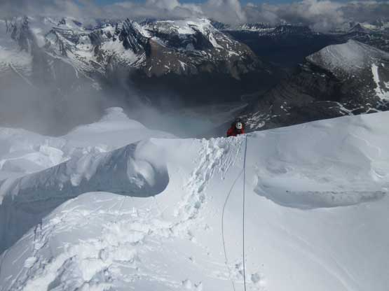
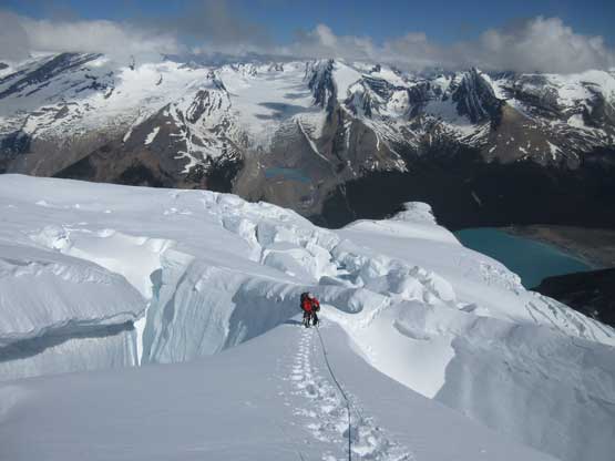
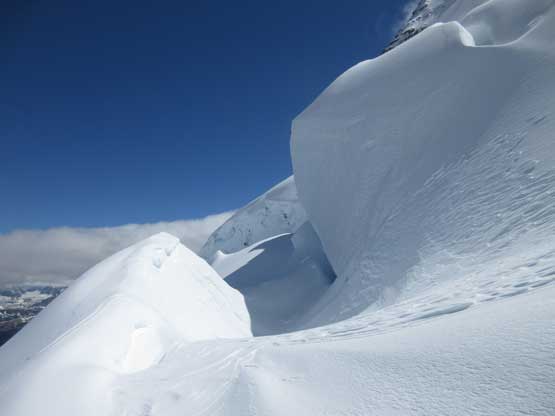
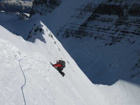
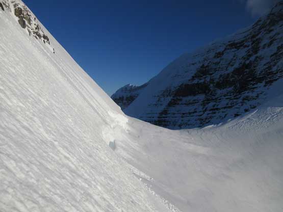
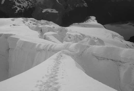
After negotiating the lower maze of crevasses (sticking well to the climber’s left of the main flow) we made the decision to use an obvious ramp system on climber’s left side to short-cut the traditional route (coming from the top of Dog Buttress). Our early observations showed a continuous line up the ramp with several crevasses to avoid near the top. The reality is of course more complicated than it seemed. Much of the lower ramp was a steep 35 degree climb on nothing but soft powder hence tedious wallowing. Large cracks showed up as we gained elevation and we had to find a way across, or around a couple impressive chasms. I wouldn’t even call them “crevasses” simply because of the size. If the ones on Mt. Rainier can eat cars then the chasms on The Helmet can easily eat apartments. It’s that bad and I’m not exaggerating. The most interesting move was crossing a 30-m overhanging chasm on a piece of 1.5 meter wide bridge. The sideways view confirmed that it’s an ice bridge at least but with the amount of soft fresh snow we couldn’t feel it. I asked for a belay across just in case and then belayed Ben over on a deadman picket.

Charging up the ramp now. It’s getting steep…
As typical as the terrain here. If you freak out here then turn around…

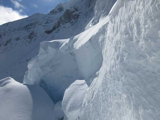
Just another “smaller” sized crevasse we had to work our way around

This piece of snow bridge is interesting. If it collapsed then the route is over
Typical, typical… You gotta love these .
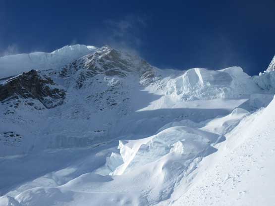
Above the ramp now, here we came more chasms maze

Trying to find a way around the largest chasm
Indeed we found a way. Sketchy bridge. Marginally OK.
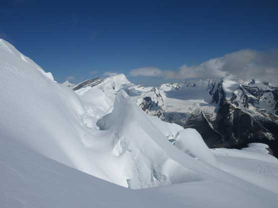
After crossing that sketchy bridge. This is one of my favourate photos
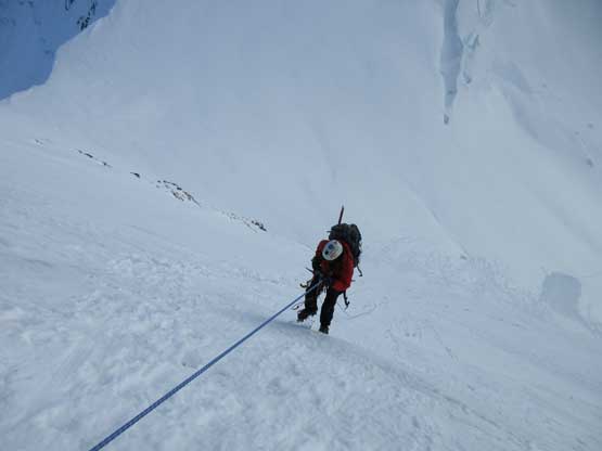
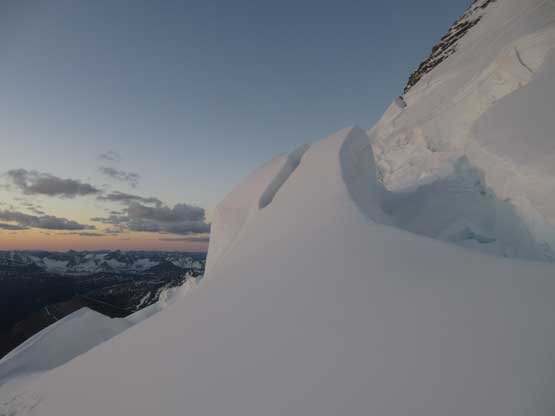
After this piece of bridge our “ramp route” had officially joined the standard climber’s right bypass option. The terrain doesn’t too look terribly bad up the valley towards Robson/Helmet col but one doesn’t normally get to see the giant crevasses from below. We still had at least half a dozen chasms to avoid or cross, along with increasingly difficult post-holing. On some leeward slopes I was literally trenching up the bottomless powder using all fours and using my knees to break the surface and arms to swap the loose snow. The progress was painfully slow but at least we did get higher and higher. In what seemed like a long while we reached the flats leading towards the col. The NW Face of The Helmet didn’t look too bad and we could see several spots to cross the bergschrund. Instead of travelling all the way to the col we decided to short-cut this stretch mostly because of the arduous trail-breaking. I found a not-so-bad spot and managed to cross the schrund using two sporty step-cross moves and then belayed Ben up on again, a deadman picket. We left the picket there for the return and I continued the lead up a full 70-m pitch steep snow without putting in any protection. Once the rope ran out we started simul-climbing but shortly after that I started hitting hard ice under the surface layer. I continued soloing for half a pitch and built a two-screw anchor. Ice is not my expertise.

More and more to come. It’s never ending.
They make cool ice sculptures though. Pretty scenic…
The north face of Mt. Robson doesn’t look that steep from here, but still steep as hell

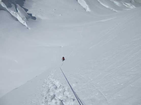
Wallowing the bottomless power.

Ben took over the lead here and got us to below the schrund

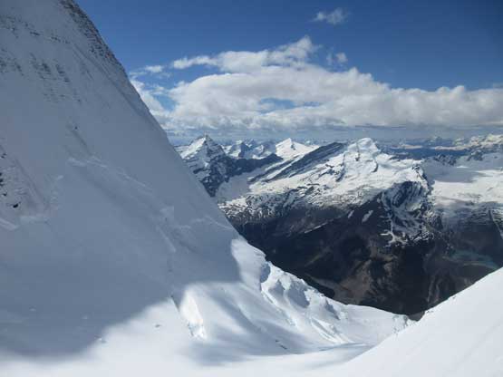
After crossing the schrund I took a picture towards Robson/Helmet col
I led a full pitch of steep snow before running into ice
Ben had done a lot of waterfall ice climbing in the past two winters and is now comfortable climbing WI4 grade. I had never touched waterfall ice and my experience on ice is still limited to the Kain Face plus a couple shorter alpine climbs. I had no idea what a WI4 means but I figured Ben would have no problem running up the 55-degree alpine ice. The problem was, we didn’t bring enough screws and the ice wasn’t nearly in the greatest conditions. To make bomber anchors we really needed 2 or 3 screws and that meant Ben only got to lead 20 meters each pitch before running out of gears. That further meant we needed 4 pitches to top out on the ridge and that’s quite a mentally and physically exhausting progress. Ben nailed it, slowly but safely and then we were on the corniced upper south ridge. The condition was still thin-snow-covered-ice that we determined front-pointing all the way across was not an option based on our current speed. I said we should ascend higher onto the cornice and we did so exactly, peeked over the other side and the cornices weren’t that huge actually. I volunteered to run the ridge traverse with my feet on the edge of snow vs. ice and my tools balancing on the cornices. Had one of us fallen the other climber would jump to the opposite side to break the fall. Thankfully that wasn’t required on this day. It’s a long way across, more than one full rope length with each step being a careful sideways shuffle. I also had to “feel” each step before committing to shift my body weight for one reason I wouldn’t want to slip on ice and for another reason I had to make sure I wasn’t entirely on the cornices. This worked as much as to our expectation and we were on the summit, less than 2 hours from sunset.

Ben leading one of the several pitches of ice. The surface snow is garbage
Almost topping out on the south ridge now.

Topping out on the very corniced south ridge… It’s not over yet.
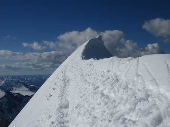
Could finally see the summit. Not quite close yet.

I cleaned a small portion of a cornice and got a shot of this.

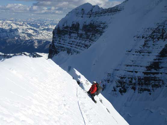
Traversing on the edge of snow and ice along south ridge.

Ben looks tiny comparing with the Kain Face

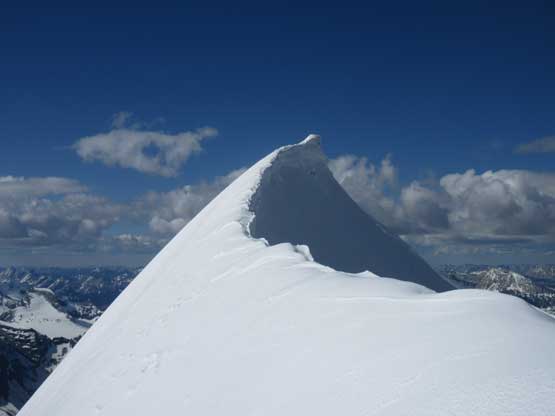
Ben on the summit of The Helmet

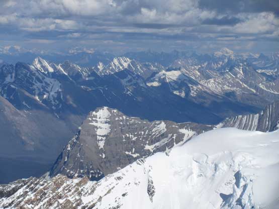
Looking over Mt. Anne-Alice towards the remote Bess/Chown group

Just one snow bridge we crossed. It’s the easiest one on the flats..
Resplendent Mountain
Too lazy to name them – they are all remote peaks in northern JNP

Lynx Mountain would be cool to ascend.
After a short celebration for mine #46/58 and Ben’s #51/54 we immediately turned around to focus on the descent. This time I let Ben to run the full rope length across the summit ridge and followed on the tailing end with a bit of simul-climbing in between. The task was much easier now with our steps already made. Looking down the NW Face we could see that we had triggered a few avalanches while traversing and one big path had run entirely down the face covering our tracks on the glacier. I didn’t even notice that because it’s a point release. The surface new snow wasn’t bonding to the ice underneath, not at all. Once at the ice anchors Ben belayed me over to the station and then led two full pitches of rappels using v-thread anchors. Again it was a great asset to have Ben’s knowledge in building the threads as this was again, something I had never done in person other than helping Ben/Ferenc out on the Kain Face’s descent. Back onto the snow we easily down-climbed solo to the ditched picket anchor and then we belayed each other back across the schrund. Those sporty moves felt even harder on descent because the snow was soft that we didn’t know whether they’d break on us or not. Thankfully the snow bridge held and we were now back onto Berg Glacier.
Back across the south ridge traverse.
Now the south ridge is heavily tracked out.
Ben building v-thread anchors like a guide
Ben leading down two pitches of rappels on ice

This is the upper anchor I think
Almost down to the bergschrund now

As soon as we hit snow we started the down-solo mode
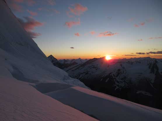
Watching sunset from high up on Berg Glacier was as memorable and scenic as it seemed but that also indicated we didn’t have much time left anymore. There were at least a dozen chasms to avoid lower down. Now the hideous post-holing effort paid off as the tracks were highly visible even in the fading daylight. We didn’t bother to set up any further belay as we trusted our own tracks. Crossing that overhanging chasm still had some eerie feeling but I just ran as fast as I could while shutting my mind off, and soon enough Ben’s back across too. There’s another sketchy snow bridge lower down that we each opted to crawl across and then onto the lower ramp it’s a fast plunge on soft snow. In another ten minutes we had to use headlamps but at this point we knew The Helmet’s in the bag with no further difficulty ahead. The rest of the glaciated descent was uneventful and then Ben (with his GPS turned on) led us back across the Rearguard Meadows flats, exactly 19 hours since we left camp in the morning…

Back down to Berg Glacier. We took a lengthy break here

Crevasses on Mt. Robson.

The Fuhrer Ridge on Mt. Robson climbs that rock part
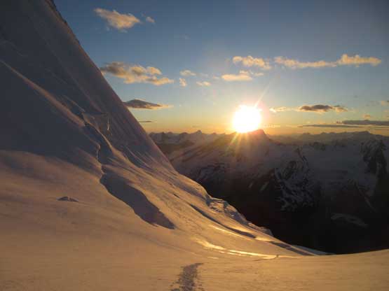
Golden glow time in evening. We had to soak in the views

Orange glow now. Almost sunset time.

Another shot towards the lower Fuhrer Ridge
The lower North Face

Just one of the many crevasses that we bypassed
Now it’s the true sunset
Officially dusk

Down, down and down.

Whitehorn Mountain at dusk

On the skyline one could see Mt. Chown a near 11k also an “ultra”
This is that sketchiest bridge. Didn’t bother to belay on the way back

Almost time for headlamps.
After a late dinner we all turned in and decided to sleep till whenever we wanted. The next morning we woke up at around 10 am under a bluebird sky but the temperature had gone nuclear. I wanted to just go home but Ben encouraged me that the summit of Rearguard Mountain has some of the finest views he had ever seen. It’s over 400 meters of elevation gain on choss but I did bring my trail-runners here as a camp shoe. I decided to run up there while carrying absolutely nothing other than a jacket and an energy bar. This worked out pretty well and I was very glad I pushed to get that summit. The view looking back at Mt. Robson is something I’ll never forget.

Our home on the morning of Day 3

Resplendent Mountain from our camp.
Our tracks through the icefalls. Good luck to you all

Mt. Robson massif from the summit of Rearguard Mountain
Waffl, Helmet and Robson from Rearguard.
Once back to the campsite we quickly packed things in and started the long descent. Crossing the upper Robson Glacier involved more post-holing plus we had to wallow through a section of “water pool”. I had my brand new gaitors on and they somehow kept my boots relatively dry but Ben wasn’t so lucky. His feet were already swimming… The rest of the descent to, and from Extinguisher Tower camp was tedious but scenic and then there came the stream crossing. I spotted the rocks we used and made one sporty jump into the submerged rock. For the lower Robson Glacier we didn’t bother to don any gear including the crampons. The grade was just flat enough to walk without the ‘pons. The kilometer-long side-hill bash on moraine was just as shitty as we remembered but merging back onto the trail was a welcoming change of pace. I immediately swapped my footwear from the Nepal Evos back to the trail-runners but Ben wasn’t so lucky. He had to deal with the wet boots for the rest of the hike-out.
Onto the upper Robson Glacier now. It’s a long plod across

Ben with Rearguard Mountain behind
Ben with the mighty Mt. Robson behind
Back to Extinguisher Tower camp now.

This is The Dome with Kain Face behind
Descending compacted terrain below Extinguisher Tower
The icy icefalls on lower Robson Glacier

Another shot of the icefalls. Mt. Waffl behind

Ben searching for away to hop across the stream

In the end he opted to ford it while wearing boots.

Easily hiked down the lower glacier without bothering with crampons

Back to that tarn now. On trail now..
Unfortunately Ben’s feeling huge pain on his legs so after a long break at Berg Lake I took over the loads-carrying duty. I also got an inReach message from Eric/Greg that I should aim to get back to Vancouver a day earlier than planned and be ready to fly to Mt. Fairweather starting Tuesday morning. This greatly messed up our schedule and that pretty much meant we had to push all the way out on this day. Down the Emperor Hill we went both of us had developed leg/knee pain but we just to keep pushing. I made two stops at Emperor Falls and Falls of the Pools mostly because I wanted to drop the heavy packs for a few minutes. Ben opted to sit out the tourism thing as he had seen those falls for many times in the past. We pushed back to Whitehorn Campground before calling it’s realistically better to rest a couple hours here, so we cooked dinner and pitched the tents out. The next morning we woke up at around 2 am (BC time) and hiked the final 11 km back to the trail-head using headlamps. It was exhausting but we made it.
Whitehorn Mountain is a mighty one. Too bad it’s close to Robson

Hiking back down Snowbird Pass trail

A review shot of The Helmet

This is that classic tourist’s shot of Berg Lake and Mt. Robson
Now I finally paid my long overdued visit to Berg Lake
Lots of hikers coming in.
Lovely.

Emperor Face of Mt. Robson. It’s been soloed by late legendary Marc Andre Leclerc

Hiking out along Berg Lake’s flats

I paid an extra 500 meters to see Emperor Falls – worth a detour

The Emperor Ridge leading up Robson.

As much as the long, long hike-out goes… Note the 105L backpack
Ideally I should start driving home immediately but not aware the change of forecast I left my car in Ben’s place in Jasper. This added at least 2 extra hours to the drive but that’s fine. I managed to take a short nap on the way to Jasper and after saying goodbye to Ben I went to a nearby A&W for a huge breakfast. I know that’s not the most healthy place but I don’t care.. At this point every minute counted as I pushed my way back to Vancouver. I still had to buy several items including the important duffle bags and I also needed to buy, and pack two weeks of backcountry food. It’s Monday morning and I was still in Jasper. By 9 am Tuesday morning I had to make to Seattle so time was ticking on me. I pushed all the way back to Kamloops in one shot and then all the way back to Langley’s MEC in another single shot. I managed to make to Langley half an hour before the MEC’s closing hours so that’s a tight fight, but I did it. Then swapping to several other stores I got back home at around 8 pm, had a late dinner. Several hours were spent packing things and eventually I turned in at 1 am in the morning with the alarm set at 5 am (because I didn’t really finish the packing). I was too tired to think and really needed some sleep…
For those of you curious, Mt. Fairweather was a huge success in our smash-and-grab fashion.
All in all this was another successful 11,000er trip with Ben. We got the luckiest condition this peak will ever going to offer (sans the post-holing part of course, but that’s just physical). One needs everything to line up precisely otherwise The Helmet wouldn’t happen. Most friends’ attempts ended up in failures and the last successful climb via the standard route I know was Robb/Maury’s trip back in 2014. Make sure to read Ben’s trip report.
