Chetamon Mountain
May 18, 2013
2606m
Jasper, AB
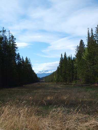
After a tiring 12.5 hour day on Daybreak Peak, Ben, Eric, and I drove back to Hinton for some good quality food. We bailed our ambitious plan of bagging the remote Mt. Persimmon and decided to go for a series of day-trips in the following few days. It was hard to make an agreement on what we would do. We started to brainstorm the possible objectives. Long story short, we eventually made the call of exploring Chetamon Mountain. Despite its proximity to Yellowhead Highway there was no route information available on the Internet and we felt exciting to try it out.
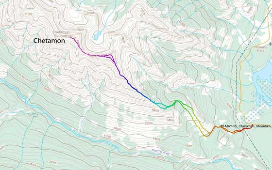
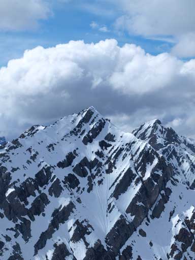
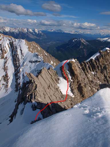
Chetamon Mountain scramble route
We drove past the Snaring campground and parked at a small pull-out that led to an old logging road, and followed that road in (on foot) for 10 minutes or so, crossing an old pipeline, before entering the forest. We also packed ice axe and crampons since the upper mountain still looked snowy. I had my flexible crampons which work very well with hiking shoes, but Ben and Eric had no choice but wearing their heavy and inflexible mountaineering boots. I’ve never had any experience with mountaineering boots yet although I did wear ski boots a few times, and from what I’ve heard, they’re great on snow, but horrible on scrambling terrain especially on slabs.
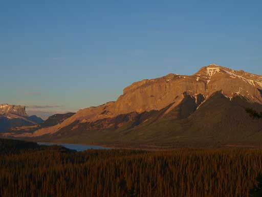
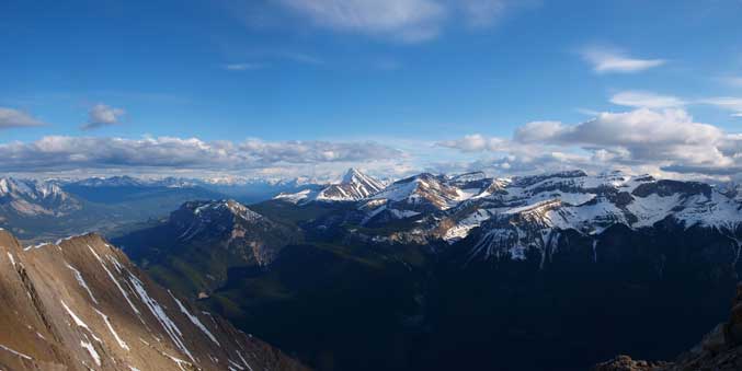
A bit of Brule Lake and part of Boule Range from our car campsite
The old road leads to this pipeline. We crossed it and started the bushwhacking
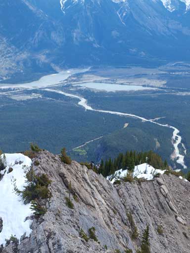
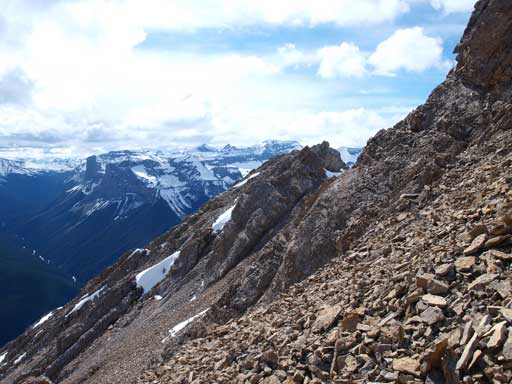
After some bushwhacking we were surprised to see game trails here and there. We kept following one that’s the most obvious branch, cutting horizontally resisting gaining elevation too early, and made to a dead-fall field. The trail disappeared and we were soon doing some unpleasant hopping over one after another dead fall. The ridge which looked to be right in front of us was actually quite a ways back. The bushwhacking here was very tedious but thankfully it was short lived and we would soon hit an open slope. That slope was free of bush and offered some nice views down to the Athabasca Valley, as well as the impressive peaks on Colin Range behind. The open slope gave way to open forest higher up. We soon encountered lingering forest snow. Here we briefly lost sight of our objective, but the general direction was to turn left and gain the ridge. The next short forested section was very steep, but again, we were able to find game trails and the bush was not bad at all. After what seemed like a long time we slogged to the ridge proper where we finally could see the other side briefly through trees (it was still way below treeline). From there on the route was essentially following the ridge line all the way to the summit. Sounds easy? Oh well.
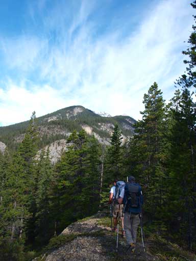
The ascending ridge was still quite a distance away.

Eric and I hiking up the open slope. Photo by Ben N
Forested ridge usually holds more snow than expected, and we were right. In short time we were post-holing to knee deep although the snow did get more supportive as we slowly gaining elevation. Some dark clouds were building up and given the forecasted thunderstorms we weren’t feeling too optimistic. I was way ahead at this point and looking back I could see Eric and Ben stopping at the last trees hanging around there. I didn’t know if they decided to turn around or they just took a break. But in order to bag the “peak” before the storms hit me, I had to keep my pace up. There was only one somehow exposed section on the way to the “summit”, but the route took me much longer than expected. But, bad news started to show up as I approaching the “summit”. I started to see a higher peak at another kilometer or so further down the ridge. I thought that was Cliff Mountain, but after seeing the true Cliff Mountain at a way distance back, I had no choice but realizing I was actually standing on the false summit. The connecting ridge didn’t look that nice and it would certainly took me a long time to traverse both ways. There was another set of clouds pushing from west, and it really started to hit me. I traversed towards the true summit for 10 minutes or so before making the call that it would be too risky to continue. There was absolutely no bailing line on that ridge and if the t-storm did come, I was in a big trouble. Back around the false summit I didn’t see Eric nor Ben so they must have turned around too. I eventually caught up with them at below treeline and now the weather was improving…

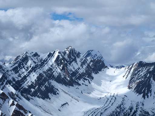
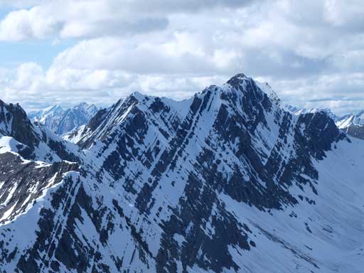
Hawk and Colin look impressive
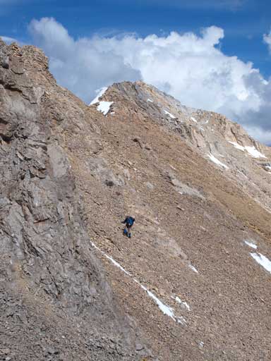
Looking back at Eric and Ben scrambling up the typical terrain
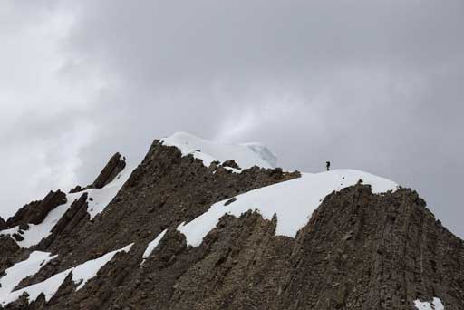
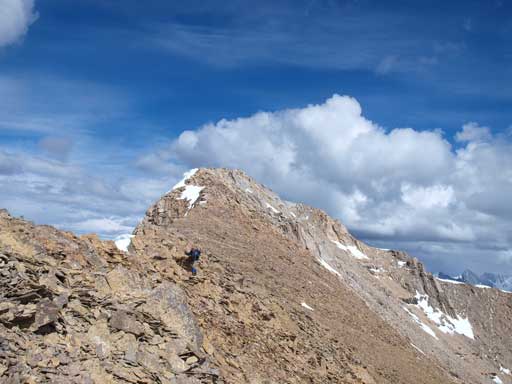
Me scrambling up towards false summit. Photo by Ben N

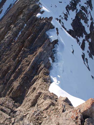
Looking back at an interesting section of the ridge
And, they were actually going upwards… They bailed the attempt too but decided to go up the mountain for a second time. I totally agreed. Well, our group is hardcore and we would not let Chetamon defeat us easily. So up we went, with weather slowly improving we were in a better mood. Snow, a bit of rock, and more trees, we slogged back to the last trees. The rest of the way to false summit was a mere repeat of what I just did an hour ago, although with better views this time. Another set of horribly looking dark clouds were forming around Colin Range that worried us again, but it wasn’t hitting us. After that bit, we felt like the rain was done for this day. After a quick panorama and some obligatory shots, Ben and I soon started the traverse towards the true summit which looked to be quite a distance away. Eric would take a short break and follow us behind.
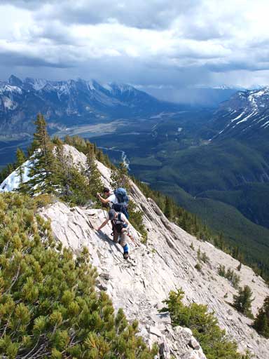
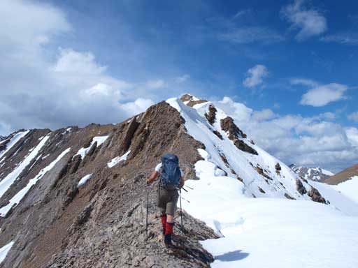
Up we went again. Ben and Eric scrambling up the typical terrain

Looking towards Esplanade Mountain
The mountain looks much more beautiful with snow and blue sky
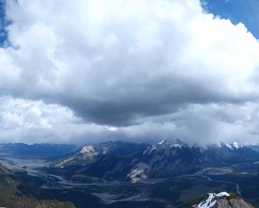
What a impressive cloud above Colin and Jacques Ranges

Ben balancing on a bit exposed section
Eric hiking towards the false summit. Still a long way to go

Scrambling some hands-on terrain. Photo by Ben N
The impressive Snaring Mountain
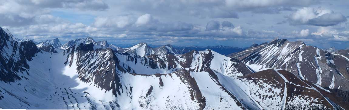
Panorama from false summit again. Click to view large size.
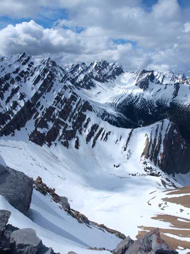
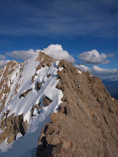
This is the true summit, quite far away though
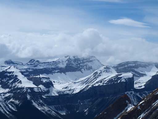
Cliff Mountain with Whitecap behind

Gargoyle Mountain

Roche De Smet on left. Esplanade at center, foreground.
Chetamon Lake was still frozen. Note the large avalanche.
The traverse initially went smoothly until a jagged section that forced us to descend on left side route-finding through some loose terrain, bypassing the pinnacles on the ridge crest. But soon we realized the terrain was much more involved that appeared and ahead was a horribly looking down-climb, with the only possible bypass route on skier’s left side. It was here that Ben made the call that we wouldn’t have enough daylight time for the ascent. I had similar feeling but there’s no way I could let this peak turn me around twice without pushing really hard. The bypass ledge was loose and exposed, but did get me rid of the most difficult down-climb. But what I didn’t know was, this was just the start of the game. After committing to all of this big step, looking back, I found Eric and Ben stopping around, and I was sure they would soon turn around so I was on my own from now on.

Hiking down from false summit
Same as above
The terrain would soon force us descending towards skier’s left looking for easier stuffs
Ben traversing scree slope
Ben climbing up a down-sloping and wet slabby part. Mountaineering boots are awkward here.

Ben checking his watch… Not much daylight time left…

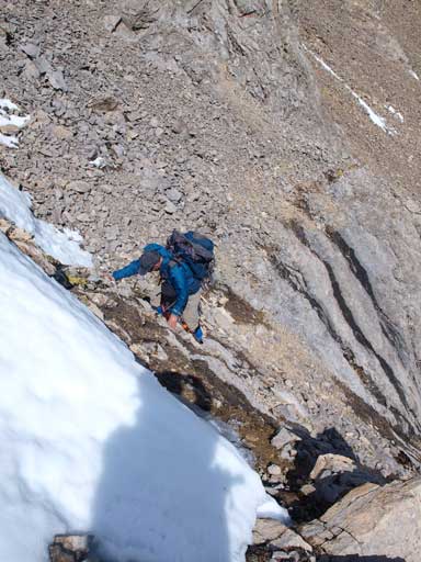
Me continuing down, traversing an exposed ledge looking for a easier line. Photo by Ben N
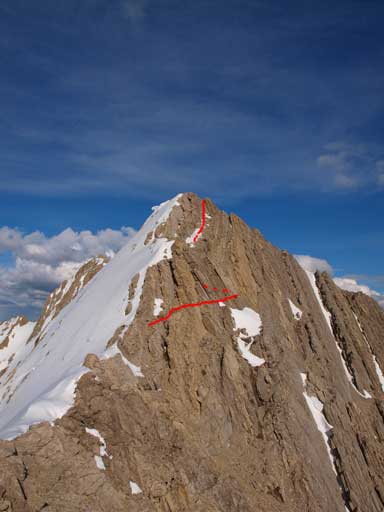
I didn’t take photos on the way up to the true summit, but I did took a couple on the way back. For illustrating purpose I’ll show these photos here. Near the col between false and true peak there was more and more jagged terrain. Unlike the ridge right after the false summit, here the left side was just purely steep slabs, while the right side was snow. I didn’t know if it’s slabs beneath the snow, or easier terrain. I generally could move on the ridge crest, but occasionally some very exposed parts forced me bypassing on left side on some ledges. It was a sustained difficult scramble with some route-finding to get through this part, and then I was facing against a big rock buttress on the uphill side of the traverse. Now since I was on its base, a clear bypass line on climber’s left side showed up. It was a scree slog to get around this obstacle, and then the next rock step, I had no choice but tackling it head-on through some loose, but only moderate scrambling terrain. After this bit, the most difficult parts were really coming. I would soon facing against an impossible looking pinnacle. I used an exposed ledge on left side to see if there’s a route through this way, and yes, but what I would see soon was more things like that. At this point I was committed to give the summit a go, and after one or two more ledge traverses, I was sick of these and moved to the ridge crest. Squeezing between rock and steep snow, and then climbed up some steep snow on climber’s right to overcome more jagged ridge sections. Now I found it was actually easier to stay on the snow or ridge crest rather than looking for a bypass. Keeping this in my mind, overcoming some sustained but slightly easier terrain I was not far from the top. And then the last bit was merely a moderate scrambling. With good route-finding skill and a clear mind, I didn’t actually encounter any climbing section. I felt a great sense of accomplishment to stand on this summit. However, I didn’t even have the time to look around. After some obligatory panorama shots I would quickly go down.
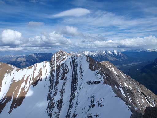
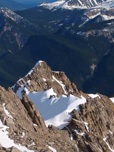
Looking back at the (second) false peak where Eric and Ben turned around. It’s steeper than it looks, and red line shows the route I took.
This is the theme of this ridge. Exposed and jagged. I had no choice but making down the ridge crest here and scrambling up the other side.
Looking back again. Here again, I had to balance over the ridge crest. I was getting closer to the col now.
Gaining elevation on the other side, looking back

Terrain was getting easier briefly. Higher up I needed to go directly over the rock band.

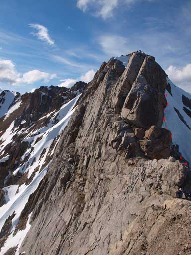
After traversing an exposed ledge over an impossible pinnacle, this was what I saw… More and more . Red line shows my route
I was forced to bail the ridge and any possible bypass. The snow on climber’s right was my only option even though it was isothermal.

Looking back at that part.

And, more to come…
And, more
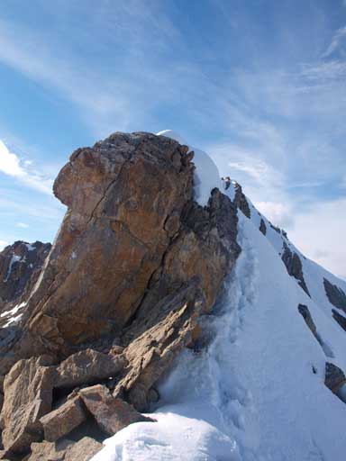
I went straight up this rock step which involved overhanging moves, but on the way back I used the snow as you can see from my footprints. The snow was much easier.
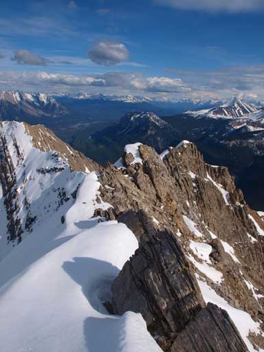
Terrain was getting easier near the summit

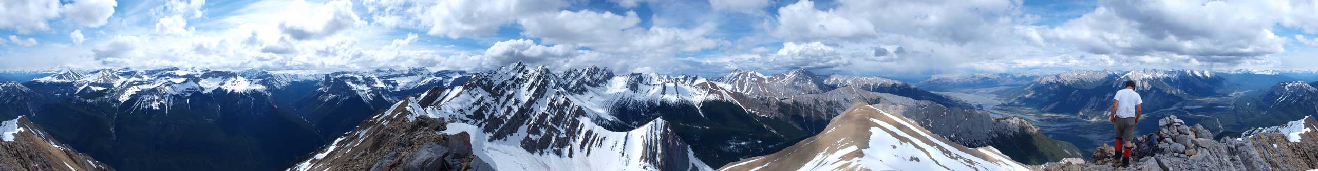
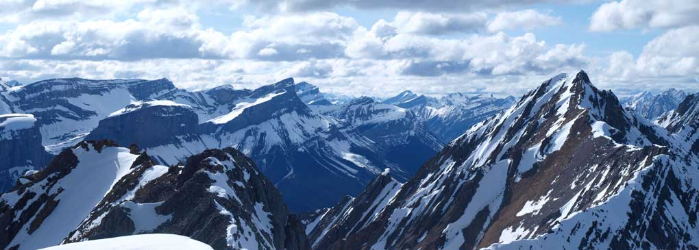
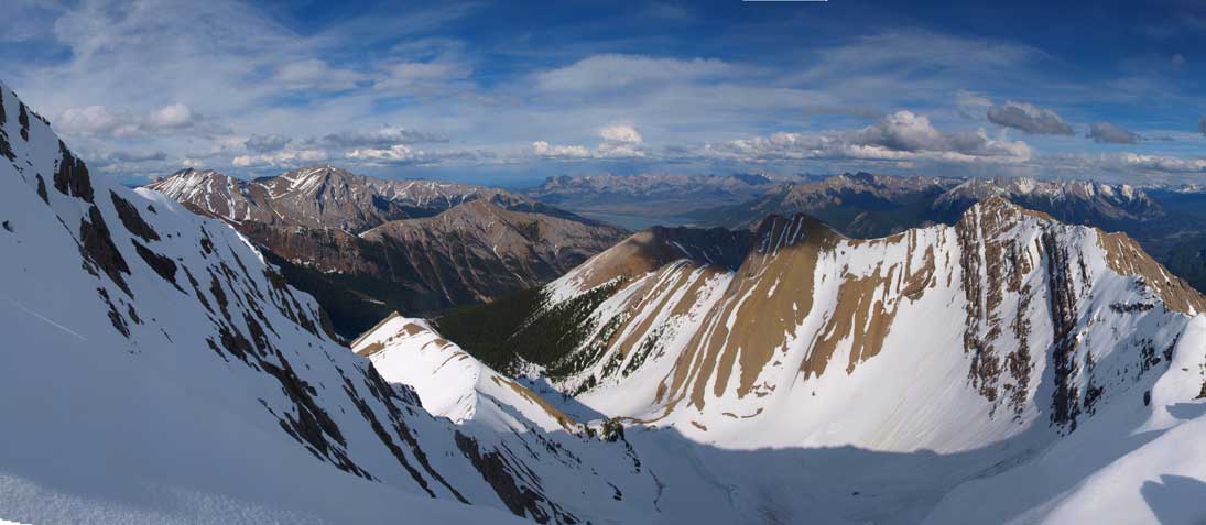
Summit Panorama. Click to view large size.

Panorama of Victoria Cross Range. Pyramid, Zengel and Buttress Mountains.

The big Snaring Mountain. Impressive, but nearly impossible to access even though it might be just an easy scramble.
Peaks north of Snaring Mountain. Even more difficult to access. Need to prepare a week or so’s bushwhacking to get there. The high peak on right was an unnamed summit between Chetamon and Cliff
Cliff Mountain.
More obscured peaks NE of Cliff Mountain.
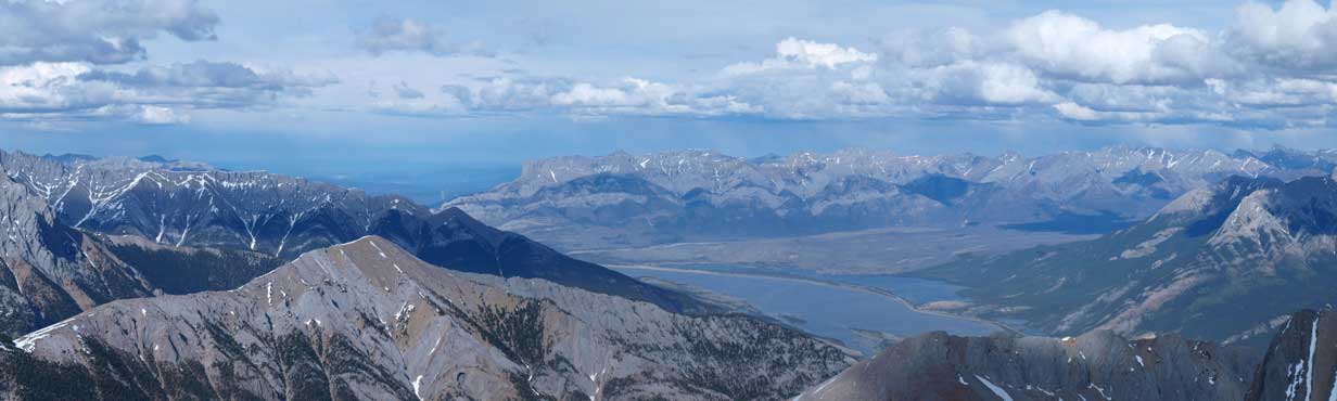
Miette Range and Jasper Lake area.
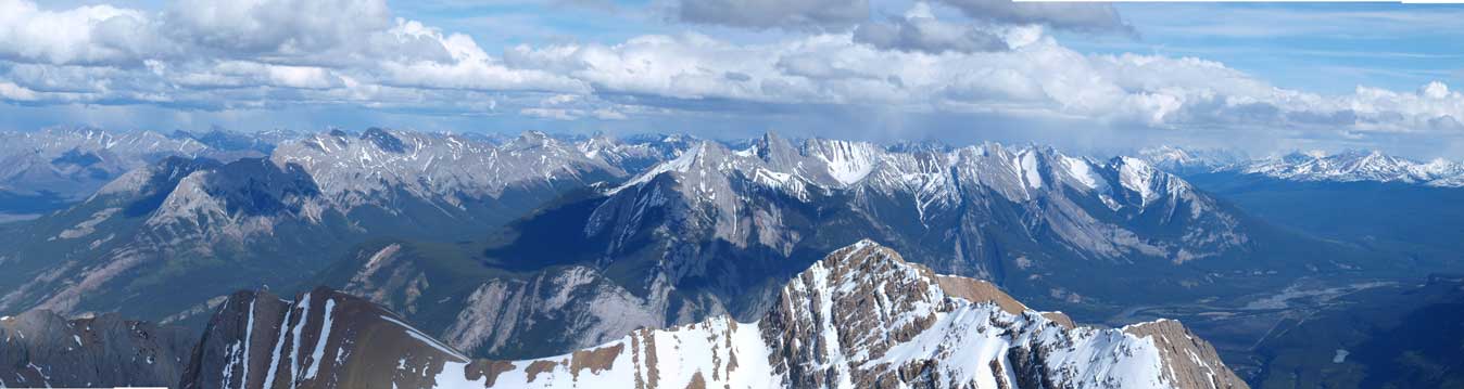
Colin Range looks small from here.

Another panorama using sunset mode.
Looking down the ridge I went up…
I used more snow on the way down, but generally retraced my steps. With a fresh idea of where to go, I could still maintain a fast pace through all of the terrain down to the col. I still didn’t feel like needing an energy break, so kept pushing back towards the false summit. Climbing back up the “big step” did slow me down and I took a break after negotiating back all of the difficult scrambling terrain. It was actually my first time of this day sitting on the ridge line soaking in the views, but only for maybe 5 minutes or so. I must descent fast to catch up the boys otherwise they might not wait for me. It took me 1.5 hours on a rush from false summit to true summit back to false summit bypass. I’m pretty sure if Eric and Ben kept pushing on, they could have the mountain bagged, but they could not move at this pace. And if that was the case, we definitely had to descend a good distance (in the bush) with headlamps on. But still, we had the GPS tracks, and the bush was not hard to negotiate, and it certainly doesn’t have a crux like the nearby Hawk. I bypassed the false summit again, and ran down the rest of the ridge into the trees. More fast descent through the trees I eventually re-joined Ben and Eric at way below treeline. I had to thank them a big time for waiting for me.

Looking back towards the summit
Gorgeous view from the ridge top. But too bad I couldn’t stop and soak in the view.
Finally got a chance to take a break after negotiating all the difficult terrain back.
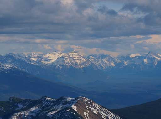
Mount Kerkeslin, another peak I’m interested in.

Pyramid Mountain. I haven’t got this one yet.

CR3 and Meisner Ridge at center. Both are interesting looking peaks. Roche Bonhomme on right. I did that with my mom.

Beautiful panorama view from where I took the break. The peak is the false summit
Another panorama view.

Panorama of Athabasca Valley. The Lakes on left.
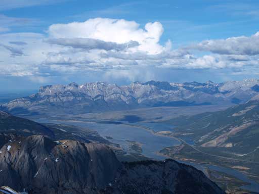
Miette Range rises behind Jasper & Talbot Lakes

Another panorama using a different mode.

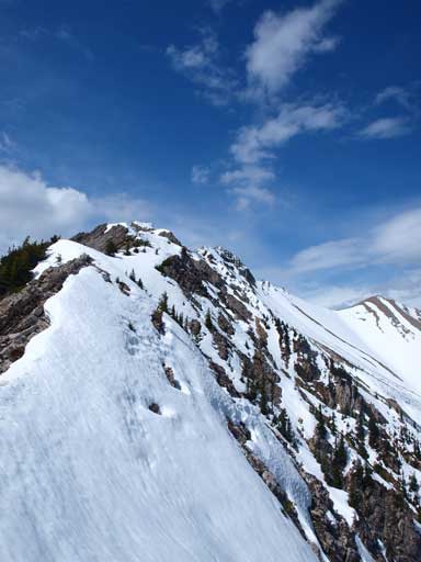
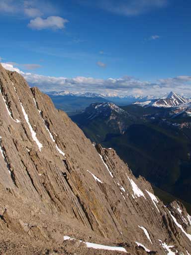
A good-looking ridge section
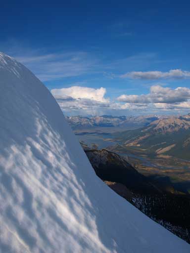
A bit of snow to hike through
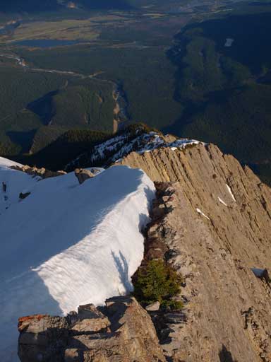
One more exposed section

One last panorama view from this beautiful mountain.
We didn’t bother to take a break and soon started the tedious slog in the forest. It was now that I finally started to feel the elevation gain of this day. I must have gained near 2000, or 2500 vertical meters, all moving fast… After negotiating the steep forested slope we made back to the long open slope. It was such a relieve to encounter softer ground, and we stayed on this slope for pretty much as far as we could. During which we were treated with excellent evening views towards the Colin Range and Pyramid and Palisade. Once into the bush lower down, we were surprised to find another well defined trail that we could follow it bypassing most of the nasty dead falls. There would still be plenty of those but overall much better than the route we took in the morning. The trail disappeared briefly for a couple times but for every time, we could manage to find it again. It wasn’t dark enough for headlamp when we made back to Ben’s car, and our round trip time was 14 hours.

The Palisade is one of the easiest summits.

Hawk and Colin at sunset hour
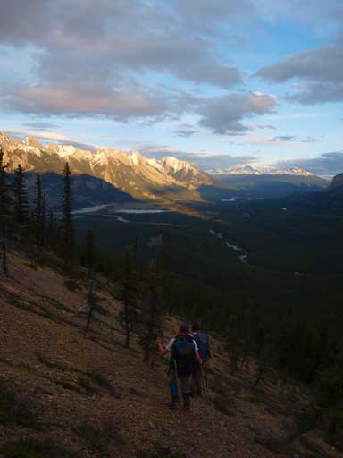
Hiking down the open slope with big views behind
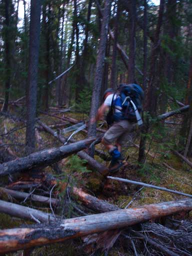
Ben negotiating the dead-fall zone on the way back.
We went to Jasper for some food, and thankfully we could find one that wasn’t closed yet, and then we drove back to where we car camped the night before, and we still had some plans for the next day.
