Lake Mountains High Point
December 22, 2021
2344m
Salt Lake City, UT
Lake Mountains occupy a small area immediately to the west of Utah Lake and to the south of Salt Lake City. The highest point in Lake Mountains boasts over 800 m prominence but the entire mountain is riddled with service roads and communication structures. Both the northern and the southern access roads can be driven to very much near the summit in snow-free conditions but in winter one must walk unless one owns a sled. I picked the northern approach through Isreal Canyon because it looks to be shorter, assuming one has to walk from the bottom. There was a lot of snow down to highway level so I wouldn’t expect this road to be driveable in a vehicle without tire chains.
I decided to drive into Isreal Canyon the night before, car camp and to scout out the conditions since I had little idea how much trail-breaking I should expect. I followed the Google’s direction easily to the start of the dirt roads. The start of the dirt roads was quite rough but soon I encountered continuous compact snow, but also abundant tire tracks. I didn’t know where I should stop and turn around since the road was narrow and became increasingly steep. I ended up pushing to a gate and parked outside on a large open area. I actually went to check out that gate and to my surprise, it was not locked. I thought about to push further but I couldn’t risk getting locked inside, and I also didn’t know the conditions beyond. There were still tire tracks heading further in, but everything was unknown beyond what I could see. I did however, expect this ascent to be much simpler than I originally thought, so set the alarm at 8 am for a lazy morning routine. In retrospect I could have easily driven another 2-3 km but I didn’t really care.
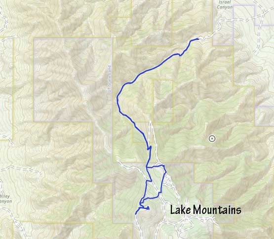
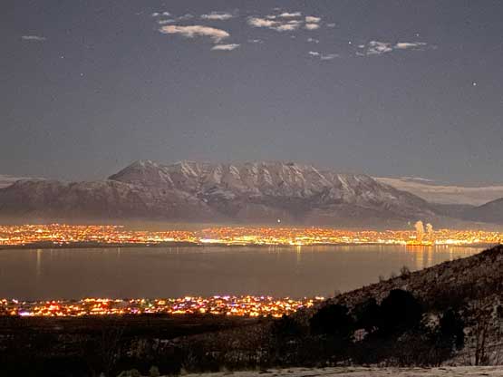
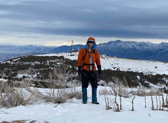
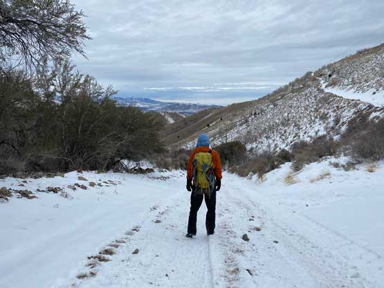
The next morning I cooked a spicy ramen breakfast while enjoying a spectacular sunrise show looking back towards Mt. Timpanogos etc. I decided to carry snowshoes since this peak was tall enough to require that, unless tire and/or snowmobile tracks went all the way to the summit. There was very little worth documenting about this ascent since I essentially just plodded up a road. Once the road made a gradual turn due SE the grade picked up and the truck tracks transitioned to sled tracks. I was still able to walk on the sled tracks without sinking in, so the snowshoes stayed strapped to the pack, at least for now.


Nearing the “2250 m col” I started to encounter some cold winds and the sky had gradually turned into high overcast. I didn’t know which exact spur road to take to reach the true summit so I just randomly picked one, sticking closer to the north ridge with views down towards west. This road was not tracked by snowmobiles so I did have to put the snowshoes in use. Nearing the summit I joined the other road branch and the sled tracks reappeared, so in retrospect the snowshoes could have been left in the truck. The summit was not an exciting place. I also explored another contender slightly to the SW and the views were better.

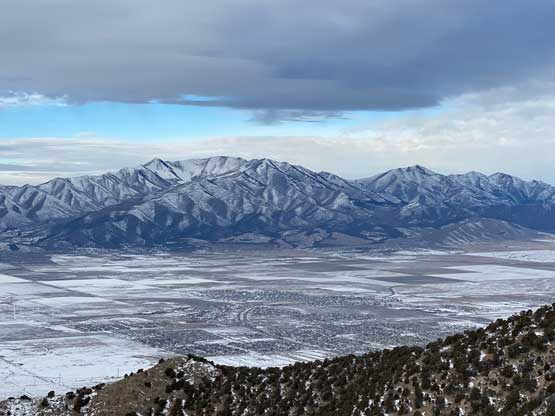

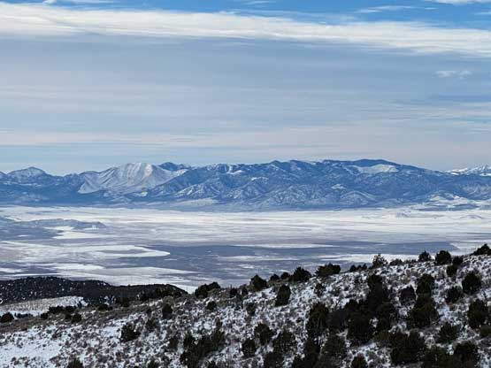

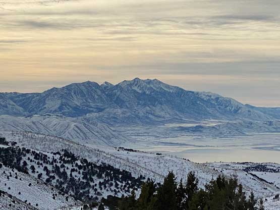

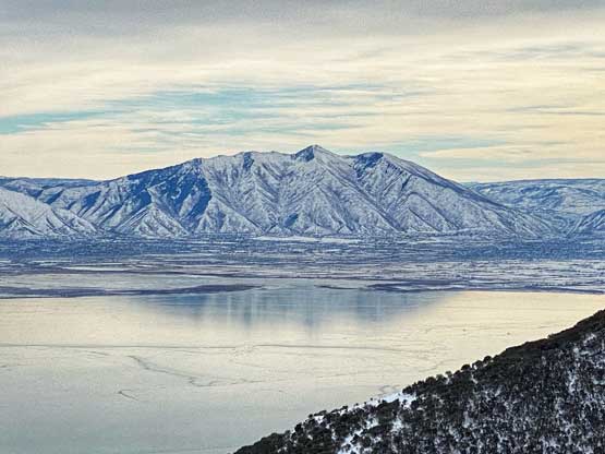
On the descent I followed the bigger spur road back to near that aforementioned col, but instead of going down I decided to check out another high point to the NE. This turned out to be a great call since I got some incredible views of Utah Lake and the high peaks behind. The rest of the descent was uneventful and quite boring.


Not wasting much time I turned on the engine and drove down to the nearest McDonald’s at Lehi. I made some connection to Adam Walker from Las Vegas since that was my primary destination in this trip. The weather seemed to be still okay-ish on the following day so I decided to bag another peak in southern Utah before heading to Las Vegas. In the afternoon of this day I leisurely drove south to St. George with a few rest stops here and there. I did this drive in daylight so I could see the views of the area. The evening routine in St. George was a mess thank to the high volume of tourists. I went into an Olive Garden but immediately went out since the line-up was crazy as fuck. I found a Subway nearby where there was no line-up. By about 9 pm I continued driving south and turned into Beaver Dam Mountains.
